Ringwood to Belgrave Rail Trail

Last updated

Ringwood - Belgrave Rail Trail
Belgrave rail trail.jpg
The Ringwood - Belgrave Rail Trail in Upwey
Length19.2km
Location Melbourne, Victoria, Australia
DifficultyEasy to medium
Hazards Numerous road crossings
Minor on-road sections
Travel through several car parks
Surface Mostly asphalt, with some concrete sections
HillsFrom Upper Ferntree Gully to Belgrave
Train(s) Belgrave line
ParkingAdjacent railway stations
H.E. Parker Reserve, Heathmont
Ringwood Lake, Ringwood
Marie Wallace Bayswater Park, Bayswater
Tim Neville Arboretum, Ferntree Gully
An overview map of the trail. Ringwood - Belgrave Rail Trail Overview Map.png
An overview map of the trail.

The Ringwood - Belgrave Rail Trail is a shared use path for cyclists and pedestrians, which follows the Belgrave railway line from the Mullum Mullum Creek Trail in Ringwood to Belgrave railway station in Belgrave, in the outer eastern suburbs of Melbourne, Victoria, Australia. [1] [2] [3]

Contents

This trail connects with various other cycling and walking routes in the area as well as being directly serviced by eight railway stations on the Belgrave railway line along its 19.2 km route. A new section of path at its western end in Ringwood is scheduled for completion in 2025 as part of the Level Crossing Removal Project at Bedford Road. [4]

Following the trail

Despite the trail being marked in several publications and on cycle route websites, the trail has minimal directional signage. The following sections describe the route of the trail:

Ringwood - Bayswater

Starting in Ringwood and ending in Belgrave, the trail begins as a turn-off from the Mullum Mullum Creek Trail near the Ringwood Bypass underpass in Ringwood, before the trail travels on a short 250 m section of local streets before a short path goes to the Maroondah Highway / Ringwood Bypass / Mount Dandenong Road intersection. The trail resumes at the south-east corner of this intersection before travelling through Ringwood Lake and crossing the Lilydale railway line before travelling through Bedford Reserve on a sealed access road.

The trail now follows Bedford Road east for 170 m, which can be traversed either on-road or via the roadside footpaths and the pedestrian traffic lights outside Ringwood Secondary College. The trail takes a right and runs south down Lena Grove for 360 m before the off-road shared path resumes at the cul-de-sac. The trail now follows the Belgrave railway line on the eastern side until Heathmont railway station, before the trail swaps to the western side of the railway at Canterbury Road. The trail now goes downhill to H.E. Parker reserve in Heathmont. Using the reserve access road heading south, a left turn at the footbridge over the Dandenong Creek takes you to the Dandenong Creek Trail. At this point, the Ringwood - Belgrave Rail Trail and the Dandenong Creek Trail share the same path for 835 m east before the trails branch off from each other. A right turn immediately after the tunnel under the railway then takes you south along the eastern side of the railway line towards Mountain Highway and Bayswater railway station.

Bayswater - Upper Ferntree Gully

Ringwood-Belgrave Rail Trail at Ferntree Gully. Ringwood-Belgrave Rail Trail, Ferntree Gully (32095536513).jpg
Ringwood-Belgrave Rail Trail at Ferntree Gully.

Around Bayswater railway station, the trail runs past the bus stops and the station car park, which usually creates a congested environment with many pedestrian and vehicular movements, so care needs to be taken when traversing this section. The trail then continues on the western side of the railway until Bayswater Road, where the trail then switches back to the eastern side. The trail then travels uninterrupted to Boronia railway station where the user has to cautiously navigate through the Boronia Junction Shopping Centre car park to reach the Boronia Road / Dorset road intersection. The trail resumes on the south-east corner of the intersection, where it once again follows the railway on the eastern side. The turn-off for the Blind Creek Trail is encountered halfway between Boronia and Ferntree Gully. Once reaching Ferntree Gully railway station, the trail travels through the station car park to the level crossing, where the trail resumes. After crossing at the Alpine Street / Station Street / The Avenue intersection, the trail continues south on the western side of the railway, with a scenic footbridge over Forest Road before the trail arrives at pedestrian traffic lights at Burwood Highway in Upper Ferntree Gully. A short 400 m shared use path takes the user to the entrance to Upper Ferntree Gully railway station while crossing at the traffic lights takes you further along the trail.

Upper Ferntree Gully - Belgrave

The trail now travels south on a shared use path alongside Forest Oak Drive before arriving at the turn-off for the Ferny Creek Trail. A left turn then takes you east through the area immediately south of Upper Ferntree Gully. Most of this section runs along shared-use paths alongside local streets. Upon reaching the railway bridge over Burwood Highway, the trail runs east alongside native trees and shrubs between the northern side of the railway and the southern side of Burwood Highway. This takes the user to Upwey and Upwey railway station. Staying on the northern side of the railway, the trail continues to run alongside Burwood Highway until Glenfern Road, where the trail leaves the highway and follows the railway once again until arriving at the end of Campbell street in Tecoma. A 130 m trip along Campbell Street and a right turn down McNicol Road leads to an immediate right turn to Tecoma railway station while an immediate left turn is where the trail continues. A short trip down this final section of shared use path leads to the back of the Belgrave strip shops where a short 220 m on-road trip down Blacksmiths Way east leads to the entrance to Belgrave railway station, where the trail finishes.

Connections

Travelling downhill, from south to north, the Ferny Creek Trail is encountered first, then the Blind Creek Trail, then the Dandenong Creek Trail and finally the upper Mullum Mullum Creek Trail.

The start of the Birds Land Reserve to Lysterfield Park Trail starts near the Belgrave Rail Trail. Leave the trail at Tecoma railway station and head south down McNicol Road, arriving at the reserve 2.5 km later. Alternatively leave from Belgrave railway station and head south, down the Belgrave-Hallam Road. Turn right (west) at Kaola Street 600 m later cross the very small reserve to Apsley Rd. Continue down Apsley Rd and turn left at McNicol Road, cross the bridge and arrive at Birds Land reserve, 3 km all up.

The south end of the Birds Land Reserve to Lysterfield Park Trail starts at the very south end of Lysterfield Park, just 4.5 km by quiet roads from the Hallam Bypass Trail. Leave the Hallam Bypass Trail using the freeway underpass 400 m west of Ernst Wanke Road. Follow the shared path, than travel along Drysdale Road and Heathdale Road. At the small roundabout turn left (north) up Glenwood Road. Cross Belgrave-Hallam Road and continue north up Jacques Road. Turn left (west) at Heatherton Road and then right (north) up Reservoir Road.

The north and south ends of the trail are at 37°48′39″S145°14′01″E / 37.810814°S 145.233744°E / -37.810814; 145.233744 and 37°54′34″S145°21′17″E / 37.909461°S 145.354609°E / -37.909461; 145.354609 , respectively.

Related Research Articles

<span class="mw-page-title-main">Dandenong Ranges</span> Mountain range in Victoria, Australia

The Dandenong Ranges are a set of low mountain ranges in Victoria, Australia, approximately 35 km (22 mi) east of the state capital Melbourne. A minor branch of the Great Dividing Range, the Dandenongs consist mostly of rolling hills, rising to 633 m (2,077 ft) at Mount Dandenong, as well as steeply weathered valleys and gullies covered in thick temperate rainforest, predominantly of tall mountain ash trees and dense ferny undergrowth. The namesaked Dandenong Creek and most of its left-bank tributaries originate from headwaters in these mountain ranges. Two of Melbourne's most important storage reservoirs, the Cardinia and Silvan Reservoir, are also located within the Dandenongs.

<span class="mw-page-title-main">Ferntree Gully, Victoria</span> Suburb of Melbourne, Victoria, Australia

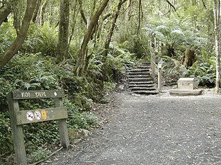
Ferntree Gully is a suburb in Melbourne, Victoria, Australia, at the foothills of the Dandenong Ranges, 30 km south-east of Melbourne's Central Business District, located within the City of Knox local government area. Ferntree Gully recorded a population of 27,398 at the 2021 census.

<span class="mw-page-title-main">Belgrave, Victoria</span> Suburb of Melbourne, Victoria, Australia

Belgrave is a town and outer suburb in Melbourne, Victoria, Australia, 36 km east of Melbourne's central business district, located within the Shire of Yarra Ranges local government area. Belgrave recorded a population of 3,894 at the 2021 census.

<span class="mw-page-title-main">Upwey, Victoria</span> Suburb of Melbourne, Victoria, Australia

Upwey is a suburb of Melbourne, Victoria, Australia, 33 kilometres (21 mi) east from Melbourne's central business district, located within the City of Knox and the Shire of Yarra Ranges local government areas. Upwey recorded a population of 6,818 at the 2021 census.

<span class="mw-page-title-main">Bayswater railway station, Melbourne</span> Melbourne railway station

Bayswater railway station is located on the Belgrave line in Victoria, Australia. It serves the eastern Melbourne suburb of Bayswater, and opened on 4 December 1889.

<span class="mw-page-title-main">Ferntree Gully railway station</span> Railway station in Melbourne, Australia

Ferntree Gully railway station is located on the Belgrave line in Victoria, Australia. It serves the eastern Melbourne suburb of Ferntree Gully, and opened on 5 December 1889 as Lower Ferntree Gully. It was renamed Ferntree Gully on 1 October 1962, and renamed Fern Tree Gully on 29 February 1972 before being renamed back to Ferntree Gully in May 1977.

<span class="mw-page-title-main">Tecoma railway station</span> Railway station in Melbourne, Australia

Tecoma railway station is located on the Belgrave line in Victoria, Australia. It serves the eastern Melbourne suburb of Tecoma, and opened on 1 December 1924.

<span class="mw-page-title-main">Belgrave line</span> Passenger rail service in metropolitan Melbourne, Victoria, Australia

The Belgrave line is a commuter railway line in the city of Melbourne, Victoria, Australia. Operated by Metro Trains Melbourne, it is the city's fourth-longest metropolitan railway line at 41.8 kilometres (26.0 mi). The line runs from Flinders Street station in central Melbourne to Belgrave station in the east, serving 31 stations via Burnley, Box Hill, Ringwood, and Upper Ferntree Gully. Beyond Belgrave, the narrow-gauge line has been restored as the Puffing Billy Railway, which runs tourist services to the original terminus of Gembrook. The line operates for approximately 19 hours a day with 24 hour service available on Friday and Saturday nights. During peak hours, headways of up to 15 minutes are operated, with services every 20–30 minutes during off-peak hours. Trains on the Belgrave line run in a two three-car formations of X'Trapolis 100 trainsets.

<span class="mw-page-title-main">Upper Ferntree Gully, Victoria</span> Suburb of Melbourne, Victoria, Australia

Upper Ferntree Gully is a suburb of Melbourne, Victoria, Australia, 32 km east of Melbourne's Central Business District, located within the City of Knox and Shire of Yarra Ranges local government areas. Upper Ferntree Gully recorded a population of 3,417 at the 2021 census.

<span class="mw-page-title-main">Dandenong Creek Trail</span> Suburban trail in Melbourne, Australia

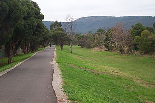
The Dandenong Creek Trail is a shared use path for cyclists and pedestrians, which follows Dandenong Creek through the outer eastern and south-eastern suburbs of Melbourne, Victoria, Australia.

<span class="mw-page-title-main">Koomba Park</span> Park in Wantirna, Australia

Koomba Park is one of the parks comprising the Dandenong Valley Parklands in the eastern suburbs of Melbourne, Australia. It consists of 92 hectares of which 33 hectares are publicly accessible, and is bounded by Dandenong Creek, Boronia Road, EastLink, Mountain Highway and Burwood Highway in a clockwise direction. It is managed primarily by VicRoads and Parks Victoria. The park opened in December 1981, and its land was previously used for cattle grazing and apple orchards. The surrounding area is still used for grazing. There are three major power transmission lines running through the park: Rowville-Templestowe Single Circuit Southern, and Rowville-Ringwood.

<span class="mw-page-title-main">Dandenong Creek</span> Urban creek in Melbourne, Australia

The Dandenong Creek is an urban creek of the Port Phillip catchment, located in the eastern and south-eastern Greater Melbourne region of the Australian east coast state of Victoria. The creek descends approximately 550 metres (1,800 ft) over its course of 53 kilometres (33 mi) before joining the Eumemmerring Creek to form the Patterson River and eventually draining into the Beaumaris Bay.

<span class="mw-page-title-main">Blind Creek Trail</span>

The Blind Creek Trail, in the outer eastern suburbs of Melbourne, in the Australian state of Victoria, is a shared-use path for cyclists and pedestrians, which follows the Blind Creek from the Dandenong Creek Trail in Wantirna South to the Ringwood - Belgrave Rail Trail in Boronia.

<span class="mw-page-title-main">Ferny Creek Trail</span>

The Ferny Creek Trail is a shared use path for cyclists and pedestrians, which follows Ferny and Corhanwarrabul Creeks through the suburbs of Knoxfield and Ferntree Gully in Melbourne, Victoria, Australia.

The Hallam Bypass Trail is a shared use path for cyclists and pedestrians running along the Hallam Bypass between Doveton and Berwick in the outer eastern suburbs of Melbourne, Victoria, Australia. The trail was completed in 2003.

<span class="mw-page-title-main">Mullum Mullum Creek Trail</span>

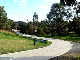
The Mullum Mullum Creek Trail is a shared use path for cyclists and pedestrians, which follows Mullum Mullum Creek in the outer eastern suburbs in Melbourne, Victoria, Australia.

The Tarralla Creek Trail is a shared use path for cyclists and pedestrians, which follows Tarralla Creek, in the outer eastern suburb of Croydon in Melbourne, Victoria, Australia. It is part of the Carrum to Warburton trail and Bayswater to Lilydale link.

<span class="mw-page-title-main">Lakes and reservoirs of Melbourne</span>

Melbourne is the capital city of southeastern Australian state of Victoria and also the nation's second most populous city, and has been consistently voted one of the most liveable cities in the world. Located on the northern/eastern coastal plains of Port Phillip Bay, the city is one of the drier capital cities in Australia, but due to its relatively flat terrain and the runoffs fed from surrounding highlands, still has many lakes, ponds and wetlands, mainly managed by Melbourne Water and Parks Victoria. The larger waterbodies are used for water sports, mostly boating but some are used for recreational activities like swimming, water skiing or model boating.

<span class="mw-page-title-main">EastLink Trail</span> Suburban trail in Melbourne, Australia

The EastLink Trail is a shared use path for cyclists and pedestrians in the outer eastern/southeastern suburbs of Melbourne, Victoria, Australia. The trail gets its name from the north-south EastLink tollway, along which it follows for most of its length from Ringwood to Dandenong, until it joins the Dandenong Creek Trail near the Dandenong Bypass bridge at the tri-suburban junction between Dandenong, Dandenong South and Keysborough.

References

  1. VicRoads - Bicycle Facilities Map Archived 2007-02-19 at the Wayback Machine
  2. Melbourne and Geelong's shared paths in Google Maps
  3. Melbourne and Geelong's shared paths in Google Earth
  4. "New trail addition in Ringwood". Bicycle Network. 17 May 2022. Retrieved 11 December 2023.