The Black Friar, Blackfriars

Last updated

The Black Friar
Black-Friar-Pub-Londres-230819.jpg
The Black Friar, 2019
The Black Friar, Blackfriars
General information
Architectural style Arts and Crafts
Address174 Queen Victoria Street
Town or city London, EC4
CountryUnited Kingdom
Completed1905
Design and construction
Architect(s) Herbert Fuller-Clark
Other designers Henry Poole (sculptor)
Designations Grade II* listed [1]
Website
www.nicholsonspubs.co.uk/restaurants/london/theblackfriarblackfriarslondon

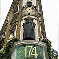
The Black Friar is a Grade II* listed [1] public house on Queen Victoria Street in Blackfriars, London. [2]

Contents

It was built in about 1875 on the site of a former medieval Dominican friary, [3] and then remodelled in about 1905 by the architect Herbert Fuller-Clark. Much of the internal decoration was done by the sculptors Frederick T. Callcott & Henry Poole. [2]

The building was nearly demolished during a phase of redevelopment in the 1960s, until it was saved by a campaign spearheaded by poet Sir John Betjeman. [4] It is on the Campaign for Real Ale's National Inventory of Historic Pub Interiors. [5]

Exterior

Interior


Related Research Articles

<span class="mw-page-title-main">Hope and Anchor, Hammersmith</span> Pub in Hammersmith, London

The Hope and Anchor is a Grade II listed public house at 20 Macbeth Street, Hammersmith, London.

<span class="mw-page-title-main">Seven Stars, Holborn</span> Pub in Holborn, London

The Seven Stars is a Grade II listed public house at 53-54 Carey Street, Holborn, London. It is unusual for having survived the Great Fire of London.

<span class="mw-page-title-main">Ye Olde Mitre</span> Pub in Holborn, London

The Ye Olde Mitre is a Grade II listed public house at 1 Ely Court, Ely Place, Holborn, London EC1N 6SJ.

<span class="mw-page-title-main">Argyll Arms</span> Pub in Soho, London

The Argyll Arms is a Grade II* listed public house at 18 Argyll Street, Soho, London, W1. It is located close to the site of the former Argyll House, the London residence of the Dukes of Argyll.
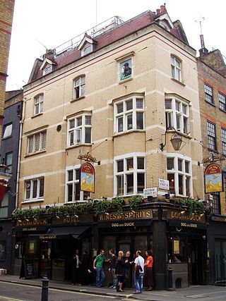
<span class="mw-page-title-main">Dog and Duck, Soho</span> Pub in Soho, London

The Dog and Duck is a Grade II listed public house at 18 Bateman Street, Soho, London W1D 3AJ, built in 1897 by the architect Francis Chambers for Cannon Brewery.

<span class="mw-page-title-main">King's Head, Tooting</span> Pub in Tooting, London

The King's Head is a Grade II listed public house at 84 Upper Tooting Road, Tooting, London SW17 7PB.

<span class="mw-page-title-main">Black Lion, Kilburn</span> Pub in Kilburn, London

The Black Lion is a Grade II* listed public house at 274 Kilburn High Road, Kilburn, London.

<span class="mw-page-title-main">The Flying Horse</span> Pub on Oxford Street, London

The Flying Horse is a Grade II* listed public house at 6 Oxford Street, Marylebone in the City of Westminster. It was built in the 19th century, and is the last remaining pub on Oxford Street. The pub is on the Campaign for Real Ale's National Inventory of Historic Pub Interiors.

<span class="mw-page-title-main">Viaduct Tavern</span> Pub in Holborn, London

The Viaduct Tavern is a Grade II listed public house at 126 Newgate Street, Holborn, London. It was built 1874-5, and the interior was remodelled 1898–1900 by Arthur Dixon. It is on the Campaign for Real Ale's National Inventory of Historic Pub Interiors.

<span class="mw-page-title-main">The Warrington, Maida Vale</span> Pub in Maida Vale, London

The Warrington is a Grade II listed public house at Warrington Crescent, Maida Vale, London W9 1EH.

<span class="mw-page-title-main">Hand and Shears</span> Pub in Farringdon, London

The Hand and Shears is a Grade I listed public house at 1 Middle Street, Smithfield, London.

<span class="mw-page-title-main">Lord Nelson, Bermondsey</span> Pub in Bermondsey, London

The Lord Nelson is a Grade II listed public house at 386 Old Kent Road, Bermondsey, London.

<span class="mw-page-title-main">The Barley Mow, Marylebone</span> Pub in Marylebone, London

The Barley Mow is a grade II listed pub located at 8 Dorset Street, Marylebone, London, W1.

<span class="mw-page-title-main">The Winchester, Highgate</span> UK historic pub

The Winchester is a public house in Highgate, London. It was built in 1881 as the Winchester Tavern, and later became the Winchester Hall Hotel. The name derives from Winchester Hall, a nearby late 17th-century mansion. The pub has featured on the Campaign for Real Ale's National Inventory of Historic Pub Interiors.
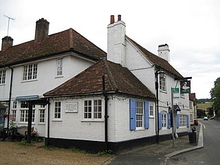
<span class="mw-page-title-main">The Swan, West Wycombe</span>

The Swan is a Grade II listed pub at High Street, West Wycombe, Buckinghamshire.

<span class="mw-page-title-main">Old Ship, Aveley</span> Public house in Aveley, Essex, England

The Old Ship is a public house in Aveley, Essex, in England. It is on the Campaign for Real Ale's National Inventory of Historic Pub Interiors.

The Old House is a Grade II listed public house at Redwell Lane, Ightham Common, Kent TN15 9EE.

<span class="mw-page-title-main">Red Lion, Snargate</span>

The Red Lion is a three-roomed Grade II listed public house at Snargate, Kent, TN29 9UQ.

<span class="mw-page-title-main">Duke of York, Bloomsbury</span> Pub in Bloomsbury, London

The Duke of York is a Grade II listed public house at 7 Roger Street, Bloomsbury, London WC1N 2PB.

<span class="mw-page-title-main">Red Lion, Duke of York Street</span> Pub in St Jamess, London

The Red Lion is a Grade II listed public house at 2 Duke of York Street, St James's, London, SW1.

References

  1. 1 2 Historic England. "Black Friar public house (1285723)". National Heritage List for England . Retrieved 26 September 2014.
  2. 1 2 Jephcote, Geoff Brandwood & Jane (2008). London heritage pubs : an inside story. St. Albans: Campaign for Real Ale. pp. 28–30. ISBN   9781852492472.
  3. "Black Friar pub: London Remembers, Aiming to capture all memorials in London". Londonremembers.com. Retrieved 27 March 2018.
  4. "The Blackfriar: All London's Secrets Exposed". Discoveringsecretlondon.co.uk. Retrieved 27 March 2018.
  5. Brandwood, Geoff (2013). Britain's best real heritage pubs. St. Albans: CAMRA. p. 60. ISBN   9781852493042.

51°30′44″N0°06′14″W / 51.512121°N 0.103751°W / 51.512121; -0.103751