
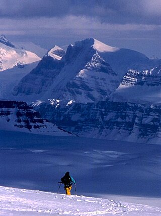
Mount Assiniboine, also known as Assiniboine Mountain, is a pyramidal peak mountain on the Great Divide, on the British Columbia/Alberta border in Canada.

Mount Columbia is a mountain located in the Winston Churchill Range of the Rocky Mountains. It is the highest point in Alberta, Canada, and is second only to Mount Robson for height and topographical prominence in the Canadian Rockies. It is located on the border between Alberta and British Columbia on the northern edge of the Columbia Icefield. Its highest point, however, lies within Jasper National Park in Alberta.

Crowsnest Pass is a low mountain pass across the Continental Divide of the Canadian Rockies on the Alberta–British Columbia border.
Highway 93 is a north–south route through the southeastern part of British Columbia, in the Regional District of East Kootenay and takes its number from U.S. Highway 93 that it connects with at the Canada–United States border. It follows the Crowsnest Highway (Highway 3) and Highway 95 through Radium Hot Springs and to where it crosses the Continental Divide into Alberta at Vermilion Pass, where it continues as Alberta Highway 93. The section between the Canada-U.S. border and the Crowsnest Highway is known as the Elko–Roosville Highway, the section between the Crowsnest Highway and Radium Hot Springs is known as the Kootenay–Columbia Highway, while the section east of Radium Hot Springs is known as the Banff–Windermere Parkway.

The Peace River is a 1,923-kilometre-long (1,195 mi) river in Canada that originates in the Rocky Mountains of northern British Columbia and flows to the northeast through northern Alberta. The Peace River joins the Athabasca River in the Peace-Athabasca Delta to form the Slave River, a tributary of the Mackenzie River. The Finlay River, the main headwater of the Peace River, is regarded as the ultimate source of the Mackenzie River. The combined Finlay–Peace–Slave–Mackenzie river system is the 13th longest river system in the world.

Athabasca Pass is a high mountain pass in the Canadian Rockies on the border between Alberta and British Columbia. In fur trade days it connected Jasper House on the Athabasca River with Boat Encampment on the Columbia River.

Del Bonita is a hamlet in southern Alberta, Canada within Cardston County. It is located approximately 49 km (30 mi) south of Magrath at the junction of Highway 62 and Highway 501. Due to its location near the Canada–United States border, it serves as a port of entry into the U.S. state of Montana at the nearby Del Bonita Border Crossing which is located 3 km (1.9 mi) to the south. Del Bonita is a name derived from Spanish meaning "of the pretty".

The Mount Edziza volcanic complex is a group of volcanoes and associated lava flows in northwestern British Columbia, Canada. Located on the Tahltan Highland, it is 40 kilometres southeast of Telegraph Creek and 85 kilometres southwest of Dease Lake. The complex encompasses a broad, steep-sided lava plateau that extends over 1,000 square kilometres. Its highest summit is 2,786 metres in elevation, making the MEVC the highest of four large complexes in an extensive north–south trending volcanic region. It is obscured by an ice cap characterized by several outlet glaciers that stretch out to lower altitudes.

Lynx Mountain is a mountain peak in the Canadian Rockies. It is located on the Continental Divide between the provinces of Alberta and British Columbia, in the Cushina Ridge of the Continental Ranges. It was named by Lucius Quincy Coleman for the remains of a lynx they found on the ice of the nearby Coleman Glacier in 1908.
Treadmill Ridge is a mountain ridge located at the northern end of Mount Robson Provincial Park, on the Alberta/British Columbia border. It is Alberta's 98th most prominent mountain. It was named in 1923 by Arthur O. Wheele who believed that the mountain resembled a treadmill.
Tatei Ridge is a mountain ridge east of Berg Lake at the northern end of Mount Robson Provincial Park on the Continental Divide marking the Alberta-British Columbia border. It was named in 1912 by Charles D. Walcott as tatei is the Stoney language word for "wind".
Younghusband Ridge is located east of Wood Arm Kinbasket Lake and straddles the Continental Divide marking the Alberta-British Columbia border. It was named in 1927 by Alfred J. Ostheimer after Lt. Col. Sir Francis Younghusband.
Farbus Mountain is located on the provincial border of Alberta and British Columbia in Banff National Park. It was named in 1918 after Farbus, a village on the eastern slopes of Vimy Ridge in France.In the Battle of Vimy Ridge, Canadian troops retook Farbus from German control on April 9, 1917 as part of securing the Brown Line objective.
Mount Armstrong is a mountain located on the Canadian provincial boundary between Alberta and British Columbia on the Continental Divide. It was named in 1918 after John Douglas Armstrong, a lieutenant with the Canadian Engineers who was killed in action on April 9, 1917, at Vimy Ridge World War I.
Hollebeke Mountain is located on the border of Alberta and British Columbia on the Continental Divide. It was named in 1917 after Hollebeke, a village in Belgium.

Mount Haig is located on the border of Alberta and British Columbia on the Continental Divide. It was named in 1862 after Haig, Captain R.W. Mount Haig is the highest peak of Gravenstafel Ridge; its lower north and east faces feature as back country cat skiing for Castle Mountain Resort on neighbouring Gravenstafel Mountain.
Rainy Ridge is a ridge located on the Eastern side of Middle Kootenay Pass and straddles the Continental Divide marking the Alberta-British Columbia border. It was named in 1958 but the origin of the name is unknown.
La Coulotte Peak is located SE of Fernie and straddles the Continental Divide marking the Alberta-British Columbia border. It was named after La Coulotte near Lens, France where Canadian troops fought the German army at the Battle of Vimy Ridge in World War I.
La Coulotte Ridge is a mountain ridge which straddles the Continental Divide marking the Alberta-British Columbia border. It was named after La Coulotte in France.

Mount Smuts is a 2,938-metre (9,639-foot) mountain summit located in the Canadian Rockies of Alberta, Canada. It is set in the Spray Valley near the northern end of the Spray Mountains range. It is situated on the common boundary shared by Peter Lougheed Provincial Park with Banff National Park. Mount Smuts is not visible from any road in Banff Park, however it can be seen from Alberta Highway 742, also known as Smith-Dorrien/Spray Trail in Kananaskis Country. Mount Smuts' nearest higher neighbor is Mount Birdwood, 2.8 km (1.7 mi) to the south-southeast.


