Related Research Articles
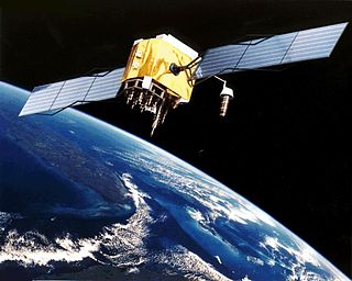
The Global Positioning System (GPS), originally Navstar GPS, is a satellite-based radionavigation system owned by the United States government and operated by the United States Space Force. It is one of the global navigation satellite systems (GNSS) that provides geolocation and time information to a GPS receiver anywhere on or near the Earth where there is an unobstructed line of sight to four or more GPS satellites. Obstacles such as mountains and buildings block the relatively weak GPS signals.

Radio navigation or radionavigation is the application of radio frequencies to determine a position of an object on the Earth, either the vessel or an obstruction. Like radiolocation, it is a type of radiodetermination.

A radio clock or radio-controlled clock (RCC) is a type of quartz clock or watch that is automatically synchronized to a time code transmitted by a radio transmitter connected to a time standard such as an atomic clock. Such a clock may be synchronized to the time sent by a single transmitter, such as many national or regional time transmitters, or may use the multiple transmitters used by satellite navigation systems such as GPS. Such systems may be used to automatically set clocks or for any purpose where accurate time is needed. RC clocks may include any feature available for a clock, such as alarm function, display of ambient temperature and humidity, broadcast radio reception, etc.
Clock synchronization is a topic in computer science and engineering that aims to coordinate otherwise independent clocks. Even when initially set accurately, real clocks will differ after some amount of time due to clock drift, caused by clocks counting time at slightly different rates. There are several problems that occur as a result of clock rate differences and several solutions, some being more appropriate than others in certain contexts.
A satellite navigation or satnav system is a system that uses satellites to provide autonomous geo-spatial positioning. It allows small electronic receivers to determine their location to high precision using time signals transmitted along a line of sight by radio from satellites. The system can be used for providing position, navigation or for tracking the position of something fitted with a receiver. The signals also allow the electronic receiver to calculate the current local time to high precision, which allows time synchronisation. These uses are collectively known as Positioning, Navigation and Timing (PNT). Satnav systems operate independently of any telephonic or internet reception, though these technologies can enhance the usefulness of the positioning information generated.
The Precision Time Protocol (PTP) is a protocol used to synchronize clocks throughout a computer network. On a local area network, it achieves clock accuracy in the sub-microsecond range, making it suitable for measurement and control systems. PTP is currently employed to synchronize financial transactions, mobile phone tower transmissions, sub-sea acoustic arrays, and networks that require precise timing but lack access to satellite navigation signals.

Real-time kinematic (RTK) positioning is a satellite navigation technique used to enhance the precision of position data derived from satellite-based positioning systems such as GPS, GLONASS, Galileo, NavIC and BeiDou. It uses measurements of the phase of the signal's carrier wave in addition to the information content of the signal and relies on a single reference station or interpolated virtual station to provide real-time corrections, providing up to centimetre-level accuracy. With reference to GPS in particular, the system is commonly referred to as carrier-phase enhancement, or CPGPS. It has applications in land survey, hydrographic survey, and in unmanned aerial vehicle navigation.
Multilateration is a technique for determining a 'vehicle's' position based on measurement of the times of arrival (TOAs) of energy waves having a known speed when propagating either from (navigation) or to (surveillance) multiple system stations. These stations are at known locations and have synchronized 'clocks'. Prior to computing a solution, the time of transmission (TOT) of the waves is unknown to the receiver on the 'vehicle' (navigation) or the receivers at the stations (surveillance); consequently, also unknown is the wave time of flight. In navigation applications, the 'vehicle' is often termed the 'user'; in surveillance applications, the 'vehicle' may be termed the 'target'.
A pulse per second is an electrical signal that has a width of less than one second and a sharply rising or abruptly falling edge that accurately repeats once per second. PPS signals are output by radio beacons, frequency standards, other types of precision oscillators and some GPS receivers. Precision clocks are sometimes manufactured by interfacing a PPS signal generator to processing equipment that aligns the PPS signal to the UTC second and converts it to a useful display. Atomic clocks usually have an external PPS output, although internally they may operate at 9,192,631,770 Hz. PPS signals have an accuracy ranging from a 12 picoseconds to a few microseconds per second, or 2.0 nanoseconds to a few milliseconds per day based on the resolution and accuracy of the device generating the signal.
StarFire is a wide-area differential GPS developed by John Deere's NavCom and precision farming groups. StarFire broadcasts additional "correction information" over satellite L-band frequencies around the world, allowing a StarFire-equipped receiver to produce position measurements accurate to well under one meter, with typical accuracy over a 24-hour period being under 4.5 cm. StarFire is similar to the FAA's differential GPS Wide Area Augmentation System (WAAS), but considerably more accurate due to a number of techniques that improve its receiver-end processing.

An atomic clock is a clock whose timekeeping mechanism is based on the interaction of electromagnetic radiation with the excited states of certain atoms. Specifically, either a hyperfine transition in the microwave, or electron transition in the optical or ultraviolet region of the emission spectrum of an atom is used as a frequency standard for the timekeeping element. Atomic clocks are the most accurate time and frequency standards known, and are used as primary standards for international time distribution services, to control the wave frequency of television broadcasts, and in global navigation satellite systems such as GPS.
Spectracom is a global manufacturer of precision time and frequency instruments and network-centric equipment used in a wide range of industries.
The error analysis for the Global Positioning System is important for understanding how GPS works, and for knowing what magnitude of errors should be expected. The GPS makes corrections for receiver clock errors and other effects but there are still residual errors which are not corrected. GPS receiver position is computed based on data received from the satellites. Errors depend on geometric dilution of precision and the sources listed in the table below.
GNSS enhancement refers to techniques used to improve the accuracy of positioning information provided by the Global Positioning System or other global navigation satellite systems in general, a network of satellites used for navigation. Enhancement methods of improving accuracy rely on external information being integrated into the calculation process. There are many such systems in place and they are generally named or described based on how the GPS sensor receives the information. Some systems transmit additional information about sources of error, others provide direct measurements of how much the signal was off in the past, while a third group provide additional navigational or vehicle information to be integrated in the calculation process.
Precise Point Positioning (PPP) is a global navigation satellite system (GNSS) positioning method that calculates very precise positions, with errors as small as a few centimeters under good conditions. PPP is a combination of several relatively sophisticated GNSS position refinement techniques that can be used with near-consumer-grade hardware to yield near-survey-grade results. PPP uses a single GNSS receiver, unlike standard RTK methods, which use a temporarily fixed base receiver in the field as well as a relatively nearby mobile receiver. PPP methods overlap somewhat with DGNSS positioning methods, which use permanent reference stations to quantify systemic errors.
Two independent clocks, once synchronized, will walk away from one another without limit. To have them display the same time it would be necessary to re-synchronize them at regular intervals. The period between synchronizations is referred to as holdover and performance under holdover relies on the quality of the reference oscillator, the PLL design, and the correction mechanisms employed.

A GPS clock, or GPS disciplined oscillator (GPSDO), is a combination of a GPS receiver and a high-quality, stable oscillator such as a quartz or rubidium oscillator whose output is controlled to agree with the signals broadcast by GPS or other GNSS satellites. GPSDOs work well as a source of timing because the satellite time signals must be accurate in order to provide positional accuracy for GPS in navigation. These signals are accurate to nanoseconds and provide a good reference for timing applications.

Hyperbolic navigation is a class of obsolete radio navigation systems in which a navigation receiver instrument on a ship or aircraft is used to determine location based on the difference in timing of radio waves received from fixed land-based radio navigation beacon transmitters. Measuring the difference in timing (phase) of radio signals received from two beacons gives the difference in distance of the receiver from the beacons. Plotting all of the potential locations of the receiver for the measured delay localizes the receiver to a hyperbolic line on a chart. Taking timing measurements from two pairs of beacons gives two such hyperbolic lines, and the receiver's location is at the intersection of the lines. The two lines may intersect in two points, in which case other navigation information is used to determine which point is the receiver's location.
White Rabbit is the name of a collaborative project including CERN, GSI Helmholtz Centre for Heavy Ion Research and other partners from universities and industry to develop a fully deterministic Ethernet-based network for general purpose data transfer and sub-nanosecond accuracy time transfer. Its initial use was as a timing distribution network for control and data acquisition timing of the accelerator sites at CERN as well as in GSI's Facility for Antiproton and Ion Research (FAIR) project. The hardware designs as well as the source code are publicly available. The name of the project is a reference to the White Rabbit appearing in Lewis Carroll's novel Alice's Adventures in Wonderland.
Time synchronization in North America can be achieved with many different methods, some of which require only a telephone, while others require expensive, sensitive, and rare electronic equipment. In the United States, the United States Naval Observatory provides the standard of time, called UTC(USNO), for the United States military and the Global Positioning System, while the National Institute of Standards and Technology provides the standard of time for civil purposes in the United States, called UTC(NIST).
References
- 1 2 Jones, T (2000). Splitting the second. Institute of Physical Publishing.
- ↑ "Set your computer clock via the Internet using tools built into the operating system". National Institute of Standards and Technology. Retrieved 2012-12-22.
- ↑ Novick, Andrew N.; et al. Time Distribution Using the World Wide Web http://tf.nist.gov/timefreq/general/pdf/1499.pdf .External link in
|title=(help) - ↑ Allan, David W.; Weiss, Marc A. (May 1980), "Accurate Time and Frequency Transfer During Common-View of a GPS Satellite" (PDF), Proceedings of the 34th Annual Frequency Control Symposium USAERADCOM, Ft. Monmouth, NJ: 334–346
- ↑ Marc Weiss, Common View GPS Time Transfer, NIST Time and Frequency Division, archived from the original on 2012-10-28, retrieved 2011-11-22
- ↑ Department of Defense and Department of Transportation (1994). "USNO NAVSTAR Global Positioning System". Federal Radionavigation Plan. US Navy. Retrieved 2008-11-13.
- ↑ "Global Positioning System Timing". U.S. Coast Guard Navigation Center. Retrieved 2008-11-13.
- ↑ "GPS and UTC Time Transfer". RoyalTek. Archived from the original on 2010-03-23. Retrieved 2009-12-18.
| Key concepts |  | ||||||
|---|---|---|---|---|---|---|---|
| Measurement and standards |
| ||||||
| Clocks | |||||||
| |||||||
| |||||||
| Philosophy of time | |||||||
| Human experience and use of time |
| ||||||
| Time in |
| ||||||
| Related topics | |||||||
| International standards |
|  |
|---|---|---|
| Obsolete standards | ||
| Time in physics | ||
| Horology | ||
| Calendar | ||
| Archaeology and geology | ||
| Astronomical chronology | ||
| Other units of time | ||
| Related topics | ||