Radio clock

Last updated
A modern LF radio-controlled clock Atomic clock.jpg
A modern LF radio-controlled clock

A radio clock or radio-controlled clock (RCC), and often colloquially (and incorrectly [1] ) referred to as an "atomic clock", is a type of quartz clock or watch that is automatically synchronized to a time code transmitted by a radio transmitter connected to a time standard such as an atomic clock. Such a clock may be synchronized to the time sent by a single transmitter, such as many national or regional time transmitters, or may use the multiple transmitters used by satellite navigation systems such as Global Positioning System. Such systems may be used to automatically set clocks or for any purpose where accurate time is needed. Radio clocks may include any feature available for a clock, such as alarm function, display of ambient temperature and humidity, broadcast radio reception, etc.

Contents

One common style of radio-controlled clock uses time signals transmitted by dedicated terrestrial longwave radio transmitters, which emit a time code that can be demodulated and displayed by the radio controlled clock. The radio controlled clock will contain an accurate time base oscillator to maintain timekeeping if the radio signal is momentarily unavailable. Other radio controlled clocks use the time signals transmitted by dedicated transmitters in the shortwave bands. Systems using dedicated time signal stations can achieve accuracy of a few tens of milliseconds.

GPS satellite receivers also internally generate accurate time information from the satellite signals. Dedicated GPS timing receivers are accurate to better than 1 microsecond; however, general-purpose or consumer grade GPS may have an offset of up to one second between the internally calculated time, which is much more accurate than 1 second, and the time displayed on the screen.

Other broadcast services may include timekeeping information of varying accuracy within their signals.

Single transmitter

Radio clocks synchronized to a terrestrial time signal can usually achieve an accuracy within a hundredth of a second relative to the time standard, [1] generally limited by uncertainties and variability in radio propagation. Some timekeepers, particularly watches such as some Casio Wave Ceptors which are more likely than desk clocks to be used when travelling, can synchronise to any one of several different time signals transmitted in different regions.

Longwave and shortwave transmissions

Radio clocks depend on coded time signals from radio stations. The stations vary in broadcast frequency, in geographic location, and in how the signal is modulated to identify the current time. In general, each station has its own format for the time code.

List of radio time signal stations

List of radio time signal stations
FrequencyCallsignCountry AuthorityLocationAerial typePowerRemarks
RJH69 Flag of Belarus.svg  Belarus
VNIIFTRI
Vileyka
54°27′47″N26°46′37″E / 54.46306°N 26.77694°E / 54.46306; 26.77694 (RJH69)
Triple umbrella antenna [lower-alpha 1] 300 kWThis is Beta time signal. [2] The signal is transmitted in non-overlapping time:
02:00–02:20 UTC RAB99
04:00–04:25 UTC RJH86
06:00–06:20 UTC RAB99
07:00–07:25 UTC RJH69
08:00–08:25 UTC RJH90
09:00–09:25 UTC RJH77
10:00–10:25 UTC RJH86
11:00–11:20 UTC RJH63
RJH77Flag of Russia.svg  Russia
VNIIFTRI
Arkhangelsk
64°21′29″N41°33′58″E / 64.35806°N 41.56611°E / 64.35806; 41.56611 (RJH77)
Triple umbrella antenna [lower-alpha 2] 300 kW
RJH63Flag of Russia.svg  Russia
VNIIFTRI
Krasnodar
44°46′25″N39°32′50″E / 44.77361°N 39.54722°E / 44.77361; 39.54722 (RJH63)
Umbrella antenna [lower-alpha 3] 300 kW
RJH90Flag of Russia.svg  Russia
VNIIFTRI
Nizhny Novgorod
56°10′20″N43°55′38″E / 56.17222°N 43.92722°E / 56.17222; 43.92722 (RJH90)
Triple umbrella antenna [lower-alpha 4] 300 kW
RJH86 [2] [lower-alpha 5] Flag of Kyrgyzstan (2023).svg  Kyrgyzstan
VNIIFTRI
Bishkek
43°02′29″N73°37′09″E / 43.04139°N 73.61917°E / 43.04139; 73.61917 (RJH86)
Triple umbrella antenna [lower-alpha 6] 300 kW
RAB99Flag of Russia.svg  Russia
VNIIFTRI
Khabarovsk
48°29′29″N134°48′59″E / 48.49139°N 134.81639°E / 48.49139; 134.81639 (RAB99)
Umbrella antenna [lower-alpha 7] 300 kW
JJY Flag of Japan.svg  Japan
NICT
Mount Otakadoya, Fukushima
37°22′21″N140°50′56″E / 37.37250°N 140.84889°E / 37.37250; 140.84889 (JJY)
Capacitance hat, height 250 metres (820')50 kWLocated near Fukushima [3]
RTZ Flag of Russia.svg  Russia
VNIIFTRI
Irkutsk
52°25′41″N103°41′12″E / 52.42806°N 103.68667°E / 52.42806; 103.68667 (RTZ)
Umbrella antenna10 kW PM time code
JJY Flag of Japan.svg  Japan
NICT
Mount Hagane, Kyushu
33°27′54″N130°10′32″E / 33.46500°N 130.17556°E / 33.46500; 130.17556 (JJY)
Capacitance hat, height 200 metres (656')50 kWLocated on Kyūshū Island [3]
MSF Flag of the United Kingdom.svg  United Kingdom
NPL
Anthorn, Cumbria
54°54′27″N03°16′24″W / 54.90750°N 3.27333°W / 54.90750; -3.27333 (MSF) [lower-alpha 8]
Triple T-antenna [lower-alpha 9] 17 kWRange up to 1,500 km (1000 miles)
WWVB Flag of the United States (23px).png  United States
NIST
Near Fort Collins, Colorado [4]
40°40′41″N105°02′48″W / 40.67806°N 105.04667°W / 40.67806; -105.04667 (WWVB)
Two capacitance hats, height 122 metres (400')70 kWReceived through most of mainland U.S. [3]
RBU Flag of Russia.svg  Russia
VNIIFTRI
Taldom, Moscow
56°43′59″N37°39′47″E / 56.73306°N 37.66306°E / 56.73306; 37.66306 (RBU) [lower-alpha 10]
Umbrella antenna [lower-alpha 11] 50 kW PM time code
BPC Flag of the People's Republic of China.svg  China
NTSC
Shangqiu, Henan
34°27′25″N115°50′13″E / 34.45694°N 115.83694°E / 34.45694; 115.83694 (BPC)
4 guyed masts, arranged in a square90 kW21 hours per day, with a 3 hour break from 05:00–08:00 (China Standard Time) daily (21:00–24:00 UTC) [5]
HBG Flag of Switzerland (Pantone).svg Switzerland
METAS
Prangins
46°24′24″N06°15′04″E / 46.40667°N 6.25111°E / 46.40667; 6.25111 (HBG)
T-antenna [lower-alpha 12] 20 kWDiscontinued as of 1 January 2012
DCF77 Flag of Germany.svg  Germany
PTB
Mainflingen, Hessen
50°00′58″N09°00′29″E / 50.01611°N 9.00806°E / 50.01611; 9.00806 (DCF77)
Vertical omni-directional antennas with top-loading capacity, height 150 metres (492') [6] 50 kWLocated southeast of Frankfurt am Main with a range of up to 2,000 km (1250 miles) [3] [7]
BSF Flag of the Republic of China.svg  Taiwan Zhongli
25°00′19″N121°21′55″E / 25.00528°N 121.36528°E / 25.00528; 121.36528 (BSF)
T-antenna [lower-alpha 13] [8]
BPL Flag of the People's Republic of China.svg  China
NTSC
Pucheng, Shaanxi
34°56′56″N109°32′35″E / 34.94889°N 109.54306°E / 34.94889; 109.54306 (BPL)
Single guyed lattice steel mast800 kW Loran-C compatible format signal on air from 05:30 to 13:30 UTC, [9] with a reception radius up to 3,000 km (2000 miles) [10]
RNS-EFlag of Russia.svg  Russia
VNIIFTRI
Bryansk
53°08′00″N34°55′00″E / 53.13333°N 34.91667°E / 53.13333; 34.91667 (RNS-E)
5 guyed masts800 kW CHAYKA compatible format signal [2]
04:00–10:00 UTC and 14:00–18:00 UTC
RNS-VFlag of Russia.svg  Russia
VNIIFTRI
Alexandrovsk-Sakhalinsky
51°05′00″N142°43′00″E / 51.08333°N 142.71667°E / 51.08333; 142.71667 (RNS-V)
Single guyed mast400 kW CHAYKA compatible format signal [2]
23:00–05:00 UTC and 11:00–17:00 UTC
DCF49Flag of Germany.svg  Germany
PTB
Mainflingen
50°00′58″N09°00′29″E / 50.01611°N 9.00806°E / 50.01611; 9.00806 (DCF49)
T-antenna100 kW EFR radio teleswitch [11]
time signal only (no reference frequency)
FSK ± 170 Hz 200 baud
HGA22Flag of Hungary.svg  Hungary
PTB
Lakihegy
47°22′24″N19°00′17″E / 47.37333°N 19.00472°E / 47.37333; 19.00472 (HGA22)
Single guyed mast100 kW
DCF39Flag of Germany.svg  Germany
PTB
Burg bei Magdeburg
52°17′13″N11°53′49″E / 52.28694°N 11.89694°E / 52.28694; 11.89694 (DCF39)
Single guyed mast50 kW
ALS162 Flag of France.svg  France
ANFR  [ fr ]
Allouis
47°10′10″N02°12′16″E / 47.16944°N 2.20444°E / 47.16944; 2.20444 (ALS162)
Two guyed steel lattice masts, height 350 metres (1150'), fed on the top800 kWAM-broadcasting transmitter, located 150 km (100 miles) south of Paris with a range of up to 3,500 km (2200 miles), using PM with encoding similar to DCF77 [lower-alpha 17]
BBC Radio 4 Flag of the United Kingdom.svg  United Kingdom
NPL
Droitwich
52°17′44″N2°06′23″W / 52.2955°N 2.1063°W / 52.2955; -2.1063 (BBC4)
T-aerial [lower-alpha 19] 500 kW [12] Additional (50 kW) transmitters is at Burghead and Westerglen. The time signal is transmitted by 25 bit/s phase modulation. [13]
BPM Flag of the People's Republic of China.svg  China
NTSC
Pucheng, Shaanxi
34°56′56″N109°32′35″E / 34.94889°N 109.54306°E / 34.94889; 109.54306 (BPM)
(BCD time code on 125 Hz sub-carrier not yet activated)

07:30–01:00 UTC [14]

WWV Flag of the United States (23px).png  United States
NIST
Near Fort Collins, Colorado
40°40′41″N105°02′48″W / 40.67806°N 105.04667°W / 40.67806; -105.04667 (WWV)
Broadband monopole2.5 kW Binary-coded decimal (BCD) time code on 100 Hz sub-carrier
WWVH Flag of the United States (23px).png  United States
NIST
Kekaha, Hawaii
21°59′16″N159°45′46″W / 21.98778°N 159.76278°W / 21.98778; -159.76278 (WWVH)
5 kW
CHU Flag of Canada (Pantone).svg  Canada
NRC
Ottawa, Ontario
45°17′40″N75°45′27″W / 45.29444°N 75.75750°W / 45.29444; -75.75750 (CHU)
3 kW300 baud Bell 103 time code
RWM Flag of Russia.svg  Russia
VNIIFTRI
Taldom, Moscow
56°44′58″N37°38′23″E / 56.74944°N 37.63972°E / 56.74944; 37.63972 (RWM) [lower-alpha 10]
10 kW CW (1 Hz, 10 Hz)
BPM Flag of the People's Republic of China.svg  China
NTSC
Pucheng, Shaanxi
34°56′56″N109°32′35″E / 34.94889°N 109.54306°E / 34.94889; 109.54306 (BPM)
BCD time code on 125 Hz sub-carrier.
00:00–24:00 UTC [14]
HLA Flag of South Korea.svg  South Korea
KRISS
Daejeon
36°23′14″N127°21′59″E / 36.38722°N 127.36639°E / 36.38722; 127.36639 (HLA)
2 kW
WWV Flag of the United States (23px).png  United States
NIST
Near Fort Collins, Colorado
40°40′41″N105°02′48″W / 40.67806°N 105.04667°W / 40.67806; -105.04667 (WWV)
Broadband monopole10 kW [lower-alpha 20] BCD time code on 100 Hz sub-carrier
WWVH Flag of the United States (23px).png  United States
NIST
Kekaha, Hawaii
21°59′16″N159°45′46″W / 21.98778°N 159.76278°W / 21.98778; -159.76278 (WWVH)
10 kW
YVTO Flag of Venezuela.svg  Venezuela Caracas
10°30′13″N66°55′44″W / 10.50361°N 66.92889°W / 10.50361; -66.92889 (YVTO)
1 kW
CHU Flag of Canada (Pantone).svg  Canada
NRC
Ottawa, Ontario
45°17′40″N75°45′27″W / 45.29444°N 75.75750°W / 45.29444; -75.75750 (CHU)
10 kW300 baud Bell 103 time code
RWM Flag of Russia.svg  Russia
VNIIFTRI
Taldom, Moscow
56°44′58″N37°38′23″E / 56.74944°N 37.63972°E / 56.74944; 37.63972 (RWM) [lower-alpha 10]
10 kW CW (1 Hz, 10 Hz)
BPM Flag of the People's Republic of China.svg  China
NTSC
Pucheng, Shaanxi
34°56′56″N109°32′35″E / 34.94889°N 109.54306°E / 34.94889; 109.54306 (BPM)
(BCD time code on 125 Hz sub-carrier not yet activated)
00:00–24:00 UTC [14]
LOL Flag of Argentina.svg  Argentina
SHN
Buenos Aires [lower-alpha 21] 2 kWObservatorio Naval Buenos Aires [15]
WWV Flag of the United States (23px).png  United States
NIST
Near Fort Collins, Colorado
40°40′41″N105°02′48″W / 40.67806°N 105.04667°W / 40.67806; -105.04667 (WWV)
Broadband monopole10 kWBCD time code on 100 Hz sub-carrier
WWVH Flag of the United States (23px).png  United States
NIST
Kekaha, Hawaii
21°59′16″N159°45′46″W / 21.98778°N 159.76278°W / 21.98778; -159.76278 (WWVH)
10 kW
PPE [16] Flag of Brazil.svg  Brazil Rio de Janeiro, RJ 22°53′44″S43°13′27″W / 22.89556°S 43.22417°W / -22.89556; -43.22417 (PPE) [16] Horizontal half-wavelength dipole [16] 1 kW [16] Maintained by National Observatory (Brazil)
CHU Flag of Canada (Pantone).svg  Canada
NRC
Ottawa, Ontario
45°17′40″N75°45′27″W / 45.29444°N 75.75750°W / 45.29444; -75.75750 (CHU)
3 kW300 baud Bell 103 time code
RWM Flag of Russia.svg  Russia
VNIIFTRI
Taldom, Moscow
56°44′58″N37°38′23″E / 56.74944°N 37.63972°E / 56.74944; 37.63972 (RWM) [lower-alpha 10]
10 kW CW (1 Hz, 10 Hz)
BPM Flag of the People's Republic of China.svg  China
NTSC
Pucheng, Shaanxi
34°56′56″N109°32′35″E / 34.94889°N 109.54306°E / 34.94889; 109.54306 (BPM)
(BCD time code on 125 Hz sub-carrier not yet activated)
01:00–09:00 UTC [14]
WWV Flag of the United States (23px).png  United States
NIST
Near Fort Collins, Colorado
40°40′41″N105°02′48″W / 40.67806°N 105.04667°W / 40.67806; -105.04667 (WWV)
Broadband monopole10 kWBCD time code on 100 Hz sub-carrier
WWVH Flag of the United States (23px).png  United States
NIST
Kekaha, Hawaii
21°59′16″N159°45′46″W / 21.98778°N 159.76278°W / 21.98778; -159.76278 (WWVH)
10 kW
WWV Flag of the United States (23px).png  United States
NIST
Near Fort Collins, Colorado
40°40′41″N105°02′48″W / 40.67806°N 105.04667°W / 40.67806; -105.04667 (WWV)
Broadband monopole2.5 kWBCD time code on 100 Hz sub-carrier
WWV Flag of the United States (23px).png  United States
NIST
Near Fort Collins, Colorado
40°40′41″N105°02′48″W / 40.67806°N 105.04667°W / 40.67806; -105.04667 (WWV)
Broadband monopole2.0 kWSchedule: variable (experimental broadcast)
MIKES Flag of Finland.svg  Finland
MIKES
Espoo, Finland
60°10′49″N24°49′35″E / 60.18028°N 24.82639°E / 60.18028; 24.82639 (MIKES time signal transmitter)
λ/4 sloper antenna 0.2 kW [17] 1 kHz amplitude modulation similar to DCF77.
As of 2017 the transmission is discontinued until further notice. [18]
"MIKES has a transmitter for time code and precise 25 MHz frequency for those near the Helsinki metropolitan area who need precise time and frequency." [19]

Descriptions

  1. 3 umbrella antennas, fixed on 3 guyed tubular masts, insulated against ground with a height of 305 metres (1000') and 15 guyed lattice masts with a height of 270 metres (885')
  2. 3 umbrella antennas, fixed on 18 guyed lattice masts, height of central masts: 305 metres (1000')
  3. umbrella antenna, fixed on 13 guyed lattice masts, height of central mast: 425 metres (1395')
  4. 3 umbrella antennas, fixed on 3 guyed tubular masts, insulated against ground with a height of 205 metres (673') and 15 guyed lattice masts with a height of 170 metres (558')
  5. in air RJH66
  6. 3 umbrella antennas, fixed on 18 guyed lattice masts, height of central masts: 276 metres (905')
  7. umbrella antenna, fixed on 18 guyed lattice masts arranged in 3 rows, height of central masts: 238 metres (780')
  8. Before 1 April 2007, the signal was transmitted from Rugby, Warwickshire 52°21′33″N01°11′21″W / 52.35917°N 1.18917°W
  9. 3 T-antennas, spun 150 metres (492') above ground between two 227 metres (745') high guyed grounded masts in a distance of 655 metres (715 yards)
  10. 1 2 3 4 Before 2008, transmitter located at 55°44′14″N38°09′04″E / 55.73722°N 38.15111°E
  11. umbrella antenna, fixed on a 275 metres (902') high central tower insulated against ground and five 257 metres (843') high lattice masts insulated against ground in a distance of 324 metres (355 yards) from the central tower
  12. T-antenna spun between two 125 metres (410') tall, grounded free-standing lattice towers in a distance of 227 metres (248 yards)
  13. T-antenna spun between two telecommunication towers in a distance of 33 metres (36 yards)
  14. Frequency for radio navigation system
  15. 1 2 3 Frequency for radio teleswitch system
  16. 1 2 Frequency for AM-broadcasting
  17. and requiring a more complex receiver for demodulating time signal
  18. since 1988, before 200 kHz
  19. Droitwich uses a T-aerial suspended between two 213 metres (699') guyed steel lattice radio masts, which stand 180 metres (197 yards) apart.
  20. Time signal article says 2.5 kW
  21. [15] says that the transmitter is located in Observatorio Naval Buenos Aires at Avenida España 2099, Buenos Aires; on Google Street View, some antenna structures can be seen both on and near the building, however, it's unclear where exactly the specific antenna is located. The coordinates here point to the building itself. 34°37′19″S58°21′18″W / 34.62194°S 58.35500°W
World location map (equirectangular 180).svg
Red pog.svg
RJH69 RJH6
/|
/|
/|
Red pog.svg
JH77RJH77
Red pog.svg
RJH63
Red pog.svg
 RJH90
Red pog.svg
RJH86
Red pog.svg
RAB99
Green pog.svg
RTZ RT
Green pog.svg
MSF
Green-blue dot.svg
WWV,  WWVB
Green-blue dot.svg
↖︎ RBU,  RWM
Green pog.svg
BPC ↗︎
Black pog.svg
 
HBG HBG
Red-green dot.svg
|
|
|
|
DCF49,  DCF77 DCF49, DCF7
Green pog.svg
BSF
Red-blue dot.svg
BPL,  BPM
Red pog.svg
|
|
NS-ERNS-E
Red pog.svg
RNS-V
Red pog.svg
HGA22
Red pog.svg
DCF39
Red pog.svg
TDF ↗︎
Red pog.svg
BBC Radio 4  ↗︎
Blue pog.svg
CHU
Blue pog.svg
HLA
Blue pog.svg
VTO YVTO
Blue pog.svg
LOL
Blue pog.svg
PE PPE
Black pog.svg
MIKES MIKE

Many other countries can receive these signals (JJY can sometimes be received in New Zealand, Western Australia, Tasmania, Southeast Asia, parts of Western Europe and the Pacific Northwest of North America at night), but success depends on the time of day, atmospheric conditions, and interference from intervening buildings. Reception is generally better if the clock is placed near a window facing the transmitter. There is also a propagation delay of approximately 1 ms for every 300 km (200 miles) the receiver is from the transmitter.

Clock receivers

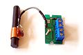
A number of manufacturers and retailers sell radio clocks that receive coded time signals from a radio station, which, in turn, derives the time from a true atomic clock.

One of the first radio clocks was offered by Heathkit in late 1983. Their model GC-1000 "Most Accurate Clock" received shortwave time signals from radio station WWV in Fort Collins, Colorado. It automatically switched between WWV's 5, 10, and 15 MHz frequencies to find the strongest signal as conditions changed through the day and year. It kept time during periods of poor reception with a quartz-crystal oscillator. This oscillator was disciplined, meaning that the microprocessor-based clock used the highly accurate time signal received from WWV to trim the crystal oscillator. The timekeeping between updates was thus considerably more accurate than the crystal alone could have achieved. Time down to the tenth of a second was shown on an LED display. The GC-1000 originally sold for US$250 in kit form and US$400 preassembled, and was considered impressive at the time. Heath Company was granted a patent for its design. [20] [21]

In the 2000s (decade) radio-based "atomic clocks" became common in retail stores; as of 2010 prices start at around US$15 in many countries. [22] Clocks may have other features such as indoor thermometers and weather station functionality. These use signals transmitted by the appropriate transmitter for the country in which they are to be used. Depending upon signal strength they may require placement in a location with a relatively unobstructed path to the transmitter and need fair to good atmospheric conditions to successfully update the time. Inexpensive clocks keep track of the time between updates, or in their absence, with a non-disciplined quartz-crystal clock, with the accuracy typical of non-radio-controlled quartz timepieces. Some clocks include indicators to alert users to possible inaccuracy when synchronization has not been recently successful.

The United States National Institute of Standards and Technology (NIST) has published guidelines recommending that radio clock movements keep time between synchronizations to within ±0.5 seconds to keep time correct when rounded to the nearest second. [23] Some of these movements can keep time between synchronizations to within ±0.2 seconds by synchronizing more than once spread over a day. [24]

Other broadcasts

Attached to other broadcast stations
Broadcast stations in many countries have carriers precisely synchronized to a standard phase and frequency, such as the BBC Radio 4 longwave service on 198 kHz, and some also transmit sub-audible or even inaudible time-code information, like the Radio France longwave transmitter on 162 kHz. Attached time signal systems generally use audible tones or phase modulation of the carrier wave.
Teletext (TTX)
Digital text pages embedded in television video also provide accurate time. Many modern TV sets and VCRs with TTX decoders can obtain accurate time from Teletext and set the internal clock. However, the TTX time can vary up to 5 minutes. [25]

Many digital radio and digital television schemes also include provisions for time-code transmission.

Digital Terrestrial Television
The DVB and ATSC standards have 2 packet types that send time and date information to the receiver. Digital television systems can equal GPS stratum 2 accuracy (with short term clock discipline) and stratum 1 (with long term clock discipline) provided the transmitter site (or network) supports that level of functionality.
VHF FM Radio Data System (RDS)
RDS can send a clock signal with sub-second precision but with an accuracy no greater than 100 ms and with no indication of clock stratum. Not all RDS networks or stations using RDS send accurate time signals. The time stamp format for this technology is Modified Julian Date (MJD) plus UTC hours, UTC minutes and a local time offset.
L-band and VHF Digital Audio Broadcasting
DAB systems provide a time signal that has a precision equal to or better than Digital Radio Mondiale (DRM) but like FM RDS do not indicate clock stratum. DAB systems can equal GPS stratum 2 accuracy (short term clock discipline) and stratum 1 (long term clock discipline) provided the transmitter site (or network) supports that level of functionality. The time stamp format for this technology is BCD.
Digital Radio Mondiale (DRM)
DRM is able to send a clock signal, but one not as precise as navigation satellite clock signals. DRM timestamps received via shortwave (or multiple hop mediumwave) can be up to 200 ms off due to path delay. The time stamp format for this technology is BCD.

Multiple transmitters

A radio clock receiver may combine multiple time sources to improve its accuracy. This is what is done in satellite navigation systems such as the Global Positioning System. GPS, Galileo and GLONASS satellite navigation systems have one or more caesium, rubidium or hydrogen maser atomic clocks on each satellite, referenced to a clock or clocks on the ground. Dedicated timing receivers can serve as local time standards, with a precision better than 50 ns. [26] [27] [28] [29] The recent revival and enhancement of LORAN, a land-based radio navigation system, will provide another multiple source time distribution system.

GPS clocks

Many modern radio clocks use satellite navigation systems such as Global Positioning System to provide more accurate time than can be obtained from terrestrial radio stations. These GPS clocks combine time estimates from multiple satellite atomic clocks with error estimates maintained by a network of ground stations. Due to effects inherent in radio propagation and ionospheric spread and delay, GPS timing requires averaging of these phenomena over several periods. No GPS receiver directly computes time or frequency, rather they use GPS to discipline an oscillator that may range from a quartz crystal in a low-end navigation receiver, through oven-controlled crystal oscillators (OCXO) in specialized units, to atomic oscillators (rubidium) in some receivers used for synchronization in telecommunications. For this reason, these devices are technically referred to as GPS-disciplined oscillators.

GPS units intended primarily for time measurement as opposed to navigation can be set to assume the antenna position is fixed. In this mode, the device will average its position fixes. After approximately a day of operation, it will know its position to within a few meters. Once it has averaged its position, it can determine accurate time even if it can pick up signals from only one or two satellites.

GPS clocks provide the precise time needed for synchrophasor measurement of voltage and current on the commercial power grid to determine the health of the system. [30]

Astronomy timekeeping

Although any satellite navigation receiver that is performing its primary navigational function must have an internal time reference accurate to a small fraction of a second, the displayed time is often not as precise as the internal clock. Most inexpensive navigation receivers have one CPU that is multitasking. The highest-priority task for the CPU is maintaining satellite lock—not updating the display. Multicore CPUs for navigation systems can only be found on high end products.

For serious precision timekeeping, a more specialized GPS device is needed. Some amateur astronomers, most notably those who time grazing lunar occultation events when the moon blocks the light from stars and planets, require the highest precision available for persons working outside large research institutions. The Web site of the International Occultation Timing Association [31] has detailed technical information about precision timekeeping for the amateur astronomer.

Daylight saving time

Various formats listed above include a flag indicating the status of daylight saving time (DST) in the home country of the transmitter. This signal is typically used by clocks to adjust the displayed time to meet user expectations.

See also

Related Research Articles

<span class="mw-page-title-main">Global Positioning System</span> American satellite-based radio navigation service

The Global Positioning System (GPS), originally Navstar GPS, is a satellite-based radio navigation system owned by the United States government and operated by the United States Space Force. It is one of the global navigation satellite systems (GNSS) that provide geolocation and time information to a GPS receiver anywhere on or near the Earth where there is an unobstructed line of sight to four or more GPS satellites. It does not require the user to transmit any data, and operates independently of any telephonic or Internet reception, though these technologies can enhance the usefulness of the GPS positioning information. It provides critical positioning capabilities to military, civil, and commercial users around the world. Although the United States government created, controls and maintains the GPS system, it is freely accessible to anyone with a GPS receiver.

<span class="mw-page-title-main">Loran-C</span> Radio navigation system

Loran-C is a hyperbolic radio navigation system that allows a receiver to determine its position by listening to low frequency radio signals that are transmitted by fixed land-based radio beacons. Loran-C combined two different techniques to provide a signal that was both long-range and highly accurate, features that had been incompatible. Its disadvantage was the expense of the equipment needed to interpret the signals, which meant that Loran-C was used primarily by militaries after it was introduced in 1957.

<span class="mw-page-title-main">Transit (satellite)</span> Satellite navigation system

The Transit system, also known as NAVSAT or NNSS, was the first satellite navigation system to be used operationally. The radio navigation system was primarily used by the U.S. Navy to provide accurate location information to its Polaris ballistic missile submarines, and it was also used as a navigation system by the Navy's surface ships, as well as for hydrographic survey and geodetic surveying. Transit provided continuous navigation satellite service from 1964, initially for Polaris submarines and later for civilian use as well. In the Project DAMP Program, the missile tracking ship USAS American Mariner also used data from the satellite for precise ship's location information prior to positioning its tracking radars.

Time and frequency transfer is a scheme where multiple sites share a precise reference time or frequency. The technique is commonly used for creating and distributing standard time scales such as International Atomic Time (TAI). Time transfer solves problems such as astronomical observatories correlating observed flashes or other phenomena with each other, as well as cell phone towers coordinating handoffs as a phone moves from one cell to another.

<span class="mw-page-title-main">Radio navigation</span> Use of radio-frequency electromagnetic waves to determine position on the Earths surface

Radio navigation or radionavigation is the application of radio frequencies to determine a position of an object on the Earth, either the vessel or an obstruction. Like radiolocation, it is a type of radiodetermination.

<span class="mw-page-title-main">Omega (navigation system)</span> First global radio navigation system for aircraft

OMEGA was the first global-range radio navigation system, operated by the United States in cooperation with six partner nations. It was a hyperbolic navigation system, enabling ships and aircraft to determine their position by receiving very low frequency (VLF) radio signals in the range 10 to 14 kHz, transmitted by a global network of eight fixed terrestrial radio beacons, using a navigation receiver unit. It became operational around 1971 and was shut down in 1997 in favour of the Global Positioning System.

<span class="mw-page-title-main">DCF77</span> German time signal radio station

DCF77 is a German longwave time signal and standard-frequency radio station. It started service as a standard-frequency station on 1 January 1959. In June 1973 date and time information was added. Its primary and backup transmitter are located at 50°0′56″N9°00′39″E in Mainflingen, about 25 km south-east of Frankfurt am Main, Germany. The transmitter generates a nominal power of 50 kW, of which about 30 to 35 kW can be radiated via a T-antenna.

<span class="mw-page-title-main">Wide Area Augmentation System</span> System that enhances the accuracy of GPS receivers

The Wide Area Augmentation System (WAAS) is an air navigation aid developed by the Federal Aviation Administration to augment the Global Positioning System (GPS), with the goal of improving its accuracy, integrity, and availability. Essentially, WAAS is intended to enable aircraft to rely on GPS for all phases of flight, including precision approaches to any airport within its coverage area. It may be further enhanced with the Local Area Augmentation System (LAAS) also known by the preferred ICAO term Ground-Based Augmentation System (GBAS) in critical areas.

Clock synchronization is a topic in computer science and engineering that aims to coordinate otherwise independent clocks. Even when initially set accurately, real clocks will differ after some amount of time due to clock drift, caused by clocks counting time at slightly different rates. There are several problems that occur as a result of clock rate differences and several solutions, some being more acceptable than others in certain contexts.

<span class="mw-page-title-main">Satellite navigation</span> Use of satellite signals for geo-spatial positioning

A satellite navigation or satnav system is a system that uses satellites to provide autonomous geopositioning. A satellite navigation system with global coverage is termed global navigation satellite system (GNSS). As of 2023, four global systems are operational: the United States's Global Positioning System (GPS), Russia's Global Navigation Satellite System (GLONASS), China's BeiDou Navigation Satellite System (BDS), and the European Space Agency's Galileo.

<span class="mw-page-title-main">Differential GPS</span> Enhancement to the Global Positioning System providing improved accuracy

Differential Global Positioning Systems (DGPSs) supplement and enhance the positional data available from global navigation satellite systems (GNSSs). A DGPS for GPS can increase accuracy by about a thousandfold, from approximately 15 metres (49 ft) to 1–3 centimetres.

Pseudo-range multilateration, often simply multilateration (MLAT) when in context, is a technique for determining the position of an unknown point, such as a vehicle, based on measurement of the times of arrival (TOAs) of energy waves traveling between the unknown point and multiple stations at known locations. When the waves are transmitted by the vehicle, MLAT is used for surveillance; when the waves are transmitted by the stations, MLAT is used for navigation. In either case, the stations' clocks are assumed synchronized but the vehicle's clock is not.

A pulse per second is an electrical signal that has a width of less than one second and a sharply rising or abruptly falling edge that accurately repeats once per second. PPS signals are output by radio beacons, frequency standards, other types of precision oscillators and some GPS receivers. Precision clocks are sometimes manufactured by interfacing a PPS signal generator to processing equipment that aligns the PPS signal to the UTC second and converts it to a useful display. Atomic clocks usually have an external PPS output, although internally they may operate at 9,192,631,770 Hz. PPS signals have an accuracy ranging from a 12 picoseconds to a few microseconds per second, or 2.0 nanoseconds to a few milliseconds per day based on the resolution and accuracy of the device generating the signal.

Global Navigation Satellite System (GNSS) receivers, using the GPS, GLONASS, Galileo or BeiDou system, are used in many applications. The first systems were developed in the 20th century, mainly to help military personnel find their way, but location awareness soon found many civilian applications.

<span class="mw-page-title-main">Radio</span> Use of radio waves to carry information

Radio is the technology of communicating using radio waves. Radio waves are electromagnetic waves of frequency between 3 hertz (Hz) and 300 gigahertz (GHz). They are generated by an electronic device called a transmitter connected to an antenna which radiates the waves. They are received by another antenna connected to a radio receiver. In addition to communication, radio is used for radar, radio navigation, remote control, remote sensing, and other applications.

<span class="mw-page-title-main">Atomic clock</span> Extremely accurate clock

An atomic clock is a clock that measures time by monitoring the resonant frequency of atoms. It is based on atoms having different energy levels. Electron states in an atom are associated with different energy levels, and in transitions between such states they interact with a very specific frequency of electromagnetic radiation. This phenomenon serves as the basis for the International System of Units' (SI) definition of a second:

The second, symbol s, is the SI unit of time. It is defined by taking the fixed numerical value of the caesium frequency, , the unperturbed ground-state hyperfine transition frequency of the caesium-133 atom, to be 9192631770 when expressed in the unit Hz, which is equal to s−1.

<span class="mw-page-title-main">Error analysis for the Global Positioning System</span> Detail of the global positioning system

The error analysis for the Global Positioning System is important for understanding how GPS works, and for knowing what magnitude of error should be expected. The GPS makes corrections for receiver clock errors and other effects but there are still residual errors which are not corrected. GPS receiver position is computed based on data received from the satellites. Errors depend on geometric dilution of precision and the sources listed in the table below.

Two independent clocks, once synchronized, will walk away from one another without limit. To have them display the same time it would be necessary to re-synchronize them at regular intervals. The period between synchronizations is referred to as holdover and performance under holdover relies on the quality of the reference oscillator, the PLL design, and the correction mechanisms employed.

<span class="mw-page-title-main">GPS disciplined oscillator</span> Combination of a GPS receiver and a stable oscillator

A GPS clock, or GPS disciplined oscillator (GPSDO), is a combination of a GPS receiver and a high-quality, stable oscillator such as a quartz or rubidium oscillator whose output is controlled to agree with the signals broadcast by GPS or other GNSS satellites. GPSDOs work well as a source of timing because the satellite time signals must be accurate in order to provide positional accuracy for GPS in navigation. These signals are accurate to nanoseconds and provide a good reference for timing applications.

<span class="mw-page-title-main">Hyperbolic navigation</span> Class of obsolete radio navigation systems

Hyperbolic navigation is a class of radio navigation systems in which a navigation receiver instrument is used to determine location based on the difference in timing of radio waves received from radio navigation beacon transmitters.

References

  1. 1 2 Lombardi, Michael A. (March 2010). "How Accurate is a Radio Controlled Clock?" (PDF). Horological Journal. 152 (3): 108–111. Archived (PDF) from the original on 2021-01-07. Retrieved 2023-12-01 via National Institute of Standards and Technology website.
  2. 1 2 3 4 Standard Time and Frequency Signals (PDF) (in Russian), retrieved 2018-07-15 — official signal specification.
  3. 1 2 3 4 Dennis D. McCarthy, P. Kenneth Seidelmann Time: From Earth Rotation to Atomic Physics Wiley-VCH, 2009 ISBN   3-527-40780-4 page 257
  4. "NIST Radio Station WWVB". NIST. March 2010. Archived from the original on 25 March 2014. Retrieved 18 March 2014.
  5. "BPC". National Time Service Center, Chinese Academy of Sciences. Archived from the original on February 14, 2018. Retrieved 16 March 2013.
  6. Yvonne Zimber (2007-05-09). "DCF77 transmitting facilities". Archived from the original on 2010-05-14. Retrieved 2010-05-02.
  7. "Synchronizing time with DCF77 and MSF60". Archived from the original on 2011-01-12. Retrieved 2011-09-12. 090917 compuphase.com
  8. "A Time Station Signal Project for Taiwan". Archived from the original on 2017-04-20. Retrieved 2018-07-09.
  9. "长波授时 (Longwave time signal)". National Time Service Center, Chinese Academy of Sciences. Archived from the original on 10 January 2013. Retrieved 16 March 2013.
  10. "科研成果 (Research achievements)". National Time Service Center, Chinese Academy of Sciences. Archived from the original on 17 April 2013. Retrieved 16 March 2013.
  11. "PTB time monitor". Archived from the original on 2018-07-16. Retrieved 2018-07-16. — in German
  12. "Radio stations in London, England". Archived from the original on 2016-04-19. Retrieved 2016-04-26. Birmingham, Droitwich, 500 kW + Blackwall Tunnel + Rotherhithe Tunnel
  13. "L.F. RADIO-DATA: Specification of BBC phase-modulated transmissions on long-wave" (PDF) (published 2006-10-24). December 1984. Archived (PDF) from the original on 2016-03-04. Retrieved 2016-04-25. The BBC long-wave a.m. transmitter network carries a low bit-rate data signal, in addition to the normal programme signal modulation. The data signal is conveyed by phase-modulation of the carrier
  14. 1 2 3 4 "短波授时 (Shortwave time signal)". National Time Service Center, Chinese Academy of Sciences. Archived from the original on 2013-01-15. Retrieved 2013-03-16.
  15. 1 2 Information on the Official Time and Standard Frequency Archived 2018-08-28 at the Wayback Machine — in Spanish
  16. 1 2 3 4 "Rádio-Difusão de Sinais Horários". Observatório Nacional. Archived from the original on 2014-03-12. Retrieved 2012-02-23.
  17. "QSL: MIKES Time Station, Espoo, Finland". SWL DX Blog. 14 May 2014. Archived from the original on 2016-10-12. Retrieved 2016-10-11. Reproduces a QSL letter from MIKES with technical details.
  18. BIPM Annual Report on Time Activities – Time Signals Archived 2021-10-10 at the Wayback Machine , retrieved 2018 July 31.
  19. "SI units in Finland, time and frequency |".
  20. "Heathkit GC-1000-H Most Accurate Clock". Pestingers. Archived from the original on February 14, 2020.
  21. USpatent 4582434,David Plangger and Wayne K. Wilson, Heath Company,"Time corrected, continuously updated clock",issued April 15, 1986
  22. " Radio controlled clock £19.95 Archived 2013-02-16 at archive.today
  23. "How Accurate is a Radio Controlled Clock?" by Michael Lombardi (2010).
  24. RADIO-CONTROLLED WALLCLOCK INSTRUCTION MANUAL
  25. "How's your GHD8015F2 operating? — Personal Video Recorders — Digital Spy Forums". Digital Spy . 100506 digitalspy.co.uk
  26. "datasheet i-Lotus TX Oncore" (PDF). Archived (PDF) from the original on 2015-10-16. Retrieved 2014-01-22.
  27. "Symmetricom XL-GPS". Archived from the original on 2014-02-01. Retrieved 2014-01-22.
  28. "datasheet Trimble Resolution SMT GG" (PDF). Archived (PDF) from the original on 2013-06-22. Retrieved 2014-01-22.
  29. "datasheet u-blox NEO/LEA-M8T" (PDF). Archived (PDF) from the original on 2017-04-12. Retrieved 2017-04-11.
  30. KEMA, Inc. (November 2006). "Substation Communications: Enabler of Automation / An Assessment of Communications Technologies". UTC — United Telecom Council: 3.{{cite journal}}: Cite journal requires |journal= (help)
  31. "International Occultation Timing Association". Archived from the original on 2006-07-20. Retrieved 2006-07-19.