
The following detailed sequence of events covers the timeline of Cluj-Napoca, a city in Transylvania, Romania.
Contents
- 2nd century
- 3rd century
- 4th century
- 5th century
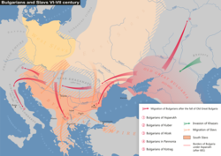
- 6th century
- 7th century
- 8th century
- 9th century
- 10th century
- 11th century
- 12th century
- 13th century
- 14th century
- 15th century
- 16th century
- 17th century
- 18th century
- 19th century
- 20th century
- 21st century
- See also
- References
- Sources
- Primary sources
- Secondary sources
- Tertiary sources
- External links
Cluj-Napoca (Romanian pronunciation: [ˈkluʒnaˈpoka] ⓘ , German: Klausenburg; Hungarian : Kolozsvár, Hungarian pronunciation: [ˈkoloʒvaːr] ⓘ ; Medieval Latin: Castrum Clus, Claudiopolis; and Yiddish : קלויזנבורג, Kloiznburg), commonly known as Cluj, is located in the Someșul Mic River valley, roughly equidistant from Bucharest (324 kilometres (201 miles)), Budapest (351 km (218 mi)) and Belgrade (322 km (200 mi)). Throughout its long history, the area around Cluj-Napoca was part of many empires and kingdoms, including the Roman Empire (as part of the Dacia province and later a sub-division of Dacia Porolissensis), Gepidia , Avaria , the Hungarian Kingdom, the Habsburg monarchy, Austria-Hungary and the Kingdom of Romania. From 1790 to 1848 and 1861–1867, it was the official capital of the Grand Principality of Transylvania.
In modern times, the city holds the status of municipiu , is the seat of Cluj County in the north-western part of Romania, and continues to be considered the unofficial capital of the historical province of Transylvania. Cluj continues to be one of the most important academic, cultural, industrial and business centres in Romania. Among other institutions, it hosts the country's largest university, Babeș-Bolyai University, with its famous botanical garden. The current boundaries of the municipality contain an area of 179.52 square kilometres (69.31 sq mi). The Cluj-Napoca metropolitan area has a population of 411,379 people, while the population of the peri-urban area (Romanian : zona periurbană) exceeds 420,000 residents, making it one of the most populous cities in Romania.

![Text of Roman milliarium from 108, describing the construction of the road from Potaissa to Napoca, by request of the Emperor Trajan. It indicates the distance of ten thousand feet (P.M.X.) to Potaissa. The complete inscription is: "Imp[erator]/ Caesar Nerva/ Traianus Aug[ustus]/ Germ[anicus] Dacicus/ pontif[ex] maxim[us]/ [sic] pot[estate] XII co[n]s[ul] V/ imp[erator] VI p[ater] p[atriae] fecit/ per coh[ortem] I Fl[aviam] Vlp[iam]/ Hisp[anam] mil[liariam] c[ivium] R[omanorum] eq[uitatam]/ a Potaissa Napo/cam / m[ilia] p[assuum] X
". Inscription from the Milliarium of Aiton, Aiton commune, Romania.jpg](http://upload.wikimedia.org/wikipedia/commons/a/a5/Inscription_from_the_Milliarium_of_Aiton%2C_Aiton_commune%2C_Romania.jpg)


![Seal of Cluj granted in 1377 by King Louis I of Hungary, with the inscription S[igilium] CIVIVM de CLVS WAR Sigilium Civium de Clus War.jpg](http://upload.wikimedia.org/wikipedia/commons/4/47/Sigilium_Civium_de_Clus_War.jpg)