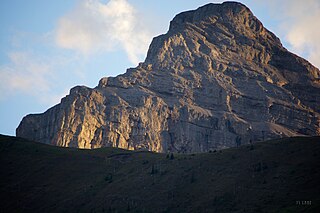
Mount Lyell is a mountain on the Alberta–British Columbia border in western Canada. Comprising five distinct summits, Mount Lyell reaches a height of 3,498 m (11,476 ft). The mountain was named by James Hector in 1858 in recognition of Scottish geologist Sir Charles Lyell.

Mount Muir is a mountain located on the Continental Divide on the Alberta-British Columbia border. The mountain was named in 1918 after Alexander Muir. It is located in the High Rock Range.
Intersection Mountain is a 2,452-metre (8,045 ft) mountain on the Continental Divide. The mountain is so named because it lies at the intersection of the 120th meridian where the British Columbia and Alberta border diverges from its line along the Divide northwards along the meridian. The mountain is in Kakwa Provincial Park in British Columbia and Willmore Wilderness Park in Alberta and is near Casket Pass.

Mount Phillips is a mountain located on the border of Jasper National Park (Alberta) and Mount Robson Provincial Park. It is Alberta's 61st highest peak, and British Columbia's 84th highest peak. It was named in 1923 by J. Norman Collie after Donald "Curly" Phillips, a Jasper area outfitter and guide who made the disputed first ascent of Mount Robson in 1909.
Drawbridge Peak is located on the Continental Divide along the provincial borders of Alberta and British Columbia. The Alberta side is in Jasper National Park while Mount Robson Provincial Park is on the B.C. side. It was named in 1920 by the Interprovincial Boundary Survey.
Alnus Peak is located on the Canadian provincial boundary between Alberta and British Columbia. It was named in 1921 by Arthur O. Wheeler; alnus is the Latin name of the Alder tree. The name may refer to the dense stands of Red Alder found in the area.
Wales Peak is located on the border of Alberta and British Columbia. It was named in 1927 by Alfred J. Ostheimer after the British astronomer William Wales who sailed on Captain Cook's second voyage of discovery.
Triad Peak is a mountain located on the border of Alberta and British Columbia, Canada. It lies very close to the continental divide at the head of the Athabasca River valley near Jasper National Park. Major headwaters are the Athabasca and Columbia rivers.
Mount Barnard is located on the border of Alberta and British Columbia, NW of the head of Waitabit Creek and North of Golden. It is the 30th highest peak in Alberta and the 42nd highest peak in British Columbia. It was named in 1917 by boundary surveyors after Sir Francis Stillman Barnard, a Lieutenant Governor of BC during the 1910s. It should not be confused with the higher Californian peak of the same name.
Mount Trutch is a mountain located on the border of Alberta and British Columbia, Canada. It was named in 1920 after Sir Joseph Trutch, a Canadian politician who was the first Lieutenant Governor of British Columbia.
Waitabit Peak is located on the border of Alberta and British Columbia. It was named in 1900 after Waitabit Creek.
Chimney Peak is located at the northeastern end of Kootenay National Park just south of Quadra Mountain and straddles the Continental Divide marking the Alberta-British Columbia border. It was named in 1910 by T.G. Longstaff and Captain E.O. Wheeler who made its first ascent through a chimney.

Mount Cautley is located on the border of Alberta and British Columbia on the Continental Divide, SE of Assiniboine Pass. Richard W. Cautley was a surveyor from Ipswich, England. As part of the Alberta/British Columbia Boundary Commission, his party was in charge of mapping precise boundaries in the usable mountain passes of the Canadian Rockies.
A mountain formerly known as Mount Pétain, but with no current official name, is located on the border of the Canadian provinces of Alberta and British Columbia (BC) on the Continental Divide.
Mount Bolton is located on the border of Alberta and British Columbia on the Continental Divide, northeast of Elkford, Kootenay Land District. It was named after Bolton, Lambert Ernest Stanley DLS. Bolton was serving with the Canadian Pioneers, 1st Battilion when he was killed in action on June 13, 1916.
Allison Peak is located on the Canadian provincial boundary of Alberta and British Columbia along the Continental Divide. It was named in 1915 by Morrison P. Bridgland after Douglas Allison. Douglas Allison was a law enforcement agent.
Rainy Ridge is located on the border of Alberta and British Columbia on the Continental Divide. It was named in 1958 origin of the name is unknown.
Three Lakes Ridge is located on the border of Alberta and British Columbia on the Continental Divide. It was named by the Interprovincial Boundary Survey.
La Coulotte Ridge is a mountain ridge which straddles the Continental Divide marking the Alberta-British Columbia border. It was named after La Coulotte in France.
Kishinena Peak is located on the border of Alberta and British Columbia on the Continental Divide. It was named in 1959.


