Zapovednik

Last updated
A view of the Bryansky Les Nature Reserve, a zapovednik of Russia Zapovednik "Brianskii Les". Reka Terebushka.jpg
A view of the Bryansky Les Nature Reserve, a zapovednik of Russia

Zapovednik [lower-alpha 1] is an established term on the territory of the former Soviet Union for a protected area which is kept "forever wild". It is the highest degree of environmental protection for the assigned areas, which are strictly protected and access to the public is restricted.

Contents

Overview

The literal English translation of zapovednik is "nature sanctuary" (like animal sanctuary); however, in practice, zapovedniks sometimes have to do with the protection of things other than nature and can incorporate historical-cultural, historical–archaeological, and other types of cultural or natural heritage. They also function as important sites for historical research and education and so are comparable to the Sites of Special Scientific Interest as found in the United Kingdom and Hong Kong.

The term zapovednik, which refers to the reserve, staff and infrastructure, was used in the former Soviet Union and is still in use in the Russian Federation and in some of the other former Soviet republics. Many reserves have areas with different degrees of protection; sometimes grazing is permitted to a certain extent.

Other types of protected areas include national nature parks, zakazniks (referring to "state game reserve" because a limited amount of hunting is allowed there), nature monuments (often individual trees, geological exposures, or other small areas), etc. Some zapovedniks are recognized as biosphere reserves (or sanctuaries).

In Russia there are 101 zapovedniks covering about 330,000 square kilometers (130,000 sq mi), or about 1.4% of the country's total area. They include everything from isolated patches of steppe to large tracts of Siberia and the Arctic, and range in size from Galich'ya Gora at 2.31 km2 (570 acres) to the Great Arctic State Nature Reserve at 41,692 square kilometers (16,097 sq mi). The Russian Ministry of Natural Resources oversees 99 of the zapovedniks. The exception is Il'menskiy, which is administered by the Russian Academy of Sciences, and Galich'ya Gora, administered by Voronezh State University. [1]

Theory of zapovednost'

The theoretical justification for the zapovedniks is known as zapovednost' (заповедность) – meaning "the state of being protected in a zapovednik". It was developed in the 1890s and early 20th century, principally by the soil biologist Vasily Dokuchaev.

The fundamental idea of zapovednost' is the exclusion of people and the prohibition of economic activity, the only exceptions being non-intrusive access allowed to scientists and rangers. [2] Zapovedniks are intended to be parcels of untouched natural ecosystems that can be studied as standards with which to compare managed ecosystems, such as are created in agriculture and forestry. [3] To this end, zapovedniks need to be large enough to be self-sufficient, with a complete range of trophic levels up to the top predators. [4]

In 1910 the theory of zapovednost' was taken a step forward by I. P. Borodin, who argued that zapovedniks should not be established piecemeal, but as a planned system of reserves including samples of all the main natural regions in the country. [5]

In the 1940s Aldo Leopold understood the need for zapovednik-type reserves: "While even the largest wilderness areas become partially deranged, it required only a few wild acres for J. E. Weaver to discover why the prairie flora is more drought-resistant than the agronomic flora which has supplanted it." The answer was that the wild prairie had a much more complex, and more efficient, root system, and this could only have been discovered by studying the undisturbed natural ecosystem. [6]

Of course it would be difficult, if not impossible, to establish a 'perfect' zapovednik today, entirely natural and self-sufficient, especially in view of downstream effects involving pollution and greenhouse gases. Nevertheless, many Russian zapovedniks are a good approximation to the ideal and have been operating as scientific institutions for many decades.

History

The first zapovedniks were set up in the steppe region of the Russian Empire in the 1890s. Some were equipped with research stations. Dokuchaev was the guiding spirit behind these early zapovedniks. Areas of steppe were chosen for the first zapovedniks because of the rapid disappearance of virgin steppe as it was ploughed up, and because it was thought that ploughing might be exacerbating the effects of drought; clearly, research was needed in order to understand the steppe and how it could be best exploited. [7]

The applied-science motivation for setting up zapovedniks was continued in the first state-organized zapovednik. Barguzin Nature Reserve was established by the tsarist government in 1916 on the eastern shore of Lake Baikal. Its purpose was to protect and study a population of sable  – a valuable fur species that was declining due to over-hunting. [8] Other zapovedniks appear to have been set up at about the same time but either lapsed (e.g. Sayan) or did not receive formal recognition until later. [9] [10]

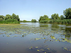
Lenin's nationalization of the land in 1917 and 1918 created a legally favourable environment for the Soviet zapovednik system since securing areas of land for this purpose from private owners was no longer a problem. [11] Lenin may have had an interest in nature protection because permission was granted promptly for the creation in 1919 of [12] in the Volga Delta on the north-western shore of the Caspian Sea. [13]

The recognition of zapovedniks was put on a firm legal footing by a measure "On the Protection of Nature Monuments, Gardens and Parks", signed into law by Lenin in 1921. [14] The creation of zapovedniks continued, but the measure also allowed for the establishment of national parks, though none were set up in the Soviet Union for another half century[ citation needed ].

By 1933 there were 15 state zapovedniks in Russia, [15] and by 1995, there were 115. The average area of new zapovedniks declined from 780 km2 in 1916–25 to 110 km2 in 1936–45, and then rose to 5,060 km2 in 1986–95. [16] In 2007 there were 101 operating zapovedniks, reflecting a small number of new ones opened since 1995, but also two periods of closures and contraction of the system. The first of these was planned by Aleksandr Malinovskii; it was carried out in 1951 with a view to turning the zapovedniks into "commercial-and-research" institutions as well as releasing substantial areas of protected forest for commercial exploitation. [17] Over the next 10 years the zapovednik system recovered somewhat, but in 1961 Nikita Khrushchev criticized it, famously referring to a film about them [18] in which a scientist was shown watching a squirrel gnawing a nut. [19] Six zapovedniks were closed and others were amalgamated or reduced in area. [20]

Although in theory a zapovednik is an extensive area of unspoilt natural ecosystems used for scientific research with a residential staff of scientists and rangers, the history of many zapovedniks has in fact been rather different, sometimes involving closure, exploitation (including the felling of forest), and eventual reopening. Even so, some zapovedniks have had an almost unblemished history and most retain the original vision of being scientific research institutions not open to public recreation.

Environments protected

Map of zapovedniks in Russia Zapsmap.jpg
Map of zapovedniks in Russia

It is not easy to summarize the coverage of ecosystems protected by zapovedniks, but a rough idea can be gained by counting the number of reserves in the main natural-vegetation zones. On the map these are, from north to south:

This is a highly simplistic classification. Each major zone is divided into subzones, and there are transitional vegetation types. Moreover, many zapovedniks, especially if in a transitional zone or covering a range of altitudes, will contain examples of several vegetation types.

With those qualifications, the numbers of zapovednik sites (some zapovedniks occupy widely dispersed sites, some of which are here counted separately) in the different zones are as follows: Arctic desert and tundra – c.15; taiga – c.40; deciduous forest – c.13; steppe – c.30. About half a dozen are predominantly montane, especially in the Caucasus. Komandorsky and Wrangel Island are remote islands. A few are mainly wetlands.

Management and uses

Although the principle of zapovednost' stipulates no economic use, in practice zapovedniks have often been required to contribute to the national economy. Voronezh Zapovednik, for instance, bred European beavers for reintroduction to other areas in support of the fur industry. [21] Several zapovedniks have also been regarded as a breeding ground for other commercially valuable fur-bearing animals, such as sable and desman, allowing them to spread into neighboring unprotected areas to support commercial trapping. [22]

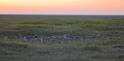
Non-intervention management is difficult to practise in steppe zapovedniks, which are often far too small to support a self-sustaining ecosystem including wild herbivores (such as saiga) that may have been migratory. Resort is sometimes made to various mowing regimes, which however cannot satisfactorily replace natural processes insofar as it does not recycle nutrients and organic matter through the herbivore and carnivore food chain, and cannot replicate trampling effects.

An important activity in all zapovedniks is regular monitoring of seasonal events (phenology). This is now standardized in a programme of observations known as the Chronicle of Nature (Летопись природы). The name was suggested by Aleksandr Formozov in 1937 although a monitoring programme was being developed by V.N.Sukachev in 1914 and Grigorii Kozhevnikov in 1928. [23] Instructions for conducting the Chronicle of Nature are periodically updated. [24]

Under the pressure to become self-financing, some zapovedniks have tried at various times to develop ecological tourism - usually in the reserve's buffer zone, so avoiding infringement of the principle of zapovednost'. In some cases tourism does however become a serious problem on account of the proximity of recreation centres, e.g. at Teberdinsky Zapovednik in the Caucasus. The Dombai recreation center, long a favorite Russian alpine skiing destination, is located near the center of the zapovednik, and the impact of tourism in the area as more Russians and foreigners come to visit has created pressure on the preserved ecosystems around it.

International significance of the zapovednik system

The anthropogenic impact on the environment - due to pollution, climate change and ultimately human population growth - is generating increasingly serious problems, the solution of which will depend on a better understanding of the biosphere than we already have. To provide conditions in which such an understanding can be developed, it is essential to preserve as far as possible intact examples of natural ecosystems, and the zapovedniks are the only large system of protected areas created primarily for this purpose. In the case of soil erosion, for example, it is only by comparing soil formation and loss rates from intact steppe or prairie and from the same kind of land under intensive agriculture that we can appreciate how destructive of natural capital the latter often is. [25]

Regular long-term monitoring of natural phenomena in zapovedniks has also provided a baseline set of data which is now valuable for assessing how anthropogenic pressure, primarily through climate change, is affecting natural ecosystems. Since the latter perform essential functions such as carbon sequestration and nutrient cycling, it is obviously important to know how these ecosystem services are being affected by anthropogenic pressure. [26] There is an argument for establishing a well-funded global network of zapovedniks in order to increase our understanding of anthropogenic pressures on all the natural ecosystems of the world.

List of Nature Reserves ("Zapovedniks") in Russia

NamePhotoLocationWebsiteAreaYearDescription
Altai Chulyshman reka 01.jpg Altai Republic
52°52′0″N88°57′0″E / 52.86667°N 88.95000°E / 52.86667; 88.95000 (Altai)
Park:
Алтайский
881,238 ha (3,402.5 sq mi)1932 Altai Mountains of south central Russia. Part of the UNESCO World Heritage Site "Golden Mountains of Altai". [27] [28]
Astrakhan Astrachan Volgadelta.jpg Astrakhan Oblast
45°34′52″N47°54′59″E / 45.58111°N 47.91639°E / 45.58111; 47.91639 (Astrakhan)
Park:
Астраханский
66,816 ha (258.0 sq mi)1919Island and wetland area on the southwest corner of the Volga Delta. Reeds, cattails, willows. 50 species of fish, including beluga sturgeon. [29] [30]
Azas Vid s berega na ozero (zima).JPG Tuva
52°28′12″N96°8′11″E / 52.47000°N 96.13639°E / 52.47000; 96.13639 (Azas)
Park:
Азас
300,390 ha (1,159.8 sq mi)1985Located in the central part Todzha basin (an enormous intermountain trough within the Altai-Sayan mountain country) in northeastern Tuva and stretched along the Azas River. [31] [32]
Baikal Baikal reservate -2.jpg Buryatia
51°20′36″N105°9′27″E / 51.34333°N 105.15750°E / 51.34333; 105.15750 (Baikalsky)
Park:
Байкальский
165,724 ha (639.9 sq mi)1968On the southeast shore of Lake Baikal. Protects taiga and mountain habitats along the lake and the neighbouring central part of the Khamar-Daban Range. [33] [34]
Baikal-Lena Baykal-Lena nature reserve.jpg Irkutsk Oblast
55°13′0″N107°45′0″E / 55.21667°N 107.75000°E / 55.21667; 107.75000 (Baykal-Lena)
Park:
Байкало-Ленский
660,000 ha (2,548.3 sq mi)1986Located on the northwest coast of Lake Baikal, stretches along the western coast of Lake Baikal about 120 km, with an average width of 65 km. [35] [36]
Barguzin Davsha.jpg Buryatia
54°30′0″N109°50′0″E / 54.50000°N 109.83333°E / 54.50000; 109.83333 (Barguzin)
Park:
Баргузинский
366,868 ha (1,416.5 sq mi)1916On the west slope of the Barguzin Range, including the northeast shores of the Lake Baikal, part of the lake and the Barguzin River. [37] [38]
Basegi Basegi 04.JPG Perm Krai
58°3′0″N58°2′0″E / 58.05000°N 58.03333°E / 58.05000; 58.03333 (Basegi)
Park:
Басеги
37,935 ha (146.5 sq mi)1982Main rivers are: Usva River (northern border of nature reserve) and Vilva River (southern border). There are also some small rivers, such as the typical mountain rapids channels. [39] [40]
Bashkiriya Pink mountain Masim.jpg Bashkortostan
53°20′44″N57°46′40″E / 53.34556°N 57.77778°E / 53.34556; 57.77778 (Bashkirski)
Park:
Башкирский
49,609 ha (191.5 sq mi)1930Central part of the Bashkir (Southern) Urals. Forested mountain slopes to the Kaga River; transition to steppe-forest. [41] [42]
Bastak Tigr Zavetnyi.jpg Jewish Autonomous Oblast
48°56′37″N133°7′13″E / 48.94361°N 133.12028°E / 48.94361; 133.12028 (Bastak)
Park:
Бастак
91,375 ha (352.8 sq mi)1997Located in the Amur River basin, the reserve's territory covers the south-eastern spurs Bureya ridge and the northern outskirts Sredneamurskaya lowlands. The reserve has been the site of successful reintroduction of the endangered Amur tiger. [43] [44]
Belogorye Les na Vorskle 02.jpg Belgorod Oblast
50°37′12″N35°58′12″E / 50.62000°N 35.97000°E / 50.62000; 35.97000 (Belogorye)
Park:
Белогорье
2,131 ha (8.2 sq mi)1935Southwestern slope of the Central Hills on the Western edge of Russia. Cretaceous limestone landforms. [45] [46]
Bogdo-Baskunchak Bogdo.jpg Astrakhan Oblast
48°12′42″N46°52′50″E / 48.21167°N 46.88056°E / 48.21167; 46.88056 (Bogdo-Baskunchak)
Park:
Богдинско-Баскунчакский
18,780 ha (72.5 sq mi)1997Semi-arid area around Lake Baskunchak (a salt lake) and mountain Big Bogdo, just north of Volga Delta. [47] [48]
Bolon Vodno-bolotnye ugod'ia Bolon'skogo zapovednika. leto.jpg Khabarovsk Krai
49°34′7″N135°54′49″E / 49.56861°N 135.91361°E / 49.56861; 135.91361 (Bolon)
Park:
Болоньский
103,000 ha (397.7 sq mi)1997Located on the Middle Amur lowlands adjacent to the south-west to Lake Bolon, the reserve covers the wetlands of international importance. Large numbers of migratory waterfowl use the area for nesting and stopovers on long flights. [49] [50]
Bolshekhekhtsirsky Khrebet Bol'shoi Khekhtsir.JPG Khabarovsk Krai
49°34′7″N135°54′49″E / 49.56861°N 135.91361°E / 49.56861; 135.91361 (KhekhtsirskyBolon)
Park:
Большехехцирский
45,439 ha (175.4 sq mi)1963The reserve covers and is named for the Big Khekhtsir Ridge, about 20 km south of the city of Khabarovsk, in the Russian Far East. The reserve is noteworthy for its position close to a city and for being an island of mountain-forest biodiversity surrounded by lower river floodplains. [51]
Botcha Ikha River, Khabarovsk Krai.jpg Khabarovsk Krai
48°8′11″N139°13′16″E / 48.13639°N 139.22111°E / 48.13639; 139.22111 (Botcha)
Park:
Ботчинский
267,380 ha (1,032.4 sq mi)1994The northernmost reserve inhabited by the endangered Amur tiger. The reserve is located in the north-eastern part of the Sikhote-Alin mountain range, it includes the Botchi River basin on its eastern slopes, in Sovetskaya Gavan Khabarovsk region. [52] [53]
Bryansk Forest Nerussa river.jpg Bryansk Oblast
52°30′0″N34°0′0″E / 52.50000°N 34.00000°E / 52.50000; 34.00000 (Bryansk Forest)
Park:
Брянский Лес
12,186 ha (47.1 sq mi)1987One of the last remaining unbroken forests on the southern end of the European broadleaf forest, supporting abundant wildlife in the forests and bogs. [54] [55]
Bureya Ozero Medvezh'e.jpg Khabarovsk Krai
51°55′46″N134°35′44″E / 51.92944°N 134.59556°E / 51.92944; 134.59556 (Bureya)
Park:
Буреинский
358,444 ha (1,384.0 sq mi)1987Mountain tundra, lakes, rivers and lakes, larch forests, spruce-fir forests, thickets of Siberian pine, floodplain intrazonal forests. Located on the western edge of Khabarovsk Krai in the Russian Far East. [56] [57]
Caucasus Kaukasian nature reserve.jpg Krasnodar Krai
43°50′10″N40°24′3″E / 43.83611°N 40.40083°E / 43.83611; 40.40083 (Caucasus)
Park:
Кавказский им. Х.Г. Шапошникова
280,335 ha (1,082.4 sq mi)1924The biggest and oldest in the territory of specially protected natural area in the North Caucasus. [58] [59]
Central Black Earth 20140613 204426 Richtone(HDR).jpg Kursk Oblast
51°8′49″N36°25′48″E / 51.14694°N 36.43000°E / 51.14694; 36.43000 (Central Black Earth)
Park:
Центрально-Чернозёмный
5,287 ha (20.4 sq mi)1935The reserve is located in the southwestern part of the Upland within the middle zone of forest-steppe zone, in the territory of Medvensky, Manturovsky and Gorshechensky District. [60] [61]
Central Forest Boloto02.JPG Tver Oblast
56°27′18″N32°58′36″E / 56.45500°N 32.97667°E / 56.45500; 32.97667 (Central Forest)
Park:
Центрально-Лесной
24,447 ha (94.4 sq mi)1931Located at the south-western part of the Valdai Hills, close to the divide between the drainage basins of the Atlantic (the Western Dvina and the Lovat) and the Caspian Sea (the Volga). The landscape within the nature reserve is mainly hilly, with a large area occupied by swamps. [62] [63]
Central Siberia Bakhta. Vecher u poselka - panoramio.jpg Krasnoyarsk Krai
62°21′25″N90°39′51″E / 62.35694°N 90.66417°E / 62.35694; 90.66417 (Central Siberia)
Park:
Центрально-Сибирский
1,021,469 ha (3,943.9 sq mi)1985Reserve "Tsentralnosibirsky" is one of the largest forest reserves in the world. Yenisei, Bakhta River and Podkamennaya Tunguska River. [64] [65] The Yeloguy River Nature Reserve is subordinated to it. [66]
Chyornye Zemli Saiga tatarica in Chyornye zemli nature reserve.jpg Republic of Kalmykia
46°2′0″N46°8′0″E / 46.03333°N 46.13333°E / 46.03333; 46.13333 (Chyornye Zemli)
Park:
Чёрные земли
121,901 ha (470.7 sq mi)1990(In Russian, "Black Lands"). It was originally created in 1990 to protect the saiga antelope (Saiga tatarica).The main part of the reserve is located in the Caspian Depression, northwest of the Caspian Sea. The reserve also has colonies of egrets, cormorants, and rare pelicans. [67] [68]
Dagestan Barkhan.jpg Dagestan
44°42′3″N47°0′22″E / 44.70083°N 47.00611°E / 44.70083; 47.00611 (Dagestan)
Park:
Дагестанский
19,061 ha (73.6 sq mi)1987A wintering place for migratory birds, with sand dunes and ridges on the northwest coast of the Caspian Sea. The Sarah Kum sand dune is the highest sand dune in Europe, at 262 metres. [69] [70]
Dalnevostochny Morskoy Spaseniia bukhta, DVGMZ 1.jpg Primorsky Krai
42°33′59″N131°12′0″E / 42.56639°N 131.20000°E / 42.56639; 131.20000 (Dalnevostochny Morskoy)
Park:
Дальневосточный морской
64,316 ha (248.3 sq mi)1978Marine Reserve in Peter the Great Bay, Sea of Japan. For reserve enshrined four areas with different protection regimes total area of 64,311.6 hectares, including 63,000 hectares of sea area, and approved buffer zone around the maritime border width of 3 miles around the land - 500 metres. [71] [72]
Darwin Darwin nature reserve.jpg Vologda Oblast
58°35′0″N37°59′0″E / 58.58333°N 37.98333°E / 58.58333; 37.98333 (Darwin)
Park:
Дарвинский
11,267 ha (43.5 sq mi)1945Darwin Nature Reserve is located on Sheksna-Mologa Plain and is flat. Much of the area of the reserve is covered by coniferous forest (taiga) and swamps. In winter, swamps, rivers, and the Rybinsk reservoir stay frozen for several months [73] [74]
Dauriya Sopki na severe ozera Zun-Torei.jpg Chita Oblast
50°4′0″N115°39′0″E / 50.06667°N 115.65000°E / 50.06667; 115.65000 (Dauriya)
Park:
Даурский
44,752 ha (172.8 sq mi)1987Dry steppes and wetlands of Central Asia, in the Chita region. [75] [76]
Denezhkin Kamen Gora Denezhkin Kamen'..jpg Sverdlovsk Oblast
60°30′29″N59°29′39″E / 60.50806°N 59.49417°E / 60.50806; 59.49417 (Denezhkin Kamen)
Park:
Денежкин камень
78,192 ha (301.9 sq mi)1991Centered on Denezhkin Stone Mountain, in the Central Ural Mountains, and surrounding rivers and forests. 38% taiga spruce-pine-fir forest, 12% pine forest, 35% mixed forest. [77] [78]
Dzherginsky Bargujin1.jpg Buryatia
55°6′51″N111°27′32″E / 55.11417°N 111.45889°E / 55.11417; 111.45889 (Dzherginsky)
Park:
Джергинский
238,088 ha (919.3 sq mi)1992East of the north end of Lake Baikal, covers, the upper reaches of the Barguzin River at the junction of three major mountain ranges - the Barguzin, Ikat and South Muya ridges. Mountainous territory dominated by larch forests. [79] [80]
Dzhugdzur Dzhugzhursky Nature Reserve Boundaries.png Khabarovsk Krai
57°6′15″N138°15′26″E / 57.10417°N 138.25722°E / 57.10417; 138.25722 (Dzhugdzur)
Park:
Джугджурский
859,956 ha (3,320.3 sq mi)1990Reserve on the coast of the Sea of Okhotsk, on the territory of Ayano-Maisky region of the Khabarovsk Territory. Includes the southern part of the coastal range and central part of the Dzhugdzhur Ridge, plus maritime additions. [81] [82]
East Ural Ecodefense Mayak Exhibition 26 Reserve.jpg Chelyabinsk Oblast
55°48′52″N60°53′58″E / 55.81444°N 60.89944°E / 55.81444; 60.89944 (East Ural)
Park:
[ Восточно-Уральский]
16,600 ha (64.1 sq mi)1968A state "radiation reserve", located in the forest-steppe zone on the east slope of the southern Ural Mountains. Near site of the 1957 Kyshtym disaster, the second worst radiation release after Chernobyl. [83] [84]
Erzi Erzi, Ingushetia, Towers.jpg Ingushetia
42°45′0″N45°0′0″E / 42.75000°N 45.00000°E / 42.75000; 45.00000 (Erzi)
Park:
Эрзи
5,970 ha (23.1 sq mi)2000Located on the northern slope of the Greater Caucasus in the Dzheyrahsky Assinsky-basin, adjacent to the Rocky Ridge. Rivers in the reserve include the Assa and Armkhi that feed into the Terek River. The northern third of the territory is forested, the ridge area is alpine meadows and mountain steppe. [85] [86]
Galichya Gora Vorgol.jpg Lipetsk Oblast
52°36′5″N38°55′42″E / 52.60139°N 38.92833°E / 52.60139; 38.92833 (Galitsya Gora)
Park:
Галичья Гора
231 ha (0.9 sq mi)1925On the right bank of the Don is a famous Galich'ya Mountain, a unique natural landmark of Central Russia. It has long been known to this tract of the richness and variety of its flora and fauna. [87] [88]
Great Arctic Ursus maritimus in Alaska.jpg Krasnoyarsk Krai
75°30′0″N92°36′0″E / 75.50000°N 92.60000°E / 75.50000; 92.60000 (Great Arctic)
Park:
Большой Арктический
4,169,222 ha (16,097.5 sq mi)1993The largest reserve of Russia and Eurasia, as well as one of the largest in the world. Extensive sections of sea islands, peninsula and river basins. [89] [90]
Gydan Yamalo-Nenets Autonomous Okrug
71°50′35″N78°12′23″E / 71.84306°N 78.20639°E / 71.84306; 78.20639 (Gydan)
Park:
Гыданский
878,174 ha (3,390.6 sq mi)1996The northernmost reserve in Western Siberia. Covers the Gydansky Peninsula in the Yamalo-Nenets Autonomous Okrug. [91] [92]
Ilmen Ilmenzapoved.JPG Chelyabinsk Oblast
55°0′55″N60°9′32″E / 55.01528°N 60.15889°E / 55.01528; 60.15889 (Ilmen)
Park:
Ильменский
34,380 ha (132.7 sq mi)1920Started in 1920 as a mineralogical nature reserve, the site of deposits of many rare-earth minerals. 16 minerals were first discovered here. Pine and larch forests on low mountains; foothill ridges on east side of south Ural Mountains. 400 mines in the area in the past. [93] [94]
Kabardino-Balkaria Summit shot (west) from Semenovskogo.jpg Kabardino-Balkar Republic
43°2′56″N43°14′33″E / 43.04889°N 43.24250°E / 43.04889; 43.24250 (Kabardino-Balkaria)
Park:
Кабардино-Балкарский
82,507 ha (318.6 sq mi)1976The main Caucasian ridge here forms the famous "Bezengi wall" consisting of the vertices Gestola (4859 m.), Katyntau (4858.8 m.), Dzhangi-Tau (5058 m.), Eastern Dzhangi-Tau (5033 m.) And Shkhara (5068 m. ). There are 256 glaciers in the reserve. [95] [96]
Kaluzhskiye Zaseki Kaluzhskiye Zaseki.jpg Kaluga Oblast
53°35′26″N35°47′17″E / 53.59056°N 35.78806°E / 53.59056; 35.78806 (Kaluzhskiye Zaseki)
Park:
Калужские засеки
18,533 ha (71.6 sq mi)1992Zaseki is a Russian word suggesting 'barricade of fallen trees'. In medieval times, the Kaluga region was the defensive line between the Russian forests to the north, and potential invaders from the south. The reserve has been protected in some from for a thousand years, and remains unbroken forest. [97] [98]
Kandalaksha Kandalaksha nature reserve.jpg Murmansk Oblast
67°4′34″N32°31′30″E / 67.07611°N 32.52500°E / 67.07611; 32.52500 (Kandalaksha)
Park:
Кандалакшский
70,530 ha (272.3 sq mi)1932Nature Reserve in the Murmansk region and Karelia. One of the oldest in Russia. Located on the coast and islands of the Barents Sea, and Kandalaksha Bay of the White Sea. [99] [100]
Katun Katun nature reserve.jpg Altai Republic
49°38′0″N86°6′0″E / 49.63333°N 86.10000°E / 49.63333; 86.10000 (Katun)
Park:
Катунский
150,079 ha (579.5 sq mi)1991Highlands of the central Altai Mountains of south central Russia. Part of the UNESCO World Heritage Site "Golden Mountains of Altai". [101] [102]
Kedrovaya Pad Kedrovaia pad'.jpg Primorsky Krai
43°6′18″N131°30′45″E / 43.10500°N 131.51250°E / 43.10500; 131.51250 (Kedrovaya Pad)
Park:
Кедровая Падь
17,900 ha (69.1 sq mi)1925Kedrovaya Pad is at the coastal spurs of the Manchurian mountains. The reserve's boundaries approach Barabashevka River (until 1973 Mongugay or Bolshoy Mongugay) in the northeast, and Narva River (until 1973 Sidimi) in the southwest. In the southeast, the Far Eastern Railway separates it from Amur Bay which is less than 5 km away [103] [104]
Kerzhenets Odno nebol'shoe iz bol'shogo mnozhestva bolot zapovednika.jpg Nizhny Novgorod Oblast
56°37′0″N44°16′0″E / 56.61667°N 44.26667°E / 56.61667; 44.26667 (Kerzhinski)
Park:
Керженский
46,940 ha (181.2 sq mi)1993The reserve is located in the middle basin of the river Kerzhenets (a tributary of the Volga). Terrain is approximately half forest and half swamp. [105] [106]
Khanka Zakat nad Khankoi.jpg Primorsky Krai
45°0′0″N132°9′0″E / 45.00000°N 132.15000°E / 45.00000; 132.15000 (Khanka)
Park:
Ханкайский
43,679 ha (168.6 sq mi)1990Includes the waters of Lake Khanka and its coast. The territory is divided into 5 isolated areas. [107] [108]
Khakassia Khakasski nature reserve.jpg Khakassia
52°6′0″N89°17′0″E / 52.10000°N 89.28333°E / 52.10000; 89.28333 (Khakassia)
Park:
Хакасский
267,483 ha (1,032.8 sq mi)1999Two large mountain areas (alpine and mountain-steppe), and a steppe group includes seven cluster sites located within the left bank of the Minusinsk depression. [109] [110]
Khingan Khingan Nature Reserve.jpg Amur Oblast
49°1′1″N130°26′49″E / 49.01694°N 130.44694°E / 49.01694; 130.44694 (Khingan)
Park:
Хинганский
93,995 ha (362.9 sq mi)1963Extreme south-east of the Amur region within Arkharinskaya lowlands (70%), and spurs Small Hinggan (30%). steppe and forest-steppe landscapes. Nesting Ussuri cranes. [111] [112]
Khopyor Novokhopyorsk of Voronezh region. Khopyorsky State Reserve. Khopyor river.JPG Voronezh Oblast
51°11′41″N41°43′58″E / 51.19472°N 41.73278°E / 51.19472; 41.73278 (Khopyor)
Park:
Хопёрский
16,178 ha (62.5 sq mi)1935The territory stretches for 50 km along the Hopper River in Voronezh Oblast. About 80% of the area is covered by forests, dominated floodplain and upland oak woods, small areas of steppes and meadows. there are about 400 lakes and oxbows. [113] [114]
Kivach Kivach 2008.JPG Republic of Karelia
62°20′0″N33°55′0″E / 62.33333°N 33.91667°E / 62.33333; 33.91667 (Kivach)
Park:
Кивач
10,880 ha (42.0 sq mi)1931Includes the famous 10.7 m Kivach waterfall on the Suna River. The reserve was established in 1931 to study and protect Karelian taiga. [115] [116]
Kologrivsky Les Kologrivskii les 2.jpg Kostroma Oblast
58°56′0″N43°51′0″E / 58.93333°N 43.85000°E / 58.93333; 43.85000 (Kologrivsky)
Park:
Кологривский лес
58,940 ha (227.6 sq mi)2006Dark conifer forest in the transition zone between northern and southern taiga, in the northeast of the Russian Plain, 350 km northeast of Moscow. Contains groves of old-growth spruce, and serves for both conservation and for scientific study of forest regeneration. [117] [118]
Komandor O. Mednyi 45624.jpg Kamchatka Krai
54°0′0″N165°0′0″E / 54.00000°N 165.00000°E / 54.00000; 165.00000 (Komandor)
Park:
Командорский
3,648,679 ha (14,087.6 sq mi)1993Westernmost of the Aleutian Islands (most of which are in the US state of Alaska), the Commander Islands are treeless, sparsely populated islands 110 miles east of Russia's Kamchatchka peninsula. [119] [120]
Komsomolsk Hemerocallis middendorffii (Hemerocallidaceae) (36162213775).jpg Khabarovsk Krai
50°48′36″N137°43′9″E / 50.81000°N 137.71917°E / 50.81000; 137.71917 (Komsomolsk)
Park:
[ Комсомольский]
64,278 ha (248.2 sq mi)1963Covering the headwaters Gorin River, a left tributary of the Amur, in the Amur River Valley in Khabarovsk Krai in the Russian Far East. [121] [122]
Koryak Korjaksky nature reserve.jpg Kamchatka Krai
59°48′28″N166°11′45″E / 59.80778°N 166.19583°E / 59.80778; 166.19583 (Koryak)
Park:
Корякский
327,106 ha (1,263.0 sq mi)1995Located in the north of the Kamchatka peninsula, in the valley of the Kuyul River, the reserve includes the surrounding mountains of the Gauvin peninsula and adjacent waters in Lavrov Bay. [123] [124]
Kostomuksha Reka Kamennaia.jpg Republic of Karelia
64°28′23″N30°16′27″E / 64.47306°N 30.27417°E / 64.47306; 30.27417 (Kostmuksha)
Park:
Костомукшский
47,569 ha (183.7 sq mi)1983Forests, lakes and flowing bodies of water and other wetlands. Part of a transboundary reserve with Finland to the west. [125] [126]
Kronotsky Uzon caldera.jpg Kamchatka Krai
54°40′0″N161°0′0″E / 54.66667°N 161.00000°E / 54.66667; 161.00000 (Kronotsky)
Park:
Кроноцкий
1,142,134 ha (4,409.8 sq mi)1967Described as the 'Land of Fire and Ice', the reserve includes several mountain ranges with many volcanos - active and extinct - and Russia's only open geyser basin (the 'Valley of the Geysers'). [127] [128]
Kurils Kurils nature reserve.jpg Sakhalin Oblast
45°5′0″N145°59′0″E / 45.08333°N 145.98333°E / 45.08333; 145.98333 (Kurils)
Park:
Курильский
65,364 ha (252.4 sq mi)1984The island of Kunashir and islands of the Lesser Kuril Ridge [129] [130]
Kuznetsk Alatau Kuznetsk Alatau 1.jpg Kemerovo Oblast
53°45′0″N89°15′0″E / 53.75000°N 89.25000°E / 53.75000; 89.25000 (Kuznetsk Alatau)
Park:
Кузнецкий Алатау
401,811.7447 ha (1,551.4 sq mi)1989Low-medium-high plateau in the Altai-Sayan mountain region in the south of Western Siberia. Kuznetsky Alatau is not a single mountain range and consists of several ranges of medium height, between which there are river valleys. It is a watershed of rivers Tom and Chuly [131] [132]
Lapland Lapland reservate-2.jpg Murmansk Oblast
67°49′0″N32°28′0″E / 67.81667°N 32.46667°E / 67.81667; 32.46667 (Lapland)
Park:
Лапландский
278,436 ha (1,075.0 sq mi)1957Lapland Biosphere Reserve is located in the northwest of Russia in the center of the western part of the Kola Peninsula. The relief of the reserve is characterized Lapland mountains (tundra), extended to the south-east of the border with Finland. [133] [134]
Lazovsky Petrov-002.jpg Primorsky Krai
43°14′0″N133°24′0″E / 43.23333°N 133.40000°E / 43.23333; 133.40000 (Lazovsky)
Park:
Лазовский
120,989 ha (467.1 sq mi)1957Lazovsky Nature Reserve is located in the same district in the south-eastern part of Primorsky Krai, on the slopes of the Sikhote-Alin mountain range, facing the Sea of Japan. 95% forested, with the largest stand of yew trees in the Russian Far East. [135] [136]
Lena Delta Na Bol'shoi Tumatskoi.tif Sakha Republic
73°0′0″N127°0′0″E / 73.00000°N 127.00000°E / 73.00000; 127.00000 (Lena Delta)
Park:
Усть-Ленский
1,433,000 ha (5,532.8 sq mi)1985Located in the delta of the Lena River in Sakha Republic, in the far north of eastern Siberia, Russia. [137] [138]
Little Sosva Malaya Sosva Reserve (Borders).png Khanty-Mansi Autonomous Okrug
62°4′59″N62°5′47″E / 62.08306°N 62.09639°E / 62.08306; 62.09639 (Little Sosva)
Park:
Малая Сосьва
225,562 ha (870.9 sq mi)1976The reserve "Malaya Sosva" is located in the Northern Urals in the territory of the West Siberian Plain. Sosvinsky Ob River; broken relief, a significant incision of river valleys, and a developed river system. [139] [140]
Magadan Poberezh'e Okhotskogo moria. Ol'skii uchastok.JPG Magadan Oblast
59°38′31″N147°26′55″E / 59.64194°N 147.44861°E / 59.64194; 147.44861 (Magadan)
Park:
Магаданский
883,817 ha (3,412.4 sq mi)1982Located in the south of the Magadan region near the northern shore of the Sea of Okhotsk. All sites are far away from each other, they have no settlements and transportation routes. [141] [142]
Mordovski Lake in Mordovsky Zapovednik.png Mordovia
54°49′15″N43°20′26″E / 54.82083°N 43.34056°E / 54.82083; 43.34056 (Mordovski)
Park:
Мордовский им. П. Г. Смидовича
32,148 ha (124.1 sq mi)1935In the north of the Republic of Mordovia, on the right bank of the river Moksha, at the edge of coniferous - deciduous forests and steppe. [143] [144]
Nenets Russkii Zavorot.jpg Nenets Autonomous Okrug
68°35′35″N53°45′27″E / 68.59306°N 53.75750°E / 68.59306; 53.75750 (Nenets)
Park:
Ненецкий
313,400 ha (1,210.0 sq mi)1997Northern Arctic on the coast of the Barents Sea and the delta of the Pechora River, in the Nenets Autonomous Okrug. Abundant wetlands, rivers, and sea islands, provides habitat for thousands of migratory birds and other animals. [145] [146]
Nizhnesvirsky Sever Rossii (111).JPG Leningrad Oblast
60°36′0″N33°0′0″E / 60.60000°N 33.00000°E / 60.60000; 33.00000 (Nizhnesvirsky)
Park:
Нижнесвирский
42,390 ha (163.7 sq mi)1980Protects landscapes of the eastern shore of Lake Ladoga. The territory occupies lowlands on the right bank of the lower Svir River. [147] [148]
Nora Norsky Nature Reserve (borders).png Amur Oblast
52°30′4″N130°17′33″E / 52.50111°N 130.29250°E / 52.50111; 130.29250 (Nora)
Park:
Норский
211,168 ha (815.3 sq mi)1998North-eastern part of the Amur-Zeya plain between the rivers Nora and Selemdzha. Widespread Chenopodiaceae woodlands and thermokarst of typical areas north of the Amur region. [149] [150]
North Ossetia Vysokogornye tsvety.jpg North Ossetia-Alania
42°47′0″N44°5′0″E / 42.78333°N 44.08333°E / 42.78333; 44.08333 (North Ossetia)
Park:
Северо-Осетинский
29,000 ha (112.0 sq mi)1967High mountain reserve located on the northern slope of the Caucasus Mountains within the heights of 650–4,249 meters. There are 76 glaciers in the reserve. [151] [152]
Nurgush Nurgush.jpg Kirov Oblast
58°0′43″N48°27′24″E / 58.01194°N 48.45667°E / 58.01194; 48.45667 (Nurgush)
Park:
Нургуш
23,449.7 ha (90.5 sq mi)1994One of the few intact forest landscapes of Northern European Russia, virtually untouched by human activities. [153] [154]
Oka Oka nature reserve.jpg Ryazan Oblast
54°45′0″N40°45′0″E / 54.75000°N 40.75000°E / 54.75000; 40.75000 (Oka)
Park:
Окский
55,722 ha (215.1 sq mi)1935The main part of the reserve is located on the left bank of the River Pra. To reserve also includes the river Lamsha and Black. Plot widest floodplain Oka floodplain lakes. [155] [156]
Olyokma Krestjah river in Olekminsky nature reserve.jpg Sakha Republic
58°39′22″N122°15′28″E / 58.65611°N 122.25778°E / 58.65611; 122.25778 (Olyokma)
Park:
Олёкминский
847,102 ha (3,270.7 sq mi)1984Located south of the middle reaches of the Lena River on the right bank of its second largest tributary - Olekma at the junction of the Aldan Highlands and Prilensky Plateau in Olyokminsky District of the Republic of Sakha (Yakutia). [157] [158]
Orenburg Burtunskaya step.jpg Orenburg Oblast
51°5′8″N57°41′13″E / 51.08556°N 57.68694°E / 51.08556; 57.68694 (Orenburg)
Park:
Оренбургский
21,653 ha (83.6 sq mi)1988The purpose of the reserve - the preservation and restoration of the unique steppe landscapes of several similar areas - east of the Volga, Urals, Southern Urals and Trans-Urals. [159] [160]
Pasvik Pasvik Zapovednik, River Paz.jpg Murmansk Oblast
69°8′31″N29°13′59″E / 69.14194°N 29.23306°E / 69.14194; 29.23306 (Pasvik)
Park:
Пасвик
14,727 ha (56.9 sq mi)1992A bilateral nature reserve located in the valley of the Pasvikdalen River in Norway and Russia. On the Russian side, the reserve a large pine forest area which is not directly related to Fjærvann Reservoir on the Norwegian side. [161] [162]
Pechoro-Ilych Plato Man'pupuner.jpg Komi Republic
52°35′0″N58°15′0″E / 52.58333°N 58.25000°E / 52.58333; 58.25000 (Pechoro-Ilych)
Park:
Печоро-Илычский
721,322 ha (2,785.0 sq mi)1930In the south-eastern corner of the Komi Republic (Troitsko-Pechorsky District), on the western slopes of the Ural Mountains and the adjacent foothills and lowlands. The area is drained by the upper course of the Pechora River and its tributary Ilych. [163] [164]
Pinezhsky Golubino cave 8.JPG Arkhangelsk Oblast
64°40′36″N43°11′57″E / 64.67667°N 43.19917°E / 64.67667; 43.19917 (Pinezhsky)
Park:
Пинежский
51,522 ha (198.9 sq mi)1974Taiga complexes southeastern White Sea-Kuloiplateau. [165] [166]
Polistovsky Kliukvennoe boloto vblizi.JPG Pskov Oblast
57°10′15″N30°33′25″E / 57.17083°N 30.55694°E / 57.17083; 30.55694 (Polistovsky)
Park:
Полистовский
36,026 ha (139.1 sq mi)1994Protects bog ecosystems in northwest Russia, in the Polist-Lovat Swamp System. [167] [168]
Poronaysky Sakhalin Poronaisk.jpg Sakhalin Oblast
49°03′30″N144°21′00″E / 49.05833°N 144.35000°E / 49.05833; 144.35000 (Poronaysky)
Park:
Поронайский
56,695 ha (218.9 sq mi)1988Nature Reserve in the eastern part of the island of Sakhalin. Includes Cape Patience, the southern part of the East Sakhalin Mountains, the widest part of the Tym-Poronaisk dale. [169] [170]
Privolshky Les Privolzhskaya lesostep 102.jpg Penza Oblast
53°20′20″N46°51′55″E / 53.33889°N 46.86528°E / 53.33889; 46.86528 (Pribolshky Les)
Park:
Приволжская лесостепь
8,373 ha (32.3 sq mi)1989Steppe territory situated in the watershed between the Volga River and the Don River, the reserve contains 5 clusters (sections) located in the western part of the Volga Uplands on the territory of the Penza region. [171] [172]
Prioksko-Terrasny Zubr v zapovednike.JPG Moscow Oblast
54°54′13″N37°32′48″E / 54.90361°N 37.54667°E / 54.90361; 37.54667 (Prioksko-Terrasny)
Park:
Приокско-Террасный
4,945 ha (19.1 sq mi)1945One of Russia's smallest zapovedniks (nature reserves), sprawling over an area of 5,000 hectares along the left bank of the Oka River in the Serpukhov District of Moskva Oblast. [173] [174]
Prisursky Chuvash Republic
55°2′0″N46°45′0″E / 55.03333°N 46.75000°E / 55.03333; 46.75000 (Prisursky)
Park:
Присурский
9,150.4 ha (35.3 sq mi)1995Three parts: Alatyrski Nature Reserve, located in the valley of the river Sura (mixed coniferous and deciduous forests), and two small steppe sections to the southeast (Batyrevski Jaltsjikski.) [175] [176]
Putorana Plato Putorana 01.jpg Krasnoyarsk Krai
68°52′34″N94°48′36″E / 68.87611°N 94.81000°E / 68.87611; 94.81000 (Putorana)
Park:
Путоранский
1,887,251 ha (7,286.7 sq mi)1988Located in the centre of the Putorana Plateau, in the northern part of Central Siberia, located about 100 km north of the Arctic Circle. It contains complete subarctic and arctic ecosystems in an isolated mountain range. [177] [178]
Rdeysky Tupichenka.JPG Novgorod Oblast
57°16′0″N30°48′0″E / 57.26667°N 30.80000°E / 57.26667; 30.80000 (Rdeysky)
Park:
Рдейский
36,922 ha (142.6 sq mi)1994The nature reserve is created to protect the raised bog ecosystems of the Northwestern Russia. Lake Rdeyskoye, a major lake at the northwest of the reserve of which a part of the shore belongs to the reserve, is the source of the Redya River, a major left tributary of the Lovat River. [179] [180]
Rostov Wild horses in Rostovsky nature reserve.jpg Rostov Oblast
46°27′53″N43°3′2″E / 46.46472°N 43.05056°E / 46.46472; 43.05056 (Rostov)
Park:
Ростовский
9,465 ha (36.5 sq mi)1995North-western part of Lake Manych-Gudilo islands, Burnt Islands and adjacent waters of the lake. Moderately dry Manych valley steppe. [181] [182]
Sayano-Shushenski Sayano-Shushensky reservate, Enisey river.jpg Krasnoyarsk Krai
52°7′44″N91°47′34″E / 52.12889°N 91.79278°E / 52.12889; 91.79278 (Sayano-Shushenski)
Park:
Саяно-Шушенский
390,368 ha (1,507.2 sq mi)1976Reserve in a remote area of the West Sayan in the south of the Krasnoyarsk Territory on the left bank of the Yenisei River in the area of influence of the Sayano-Shushenskoye reservoir. [183] [184]
Shaytan-Tau R.Sakmar.jpg Orenburg Oblast
51°47′17″N57°25′3″E / 51.78806°N 57.41750°E / 51.78806; 57.41750 (Shaytan-Tau)
Park:
Шайтан-Тау
6,726 ha (26.0 sq mi)2014Located within the mountain range Shaytantau Southern Urals. The main purpose of the reserve is conservation Dubravnaya steppe as well as important habitats of rare species of plants and animals. [185] [186]
Shulgan-Tash Kapova peshchera.jpg Bashkortostan
53°2′N57°3′E / 53.033°N 57.050°E / 53.033; 57.050 (Shulgan-Tash)
Park:
22,531 ha (87.0 sq mi)2014
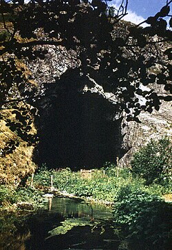
Shulgan-Tash contains some of the oldest caves of human habitation (Kapova Cave), dated to 14-17 centuries BCE. The reserve is also famous for being the only reserve in the world for the ancient apiculture (bee-keeping) practice of tree-hollow cultivation of wild honeybees. [187] [188]
Sikhote-Alin Sopka in south Sikhote-Alin.JPG Primorsky Krai
45°20′0″N136°10′0″E / 45.33333°N 136.16667°E / 45.33333; 136.16667 (Sikhote-Alin)
Park:
Сихотэ-Алинский им. К.Г. Абрамова
401,428 ha (1,549.9 sq mi)1935A mountain range in Primorsky and Khabarovsk Krais, Russia, extending about 900 kilometres (560 mi) to the northeast of the Russian Pacific seaport of Vladivostok. Temperate forest and high biodiversity. [189] [190]
Sokhondo Sokhondo Nature Reserve.jpg Chita Oblast
49°41′37″N111°5′27″E / 49.69361°N 111.09083°E / 49.69361; 111.09083 (Sokhondo)
Park:
Сохондинский
210,985 ha (814.6 sq mi)1973One of the highest parts of Khentei-Chikoy Highlands with the Sokhondo Range. Golets Sokhondo is an ancient volcano. The reserve includes a number of lakes of glacial origin. [191] [192]
South Ural Les vokrug g.Iamantau.jpg Bashkortostan
54°20′48″N57°53′9″E / 54.34667°N 57.88583°E / 54.34667; 57.88583 (South Ural)
Park:
Южно-Уральский
252,800 ha (976.1 sq mi)1979Mountain taiga ecosystems in the highest part of the Southern Urals in the Republic of Bashkortostan and the Chelyabinsk region. several mountain ranges - Mashak, Zigalga, Nara Kumardak and Yamantau. Big Mountain Yamantau having a height of 1640 meters, is the highest mountain of the Southern Urals. [193] [194]
Taymyr Vovsiu tsvetet moshchnyi mytnik lisokhvostovidnyi.jpg Krasnoyarsk Krai
73°57′0″N99°1′0″E / 73.95000°N 99.01667°E / 73.95000; 99.01667 (Taymyr)
Park:
Таймырский
1,781,928 ha (6,880.1 sq mi)1979Located on the Taimyr Peninsula in the Krasnoyarsk Krai. The area was established to the breeding grounds of the Red-breasted goose (Branta ruficollis protection) as well as the summer residences of wild reindeer (Rangifer tarandus) and the biodiversity of the Lake Taymyr. [195] [196]
Teberda Gora Belalakaia.JPG Karachay-Cherkess Republic
43°21′0″N41°42′0″E / 43.35000°N 41.70000°E / 43.35000; 41.70000 (Teberda)
Park:
Тебердинский
84,996 ha (328.2 sq mi)1936Located on the northern slopes of the Greater Caucasus Mountain Range. The terrain show extremes in variation: 31.7% forests, 20% meadows, 8.5% glaciers, 38.4% rock and scree, 0.7% - water (there are 157 lakes and 109 glaciers). [197] [198]
Tigireksky Shlyapnaya mountain.jpg Altai Republic
51°0′0″N82°55′0″E / 51.00000°N 82.91667°E / 51.00000; 82.91667 (Tigireksky)
Park:
Тигирекский
40,693 ha (157.1 sq mi)1999Southwestern part of the Altai Territory, including border. Tcherneva taiga and steppe; Karst landscape and caves. [199] [200]
Tunguska Rosomakha podoshla k sledu snegokhoda i vernulas'.jpg Krasnoyarsk Krai
60°43′53″N101°58′3″E / 60.73139°N 101.96750°E / 60.73139; 101.96750 (Tunguska)
Park:
Тунгусский
296,562 ha (1,145.0 sq mi)1995Located in the central part of the Central Siberian Plateau. As a result of a meteorite in 1908, more than 2,000 km2 of boreal forest was felled and burned. The taiga affected in the disaster area has been restored in the past 100 years. [201] [202]
Ubsunur Hollow Tuva
50°41′0″N94°2′0″E / 50.68333°N 94.03333°E / 50.68333; 94.03333 (Ubsunur Hollow)
Park:
Убсунурская котловина
323,198.4 ha (1,247.9 sq mi)1993A fragile mountain hollow or depression located on the territorial border of Mongolia and the Republic of Tuvain the Russian Federation among the mountains — Tannu-Ola Mountains, and the Altay Mountains region — part of a combination of raised lands and depressions. Here the world's most northern desert meets the world's most southern tundra zone [203] [204]
Upper Taz Prekrasnyi Verkhne-Tazovskii zapovednik)).jpg Yamalo-Nenets Autonomous Okrug
63°30′14″N84°3′28″E / 63.50389°N 84.05778°E / 63.50389; 84.05778 (Upper Taz)
Park:
Верхне-Тазовский
631,308 ha (2,437.5 sq mi)1986Located on the east-central edge of the West Siberian Plain, the territory is divided into two forests - Pokolskoe and Taz, protecting the left bank of the Ratta River. [205] [206]
Ussurisky Ussuriiskii zapovednik.jpg Primorsky Krai
43°40′49″N132°32′44″E / 43.68028°N 132.54556°E / 43.68028; 132.54556 (Ussurisky)
Park:
Уссурийский
40,432 ha (156.1 sq mi)1932Located on the southern spur of the Przewalski Mountains, in the upper reaches of the river Komarovka. In the east of the reserve are the headwaters of the right tributaries of the Artemivka River. [207] [208]
Vishera Isherim.JPG Perm Krai
61°29′0″N59°13′0″E / 61.48333°N 59.21667°E / 61.48333; 59.21667 (Vishera)
Park:
Вишерский
241,200 ha (931.3 sq mi)1991More than 75% of which covered by forest, the main river is the Vishera River, which flows through a nature reserve about 130 km. Extreme north point of the nature reserve (that also the most northern in Perm Krai) is divided by basins of the Kama River, Pechora River and Ob River. Small population of this place is the Mansi people, that makes it an interesting ethnographic region. [209] [210]
Visim Gora "Starik-kamen'".jpg Sverdlovsk Oblast
57°24′25″N59°33′55″E / 57.40694°N 59.56528°E / 57.40694; 59.56528 (Visim)
Park:
Висимский
33,487 ha (129.3 sq mi)1971Southern taiga low Middle Urals. Most of the reserve is located on its western slope in the headwaters of the Sulёm River, a right tributary of the Chusovoi River, part of the vast Volga-Kama basin. [211] [212]
Vitim Ozero Uglovoe.jpg Irkutsk Oblast
57°12′10″N116°48′28″E / 57.20278°N 116.80778°E / 57.20278; 116.80778 (Vitim)
Park:
Витимский
585,021 ha (2,258.8 sq mi)1982Part of the Sayano-Baikal mountains and lakes area, northeast of Lake Biakal. Of particular scientific and cultural value is Lake Oron. [213] [214]
Volga-Kama Raifskoe ozero.jpg Tatarstan
55°18′10″N49°17′10″E / 55.30278°N 49.28611°E / 55.30278; 49.28611 (Volga-Kama)
Park:
Волжско-Камский
10,091 ha (39.0 sq mi)1960Volga-Kama Reserve. Located on the left bank of the terraces of the Volga River. [215] [216]
Voronezh Reka Usmanka.JPG Voronezh Oblast
51°44′8″N39°34′9″E / 51.73556°N 39.56917°E / 51.73556; 39.56917 (Voronezh)
Park:
Воронежский
31,053 ha (119.9 sq mi)1927One of the oldest nature reserves in Russia is located 40 km north of the center of Voronezh. the world's first experimental beaver nursery for breeding and studying the beaver. [217] [218]
Voronina Voroninskii zapovednik.jpg Tambov Oblast
51°31′29″N42°36′52″E / 51.52472°N 42.61444°E / 51.52472; 42.61444 (Voronina)
Park:
Воронинский
10,819 ha (41.8 sq mi)1994Located in the valley of the Crow River (the right tributary of the river Hopper), forest-steppe zone, region. [219] [220]
Wrangel Island Wrangel sunrise.jpg Chukotka Autonomous Okrug
71°14′0″N179°25′0″E / 71.23333°N 179.41667°E / 71.23333; 179.41667 (Wrangel Island)
Park:
Остров Врангеля
2,225,650 ha (8,593.3 sq mi)1976An island in the Arctic Ocean, between the Chukchi Sea and East Siberian Sea. Wrangel Island lies astride the 180° meridian. It consists of a southern coastal plain that is as wide as 15 km (9.3 mi); a central belt of low-relief mountains; and a northern coastal plain that is as wide as 25 km (16 mi). [221] [222]
Yugansky Iuganskii zapovednik. r. Negus'iakh.JPG Mari El Republic
59°32′21″N74°37′48″E / 59.53917°N 74.63000°E / 59.53917; 74.63000 (Jerginsky)
Park:
Юганский
648,636 ha (2,504.4 sq mi)1982In the basin of the Big Yugan (left tributary of the Ob). [223] [224]
Zeya Zeiskii zapovednik.jpg Amur Oblast
53°57′46″N127°22′21″E / 53.96278°N 127.37250°E / 53.96278; 127.37250 (Zeya)
Park:
[ Зейский]
99,390 ha (383.7 sq mi)1963Mountainous territory on the eastern end of the Tukuringra Ridge. Taiga forest, larch, Mongolian oak. [225] [226]
Zhiguli Samarskaia Luka, gora Strel'naia.jpg Samara Oblast
53°24′54″N49°49′17″E / 53.41500°N 49.82139°E / 53.41500; 49.82139 (Zhiguli)
Park:
Жигулёвский им. И. И. Спрыгина
23,157 ha (89.4 sq mi)1966Located on the Samara Bend in the Samara region, where the Volga River swings around the Zhiguli Mountains. [227] [228]

UNESCO protection

Biosphere reserves

Since 1978, more than thirty of Russia's nature reserves have been designated by UNESCO as biosphere reserves. [229]

World Heritage Sites

Some of the nature reserves in Russia are also protected by the UNESCO as natural World Heritage Sites:

Typically, a nature reserve occupies only a part of the much larger World Heritage site.

See also

Related Research Articles

<span class="mw-page-title-main">National parks of Russia</span>

There are currently 64 national parks in Russia. Together they cover approximately 155,672 square kilometers (60,105 sq mi).

<span class="mw-page-title-main">Lapland Biosphere Reserve</span> Strict nature reserve in Murmansk Oblast, Russia

Lapland Nature Reserve is a Russian zapovednik in Murmansk Oblast, Russia, above the Arctic Circle. Officially established in 1957, the reserve protects an area of 2,784 km2 (1,075 sq mi) to the northwest of Lake Imandra, including 86 km² of inland water. The terrain is mountainous tundra and northern taiga. Since 1985 the zapovednik has been designated by UNESCO as a biosphere reserve. The name refers to the cultural area of Lapland, now preferably called Sápmi.

<span class="mw-page-title-main">Katun Nature Reserve</span> Strict nature reserve in the Altai Republic, Russia

Katun Nature Reserve is a Russian zapovednik located in the highlands of the central Altai Mountains of south Siberia. The Katun River runs down through a valley in the reserve, serving as the primary source of the Ob River. The headwaters of the Katun River originate on Mount Belukha, the highest mountain in Siberia at 4,506 metres (14,783 ft), which is located on the far eastern edge of the preserve. Katun is an internationally important center of biodiversity, forming part of the "Golden Mountains of Altai" UNESCO World Heritage Site. Katun Nature Reserve is situated in the Ust-Koksinsky District of Altai Republic.

<span class="mw-page-title-main">Wildlife of Russia</span>

The wildlife of Russia inhabits terrain that extends across 12 time zones and from the tundra region in the far north to the Caucasus Mountains and prairies in the south, including temperate forests which cover 70% of the country. Russia's forests comprise 22% of the forest in the world as well as 33% of all temperate forest.

<span class="mw-page-title-main">Azas Nature Reserve</span> Nature reserve in Tuva, Russia

Azas Nature Reserve is a Russian 'Zapovednik', located in the central part of the Todzha basin of south-central Asia about 500 km west of Lake Baikal. The reserve stretches along the Azas River, and is situated in the Todzhinsky District of Tuva.

<span class="mw-page-title-main">Altai Nature Reserve</span> Nature reserve in the Altai Republic, Russia

Altai Nature Reserve is a Russian zapovednik in the Altai Mountains of south Siberia, Russia. It is part of the UNESCO World Heritage Site "Golden Mountains of Altai", recognized as an area of high biodiversity and isolation from human intrusion. It is also included in the UNESCO World Network of Biosphere Reserves. The Altai Reserve includes the 30 km (19-mile) east bank of Lake Teletskoye and stretches 230 km into the high mountains to the southeast of the lake. It is situated in Ulagansky District and Turochaksky District in the north and east of the Altai Republic.

<span class="mw-page-title-main">Kerzhenets Nature Reserve</span> Strict nature reserve in Nizhny Novgorod Oblast, Russia

Kerzhinski Nature Reserve is a Russian 'zapovednik' located in the middle basin of the Kerzhenets River, 600 kilometres (370 mi) east of Moscow. The terrain features extensive upland and lowland swamps, and is known in particular as a site for the study of beavers, and their effects on recovery of the landscape after fires and logging. The reserve is situated 55 km northeast of the City of Nizhny Novgorod in the Bor and Semonov districts of Nizhny Novgorod Oblast. The site has been a center for scientific study of nature of the region since 1933. It is part of a UNESCO Biosphere Reserves, Ramsar wetland. The reserve was established in its current form in 1993, and covers an area of 46,940 ha (181.2 sq mi).

<span class="mw-page-title-main">Voronezh Nature Reserve</span> Strict nature reserve in Lipetsk and Voronezh Oblasts, Russia

Voronezh Nature Reserve is a Russian 'zapovednik' located 40 km north of the city Voronezh and 500 km south of Moscow. One of the oldest nature reserves in Russia, Voronezh was the world's first experimental beaver nursery for breeding and studying the beaver. The reserve is situated in the Usmansky District of Voronezh Oblast, and in Lipetsk Oblast. It is part of a UNESCO-MAB Biosphere Reserve. Its official name as of 2013 is "Voronezh Peskov Nature Reserve" in honor of journalist and writer Vasily Peskov. The reserve was created in 1927, and covers an area of 31,053 ha (119.90 sq mi).

<span class="mw-page-title-main">Sokhondo Nature Reserve</span> Nature reserve in Chita Oblast, Russia

Sokhondo Nature Reserve is a Russian 'zapovednik' in the south of Eastern Siberia, 25 km north of the border with Mongolia. It is the farthest source of the Amur River, and is centered on the Sokhondo Mountain massif, in the highest sector of the Khentei-Chikoy Highlands in the Khentei Range mountain range. The Sokhondo massif has two peaks, and is an ancient volcano. Also within the borders are many lakes of glacial origin. In 1985, Sokhondo was named a UNESCO MAB Biosphere Reserve. The reserve is situated in the Chita district of Chita Oblast.

<span class="mw-page-title-main">Shulgan-Tash Nature Reserve</span> Nature reserve in Bashkortostan, Russia

Shulgan-Tash Nature Reserve is a Russian 'zapovednik' in the western foothills of the Southern Ural Mountains. The terrain is one of heavy forest and karst topography; the site contains some of the oldest caves of human habitation. The reserve has 13 full-time "bortniks" - practitioners of the ancient apiculture (bee-keeping) of tree-hollow cultivation of wild honeybees. The reserve is situated in the Burzyansky District of Bashkortostan. It is about 40 km southeast of the District town of Starosubkhangulovo. In 2012, the reserve was added to the UNESCO Biosphere Reserve "Bashkir Ural", in particular for protection of the Burzyuan bee, which has been cultivated since ancient times by the local Bashkir people.

<span class="mw-page-title-main">Central Black Earth Nature Reserve</span> Nature reserve in Kursk Oblast, Russia

Central Tsernozemsky Nature Reserve is a Russian 'zapovednik' that protects for scientific study a collection of selected sites of black soil prairie in the southwestern part of the Central Uplands within the middle of the forest-steppe zone. The six sites of the reserve spread out to the southeast of the city of Kursk, in the Medvensky District, Manturovsky District, Gorshechensky District of Kursk Oblast. It covers an area of 5,287 ha (20.41 sq mi).

<span class="mw-page-title-main">Voronina Nature Reserve</span> Nature reserve in Tambov Oblast, Russia

Voronina (Voroninsky) Nature Reserve is a strict ecological reserve located in the valley of the Vorona River, in the forest-steppe zone of southwest Russia. The Voroninsky Reserve protects riverine wetlands in the southeast of the Oka–Don Plain. The reserve is situated in Kirsanovsky and Inzhavinsky districts of Tambov Oblast, about 100 km southeast of the city of Tambov. It was created in 1994, and covers an area of 10,819 ha (41.77 sq mi).

Prisurski Nature Reserve is a Russian zapovednik in the northern Volga Uplands of the East European Plain. It protects for study an area of forest-steppe and mixed forest, with sections in different parts of Chuvashia. The largest sector is the Alatyrski Nature Reserve, located in the valley of the Sura River, and two small steppe sections to the southeast. The reserve is situated in the Alatyr, Chuvash Republic District of the Chuvash Republic. It was set aside as a reserve in 1995 to protect the largest and least disturbed area of southern taiga lowland forest in Chuvashia, as well as steppe habitat at the northern edge of its range. A particular concern was protecting habitat of the muskrat and seasonal waterfowl. The reserve covers an area of 9,150 ha (35.3 sq mi).

<span class="mw-page-title-main">Volga-Kama Nature Reserve</span> Nature reserve in Tatarstan, Russia

Volga-Kama Nature Reserve is a Russian 'zapovednik' at the confluence of the Volga River, the Kama River, and the Myosha River. There are two sections to the reserve, one on the left bank terraces of the Volga, at the actual meeting point of the rivers, the other section about 100 km up the Volga on the western outskirts of the city of Kazan. The reserve is situated in the Zelenodolsky Districts and Laishevsky District of Tatarstan. It was formally established in 1960 to protect remaining forest and forest-steppe habitat of the middle Volga region, and has an area of 8,024 ha (30.98 sq mi). A particular focus of scientific study is the effects of the Kuybyshev Reservoir on the local environment. The reservoir was completed in the mid-1950s, and is the largest reservoir in Europe. The Volga-Kama Reserve is part of a UNESCO Biosphere Reserve.

<span class="mw-page-title-main">Khakassia Nature Reserve</span> Nature reserve in Khakassia, Russia

Khakasski Nature Reserve is a Russian 'zapovednik' covering two large mountain areas, and a cluster of seven steppe sites located within the left bank of the Minusinsk depression. The reserve is situated in the Tashtypsky District of Khakassia. It was originally created to preserve steppe ecosystems, wetlands and waterfowl nesting sites, and a historical complex of monuments and cemeteries from the 4-11 centuries BC. The reserve is particularly noted for its variety of large lakes on the Yenisei River migration route for birds. The current configuration of protected sectors was established in 1999, and covers a total area of 267,483 ha (1,032.76 sq mi).

<span class="mw-page-title-main">Khanka Nature Reserve</span> Nature reserve in Primorsky Krai, Russia

Khanka Nature Reserve is a Russian 'zapovednik' that covers portions of the shore and waters of Lake Khanka, the largest freshwater lake in the Russian Far East. It is an important area for nesting and migrating waterfowl and other birds. The reserve is divided into five distinct sectors on the southern and eastern shores of the lake. The reserve is situated in the Spassky District, in the southwest of Primorsky Krai. It was formally established in 1990, and covers an area of 437 km2 (169 sq mi). It is part of a UNESCO Biosphere Reserve.

<span class="mw-page-title-main">Kuznetsk Alatau Nature Reserve</span> Nature reserve in Kemerovo Oblast, Russia

Kuznetsk Alatau Nature Reserve is a Russian 'zapovednik' on the Kuznetsk Alatau, a mountain ridge in the Altai-Sayan mountain region in southwestern Siberia. The Kuznetsk Alatau consists of several ranges of medium height, between which there are river valleys. The reserve is in the watershed of the Tom River and the Chuly River. It is spread over three districts of Kemerovo Oblast: Tisulsky District, Mezhdurechensky District, and Novokuznetsky District. The reserve was established in 1989 and covers an area of 412,900 ha (1,594 sq mi).

<span class="mw-page-title-main">Dzherginsky Nature Reserve</span> Nature reserve in Buryatia, Russia

Dzherginsky Nature Reserve is a Russian 'zapovednik', located about 100 km east of the northern section of Lake Baikal. It covers the source and upper reaches of the Barguzin River, the second largest tributary to Lake Baikal, and is at the junction of three mountain ranges - the Barguzin Range to the west of the reserve, the Ikat Range and the Southern Muya Range. The reserve's mountainous territory is dominated by larch forests. It is situated in the Kurumkansky District of Buryatia. The nearest city, Ulan-Ude, is 560 km to the south. The reserve was formally established in 1992 to protect the biodiversity of the upper Barguzin valley, and to study natural processes of the area. It covers an area of 238,088 hectares (919.26 sq mi).

<span class="mw-page-title-main">Orenburg Nature Reserve</span> Strict nature reserve in Orenburg Oblast, Russia

Orenburg Nature Reserve is a Russian 'zapovednik' dedicated to the preservation and restoration of four separate types of steppe landscape: Transvolga, Ural Mountains, Southern Urals and Trans-Urals. The reserve does this by spreading out across four sections across 400 km of steppes in Orenburg Oblast below the southern terminus of the Ural Mountains. The city of Orenburg sits in the middle of the four sectors, approximately 1,200 km southeast of Moscow. The reserve also protects historical and archaeological sites of the Sarmation people from the seventh to third century BCE. The reserve was formally established in 1988, and covers a total area of 21,653 ha (83.60 sq mi).

<span class="mw-page-title-main">Tigireksky Nature Reserve</span> Strict nature reserve in Altai Krai, Russia

Tigirekskiy Nature Reserve is a Russian 'zapovednik' in the northwest mid-level mountains of the Altai-Sayan region. The reserve was established for the protection and study of the relic pre-glacial dark taiga of the higher elevations, and the mountain-steppe of the river valleys and lower regions. The site features extensive karst landscape and caves. The reserve is situated in the Zmeinogorsky, Tretyakovsky and Krasnoshchyokovsky districts of Altai Krai. It was formally established in 1999, and covers a total area of 40,693 ha (157.12 sq mi).

References

  1. Tsentr dickoy prirody
  2. Shtilmark (2003) p.2.
  3. Weiner (2000), p.91.
  4. Shtilmark (2003), pp.12-13.
  5. Shtilmark (2003), pp.17-18.
  6. Leopold (1968), pp.196-7.
  7. Shtilmark (2003), pp.10-13;Weiner (2000), p.12.
  8. Shtilmark (2003), p.25.
  9. "Kedrovaya Pad'".
  10. Shtilmark (2003), pp.24-25.
  11. Shtilmark (2003), p.29.
  12. "Astrakhan Zapovednik".
  13. Shtilmark (2003), p.30; Weiner (2000), p.27.
  14. Shtilmark (2003), p.34; Weiner (2000), p.28.
  15. Weiner (2000), p.251.
  16. Shtilmark (2003), p.206.
  17. Shtilmark (2003), p.118; Weiner (1999), p.102.
  18. "Altay Zapovednik".
  19. Shtilmark (2003), p.135; Weiner (1999), p.296.
  20. Shtilmark (2003), p.137.
  21. Shtilmark (2003), p.71.
  22. Shtilmark (2003), p.67.
  23. Shtilmark (2003), pp.67, 84, 96; Volkov (1996), p.9.
  24. Filonov & Nukhimovskaya (1990).
  25. Montgomery (2007), pp.150-8, 172-4.
  26. Kokorin et al.
  27. "Altai (Official Reserve Website)" (in Russian). Ministry of Natural Resources and Environment (Russia) . Retrieved January 18, 2016.
  28. "Altai (Protected Russia)" (in Russian). Ministry of Natural Resources and Environment (Russia) . Retrieved January 18, 2016.
  29. "Astrakhan (Official Reserve Website)" (in Russian). Ministry of Natural Resources and Environment (Russia) . Retrieved January 18, 2016.
  30. "Astrakhan (Protected Russia)" (in Russian). Ministry of Natural Resources and Environment (Russia) . Retrieved January 18, 2016.
  31. "Azas (Official Reserve Website)" (in Russian). Ministry of Natural Resources and Environment (Russia) . Retrieved January 18, 2016.
  32. "Azas (Protected Russia)" (in Russian). Ministry of Natural Resources and Environment (Russia) . Retrieved January 18, 2016.
  33. "Baikalsky (Official Reserve Website)" (in Russian). Ministry of Natural Resources and Environment (Russia) . Retrieved January 18, 2016.
  34. "Baikalsky (Protected Russia)" (in Russian). Ministry of Natural Resources and Environment (Russia) . Retrieved January 18, 2016.
  35. "Baykal-Lena (Official Reserve Website)" (in Russian). Ministry of Natural Resources and Environment (Russia) . Retrieved January 18, 2016.
  36. "Baykal-Lena (Protected Russia)" (in Russian). Ministry of Natural Resources and Environment (Russia) . Retrieved January 18, 2016.
  37. "Barguzin (Official Reserve Website)" (in Russian). Ministry of Natural Resources and Environment (Russia) . Retrieved January 18, 2016.
  38. "Barguzin (Protected Russia)" (in Russian). Ministry of Natural Resources and Environment (Russia) . Retrieved January 18, 2016.
  39. "Basegi (Official Reserve Website)" (in Russian). Ministry of Natural Resources and Environment (Russia) . Retrieved January 18, 2016.
  40. "Basegi (Protected Russia)" (in Russian). Ministry of Natural Resources and Environment (Russia) . Retrieved January 18, 2016.
  41. "Bashkirski (Official Reserve Website)" (in Russian). Ministry of Natural Resources and Environment (Russia) . Retrieved January 18, 2016.
  42. "Bashkirski (Protected Russia)" (in Russian). Ministry of Natural Resources and Environment (Russia) . Retrieved January 18, 2016.
  43. "Bastak (Official Reserve Website)" (in Russian). Ministry of Natural Resources and Environment (Russia) . Retrieved January 18, 2016.
  44. "Bastak (Protected Russia)" (in Russian). Ministry of Natural Resources and Environment (Russia) . Retrieved January 18, 2016.
  45. "Belogorye (Official Reserve Website)" (in Russian). Ministry of Natural Resources and Environment (Russia) . Retrieved January 18, 2016.
  46. "Belogorye (Protected Russia)" (in Russian). Ministry of Natural Resources and Environment (Russia) . Retrieved January 18, 2016.
  47. "Bogdinsko-Baskunchakski (Official Reserve Website)" (in Russian). Ministry of Natural Resources and Environment (Russia) . Retrieved January 18, 2016.
  48. "Bogdinsko-Baskunchakski (Protected Russia)" (in Russian). Ministry of Natural Resources and Environment (Russia) . Retrieved January 18, 2016.
  49. "Bolon (Official Reserve Website)" (in Russian). Ministry of Natural Resources and Environment (Russia) . Retrieved January 18, 2016.
  50. "Bolon (Protected Russia)" (in Russian). Ministry of Natural Resources and Environment (Russia) . Retrieved January 18, 2016.
  51. "Khekhtsirsky (Protected Russia)" (in Russian). Ministry of Natural Resources and Environment (Russia) . Retrieved February 23, 2016.
  52. "Botcha (Official Reserve Website)" (in Russian). Ministry of Natural Resources and Environment (Russia) . Retrieved January 18, 2016.
  53. "Botcha (Protected Russia)" (in Russian). Ministry of Natural Resources and Environment (Russia) . Retrieved January 18, 2016.
  54. "Bryansk Forest (Official Reserve Website)" (in Russian). Ministry of Natural Resources and Environment (Russia) . Retrieved January 18, 2016.
  55. "Bryansk Forest (Protected Russia)" (in Russian). Ministry of Natural Resources and Environment (Russia) . Retrieved January 18, 2016.
  56. "Bureya (Official Reserve Website)" (in Russian). Ministry of Natural Resources and Environment (Russia) . Retrieved January 18, 2016.
  57. "Bureya (Protected Russia)" (in Russian). Ministry of Natural Resources and Environment (Russia) . Retrieved January 18, 2016.
  58. "Caucasus (Official Reserve Website)" (in Russian). Ministry of Natural Resources and Environment (Russia) . Retrieved January 18, 2016.
  59. "Caucasus (Protected Russia)" (in Russian). Ministry of Natural Resources and Environment (Russia) . Retrieved January 18, 2016.
  60. "Central Tsernozemsky (Official Reserve Website)" (in Russian). Ministry of Natural Resources and Environment (Russia) . Retrieved January 18, 2016.
  61. "Central Tsernozemsky (Protected Russia)" (in Russian). Ministry of Natural Resources and Environment (Russia) . Retrieved January 18, 2016.
  62. "Central Forest (Official Reserve Website)" (in Russian). Ministry of Natural Resources and Environment (Russia) . Retrieved January 18, 2016.
  63. "Central Forest (Protected Russia)" (in Russian). Ministry of Natural Resources and Environment (Russia) . Retrieved January 18, 2016.
  64. "Central Siberia (Official Reserve Website)" (in Russian). Ministry of Natural Resources and Environment (Russia) . Retrieved January 18, 2016.
  65. "Central Siberia (Protected Russia)" (in Russian). Ministry of Natural Resources and Environment (Russia) . Retrieved January 18, 2016.
  66. "ООПТ России - Елогуйский федеральный заказник". oopt.info.
  67. "Chyornye Zemli (Official Reserve Website)" (in Russian). Ministry of Natural Resources and Environment (Russia) . Retrieved January 18, 2016.
  68. "Chyornye Zemli (Protected Russia)" (in Russian). Ministry of Natural Resources and Environment (Russia) . Retrieved January 18, 2016.
  69. "Dagestan (Official Reserve Website)" (in Russian). Ministry of Natural Resources and Environment (Russia) . Retrieved January 18, 2016.
  70. "Dagestan (Protected Russia)" (in Russian). Ministry of Natural Resources and Environment (Russia) . Retrieved January 18, 2016.
  71. "Dalnevostochny Morskoy (Official Reserve Website)" (in Russian). Ministry of Natural Resources and Environment (Russia) . Retrieved January 18, 2016.
  72. "Dalnevostochny Morskoy (Protected Russia)" (in Russian). Ministry of Natural Resources and Environment (Russia) . Retrieved January 18, 2016.
  73. "Darwin (Official Reserve Website)" (in Russian). Ministry of Natural Resources and Environment (Russia) . Retrieved January 18, 2016.
  74. "Darwin (Protected Russia)" (in Russian). Ministry of Natural Resources and Environment (Russia) . Retrieved January 18, 2016.
  75. "Dauriya (Official Reserve Website)" (in Russian). Ministry of Natural Resources and Environment (Russia) . Retrieved January 18, 2016.
  76. "Dauriya (Protected Russia)" (in Russian). Ministry of Natural Resources and Environment (Russia) . Retrieved January 18, 2016.
  77. "Denezhkin Kamen (Official Reserve Website)" (in Russian). Ministry of Natural Resources and Environment (Russia) . Retrieved January 18, 2016.
  78. "Denezhkin Kamen (Protected Russia)" (in Russian). Ministry of Natural Resources and Environment (Russia) . Retrieved January 18, 2016.
  79. "Dzherginsky (Official Reserve Website)" (in Russian). Ministry of Natural Resources and Environment (Russia) . Retrieved January 18, 2016.
  80. "Dzherginsky (Protected Russia)" (in Russian). Ministry of Natural Resources and Environment (Russia) . Retrieved January 18, 2016.
  81. "Dzhugdzursky (Official Reserve Website)" (in Russian), Ministry of Natural Resources and Environment (Russia).
  82. "Dzhugdzursky (Protected Russia)" (in Russian). Ministry of Natural Resources and Environment (Russia) . Retrieved January 18, 2016.
  83. "East Ural (Official Reserve Website)" (in Russian), Ministry of Natural Resources and Environment (Russia).
  84. "East Ural (Protected Russia)" (in Russian), Ministry of Natural Resources and Environment (Russia).
  85. "Erzi (Official Reserve Website)" (in Russian). Ministry of Natural Resources and Environment (Russia) . Retrieved January 18, 2016.
  86. "Erzi (Protected Russia)" (in Russian), Ministry of Natural Resources and Environment (Russia).
  87. "Galitsya Gora (Official Reserve Website)" (in Russian). Ministry of Natural Resources and Environment (Russia) . Retrieved January 18, 2016.
  88. "Galitsya Gora (Protected Russia)" (in Russian). Ministry of Natural Resources and Environment (Russia) . Retrieved January 18, 2016.
  89. "Great Arctic (Official Reserve Website)" (in Russian). Ministry of Natural Resources and Environment (Russia) . Retrieved January 18, 2016.
  90. "Great Arctic (Protected Russia)" (in Russian). Ministry of Natural Resources and Environment (Russia) . Retrieved January 18, 2016.
  91. "Gydan (Official Reserve Website)" (in Russian). Ministry of Natural Resources and Environment (Russia) . Retrieved January 18, 2016.
  92. "Gydan (Protected Russia)" (in Russian). Ministry of Natural Resources and Environment (Russia) . Retrieved January 18, 2016.
  93. "Ilmen (Official Reserve Website)" (in Russian). Ministry of Natural Resources and Environment (Russia) . Retrieved January 18, 2016.
  94. "Ilmen (Protected Russia)" (in Russian). Ministry of Natural Resources and Environment (Russia) . Retrieved January 18, 2016.
  95. "Kabardino-Balkarski (Official Reserve Website)" (in Russian). Ministry of Natural Resources and Environment (Russia) . Retrieved January 18, 2016.
  96. "Kabardino-Balkarski (Protected Russia)" (in Russian). Ministry of Natural Resources and Environment (Russia) . Retrieved January 18, 2016.
  97. "Kaluzhskiye Zaseki (Official Reserve Website)" (in Russian). Ministry of Natural Resources and Environment (Russia) . Retrieved January 18, 2016.
  98. "Kaluzhskiye Zaseki (Protected Russia)" (in Russian). Ministry of Natural Resources and Environment (Russia) . Retrieved January 18, 2016.
  99. "Kandalaksha (Official Reserve Website)" (in Russian). Ministry of Natural Resources and Environment (Russia) . Retrieved January 18, 2016.
  100. "Kandalaksha (Protected Russia)" (in Russian). Ministry of Natural Resources and Environment (Russia) . Retrieved January 18, 2016.
  101. "Katun (Official Reserve Website)" (in Russian). Ministry of Natural Resources and Environment (Russia) . Retrieved January 18, 2016.
  102. "Katun (Protected Russia)" (in Russian). Ministry of Natural Resources and Environment (Russia) . Retrieved January 18, 2016.
  103. "Kedrovaya Pad (Official Reserve Website)" (in Russian). Ministry of Natural Resources and Environment (Russia) . Retrieved January 18, 2016.
  104. "Kedrovaya Pad (Protected Russia)" (in Russian). Ministry of Natural Resources and Environment (Russia) . Retrieved January 18, 2016.
  105. "Kerzhinski (Official Reserve Website)" (in Russian). Ministry of Natural Resources and Environment (Russia) . Retrieved January 18, 2016.
  106. "Kerzhinski (Protected Russia)" (in Russian). Ministry of Natural Resources and Environment (Russia) . Retrieved January 18, 2016.
  107. "Khanka (Official Reserve Website)" (in Russian). Ministry of Natural Resources and Environment (Russia) . Retrieved January 18, 2016.
  108. "Khanka (Protected Russia)" (in Russian). Ministry of Natural Resources and Environment (Russia) . Retrieved January 18, 2016.
  109. "Khakasski (Official Reserve Website)" (in Russian). Ministry of Natural Resources and Environment (Russia) . Retrieved January 18, 2016.
  110. "Khakasski (Protected Russia)" (in Russian). Ministry of Natural Resources and Environment (Russia) . Retrieved January 18, 2016.
  111. "Khingan (Official Reserve Website)" (in Russian), Ministry of Natural Resources and Environment (Russia).
  112. "Khingan (Protected Russia)" (in Russian). Ministry of Natural Resources and Environment (Russia) . Retrieved January 18, 2016.
  113. "Khopyor (Official Reserve Website)" (in Russian). Ministry of Natural Resources and Environment (Russia) . Retrieved January 18, 2016.
  114. "Khopyor (Protected Russia)" (in Russian). Ministry of Natural Resources and Environment (Russia) . Retrieved January 18, 2016.
  115. "Kivach (Official Reserve Website)" (in Russian). Ministry of Natural Resources and Environment (Russia) . Retrieved January 18, 2016.
  116. "Kivach (Protected Russia)" (in Russian). Ministry of Natural Resources and Environment (Russia) . Retrieved January 18, 2016.
  117. "Kologrivsky Les (Official Reserve Website)" (in Russian). Ministry of Natural Resources and Environment (Russia) . Retrieved July 24, 2016.
  118. "Kologrivsky Les (Protected Russia)" (in Russian). Ministry of Natural Resources and Environment (Russia) . Retrieved July 24, 2016.
  119. "Komandor (Official Reserve Website)" (in Russian). Ministry of Natural Resources and Environment (Russia) . Retrieved January 18, 2016.
  120. "Komandor (Protected Russia)" (in Russian). Ministry of Natural Resources and Environment (Russia) . Retrieved January 18, 2016.
  121. "Komsomolsk (Official Reserve Website)" (in Russian), Ministry of Natural Resources and Environment (Russia).
  122. "Komsomolsk (Protected Russia)" (in Russian). Ministry of Natural Resources and Environment (Russia) . Retrieved January 18, 2016.
  123. "Koryak (Official Reserve Website)" (in Russian). Ministry of Natural Resources and Environment (Russia) . Retrieved January 18, 2016.
  124. "Koryak (Protected Russia)" (in Russian). Ministry of Natural Resources and Environment (Russia) . Retrieved January 18, 2016.
  125. "Kostamuksha (Official Reserve Website)" (in Russian). Ministry of Natural Resources and Environment (Russia) . Retrieved January 18, 2016.
  126. "Kostamuksha (Protected Russia)" (in Russian). Ministry of Natural Resources and Environment (Russia) . Retrieved January 18, 2016.
  127. "Kronotsky (Official Reserve Website)" (in Russian). Ministry of Natural Resources and Environment (Russia) . Retrieved January 18, 2016.
  128. "Kronotski (Protected Russia)" (in Russian). Ministry of Natural Resources and Environment (Russia) . Retrieved January 18, 2016.
  129. "Kurils (Official Reserve Website)" (in Russian). Ministry of Natural Resources and Environment (Russia) . Retrieved January 18, 2016.
  130. "Kurils (Protected Russia)" (in Russian). Ministry of Natural Resources and Environment (Russia) . Retrieved January 18, 2016.
  131. "Kuznetsk Alatau (Official Reserve Website)" (in Russian). Ministry of Natural Resources and Environment (Russia) . Retrieved January 18, 2016.
  132. "Kuznetsk Alatau (Protected Russia)" (in Russian). Ministry of Natural Resources and Environment (Russia) . Retrieved January 18, 2016.
  133. "Lapland (Official Reserve Website)" (in Russian). Ministry of Natural Resources and Environment (Russia) . Retrieved January 18, 2016.
  134. "Lapland (Protected Russia)" (in Russian). Ministry of Natural Resources and Environment (Russia) . Retrieved January 18, 2016.
  135. "Lazovski (Official Reserve Website)" (in Russian). Ministry of Natural Resources and Environment (Russia) . Retrieved January 18, 2016.
  136. "Lazovski (Protected Russia)" (in Russian). Ministry of Natural Resources and Environment (Russia) . Retrieved January 18, 2016.
  137. "Lena Delta (Official Reserve Website)" (in Russian). Ministry of Natural Resources and Environment (Russia) . Retrieved January 18, 2016.
  138. "Lena Delta (Protected Russia)" (in Russian). Ministry of Natural Resources and Environment (Russia) . Retrieved January 18, 2016.
  139. "Little Sosva (Official Reserve Website)" (in Russian). Ministry of Natural Resources and Environment (Russia) . Retrieved January 18, 2016.
  140. "Little Sosva (Protected Russia)" (in Russian). Ministry of Natural Resources and Environment (Russia) . Retrieved January 18, 2016.
  141. "Magadan (Official Reserve Website)" (in Russian). Ministry of Natural Resources and Environment (Russia) . Retrieved January 18, 2016.
  142. "Magadan (Protected Russia)" (in Russian). Ministry of Natural Resources and Environment (Russia) . Retrieved January 18, 2016.
  143. "Mordovski (Official Reserve Website)" (in Russian). Ministry of Natural Resources and Environment (Russia) . Retrieved January 18, 2016.
  144. "Mordovski (Protected Russia)" (in Russian). Ministry of Natural Resources and Environment (Russia) . Retrieved January 18, 2016.
  145. "Nenets (Official Reserve Website)" (in Russian). Ministry of Natural Resources and Environment (Russia) . Retrieved January 18, 2016.
  146. "Nenets (Protected Russia)" (in Russian). Ministry of Natural Resources and Environment (Russia) . Retrieved January 18, 2016.
  147. "Nizhnesvirsky (Official Reserve Website)" (in Russian). Ministry of Natural Resources and Environment (Russia) . Retrieved January 18, 2016.
  148. "Nizhnesvirsky (Protected Russia)" (in Russian). Ministry of Natural Resources and Environment (Russia) . Retrieved January 18, 2016.
  149. "Nora (Official Reserve Website)" (in Russian). Ministry of Natural Resources and Environment (Russia) . Retrieved January 18, 2016.
  150. "Nora (Protected Russia)" (in Russian). Ministry of Natural Resources and Environment (Russia) . Retrieved January 18, 2016.
  151. "North Ossetia (Official Reserve Website)" (in Russian). Ministry of Natural Resources and Environment (Russia) . Retrieved January 18, 2016.
  152. "North Ossetia (Protected Russia)" (in Russian). Ministry of Natural Resources and Environment (Russia) . Retrieved January 18, 2016.
  153. "Nurgush (Official Reserve Website)" (in Russian). Ministry of Natural Resources and Environment (Russia) . Retrieved January 18, 2016.
  154. "Nurgush (Protected Russia)" (in Russian). Ministry of Natural Resources and Environment (Russia) . Retrieved January 18, 2016.
  155. "Oka (Official Reserve Website)" (in Russian). Ministry of Natural Resources and Environment (Russia) . Retrieved January 18, 2016.
  156. "Oka (Protected Russia)" (in Russian). Ministry of Natural Resources and Environment (Russia) . Retrieved January 18, 2016.
  157. "Olyokma (Official Reserve Website)" (in Russian). Ministry of Natural Resources and Environment (Russia) . Retrieved January 18, 2016.
  158. "Olyokma (Protected Russia)" (in Russian). Ministry of Natural Resources and Environment (Russia) . Retrieved January 18, 2016.
  159. "Orenburg (Official Reserve Website)" (in Russian). Ministry of Natural Resources and Environment (Russia) . Retrieved January 18, 2016.
  160. "Orenburg (Protected Russia)" (in Russian). Ministry of Natural Resources and Environment (Russia) . Retrieved January 18, 2016.
  161. "Pasvik (Official Reserve Website)" (in Russian). Ministry of Natural Resources and Environment (Russia) . Retrieved January 18, 2016.
  162. "Pasvik (Protected Russia)" (in Russian). Ministry of Natural Resources and Environment (Russia) . Retrieved January 18, 2016.
  163. "Pechoro-Ilych (Official Reserve Website)" (in Russian). Ministry of Natural Resources and Environment (Russia) . Retrieved January 18, 2016.
  164. "Pechoro-Ilych (Protected Russia)" (in Russian). Ministry of Natural Resources and Environment (Russia) . Retrieved January 18, 2016.
  165. "Pinezhsky (Official Reserve Website)" (in Russian). Ministry of Natural Resources and Environment (Russia) . Retrieved January 18, 2016.
  166. "Pinezhsky (Protected Russia)" (in Russian). Ministry of Natural Resources and Environment (Russia) . Retrieved January 18, 2016.
  167. "Polistovsky (Official Reserve Website)" (in Russian), Ministry of Natural Resources and Environment (Russia).
  168. "Polistovsky (Protected Russia)" (in Russian). Ministry of Natural Resources and Environment (Russia) . Retrieved January 18, 2016.
  169. "Poronaysky (Official Reserve Website)" (in Russian). Ministry of Natural Resources and Environment (Russia) . Retrieved January 18, 2016.
  170. "Poronaysky (Protected Russia)" (in Russian). Ministry of Natural Resources and Environment (Russia) . Retrieved January 18, 2016.
  171. "Pribolshky Les (Official Reserve Website)" (in Russian). Ministry of Natural Resources and Environment (Russia) . Retrieved January 18, 2016.
  172. "Pribolshky Les (Protected Russia)" (in Russian), Ministry of Natural Resources and Environment (Russia).
  173. "Prioksko-Terrasny (Official Reserve Website)" (in Russian). Ministry of Natural Resources and Environment (Russia) . Retrieved January 18, 2016.
  174. "Prioksko-Terrasny (Protected Russia)" (in Russian). Ministry of Natural Resources and Environment (Russia) . Retrieved January 18, 2016.
  175. "Prisurski (Official Reserve Website)" (in Russian). Ministry of Natural Resources and Environment (Russia) . Retrieved January 18, 2016.
  176. "Prisurski (Protected Russia)" (in Russian). Ministry of Natural Resources and Environment (Russia) . Retrieved January 18, 2016.
  177. "Putorana (Official Reserve Website)" (in Russian). Ministry of Natural Resources and Environment (Russia) . Retrieved January 18, 2016.
  178. "Putorana (Protected Russia)" (in Russian). Ministry of Natural Resources and Environment (Russia) . Retrieved January 18, 2016.
  179. "Rdeysky (Official Reserve Website)" (in Russian). Ministry of Natural Resources and Environment (Russia) . Retrieved January 18, 2016.
  180. "Rdeysky (Protected Russia)" (in Russian). Ministry of Natural Resources and Environment (Russia) . Retrieved January 18, 2016.
  181. "Rostov (Official Reserve Website)" (in Russian). Ministry of Natural Resources and Environment (Russia) . Retrieved January 18, 2016.
  182. "Rostov (Protected Russia)" (in Russian). Ministry of Natural Resources and Environment (Russia) . Retrieved January 18, 2016.
  183. "Sayano-Shushenski (Official Reserve Website)" (in Russian). Ministry of Natural Resources and Environment (Russia) . Retrieved January 18, 2016.
  184. "Sayano-Shushenski (Protected Russia)" (in Russian). Ministry of Natural Resources and Environment (Russia) . Retrieved January 18, 2016.
  185. "Shaytan-Tay (Official Reserve Website)" (in Russian). Ministry of Natural Resources and Environment (Russia) . Retrieved January 18, 2016.
  186. "Shaytan-Tay (Protected Russia)" (in Russian). Ministry of Natural Resources and Environment (Russia) . Retrieved January 18, 2016.
  187. "Shatan-Tay (Official Reserve Website)" (in Russian). Ministry of Natural Resources and Environment (Russia) . Retrieved January 18, 2016.
  188. "Shatan-Tay (Protected Russia)" (in Russian). Ministry of Natural Resources and Environment (Russia) . Retrieved January 18, 2016.
  189. "Sikhote-Alin (Official Reserve Website)" (in Russian). Ministry of Natural Resources and Environment (Russia) . Retrieved January 18, 2016.
  190. "Sikhote-Alin (Protected Russia)" (in Russian). Ministry of Natural Resources and Environment (Russia) . Retrieved January 18, 2016.
  191. "Sokhondo (Official Reserve Website)" (in Russian). Ministry of Natural Resources and Environment (Russia) . Retrieved January 18, 2016.
  192. "Sokhondo (Protected Russia)" (in Russian). Ministry of Natural Resources and Environment (Russia) . Retrieved January 18, 2016.
  193. "South Ural (Official Reserve Website)" (in Russian). Ministry of Natural Resources and Environment (Russia) . Retrieved January 18, 2016.
  194. "South Ural (Protected Russia)" (in Russian). Ministry of Natural Resources and Environment (Russia) . Retrieved January 18, 2016.
  195. "Taymyr (Official Reserve Website)" (in Russian). Ministry of Natural Resources and Environment (Russia) . Retrieved January 18, 2016.
  196. "Taymyr (Protected Russia)" (in Russian). Ministry of Natural Resources and Environment (Russia) . Retrieved January 18, 2016.
  197. "Teberda (Official Reserve Website)" (in Russian). Ministry of Natural Resources and Environment (Russia) . Retrieved January 18, 2016.
  198. "Teberda (Protected Russia)" (in Russian). Ministry of Natural Resources and Environment (Russia) . Retrieved January 18, 2016.
  199. "Tigirekskiy (Official Reserve Website)" (in Russian). Ministry of Natural Resources and Environment (Russia) . Retrieved January 18, 2016.
  200. "Tigirekskiy (Protected Russia)" (in Russian). Ministry of Natural Resources and Environment (Russia) . Retrieved January 18, 2016.
  201. "Tunguska (Official Reserve Website)" (in Russian). Ministry of Natural Resources and Environment (Russia) . Retrieved January 18, 2016.
  202. "Tunguska (Protected Russia)" (in Russian). Ministry of Natural Resources and Environment (Russia) . Retrieved January 18, 2016.
  203. "Ubsunur Hollow (Official Reserve Website)" (in Russian). Ministry of Natural Resources and Environment (Russia) . Retrieved January 18, 2016.
  204. "Ubsunur Hollow (Protected Russia)" (in Russian). Ministry of Natural Resources and Environment (Russia) . Retrieved January 18, 2016.
  205. "Upper Taz (Official Reserve Website)" (in Russian). Ministry of Natural Resources and Environment (Russia) . Retrieved January 18, 2016.
  206. "Upper Taz (Protected Russia)" (in Russian). Ministry of Natural Resources and Environment (Russia) . Retrieved January 18, 2016.
  207. "Ussurisky (Official Reserve Website)" (in Russian). Ministry of Natural Resources and Environment (Russia) . Retrieved January 18, 2016.
  208. "Ussurisky (Protected Russia)" (in Russian). Ministry of Natural Resources and Environment (Russia) . Retrieved January 18, 2016.
  209. "Vishera (Official Reserve Website)" (in Russian). Ministry of Natural Resources and Environment (Russia) . Retrieved January 18, 2016.
  210. "Vishera (Protected Russia)" (in Russian). Ministry of Natural Resources and Environment (Russia) . Retrieved January 18, 2016.
  211. "Visim (Official Reserve Website)" (in Russian). Ministry of Natural Resources and Environment (Russia) . Retrieved January 18, 2016.
  212. "Visim (Protected Russia)" (in Russian). Ministry of Natural Resources and Environment (Russia) . Retrieved January 18, 2016.
  213. "Vitim (Official Reserve Website)" (in Russian). Ministry of Natural Resources and Environment (Russia) . Retrieved January 18, 2016.
  214. "Vitim (Protected Russia)" (in Russian). Ministry of Natural Resources and Environment (Russia) . Retrieved January 18, 2016.
  215. "Vosshko-Kamisky (Official Reserve Website)" (in Russian). Ministry of Natural Resources and Environment (Russia) . Retrieved January 18, 2016.
  216. "Vosshko-Kamisky (Protected Russia)" (in Russian). Ministry of Natural Resources and Environment (Russia) . Retrieved January 18, 2016.
  217. "Voronezh (Official Reserve Website)" (in Russian). Ministry of Natural Resources and Environment (Russia) . Retrieved January 18, 2016.
  218. "Voronezh (Protected Russia)" (in Russian). Ministry of Natural Resources and Environment (Russia) . Retrieved January 18, 2016.
  219. "Voronina (Official Reserve Website)" (in Russian). Ministry of Natural Resources and Environment (Russia) . Retrieved January 18, 2016.
  220. "Voronina (Protected Russia)" (in Russian). Ministry of Natural Resources and Environment (Russia) . Retrieved January 18, 2016.
  221. "Wrangel Island (Official Reserve Website)" (in Russian). Ministry of Natural Resources and Environment (Russia) . Retrieved January 18, 2016.
  222. "Wrangel Island (Protected Russia)" (in Russian). Ministry of Natural Resources and Environment (Russia) . Retrieved January 18, 2016.
  223. "Jerginsky (Official Reserve Website)" (in Russian). Ministry of Natural Resources and Environment (Russia) . Retrieved January 18, 2016.
  224. "Jerginsky (Protected Russia)" (in Russian). Ministry of Natural Resources and Environment (Russia) . Retrieved January 18, 2016.
  225. "Zeya (Official Reserve Website)" (in Russian), Ministry of Natural Resources and Environment (Russia).
  226. "Zeya (Protected Russia)" (in Russian). Ministry of Natural Resources and Environment (Russia) . Retrieved January 18, 2016.
  227. "Zhiguli (Official Reserve Website)" (in Russian). Ministry of Natural Resources and Environment (Russia) . Retrieved January 18, 2016.
  228. "Zhiguli (Protected Russia)" (in Russian). Ministry of Natural Resources and Environment (Russia) . Retrieved January 18, 2016.
  229. "Europe & North America | United Nations Educational, Scientific and Cultural Organization". www.unesco.org. Archived from the original on February 22, 2008.

Notes

  1. /ˌzæpˈvɛdnɪk/ ; Russian: заповедник [zəpɐˈvʲedʲnʲɪk] ( pl. заповедники), from the adjective заповедный, "sacred, protected"; Ukrainian: заповідник, romanized: zapovidnyk [zɐpoˈvidnɪk]

Sources