Casa Adobe De San Rafael

Last updated
Casa Adobe de San Rafael
TomasSanchezGlendaleCasaAdobeDeSanRafael.jpg
Casa Adobe De San Rafael in 1895
Location1330 Dorothy Dr, Glendale, California CA 91202
Coordinates 34°9′56″N118°15′50″W / 34.16556°N 118.26389°W / 34.16556; -118.26389 Coordinates: 34°9′56″N118°15′50″W / 34.16556°N 118.26389°W / 34.16556; -118.26389
Area1.6 acres
Built1865
DesignatedOct. 31, 1935
Reference no.235
Reference no.historic landmark #42
USA Los Angeles Metropolitan Area location map.svg
Red pog.svg
Location of Casa Adobe de San Rafael in the Los Angeles metropolitan area
Casa Adobe de San Rafael in 1936 Historic American Buildings Survey Photographed by Henry F. Withey, March 1936 WEST END OF NORTH FRONT. - Casa Adobe de San Rafael, 1340 Dorothy Drive, Glendale, Los Angeles HABS CAL,19-GLEND,1-4.tif
Casa Adobe de San Rafael in 1936

Casa Adobe de San Rafael is one of the oldest homes in Glendale, California. The home has been in continuous use since its founding in 1865. It was designated a California Historic Landmark (No. 235) on Oct. 31, 1935.

Glendale, California City in California, United States

Glendale is a city in Los Angeles County, California, United States. Its estimated 2014 population was 200,167, making it the fourth-largest city in Los Angeles County and the 23rd-largest city in California. It is located about 8 mi (13 km) north of downtown Los Angeles.

Jose Maria Verdugo petitioned Pedro Fages, Governor of Alta California, for a Spanish land grant in October in 1784. When granted it was the first of the Rancho grants and one of the largest grants. The grant called Rancho San Rafael was a 36,403-acre (147.32 km2) in the San Rafael Hills, bordering the Los Angeles River and the Arroyo Seco in present-day Los Angeles County, southern California. [1]

The Spanish issued Concessions of land to retired soldiers as an inducement for them to remain in the frontier. These Concessions reverted back to the Spanish crown upon the death of the recipient. Later, the Mexican government encouraged settlement of the coastal region of Alta California by issuing much larger land grants to Mexican citizens, both native born and naturalized. The grants were usually two or more square leagues, or 35 square kilometres (14 sq mi) in size. Unlike Spanish Concessions, Mexican land grants provided permanent, unencumbered property-ownership rights to the land, with most being called "ranchos." The ranchos granted by Mexico included most of the land along the California coast, around San Francisco Bay, inland along the Sacramento River, and land within the San Joaquin Valley.

Rancho San Rafael was a 36,403-acre (147.32 km2) Spanish land grant in the San Rafael Hills, bordering the Los Angeles River and the Arroyo Seco in present-day Los Angeles County, southern California, given in 1784 to Jose Maria Verdugo.

San Rafael Hills mountain range in Los Angeles County, California

The San Rafael Hills are a mountain range in Los Angeles County, California. They are one of the lower Transverse Ranges, and are parallel to and below the San Gabriel Mountains, adjacent to the San Gabriel Valley overlooking the Los Angeles Basin.

When parts of Rancho San Rafael were sold, Tomas Avila Sanchez, Sheriff of Los Angeles County, purchased a tract of 100 acres and in 1865 built this artistic adobe home of the hacienda type. In 1867, Sanchez married Maria Sepulveda (daughter of Fernando Sepulveda and Maria Josefa Dominguez). Maria's stepfather gave her 100 acres (40 ha) of land and she and Tomas built Casa Adobe de San Rafael which is situated approximately a half-mile from the original Verdugo Adobe. The site of the original Verdugo Adobe is now the Hoover High School. A line of trees bordered the road that separated the two adobe sites. Tomas lived in Casa Adobe de San Rafael until his death in 1882. Maria and her family lived at the Casa Adobe for a few years after Tomas death. Maria sold the Casa and here land, 100 acres, to Andrew Glassell for $12,000. Maria and her family moved to Los Angeles.

Tomas Avila Sanchez American politician

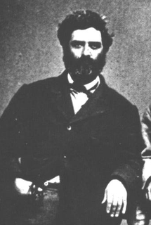
Tomas Avila Sanchez (1826–1882), soldier, sheriff and public official, was on the Los Angeles County, California, Board of Supervisors and was a member of the Los Angeles Common Council, the legislative branch of the city.

Adobe Building material made from earth and organic materials

Adobe is a building material made from earth and organic materials. Adobe is Spanish for mudbrick, but in some English-speaking regions of Spanish heritage, the term is used to refer to any kind of earth construction. Most adobe buildings are similar in appearance to cob and rammed earth buildings. Adobe is among the earliest building materials, and is used throughout the world.

The Casa Adobe was sold a number of times. In the 1920 the old home was in poor shape. Glendale community women groups took the case of the historic home to the City of Glendale. City of Glendale purchased the property in early 1930s including its gardens and eucalyptus trees. The City of Glendale trees were grown from seeds. The seeds were a gift of Phineas Banning who had received them from an Australia missionary. The home was restored in 1932. The City of Glendale founded the San Rafael Association to care for Casa Adobe. San Rafael Association decorated the casa to look like a home in the late 19th century. The park grounds cover 1.6 acres. [2] [3] [4] [5] [6]

Phineas Banning American businessman

Phineas Banning was an American businessman, financier and entrepreneur.

Australia Country in Oceania

Australia, officially the Commonwealth of Australia, is a sovereign country comprising the mainland of the Australian continent, the island of Tasmania, and numerous smaller islands. It is the largest country in Oceania and the world's sixth-largest country by total area. The neighbouring countries are Papua New Guinea, Indonesia, and East Timor to the north; the Solomon Islands and Vanuatu to the north-east; and New Zealand to the south-east. The population of 25 million is highly urbanised and heavily concentrated on the eastern seaboard. Australia's capital is Canberra, and its largest city is Sydney. The country's other major metropolitan areas are Melbourne, Brisbane, Perth, and Adelaide.

Missionary member of a religious group sent into an area to do evangelism

A missionary is a member of a religious group sent into an area to promote their faith or perform ministries of service, such as education, literacy, social justice, health care, and economic development. The word "mission" originates from 1598 when the Jesuits sent members abroad, derived from the Latin missionem, meaning "act of sending" or mittere, meaning "to send". The word was used in light of its biblical usage; in the Latin translation of the Bible, Christ uses the word when sending the disciples to preach The gospel in his name. The term is most commonly used for Christian missions, but can be used for any creed or ideology.

A Fiesta de las Luminarias (Festival of Lights) and Christmas Open House is held during the month of December. [7]

See also

List table of the properties and districts — listed on the California Historical Landmarks in Los Angeles County, Southern California.

Related Research Articles

Crescenta Valley Valley in Los Angeles County, California

The Crescenta Valley is a small inland valley in Los Angeles County, California, lying between the San Gabriel Mountains on the northeast and the Verdugo Mountains and San Rafael Hills on the southwest. It opens into the San Fernando Valley at the northwest and the San Gabriel Valley at the southeast. It is nearly bisected by the Verdugo Wash, a smaller valley separating the Verdugo Mountains from the San Rafael Hills. Most of the valley lies at an elevation of over 1,500 feet.

Rancho San Antonio a 29,513-acre (119.43 km2) Spanish land grant in present-day Los Angeles County, California to Antonio Maria Lugo. The rancho included the present-day cities of Bell, Bell Gardens, Maywood, Vernon, Huntington Park, Walnut Park, Cudahy, South Gate, Lynwood and Commerce.

Rancho de los Palos Verdes was a 31,629-acre (128.00 km2) Mexican land grant in present-day Los Angeles County, California given in 1846 by Governor Pío Pico to José Loreto and Juan Capistrano Sepulveda. The name means "range of green trees". The grant encompassed the present-day cities of the Palos Verdes Peninsula, as well as portions of San Pedro and Torrance.

Manuel Dominguez Viceroy of New Spain

Manuel Dominguez (1803–1882) Early-California ranchero holder and politician. His public career included Alcalde (Mayor) of the Pueblo de Los Ángeles and Third Prefect of the Southern District of Alta California. He was a signee of the first California Constitution. He solidified legal claim to the large southern California land concession, Rancho San Pedro, through government transitions from Spanish colonialism to Mexican government to United States statehood. The adobe home he constructed on the rancho is now a California historic landmark.

Rancho San Pascual also known as Rancho el Rincón de San Pascual was a 14,403-acre (58.29 km2) Mexican land grant in present-day Los Angeles County, California given to Juan Marine in 1834 by José Figueroa. Rancho San Pascual land now includes the cities of Pasadena, South Pasadena, and portions of San Marino, and the unincorporated communities of Altadena and San Pasqual.

Rancho La Cañada was a 5,832-acre (23.60 km2) Mexican land grant in the San Rafael Hills and Crescenta Valley, of present-day Los Angeles County, California given in 1843 by Governor Manuel Micheltorena to a Mexican schoolteacher from Los Angeles, Ygnacio Coronel.

Rancho La Ballona was a 13,920-acre (56.3 km2) Mexican land grant in the present-day Westside region of Los Angeles County, southern California.

Rancho San Jose was a 22,340-acre (90.4 km2) Mexican land grant in northeastern Los Angeles County given in 1837 by Governor Juan Bautista Alvarado to Ygnacio Palomares and Ricardo Vejar. Today, the communities of Pomona, LaVerne, San Dimas, Diamond Bar, Azusa, Covina, Walnut, Glendora, and Claremont are located in whole or part on land that was once part of the Rancho San Jose.

José María Verdugo was a soldier from the Presidio of San Diego who was assigned to the Mission San Gabriel Arcángel at the time his land was granted by the Spanish Empire in 1784.

Cornelio Ávila was the founder of a large and prominent southern California family.

Rancho Los Feliz park in Los Angeles, California

Rancho Los Feliz was a 6,647-acre (26.90 km2) Spanish land concession in present-day Los Angeles County, California given in 1795 by Spanish Governor Pedro Fages to José Vicente Feliz. The land of the grant includes Los Feliz and Griffith Park, and was bounded on the east by the Los Angeles River.

Rancho La Cienega o Paso de la Tijera was a 4,219-acre (17.07 km2) Mexican land grant in present day Los Angeles County, California given in 1843 by Governor Manuel Micheltorena to Vicente Sánchez. "La Cienega" is derived from the Spanish word cienaga, which means swamp or marshland and refers to the natural springs and wetlands in the area between Beverly Hills and Park La Brea and the Baldwin Hills range.

Rancho Cañada de los Nogales was a 1,200-acre (4.9 km2) Mexican land grant in present day Los Angeles County, California given in 1844 by Governor Manuel Micheltorena to José Maria Aguilar. The name means "canyon of the walnut trees" and refers to stands of California Black Walnut trees. The grant extended along the east bank of the Los Angeles River opposite Rancho Los Feliz, and encompassed present day Cypress Park, Mt. Washington and Highland Park. The grant adjoined Rancho San Rafael to the north.

Catalina Verdugo Adobe United States national historic site

The Catalina Verdugo Adobe, also known as the Catalina Adobe, the Verdugo Adobe, and the Teodoro Adobe, is a historic adobe building located at 2211 Bonita Drive in Glendale, California.

Henry Gage Mansion California historic landmark

The Henry Gage Mansion also called the Casa de Rancho San Antonio is the oldest remaining house in Los Angeles county. The Henry Gage Mansion was complete in 1810 and is currently located in the city of Bell Gardens, California. Henry Gage Mansion is a historic home that was designated a California Historic Landmark on May 26, 1989. Attorney Henry Tifft Gage was gifted the home in 1880. He, his wife Margaret and the Gage family lived in the home from 1883 to 1924. Henry Gage was voted in as the Governor of California in 1899 and served till 1903. The previous owner of the home was the Lugo family. Francisco Salvador Lugo and his son Antonio María Lugo began construction in 1795 on Casa de Rancho San Antonio on the land called Rancho San Antonio. Antonio Lugo served as the Alcalde (Mayor) of Los Angeles. The house is located at 7000 East Gage Avenue in Bell Gardens. It was built to qualify the younger Lugo, a former Spanish colonial soldier, for a land grant from the Spanish crown. In 1810, Antonio María Lugo completed the house and received the grant, naming his new grant Rancho San Antonio. The ranch eventually grew to encompass 29,513 acres (119.43 km2), including what are now the cities of Bell Gardens, Commerce, and parts of Bell, Cudahy, Lynwood, Montebello, South Gate, Vernon and East Los Angeles. When California became part of the U.S. in 1850, Lugo, as did all recipients of Spanish/Mexican land grants, began losing portions of his land to the growing population of Anglo newcomers. The ranch adobe, however, continued to be owned and used by the Lugo family.

Jose Dolores Sepulveda Adobe

Jose Dolores Sepulveda Adobe is an adobe home built in 1818. It is located at the Rancho de los Palos Verdes in Torrance, California. The Jose Dolores Sepulveda Adobe was designated a California Historic Landmark on Jan. 03, 1944. The Jose Dolores Sepulveda Adobe was built by José Dolores Sepúlveda, his son was Mayor of Los Angeles from 1837 to 1848. José Dolores Sepúlveda father was José Loreto Sepúlveda (1764–1808). The land that Jose Dolores Sepulveda Adobe was on is now house that is a private residence in Torrance and the current owner has lived there for 35 years. The original Adobe is gone, but current owner renovation the house on the land to reflects the Rancho history of the land. Rancho de los Palos Verdes means "range of green trees". The Rancho is now the present-day cities of the Palos Verdes Peninsula, as well as portions of San Pedro and Torrance.

La Casa de Carrión

La Casa de Carrión is an Adobe home built in 1868 by Saturnino Carrión. It is currently located in La Verne, California. The La Casa de Carrión was designated a California Historic Landmark on Dec. 14 1945. When La Casa de Carrión was built it was on the Rancho San Jose land. The Casa de Carrion the land was owned by Carrion's uncle Ygnacio Palomares and his business partner Ricardo Vejar. Ygnacio_Palomares had built his own home, Ygnacio Palomares Adobe, near by in what is now Pomona, California in 1855. The land of Casa de Carrion was gifted to Saturnino Carrión by Ygnacio_Palomares. The adobe home was built in a "L" shape with the front of the house facing north. Saturnino Carrión, his wife, Dolores, and their three sons moved into La Casa de Carrión at completion. The three sons were: Ramon del Refugio, Julian and Frank. Saturnino and Dolores married on 15 May 1865 at the Plaza Church in Pueblo Los Angeles. Born at La Casa de Carrión to Saturnino and Dolores were daughters: Josefa, Agatha and Louise. Saturnino Carrión raise livestock on his ranch at La Casa de Carrión. Saturnino Carrión grew up in the City of Los Angeles, the only child of Casiano Carrión and Josefa (Lopez) Carrión. Julian continued to run the ranch after his father passed away.

References