Cave Springs is a city in Benton County, Arkansas. The population was 5,495 at the time of the 2020 census,[3] up from 1,729 in 2010 census. It is part of the Northwest Arkansas metropolitan area. In June 2022, Cave Springs was named the 3rd highest average home values in the state of Arkansas.
The city hall of Cave Springs. This photo is taken after an early morning rain.
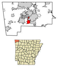
Geography
Cave Springs is located in south central Benton County in the valley of Osage Creek. AR 112 leads north 8 miles (13km) to Bentonville and south 16 miles (26km) to Fayetteville. AR 264 leads east 6 miles (10km) to Lowell and west (as Healing Springs Road) 5 miles (8km) to Northwest Arkansas National Airport.
According to the United States Census Bureau, the city has a total area of 6.9 square miles (18.0km2), of which 6.9 square miles (17.8km2) is land and 0.077 square miles (0.2km2), or 0.84%, is water.[4] Lake Keith, a small water basin in the middle of Cave Springs, harbors the rare Ozark Cavefish (Amblyopsis rosae). In October 2013, Lake Keith was temporarily drained.[5]
As of the 2020 United States census, there were 5,495 people, 1,421 households, and 1,255 families residing in the city. The population density was 250.9 people per square mile. In the city, 32.9% of persons were under the age of 18 and 8.6% were 65 years of age or older. For every 100 females, there were 105.8 males.
Cave Springs is the wealthiest city in Arkansas.[9] The median income for a household in the city is $114,286. The per capita income for the city is $140,703. Only about 2.6% of the population lies below the poverty line.[10]
Education
Public education for elementary and secondary students is provided by two school districts. Most of the community is within the Bentonville School District. For some residents, public education is zoned to the Rogers School District.[11]
School zoning for the Bentonville schools section is as follows:
Most is to Evening Star Elementary School while portions are to Central Park-Morning Star Elementary School.[12]
The current mayor is Randall Noblett who was first elected in 2018 after defeating Mayor Travis Lee by a margin of 248 votes.[16][17]
The current state representatives that serve districts containing portions of Cave Springs are Rep. Kendon Underwood, Rep. Jim Dotson, and Rep. Delia Haak. The current state senator that serves the district containing Cave Springs is Sen. Bart Hester, who is also a resident of the city.
Presidential election results
Cave Springs city vote by party in presidential elections[18]
This page is based on this Wikipedia article Text is available under the CC BY-SA 4.0 license; additional terms may apply. Images, videos and audio are available under their respective licenses.