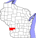
De Soto, Wisconsin | |
---|---|
Coordinates: 43°25′37″N91°11′49″W / 43.42694°N 91.19694°W | |
Country | United States |
State | Wisconsin |
Counties | Vernon, Crawford |
Area | |
• Total | 1.25 sq mi (3.24 km2) |
• Land | 1.22 sq mi (3.16 km2) |
• Water | 0.03 sq mi (0.08 km2) |
Elevation | 653 ft (199 m) |
Population | |
• Total | 287 |
• Estimate (2019) [4] | 279 |
• Density | 228.31/sq mi (88.16/km2) |
Time zone | UTC-6 (Central (CST)) |
• Summer (DST) | UTC-5 (CDT) |
Area code | 608 |
FIPS code | 55-19850 [5] |
GNIS feature ID | 1563761 [2] |
Website | www |
De Soto is a village mostly in Vernon County but also in Crawford County in Wisconsin, United States. The population was 309 at the 2020 census, [6] up from 287 at the 2010 census.
De Soto was named after Hernando De Soto the explorer who discovered the Mississippi. [7]
De Soto is located at 43°25′37″N91°11′49″W / 43.42694°N 91.19694°W (43.426905, -91.196841). [8]
According to the United States Census Bureau, the village has a total area of 1.34 square miles (3.47 km2), of which, 1.25 square miles (3.24 km2) of it is land and 0.09 square miles (0.23 km2) is water. [9]
Census | Pop. | Note | %± |
---|---|---|---|
1880 | 301 | — | |
1890 | 355 | 17.9% | |
1900 | 387 | 9.0% | |
1910 | 331 | −14.5% | |
1920 | 299 | −9.7% | |
1930 | 322 | 7.7% | |
1940 | 400 | 24.2% | |
1950 | 367 | −8.2% | |
1960 | 357 | −2.7% | |
1970 | 295 | −17.4% | |
1980 | 318 | 7.8% | |
1990 | 326 | 2.5% | |
2000 | 366 | 12.3% | |
2010 | 287 | −21.6% | |
2019 (est.) | 279 | [4] | −2.8% |
U.S. Decennial Census [10] |
As of the census [3] of 2010, there were 287 people, 129 households, and 80 families living in the village. The population density was 229.6 inhabitants per square mile (88.6/km2). There were 176 housing units at an average density of 140.8 per square mile (54.4/km2). The racial makeup of the village was 99.7% White and 0.3% from two or more races.
There were 129 households, of which 31.0% had children under the age of 18 living with them, 48.8% were married couples living together, 10.1% had a female householder with no husband present, 3.1% had a male householder with no wife present, and 38.0% were non-families. 31.8% of all households were made up of individuals, and 15.5% had someone living alone who was 65 years of age or older. The average household size was 2.22 and the average family size was 2.83.
The median age in the village was 44.1 years. 23.3% of residents were under the age of 18; 3.9% were between the ages of 18 and 24; 24.5% were from 25 to 44; 31.8% were from 45 to 64; and 16.7% were 65 years of age or older. The gender makeup of the village was 51.2% male and 48.8% female.
As of the census [5] of 2000, there were 366 people, 151 households, and 104 families living in the village. The population density was 283.6 people per square mile (109.5/km2). There were 191 housing units at an average density of 148.0 per square mile (57.2/km2). The racial makeup of the village was 95.08% White, 1.64% African American, 0.55% Asian, 0.27% from other races, and 2.46% from two or more races. Hispanic or Latino of any race were 1.64% of the population.
There were 151 households, out of which 26.5% had children under the age of 18 living with them, 61.6% were married couples living together, 4.0% had a female householder with no husband present, and 30.5% were non-families. 25.2% of all households were made up of individuals, and 13.2% had someone living alone who was 65 years of age or older. The average household size was 2.42 and the average family size was 2.93.
In the village, the population was spread out, with 22.7% under the age of 18, 4.4% from 18 to 24, 23.5% from 25 to 44, 32.2% from 45 to 64, and 17.2% who were 65 years of age or older. The median age was 44 years. For every 100 females, there were 89.6 males. For every 100 females age 18 and over, there were 88.7 males.
The median income for a household in the village was $33,036, and the median income for a family was $40,000. Males had a median income of $30,313 versus $16,250 for females. The per capita income for the village was $18,042. About 7.4% of families and 7.4% of the population were below the poverty line, including 13.7% of those under age 18 and 7.0% of those age 65 or over.
The De Soto Area Schools serves De Soto, Wisconsin. [11] De Soto Area schools consists of De Soto High/Middle School in De Soto, Wisconsin, Prairie View Elementary School and Stoddard Elementary School.
Bus service towards La Crosse and Prairie du Chien is provided three times daily per direction by Scenic Mississippi Regional Transit. [12]
De Soto is a village in Jackson County, Illinois, United States. The population was 1,590 at the 2010 census, down from 1,653 at the 2000 census. It is named for Hernando de Soto, the discoverer of the Mississippi River.
De Soto is a city in Dallas County, Iowa, United States. The population was 915 at the time of the 2020 census. It is part of the Des Moines–West Des Moines Metropolitan Statistical Area.
South Mansfield is a village in DeSoto Parish, Louisiana, United States. The population was 346 at the 2010 census. It is part of the Shreveport–Bossier City Metropolitan Statistical Area.
Stanley is a village in DeSoto Parish, Louisiana, United States. The population was 107 at the 2010 census, down from 145 in 2000. It is part of the Shreveport–Bossier City Metropolitan Statistical Area.
Carsonville is a village in Sanilac County of the U.S. state of Michigan. The population was 527 at the 2010 census. The village is situated at 43°25′37″N82°40′17″W on the boundary between Bridgehampton Township and Washington Township, with about half the village in each.
Memphis was a village in DeSoto County, Mississippi, United States. The population was 87 at the 2000 census. In 2004, the village of Memphis officially became part of the town of Walls.
Reedy is a town in Roane County, West Virginia, United States. The population was 152 at the 2020 census.
Sherwood is a village in Calumet County, Wisconsin, United States. The population was 2,713 at the 2010 census. The former historical unincorporated community of High Cliff is located within present-day Sherwood.
Ferryville is a village in Crawford County, Wisconsin, United States. The population was 176 at the 2010 census. It is located on Wisconsin Highway 35 along the Great River Road.
Freeman is a town in Crawford County, Wisconsin, United States. The population was 719 at the 2000 census. The villages of Ferryville and De Soto are located in the town. The unincorporated community of Reed is also located in the town.
Neosho is a village in Dodge County, Wisconsin, United States. The population was 574 at the 2010 census.
Monticello is a village in Green County, Wisconsin, United States. The population was 1,217 as of the 2010 census.
Chaseburg is a village in Vernon County, Wisconsin, United States. The population was 284 at the 2010 census.
Stoddard is a village in Vernon County, Wisconsin, United States. The population was 840 at the 2020 census.
Cazenovia is a village in Richland and Sauk Counties in the U.S. state of Wisconsin. The population was 318 at the 2010 census. Of this, 314 were in Richland County, and only 4 were in Sauk County.
Unity is a village in Clark and Marathon counties in the U.S. state of Wisconsin. It is part of the Wausau, Wisconsin Metropolitan Statistical Area. The population was 343 at the 2010 census. Of this, 204 were in Marathon County, and 139 were in Clark County. The village is located in northeastern town of Unity in Clark County and northwestern town of Brighton in Marathon County.
Lowell is a village in Dodge County, Wisconsin, United States, along the Beaver Dam River. The population was 340 at the 2010 census. The village is located within the Town of Lowell.
Milltown is a village in Polk County, Wisconsin, United States. The population was 917 at the 2010 census. The village is located within the Town of Milltown.
Genoa is a village in Vernon County, Wisconsin, United States. The population was 232 at the 2020 census. The village is within the Town of Genoa.
Scandinavia is a village in the Town of Scandinavia in Waupaca County, Wisconsin, United States. The population was 328 at the 2010 census.