Grand Canyon-Parashant National Monument

Last updated
Grand Canyon-Parashant National Monument

Grand Canyon Parashant sign, Arizona.JPG

A sign indicating an entrance to the monument on the Toroweap road
USA Arizona location map.svg
Red pog.svg
Usa edcp relief location map.png
Red pog.svg
Location Mohave County, Arizona, USA
Nearest city Las Vegas, Nevada
Coordinates 36°24′N113°42′W / 36.400°N 113.700°W / 36.400; -113.700 Coordinates: 36°24′N113°42′W / 36.400°N 113.700°W / 36.400; -113.700
Area 1,048,325 acres (4,242.42 km2) [1]
Created January 11, 2000 (2000-January-11)
Governing body National Park Service and
Bureau of Land Management
Website Grand Canyon-Parashant National Monument

Grand Canyon-Parashant National Monument (sometimes referred to as Parashant National Monument) is located on the northern edge of the Grand Canyon in northwest Arizona. The monument was established by Presidential Proclamation 7265 on January 11, 2000. [2]

Grand Canyon A steep-sided canyon carved by the Colorado River in Arizona, United States

The Grand Canyon is a steep-sided canyon carved by the Colorado River in Arizona, United States. The Grand Canyon is 277 miles (446 km) long, up to 18 miles (29 km) wide and attains a depth of over a mile.

Arizona state of the United States of America

Arizona is a state in the southwestern region of the United States. It is also part of the Western and the Mountain states. It is the sixth largest and the 14th most populous of the 50 states. Its capital and largest city is Phoenix. Arizona shares the Four Corners region with Utah, Colorado, and New Mexico; its other neighboring states are Nevada and California to the west and the Mexican states of Sonora and Baja California to the south and southwest.

Contents

Side canyon in the National Monument Grand canyon-parachant nm.jpg
Side canyon in the National Monument

Description

The national monument is a very remote and undeveloped place jointly managed by the National Park Service (NPS) and the Bureau of Land Management (BLM). There are no paved roads into the monument and no visitor services. The 1,048,325-acre (424,242 ha) monument is larger than the state of Rhode Island. The BLM portion of the monument consists of 808,747 acres (327,288 ha). [1] The NPS portion contains 208,453 acres (84,358 ha) of lands that were previously part of Lake Mead National Recreation Area. There are also about 23,205 acres (9,391 ha) of Arizona State Land Department lands and 7,920 acres (3,210 ha) of private lands within the monument boundaries. Grand Canyon-Parashant is not considered a separate unit of the NPS because its NPS area is counted in Lake Mead National Recreation Area.

National Park Service United States federal agency

The National Park Service (NPS) is an agency of the United States federal government that manages all national parks, many national monuments, and other conservation and historical properties with various title designations. It was created on August 25, 1916, by Congress through the National Park Service Organic Act and is an agency of the United States Department of the Interior. The NPS is charged with a dual role of preserving the ecological and historical integrity of the places entrusted to its management, while also making them available and accessible for public use and enjoyment.

Bureau of Land Management agency within the United States Department of the Interior

The Bureau of Land Management (BLM) is an agency within the United States Department of the Interior that administers more than 247.3 million acres (1,001,000 km2) of public lands in the United States which constitutes one eighth of the landmass of the country. President Harry S. Truman created the BLM in 1946 by combining two existing agencies: the General Land Office and the Grazing Service. The agency manages the federal government's nearly 700 million acres (2,800,000 km2) of subsurface mineral estate located beneath federal, state and private lands severed from their surface rights by the Homestead Act of 1862. Most BLM public lands are located in these 12 western states: Alaska, Arizona, California, Colorado, Idaho, Montana, Nevada, New Mexico, Oregon, Utah, Washington and Wyoming.

Lake Mead National Recreation Area U.S. National Recreation Area in Nevada and Arizona

Lake Mead National Recreation Area is a U.S. National Recreation Area located in southeastern Nevada and northwestern Arizona. Operated by the National Park Service, Lake Mead NRA follows the Colorado River corridor from the westernmost boundary of Grand Canyon National Park to just north of the cities of Laughlin, Nevada and Bullhead City, Arizona. It includes all of the eponymous Lake Mead as well as the smaller Lake Mohave – reservoirs on the river created by Hoover Dam and Davis Dam, respectively – and the surrounding desert terrain and wilderness.

Elevation ranges from 1,230 feet (370 m) above sea level near Grand Wash Bay at Lake Mead, to 8,029 feet (2,447 m) at Mount Trumbull. The Interagency Information Center is located in the BLM Office in St. George, Utah.

Visitor center physical location that provides tourist information on the place or attraction where it is located

A visitor center or centre, visitor information center, tourist information center, is a physical location that provides tourist information to visitors.

St. George, Utah City in Utah, United States

St. George is a city in and the county seat of Washington County, Utah, United States. Located in the southwestern part of the state on the Arizona border, near the tri-state junction of Utah, Arizona and Nevada, it is the principal city of the St. George Metropolitan Statistical Area. The city lies in the northeasternmost part of the Mojave Desert, adjacent to the Pine Valley Mountains near the convergence of three distinct geological areas: the Mojave Desert, Colorado Plateau, and Great Basin. The city is 118 miles northeast of Las Vegas and 300 miles south-southwest of Salt Lake City on Interstate 15. The St. George area is well known for its natural environment and proximity to several state and national parks.

The name Parashant is derived from Paiute word Pawteh 'ee oasoasant, meaning "tanned elk hide," or "softening of the elk hide." [3]

Colorado River Numic, of the Numic branch of the Uto-Aztecan language family, is a dialect chain that stretches from southeastern California to Colorado. Individual dialects are Chemehuevi, which is in danger of extinction, Southern Paiute, and Ute. According to the Ethnologue, there were a little less than two thousand speakers of Colorado River Numic Language in 1990, or ca. 40% out of an ethnic population of 5,000.

Wilderness areas

Grand Canyon-Parashant includes the following wilderness areas:

National Wilderness Preservation System

The National Wilderness Preservation System (NWPS) of the United States protects federally managed wilderness areas designated for preservation in their natural condition. Activity on formally designated wilderness areas is coordinated by the National Wilderness Preservation System. Wilderness areas are managed by four federal land management agencies: the National Park Service, the U.S. Forest Service, the U.S. Fish and Wildlife Service, and the Bureau of Land Management. The term "wilderness" is defined as "an area where the earth and community of life are untrammeled by man, where man himself is a visitor who does not remain" and "an area of undeveloped Federal land retaining its primeval character and influence, without permanent improvements or human habitation, which is protected and managed so as to preserve its natural conditions." As of 2016, there are 765 designated wilderness areas, totaling 109,129,657 acres (44,163,205 ha), or about 4.5% of the area of the United States.

Mount Logan Wilderness

The Mount Logan Wilderness is a 14,650 acre (59 km2) U.S. wilderness area on the Arizona Strip and is part of the Uinkaret Mountains, a small regional range. It is located about seven miles south of the Mount Trumbull Wilderness. The wilderness is within the Grand Canyon-Parashant National Monument and is managed by the BLM.

Mount Trumbull Wilderness

The Mount Trumbull Wilderness is a 7,880 acre (31 km2) wilderness area located on the Uinkaret Plateau in the Arizona Strip. It is managed by the Bureau of Land Management.

Paiute Wilderness

The Paiute Wilderness is an 87,900 acre wilderness area located in the northwestern part of the U.S. state of Arizona. The wilderness is administered by the Bureau of Land Management. The southern section of the wilderness lies within Grand Canyon-Parashant National Monument, and is also managed by the BLM. Directly to the north, separated by Interstate Highway 15, lies the Beaver Dam Mountains Wilderness.

Petroglyphs at Grand Canyon-Parashant GCPNM rock art.jpg
Petroglyphs at Grand Canyon-Parashant

Cave animals

So far, a 2005 expedition to examine 24 caves in the park has produced two new species of millipede, the first barklouse discovered in North America, a whole new genus of cricket and four new cricket species. [4]

Related Research Articles

Mohave County, Arizona County in the United States

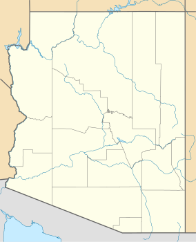
Mohave County is in the northwestern corner of the U.S. state of Arizona. As of the 2010 census, its population was 200,186. The county seat is Kingman, and the largest city is Lake Havasu City.

Grand Staircase-Escalante National Monument national monument in Kane and Garfield counties in Utah, United States

The Grand Staircase-Escalante National Monument (GSENM) is a United States national monument that originally designated 1,880,461 acres (7,610 km2) of protected land in southern Utah in 1996. The monument's size was later reduced by a succeeding presidential proclamation in 2017. The land is among the most remote in the country; it was the last to be mapped in the contiguous United States.

National monument (United States) monuments assigned protected status by Presidents of the US

In the United States, a national monument is a protected area that is similar to a national park, but can be created from any land owned or controlled by the federal government by proclamation of the President of the United States.

Northern Arizona

Northern Arizona is an unofficial, colloquially-defined region of the U.S. state of Arizona. Generally consisting of Coconino, Mohave, Navajo, and Apache counties, the region is geographically dominated by the Colorado Plateau, the southern border of which in Arizona is called the Mogollon Rim.

San Gorgonio Wilderness

The San Gorgonio Wilderness is located in the eastern San Bernardino Mountains, in San Bernardino County and into northern Riverside County, Southern California.

Arizona Strip part of Arizona north of the Colorado River, having more physical/cultural connections with southern Utah and Nevada than the rest of Arizona due to the difficulty of crossing the Grand Canyon, whose largest settlements are Colorado City and Fredonia

The Arizona Strip is the part of Arizona lying north of the Colorado River. The difficulty of crossing the Grand Canyon causes this region to have more physical and cultural connections with southern Utah and Nevada than with the rest of Arizona. The largest settlements in the Strip are Colorado City and Fredonia.

National Conservation Lands group of federally-managed protected areas in the United States

National Conservation Lands, formally known as the National Landscape Conservation System, is a 35-million-acre (140,000 km2) collection of lands in 873 federally recognized areas considered to be the crown jewels of the American West. These lands represent 10% of the 258 million acres (1,040,000 km2) managed by the Bureau of Land Management (BLM). The BLM is the largest federal public land manager and is responsible for over 40% of all the federal public land in the nation. The other major federal public land managers include the US Forest Service (USFS), National Park Service (NPS), and the US Fish and Wildlife Service (USFWS).

Beaver Dam Mountains Wilderness

The Beaver Dam Mountains Wilderness is a wilderness area located in northwestern Arizona and southwestern Utah, USA, within the arid Colorado Plateau region. The jagged mountains and gently sloping alluvial plain of the Beaver Dam Mountains straddle the border between the two states. The Wilderness contains some of the lowest elevation land in Utah, and includes a 13 miles (21 km) section of the Virgin River Gorge. The area comprises some 18,667 acres (7,554 ha), 15,000 acres (6,100 ha) of which in Arizona and approximately 3,667 acres (1,484 ha) in Utah. The area was designated Wilderness by the U.S. Congress in 1984 and is administered by the Bureau of Land Management.

Sonoran Desert National Monument national monument in Arizona

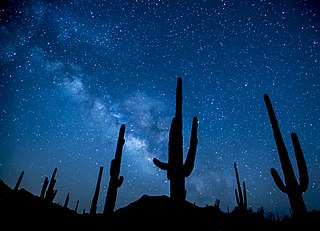
Sonoran Desert National Monument is south of Goodyear and Buckeye and east of Gila Bend, Arizona. Created by Presidential proclamation on January 17, 2001, the 496,400 acres (200,886 ha) monument is managed by the U.S. Bureau of Land Management as part of the National Landscape Conservation System. The BLM already managed the lands, however under monument status, the level of protection and preservation of resources is enhanced. Sonoran Desert National Monument protects but a small portion of the Sonoran Desert, which is 120,000 square miles (311,000 km2), and extends well into California and the country of Mexico. The North Maricopa Mountains, South Maricopa Mountains and the Table Top Wildernesses protect the richest regions of desert habitat from development.

Little Finland

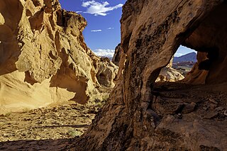
Little Finland is a scenic red rock area, located in a remote section of Clark County, Nevada south of Mesquite, known for its red rock scenery and strangely-shaped, delicate rock formations. The landscape is similar to Valley of Fire State Park, which is about 20 miles (32 km) to the west, across Lake Mead. The rock formations are composed of red Aztec Sandstone, fossil sand dunes. Many of the features are small erosional fins, hence the name.

Sand to Snow National Monument protected area in California

Sand to Snow National Monument is a U.S. National Monument located in San Bernardino County and into northern Riverside County, Southern California.

Shivwits Plateau

The Shivwits Plateau is a large plateau in northwest Arizona, and in the northwest of the Grand Canyon region. Just like the Kaibab Plateau in the east Grand Canyon forces the course of the Colorado River encircling it, the Shivwits Plateau is the major course changer of the Colorado in west Grand Canyon. The Colorado River goes due-south on the east perimeter of the plateau, goes west, then northwest to its outfall at Lake Mead. The southwest of the plateau borders the Colorado, but a lower elevation section is directly riverside; it is lower elevation hills and small canyons, called Sanup Plateau, and bordering the section of the Colorado called the Lower Granite Gorge.

Grand Wash Cliffs

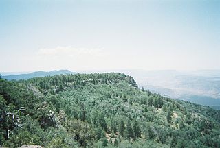
The Grand Wash Cliffs extend south-southeast from the Grand Canyon-Parashant National Monument in northwest Arizona west of the Shivwits Plateau south through the Grand Cliffs Wilderness and into the Lake Mead Recreation Area. The Grand Wash Cliffs cross the Grand Canyon where the Colorado River enters Lake Mead. To the south of the Grand Canyon the Grand Wash Cliffs continue past the east side of Grapevine Mesa and then southeast above and east of the Hualapai Valley forming the southwest margin of the Music Mountains.

Bears Ears National Monument Protected area in Utah

Bears Ears National Monument is a United States national monument located in San Juan County in southeastern Utah, established by President Barack Obama by presidential proclamation on December 28, 2016. The monument's original size was 1,351,849 acres, which was controversially reduced 85% by President Donald Trump on December 4, 2017. The monument protects the public land surrounding the Bears Ears—a pair of buttes—and the Indian Creek corridor rock climbing area. The Native American names for the buttes have the same meaning in each of the languages represented in the region. The names are listed in the presidential proclamation as "Hoon’Naqvut, Shash Jáa [sic], Kwiyagatu Nukavachi, Ansh An Lashokdiwe"—all four mean "Bears Ears".

Gold Butte National Monument protected area in Nevada

Gold Butte National Monument is a United States national monument located in Clark County, Nevada, northeast of Las Vegas and south of Mesquite and Bunkerville. The monument protects nearly 300,000 acres of desert landscapes featuring a wide array of natural and cultural resources, including rock art, sandstone towers, and important wildlife habitat for species including the Mojave Desert tortoise, bighorn sheep, and mountain lion. The area also protects historic ranching and mining sites such as the ghost town of Gold Butte, although little but mine openings, cement foundations, and a few pieces of rusting equipment remains. The monument is managed by the Bureau of Land Management.

References

  1. 1 2 "National Monument detail table as of April 2012" (PDF). Bureau of Land Management. Retrieved 2012-12-26.
  2. Proclamation 7265 of January 11, 2000, Establishment of the Grand Canyon-Parashant National Monument. http://www.gpo.gov/fdsys/pkg/CFR-2001-title3-vol1/xml/CFR-2001-title3-vol1-proc7265.xml. Retrieved 2012-1-27
  3. Rogers, Keith (2000-07-03). "A NEW PLAYGROUND TO KICK AROUND ON". Las Vegas Review-Journal.
  4. "NAU researchers chirping over discovery of new cricket genus". Northern Arizona University. Archived from the original on 2006-12-31.