| Name | Image | Agency | Location | Date established | Area (2017) [8] [9] [10] [11] [12] | Description |
|---|
| Admiralty Island | 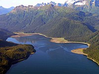 | USFS | Alaska
57°38′N134°21′W / 57.64°N 134.35°W / 57.64; -134.35 (Admiralty Island) | December 1, 1978 | 7009412723103780528♠1,019,861 acres (4,127.2 km2) | Occupying most of Admiralty Island, the 7th largest in the United States, this monument is part of Tongass National Forest in Southeast Alaska. The monument protects the densest known population of brown bear on Earth, along with habitat for the Sitka black-tailed deer. Most of the monument has been designated as the Kootznoowoo Wilderness, restricting future development. The Greens Creek mine lies within the monument. [13] |
| African Burial Ground | 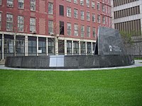 | NPS | New York
40°42′52″N74°00′15″W / 40.7144°N 74.0042°W / 40.7144; -74.0042 (African Burial Ground) | February 27, 2006 | 7003141639974784000♠0.35 acres (0.001 km2) | Re-discovered in 1991 during excavations for a new federal building, this former burial ground that contains the remains of more than 400 free and enslaved Africans buried during the 17th and 18th centuries was designated a National Historic Landmark memorial in 1993. [14] |
| Agate Fossil Beds | 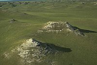 | NPS | Nebraska
42°24′58″N103°43′41″W / 42.416°N 103.728°W / 42.416; -103.728 (Agate Fossil Beds) | June 14, 1997 | 7007123747608483642♠3,057.87 acres (12.4 km2) | The valley of the Niobrara River is known for its large number of well-preserved Miocene mammal fossils which date from about 20 million years ago. [15] |
| Agua Fria | 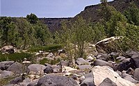 | BLM | Arizona
34°09′N112°05′W / 34.15°N 112.08°W / 34.15; -112.08 (Agua Fria) | January 11, 2000 | 7008287245868861952♠70,980 acres (287.2 km2) | Located around the canyon of the Agua Fria River, it contains more than 450 distinct Native American structures, including large pueblos with more than 100 rooms. [16] |
| Alibates Flint Quarries | 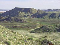 | NPS | Texas
35°34′N101°40′W / 35.57°N 101.67°W / 35.57; -101.67 (Alibates Flint Quarries) | August 21, 1965 | 7006554811874941772♠1,370.97 acres (5.5 km2) | Alibates was the quarry site for high-quality, rainbow-hued flint that was distributed throughout the Great Plains in pre-Columbian times. It is jointly operated with the Lake Meredith National Recreation Area and includes the ruins of several Plains Village Indian dwellings. [17] |
| Aniakchak | 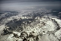 | NPS | Alaska
56°54′N158°09′W / 56.9°N 158.15°W / 56.9; -158.15 (Anikchak) | December 1, 1978 | 7008555131576599142♠137,176 acres (555.1 km2) | Mount Aniakchak, which erupted 3,500 years ago, and the surrounding region make up one of the least visited NPS sites. Surprise Lake, within the volcano's 6-mile (9.7 km) wide, 2,500-foot (760 m) deep caldera, is the source of the Aniakchak River. [18] |
| Aztec Ruins | 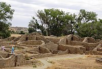 | NPS | New Mexico
36°50′N107°00′W / 36.83°N 107.00°W / 36.83; -107.00 (Aztec Ruins) | January 24, 1923 | 7006128851908489216♠318.4 acres (1.3 km2) | The ruins contain Pueblo structures from the 11th to 13th centuries with more than 400 masonry rooms which were misidentified by early American settlers as Aztec. It has been included in the Chaco Culture World Heritage Site, which also includes Chaco Culture National Historical Park. [19] |
| Bandelier | 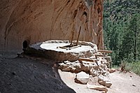 | NPS | New Mexico
35°47′N106°16′W / 35.78°N 106.27°W / 35.78; -106.27 (Bandelier) | February 11, 1916 | 7008136284648274545♠33,676.67 acres (136.3 km2) | A historic district, Bandelier contains Frijoles Canyon, which contains Ancestral Pueblo homes, kivas, rock paintings and petroglyphs. [20] [21] |
| Basin and Range | 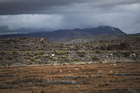 | BLM | Nevada
37°54′N115°24′W / 37.9°N 115.4°W / 37.9; -115.4 (Basin and Range) | July 10, 2015 | 7009284730747595430♠703,585 acres (2,847.3 km2) | Remote, undeveloped mountains and valleys in Lincoln and Nye counties in southeastern Nevada [22] |
| Bears Ears |  | BLM, USFS | Utah
37°38′N109°52′W / 37.63°N 109.86°W / 37.63; -109.86 (Bears Ears National Monument) | December 28, 2016 | 7008816963187128422♠201,876 acres (817.0 km2) [23] | Twin buttes, sandstone canyons, desert mesas, forested highlands, rock art, ancient cliff dwellings, ceremonial kivas [24] |
| Belmont-Paul Women's Equality |  | NPS | District of Columbia
38°53′N77°00′W / 38.89°N 77.00°W / 38.89; -77.00 (Belmont-Paul Women's Equality) | April 12, 2016 | 7003137593118361600♠0.34 acres (0.001 km2) | Home of the National Woman's Party since 1929, it was the home where party leader Alice Paul and others lived and worked. [25] [26] |
| Berryessa Snow Mountain |  | USFS, BLM | California
39°13′N122°46′W / 39.22°N 122.77°W / 39.22; -122.77 (Berryessa Snow Mountain) | July 10, 2015 | 7009133861916740147♠330,780 acres (1,338.6 km2) | Fewer than 100 miles (160 km) from the San Francisco Bay Area, Berryessa Snow Mountain protects part of the California Coast Range, one of the most biodiverse regions in the state, home to elk, osprey, river otters, half the state’s dragonfly species, and California’s second-largest population of wintering bald eagles. [22] [27] |
| Birmingham Civil Rights |  | NPS | Alabama
33°30′47″N86°48′54″W / 33.513°N 86.815°W / 33.513; -86.815 (Birmingham Civil Rights) | January 12, 2017 | 7003356123365171200♠0.88 acres (0.004 km2) | Preserves the A. G. Gaston Motel, a historic site related to the civil rights movement in Birmingham, Alabama. [28] [29] |
| Booker T. Washington |  | NPS | Virginia
37°07′23″N79°45′58″W / 37.123°N 79.766°W / 37.123; -79.766 (Booker T. Washington) | April 2, 1956 | 7005967239153517824♠239.01 acres (1.0 km2) | The Booker T. Washington National Monument preserves portions of the 207-acre (0.84 km2) tobacco farm on which educator and civil rights leader Booker T. Washington was born into slavery on April 5, 1856. The site contains replicas of the house Washington was born in, a smokehouse, a blacksmith shed, a tobacco barn, and a horse barn. [30] |
| Browns Canyon | 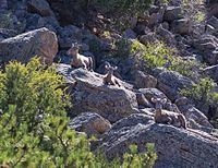 | BLM, USFS | Colorado
38°36′54″N106°03′32″W / 38.615°N 106.059°W / 38.615; -106.059 (Browns Canyon) | February 19, 2015 | 7007874282861495296♠21,604 acres (87.4 km2) | Protects 21,500 acres of steep cliffs and colorful rock outcroppings overlooking the Arkansas River in Chaffee County, Colorado, as well as the area's rich native history. [31] |
| Buck Island Reef | 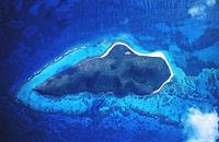 | NPS | US Virgin Islands
17°47′N64°37′W / 17.79°N 64.62°W / 17.79; -64.62 (Buck Island Reef) | December 28, 1961 | 7007769528768944545♠19,015.47 acres (77.0 km2) | Most of this 19,000-acre (77 km2) monument is underwater, containing a large elkhorn coral barrier reef that provides cover for a great variety of reef fish, sea turtles and least terns. It is based around Buck Island, an uninhabited 176-acre (0.71 km2) island. [32] |
| Cabrillo | 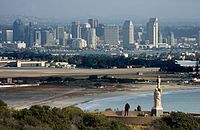 | NPS | California
32°40′N117°14′W / 32.67°N 117.24°W / 32.67; -117.24 (Cabrillo) | October 14, 1913 | 7005647254216198656♠159.94 acres (0.6 km2) | This monument commemorates the landing of Juan Rodríguez Cabrillo at San Diego Bay on September 28, 1542, which was the first European expedition on what later became the west coast of the U.S. The monument includes a statue of Cabrillo and 20th-century coastal artillery batteries built to protect the harbor of San Diego from enemy warships. [33] |
| California Coastal |  | BLM | California
36°53′N122°11′W / 36.89°N 122.18°W / 36.89; -122.18 (California Coastal) | January 11, 2000 | 7007106351386780672♠2,628 acres (10.6 km2) | This monument ensures the protection of all islets, reefs and rock outcroppings from the coast of California to a distance of 12 nautical miles (22 km), along the entire 840-mile (1,350 km) long California coastline. [34] |
| Camp Nelson | 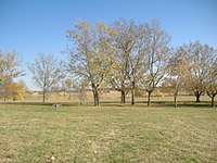 | NPS | Kentucky
37°47′N84°36′W / 37.78°N 84.60°W / 37.78; -84.60 (Camp Nelson) | October 26, 2018 | 7006150947744555520♠373 acres (1.5 km2) | Established in 1863 as a depot for the Union Army during the Civil War, Camp Nelson became a large recruitment center for African American Union soldiers: a key site of emancipation for those soldiers and a refugee camp for their families [35] . |
| Canyon de Chelly |  | NPS | Arizona
36°08′N109°28′W / 36.13°N 109.47°W / 36.13; -109.47 (Canyon de Chelly) | April 1, 1931 | 7008339288442454016♠83,840 acres (339.3 km2) | Located within the boundaries of the Navajo Nation, it preserves the valleys and rims of the canyons of de Chelly, del Muerto, and Monument, all of which are Navajo Tribal Trust Lands. [36] |
| Canyons of the Ancients | 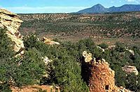 | BLM | Colorado
37°22′N109°00′W / 37.37°N 109°W / 37.37; -109 (Canyon of the Ancients) | June 9, 2000 | 7008713744067218688♠176,370 acres (713.7 km2) | Surrounding Hovenweep National Monument, it preserves and protects more than 6,000 archeological sites, the largest concentration in the U.S. [37] |
| Cape Krusenstern |  | NPS | Alaska
67°25′N163°30′W / 67.41°N 163.50°W / 67.41; -163.50 (Cape Krusenstern) | December 1, 1978 | 7009262679892338261♠649,096.15 acres (2,626.8 km2) | Co-located with the NHLD Cape Krusenstern Archeological District, this coastal plain contains large lagoons and rolling hills of limestone. The bluffs record thousands of years of change in the shorelines of the Chukchi Sea, as well as evidence of some 9,000 years of human habitation. [38] |
| Capulin Volcano | 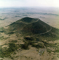 | NPS | New Mexico
36°47′N103°58′W / 36.79°N 103.96°W / 36.79; -103.96 (Capulin Volcano) | August 9, 1916 | 7006320850964593561♠792.84 acres (3.2 km2) | Capulin is an extinct cinder cone volcano that is approximately 59,000 years old and part of the Raton-Clayton Volcanic Field. The crater is 400 feet (120 m) deep and its rim is more than 1,500 feet (460 m) in diameter. [39] |
| Carrizo Plain | 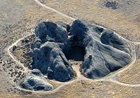 | BLM | California
35°10′N119°45′W / 35.16°N 119.75°W / 35.16; -119.75 (Carrizo Plain) | January 12, 2001 | 7008854068813665408♠211,045 acres (854.1 km2) | Carrizo Plain is the largest single native grassland remaining in California. It contains part of the San Andreas Fault and is surrounded by the Temblor Range and the Caliente Range. At the center of the plain is Soda Lake, which is near Painted Rock. [40] |
| Casa Grande Ruins | 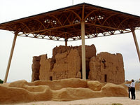 | NPS | Arizona
32°59′N111°32′W / 32.99°N 111.54°W / 32.99; -111.54 (Casa Grande Ruins) | August 3, 1918 | 7006191213965958400♠472.5 acres (1.9 km2) | This monument preserves a group of structures surrounded by a compound wall in the Gila Valley that were built in the early 13th century. They were inhabited by the Hohokam people until they were abandoned in the mid-15th century. [41] |
| Cascade–Siskiyou | 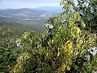 | BLM | Oregon, California
42°05′N122°28′W / 42.08°N 122.46°W / 42.08; -122.46 (Cascade-Siskiyou) | June 9, 2000 | 7008264425645496038♠65,341 acres (264.4 km2) | One of the most diverse ecosystems found in the Cascade Range, it has more than 100 dwelling and root-gathering sites belonging to the Modoc, Klamath, and Shasta tribes. [42] |
| Castillo de San Marcos |  | NPS | Florida
29°53′53″N81°18′40″W / 29.898°N 81.311°W / 29.898; -81.311 (Castillo de San Marcos) | October 15, 1924 | 7004784280774661120♠19.38 acres (0.1 km2) | This Spanish fort near St. Augustine, called Fort Marion when first protected, served for 205 years under four different flags. Built in 1672, it was involved in sieges with the British while under Spanish command, the American Revolution under Britain, the Civil War under the Confederacy, and the Seminole Wars and the Spanish–American War under the United States. [43] |
| Castle Clinton |  | NPS | New York
40°42′13″N74°01′01″W / 40.7036°N 74.0169°W / 40.7036; -74.0169 (Castle Clinton) | August 12, 1946 | 7003404685642240000♠1 acre (0.004 km2) | A circular sandstone fort built in 1811 at the southern tip of Manhattan to protect New York City from the British, Castle Clinton is now located in Battery Park. It later became a beer garden, a theater, the first immigration station (predating Ellis Island), and a public aquarium. [44] |
| Castle Mountains | 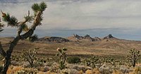 | NPS | California
35°15′N115°07′W / 35.25°N 115.11°W / 35.25; -115.11 (Castle Mountains) | February 12, 2016 | 7007850871797091712♠21,025.5 acres (85.1 km2) | Castle Mountains represents some of the most unique elements of the Mojave Desert. Nestled between the Nevada state line and Mojave National Preserve, the nearly 21,000 acres of Castle Mountains boasts Joshua tree forests, unbroken natural landscapes, rare desert grasslands, and rich human history. [45] [46] |
| Cedar Breaks |  | NPS | Utah
37°38′N112°51′W / 37.63°N 112.85°W / 37.63; -112.85 (Cedar Breaks) | August 22, 1933 | 7007249067825373030♠6,154.6 acres (24.9 km2) | A natural amphitheater canyon similar to formations at Bryce Canyon National Park, it stretches over 3 miles (4.8 km) and is more than 2,000 feet (610 m) deep. [47] |
| César E. Chávez | 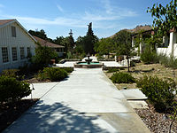 | NPS | California
35°13′38″N118°33′41″W / 35.2273°N 118.5614°W / 35.2273; -118.5614 (Cesar E. Chavez) | October 8, 2012 | 7005471701584594944♠116.56 acres (0.5 km2) | This monument commemorates the life and work of labor leader and civil right activist Cesar Chavez. Called La Paz, the site was Chavez's home for about 20 years, and his gravesite is on the premises. It is also the location of the headquarters of United Farm Workers, which was founded by Chavez. [48] |
| Charles Young Buffalo Soldiers | 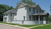 | NPS | Ohio
39°42′26″N83°53′25″W / 39.7072°N 83.8903°W / 39.7072; -83.8903 (Charles Young Buffalo Soldiers) | March 25, 2013 | 7005241435454160384♠59.66 acres (0.2 km2) | Charles Young was the first African American to reach the rank of colonel in the US Army. He was also the first national park superintendent, of Sequoia and General Grant National Parks and a professor at Wilberforce University. His home at Wilberforce is a museum commemorating his life. [49] |
| Chimney Rock | 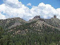 | USFS | Colorado
37°11′30″N107°18′23″W / 37.1917°N 107.3064°W / 37.1917; -107.3064 (Chimney Rock) | September 21, 2012 | 7007191173497394176♠4,724 acres (19.1 km2) | The jewel of San Juan National Forest, the site was once home to the ancestors of the modern Pueblos. Roughly 1,000 years ago, the Ancestral Pueblo People built more than 200 homes and ceremonial buildings high above the valley floor. [50] |
| Chiricahua | 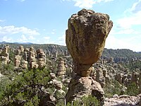 | NPS | Arizona
32°01′N109°21′W / 32.02°N 109.35°W / 32.02; -109.35 (Chiricahua) | April 18, 1924 | 7007486623558281259♠12,024.73 acres (48.7 km2) | These pillars of rhyolite tuff are the eroded remains of an immense volcanic eruption that shook the region some 27 million years ago. It was called the Land of the Standing-Up Rocks by the Apache. [51] |
| Colorado | 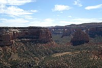 | NPS | Colorado
39°02′N108°41′W / 39.04°N 108.69°W / 39.04; -108.69 (Colorado) | May 24, 1911 | 7007831078217644111♠20,536.39 acres (83.1 km2) | Monument Canyon runs the width of the park and includes rock formations formed by erosion. The monument includes 20,500 acres (83 km2) of semi-desert land high on the Colorado Plateau and has a wide range of wildlife including pinyon pines, juniper trees, ravens, jays, desert bighorn sheep, and coyotes as well as a range of recreational activities. [52] |
| Craters of the Moon |  | NPS, BLM | Idaho
43°25′N113°31′W / 43.42°N 113.52°W / 43.42; -113.52 (Craters of the Moon) | May 2, 1924 | 7008216254456631899♠53,437.64 acres (216.3 km2) | One of the best preserved flood basalt areas in the continental U.S. contains three lava fields along the Great Rift of Idaho as well as the world's deepest open rift cracks and other volcanic features. [53] [54] |
| Devils Postpile | 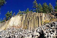 | NPS | California
37°30′N119°05′W / 37.50°N 119.08°W / 37.50; -119.08 (Devils Postpile) | July 6, 1911 | 7006323825404064025♠800.19 acres (3.2 km2) | Once part of Yosemite National Park, this monument is a dark cliff of columnar basalt created by a lava flow at least 100,000 years ago. It also has the 101-foot (31 m)-high Rainbow Falls. [55] |
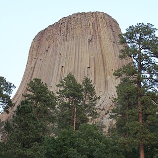
| Devils Tower | 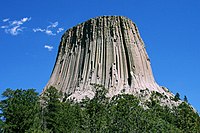 | NPS | Wyoming
44°35′N104°43′W / 44.59°N 104.72°W / 44.59; -104.72 (Devils Tower) | September 24, 1906 | 7006545196544082150♠1,347.21 acres (5.5 km2) | The tower is a monolithic igneous intrusion of volcanic neck rising dramatically 1,267 feet (386 m) above the surrounding terrain. Proclaimed by Theodore Roosevelt, this was the first national monument. [3] |
| Dinosaur |  | NPS | Colorado, Utah
40°32′N108°59′W / 40.53°N 108.98°W / 40.53; -108.98 (Dinosaur) | October 4, 1915 | 7008850980738466603♠210,281.92 acres (851.0 km2) | This sandstone and conglomerate bed, known as the Morrison Formation, was formed in the Jurassic Period and contains fossils of dinosaurs including Allosaurus and various long-neck and long-tail sauropods. [56] |
| Effigy Mounds | 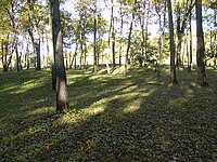 | NPS | Iowa
43°05′N91°11′W / 43.09°N 91.19°W / 43.09; -91.19 (Effigy Mounds) | October 25, 1949 | 7007102239375969871♠2,526.39 acres (10.2 km2) | This monument preserves three prehistoric sites with 206 prehistoric mounds, notable for 31 unusual mounds in the shape of mammals, birds, or reptiles. [57] |
| El Malpais | 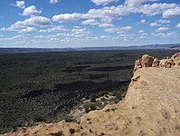 | NPS | New Mexico
34°53′N108°03′W / 34.88°N 108.05°W / 34.88; -108.05 (El Malpais) | December 31, 1987 | 7008462746336486379♠114,347.11 acres (462.7 km2) | An extremely rough, rugged lava flow covers much of the park, filling a large basin rimmed by higher sandstone that forms large, wind-carved bluffs. It has lava tube caves that stretch over 17 miles (27 km) and the Cebolla Wilderness, a forested rimrock area that features prehistoric rock art and the Zuni-Acoma Trail, an ancient Pueblo trade route. [58] |
| El Morro | 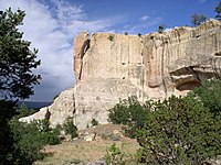 | NPS | New Mexico
35°02′N108°21′W / 35.04°N 108.35°W / 35.04; -108.35 (El Morro) | December 8, 1906 | 7006517479624445132♠1,278.72 acres (5.2 km2) | On the site of an ancient east-west trail is a great sandstone promontory with a pool of water at its base. There are inscriptions from the 17th century as well as older petroglyphs made by the Ancestral Puebloans. [59] |
| Florissant Fossil Beds | 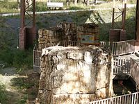 | NPS | Colorado
38°55′N105°16′W / 38.92°N 105.27°W / 38.92; -105.27 (Florissant Fossil beds) | August 20, 1969 | 7007242734090386332♠5,998.09 acres (24.3 km2) | Huge petrified redwoods and incredibly detailed fossils of ancient insects and plants reveal a very different landscape in Colorado of almost 35 million years ago in the Eocene age. [60] |
| Fort Frederica |  | NPS | Georgia
31°13′26″N81°23′35″W / 31.224°N 81.393°W / 31.224; -81.393 (Fort Frederica) | May 26, 1936 | 7006115129018360857♠284.49 acres (1.2 km2) | Built by James Oglethorpe between 1736 and 1748, these remnants of a fort and town protected the southern boundary of the British colony of Georgia from Spanish raids. It was a few miles from the site of the Battle of Bloody Marsh. [61] |
| Fort Matanzas |  | NPS | Florida
29°42′54″N81°14′20″W / 29.715°N 81.239°W / 29.715; -81.239 (Fort Matanzas) | October 15, 1924 | 7006121450208092646♠300.11 acres (1.2 km2) | This 1740 Spanish fort guarded Matanzas Inlet, the southern mouth of the Matanzas River, which allowed access to St. Augustine. The monument is managed in conjunction with Castillo de San Marcos National Monument and also protects 100 acres (0.40 km2) of salt marsh and barrier islands. [62] |
| Fort McHenry |  | NPS | Maryland
39°15′47″N76°34′44″W / 39.263°N 76.579°W / 39.263; -76.579 (Fort McHenry) | March 3, 1925 | 7005175067008833024♠43.26 acres (0.2 km2) | The only place designated a national monument and historic shrine, Fort McHenry is a star-shaped fort best known for its role in the War of 1812 when it successfully defended Baltimore Harbor from an attack by the British navy. It inspired Francis Scott Key to write "The Star-Spangled Banner". [63] |
| Fort Monroe | 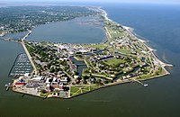 | NPS | Virginia
37°00′14″N76°18′29″W / 37.004°N 76.308°W / 37.004; -76.308 (Fort Monroe) | November 1, 2011 | 7006148568192979148♠367.12 acres (1.5 km2) | Fort Monroe National Monument spans the American story from the 17th to the 21st centuries: Captain John Smith's journeys, a haven of freedom for the enslaved during the Civil War, and a bastion of defense for the Chesapeake Bay. [64] |
| Fort Ord | 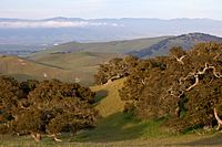 | BLM | California
36°38′21″N121°44′07″W / 36.639167°N 121.735278°W / 36.639167; -121.735278 (Fort Ord) | April 20, 2012 | 7007593188214395392♠14,658 acres (59.3 km2) | Fort Ord was an Army post from 1917 to 1994. It now has recreational trails and various wildlife. |
| Fort Pulaski | 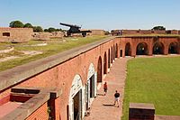 | NPS | Georgia
32°01′37″N80°53′24″W / 32.027°N 80.890°W / 32.027; -80.890 (Fort Pulaski) | October 15, 1924 | 7007227558783487974♠5,623.1 acres (22.8 km2) | In 1862 during the American Civil War, the Union Army successfully tested a rifled cannon against the defending Confederates, rendering brick fortifications obsolete. Fort Pulaski was also used as a prisoner-of-war camp during the war. The national monument includes most of Cockspur Island (containing the fort) and all of adjacent McQueens Island. [65] |
| Fort Stanwix | 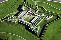 | NPS | New York
43°13′05″N75°27′32″W / 43.218°N 75.459°W / 43.218; -75.459 (Fort Stanwix) | August 21, 1935 | 7004628072116756480♠15.52 acres (0.1 km2) | Fort Stanwix guarded a strategic 18th century portage known as the Oneida Carrying Place. It was built during the French and Indian War (1754–1763). The fort successfully resisted the 1777 siege by a British invasion army during the Saratoga campaign of the American Revolutionary War. Erased by the development of Rome, New York, it was rebuilt as a national monument in the late 1970s. [66] |
| Fort Sumter | 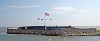 | NPS | South Carolina
32°45′07″N79°52′26″W / 32.752°N 79.874°W / 32.752; -79.874 (Fort Sumter) | April 28, 1948 | 7005949959076594176♠234.74 acres (0.9 km2) | Fort Sumter is a Third System masonry coastal fortification located in Charleston harbor, South Carolina. It is best known as the site where the shots initiating the American Civil War were fired, at the Battle of Fort Sumter. Nearby Fort Moultrie is a unit of this monument; it was made of palmetto logs and inspired the flag and nickname (Palmetto State) of South Carolina. [67] |
| Fort Union |  | NPS | New Mexico
35°55′30″N105°00′32″W / 35.925°N 105.009°W / 35.925; -105.009 (Fort Union) | April 5, 1956 | 7006291616473798144♠720.6 acres (2.9 km2) | A frontier military post and supply depot in the late 19th century, it sat at the intersection of the Mountain and Cimarron Branches of the old Santa Fe Trail. [68] |
| Fossil Butte | 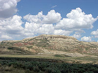 | NPS | Wyoming
41°52′N110°46′W / 41.86°N 110.77°W / 41.86; -110.77 (Fossil Butte) | October 23, 1972 | 7007331761289508352♠8,198 acres (33.2 km2) | Fossil Butte preserves the 50-million-year-old Green River lake beds, the best paleontological record of tertiary aquatic communities in North America. Fossils including fish, alligators, bats, turtles, dog-sized horses, insects, and many other species of plants and animals suggest that the region was a low, subtropical, freshwater basin when the sediments accumulated, over about a 2-million-year period. [69] |
| Freedom Riders | 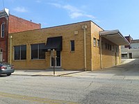 | NPS | Alabama
33°39′29″N85°49′52″W / 33.658°N 85.831°W / 33.658; -85.831 (Freedom Riders) | January 12, 2017 | 7004241192642775040♠5.96 acres (0.02 km2) | Preserves two sites related to the Freedom Riders in and near Anniston, Alabama during the civil rights movement—a former Greyhound bus station in the town and the site of a bus burning incident outside town. [28] [70] |
| George Washington Birthplace | 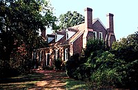 | NPS | Virginia
38°11′10″N76°55′50″W / 38.1861°N 76.9305°W / 38.1861; -76.9305 (George Washington's Birthplace) | January 23, 1930 | 7006264332567798323♠653.18 acres (2.6 km2) | Representative of 18th-century Virginia tobacco farms, this site is the birthplace and boyhood environment of George Washington. The entrance includes a Memorial Shaft obelisk of Vermont marble that is a one-tenth scale replica of the Washington Monument in Washington, D.C. Also within the monument are the historic birthplace home area, a kitchen house, and the Washington family burial ground. [71] |
| George Washington Carver | 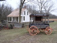 | NPS | Missouri
36°59′10″N94°21′14″W / 36.986°N 94.354°W / 36.986; -94.354 (George Washington Carver) | July 14, 1943 | 7005849839848704000♠210 acres (0.8 km2) | The site preserves Moses Carver's farm, which was the boyhood home of George Washington Carver, a scientist and educator who developed many uses for peanuts. It was the first national monument dedicated to an African-American and first to a non-president. [72] |
| Giant Sequoia |  | USFS | California
36°02′N118°30′W / 36.04°N 118.50°W / 36.04; -118.50 (Giant Sequoia National Monument) | April 15, 2000 | 7009142702679280522♠352,626 acres (1,427.0 km2) | The monument includes 38 of the 39 giant sequoia groves in the Sequoia National Forest, amounting to about half of the sequoia groves currently in existence. This includes one of the ten largest giant sequoias, the Boole Tree. Its two parts are around Kings Canyon and Sequoia National Parks. [73] |
| Gila Cliff Dwellings |  | NPS | New Mexico
33°14′N108°17′W / 33.24°N 108.28°W / 33.24; -108.28 (Gila Cliff Dwellings) | November 16, 1907 | 7006215750056447411♠533.13 acres (2.2 km2) | Located within the Gila Wilderness, the people of the Mogollon culture lived in these cliff dwellings 180 feet (55 m) above the canyon floor from the 1280s through the early 14th century. They lived in five caves with 46 rooms. Henry B. Ailman discovered them in 1878. [74] |
| Gold Butte | 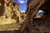 | BLM | Nevada
36°16′52″N114°12′04″W / 36.281°N 114.201°W / 36.281; -114.201 (Gold Butte National Monument) | December 28, 2016 | 7009120166140549818♠296,937 acres (1,201.7 km2) [75] | Mojave Desert landscape of dramatic red sandstone, canyons, forested mountains, ancient rock art, rock shelters, roasting pits, and a mining ghost town [24] |
| Governors Island | 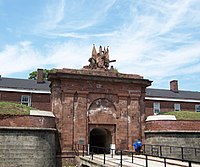 | NPS | New York
40°41′28″N74°00′58″W / 40.691°N 74.016°W / 40.691; -74.016 (Governors Island) | January 19, 2001 | 7004927134806371840♠22.91 acres (0.1 km2) | From 1783 to 1966, Governors Island in New York Harbor was an Army post, and from 1966 to 1996 it was a Coast Guard installation. Located on Governors Island are Castle Williams and Fort Jay, which served as outposts to protect New York City from sea attack. [76] |
| Grand Canyon-Parashant |  | BLM, NPS | Arizona
36°24′N113°42′W / 36.4°N 113.7°W / 36.4; -113.7 (Grand Canyon-Parashant) | January 11, 2000 | 7009413196181296307♠1,021,030 acres (4,132.0 km2) | Located on the northern rim of the Grand Canyon, this diverse landscape includes an array of scientific and historic resources. About 20,000 of the monument's 1,017,000 acres (4,120 km2) are also within Lake Mead National Recreation Area; Grand Canyon-Parashant is not considered an official NPS unit. There are no paved roads or visitor services. [77] [78] |
| Grand Portage | 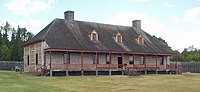 | NPS | Minnesota
47°58′N89°41′W / 47.96°N 89.68°W / 47.96; -89.68 (Grant Portage) | January 27, 1960 | 7006287314665421132♠709.97 acres (2.9 km2) | The Grand Portage itself is an 8.5-mile (13.7 km) footpath which bypasses a set of waterfalls on the Pigeon River near Lake Superior. The region was a vital trade route and center of fur trade activity as well as an Anishinaabeg Ojibwe heritage site. [79] |
| Grand Staircase-Escalante | 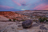 | BLM | Utah
37°24′N111°41′W / 37.4°N 111.68°W / 37.4; -111.68 (Grand Staircase-Escalante) | September 18, 1996 | 7009406248942875973♠1,003,863 acres (4,062.5 km2) [80] | Preserving 1,003,863 acres (4,062.49 km2), the monument consists of the Grand Staircase, the Kaiparowits Plateau, and the Canyons of the Escalante. It is notable for its paleontological finds and geology, and it was the first monument to be maintained by the Bureau of Land Management. [81] |
| Hagerman Fossil Beds | 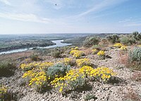 | NPS | Idaho
42°47′N114°57′W / 42.79°N 114.95°W / 42.79; -114.95 (Hagerman Fossil Beds) | November 18, 1988 | 7007176084793223257♠4,351.15 acres (17.6 km2) | This monument contains the largest concentration of Hagerman horse fossils in North America. It protects the world's richest known fossil deposits from the late Pliocene epoch, 3.5 million years ago. These plants and animals represent the last glimpse of time that existed before the Ice Age, and the earliest appearances of modern flora and fauna. [82] |
| Hanford Reach |  | FWS, DOE | Washington
46°29′N119°32′W / 46.48°N 119.53°W / 46.48; -119.53 (Hanford Reach) | June 8, 2000 | 7008786914994912152♠194,450.93 acres (786.9 km2) | Created from what used to be the security buffer surrounding the Hanford Nuclear Reservation, this area has been untouched by development or agriculture since 1943. The area is part of the Columbia River Plateau, formed by basalt lava flows and water erosion, and is named after the Hanford Reach, the last free flowing section of the Columbia River. [83] |
| Harriet Tubman Underground Railroad | 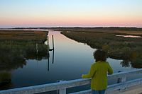 | FWS | Maryland | March 25, 2013 | 7006194249108275200♠480 acres (1.9 km2) | Harriet Tubman was a famed conductor on the Underground Railroad, leading dozens of slaves to freedom. This monument includes sites relating to Tubman's life, including the slave-built Stewart’s Canal and the home of Jacob Jackson. [49] The areas within the national monument that are managed by the NPS have been additionally designated as a National Historical Park (NHP), and are managed by the NPS with reference to the authorities of the NHP legislation. [84] |
| Hohokam Pima | 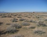 | NPS | Arizona
33°11′N111°55′W / 33.19°N 111.91°W / 33.19; -111.91 (Hohokam Pima) | October 21, 1972 | 7006683918735385600♠1,690 acres (6.8 km2) | Hohokam Pima is part of the Gila River Indian Community and not open to the public. The monument preserves the Snaketown-Settlement, archeological remains of the Hohokam culture, which lived in the area until 1500. [85] |
| Homestead | 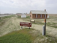 | NPS | Nebraska
40°17′06″N96°49′19″W / 40.285°N 96.822°W / 40.285; -96.822 (Homestead) | March 19, 1936 | 7005854250922204416♠211.09 acres (0.9 km2) | Daniel Freeman's homestead was recognized by the United States Congress as the first homestead in the nation obtained through the Homestead Act of 1862. The monument contains a visitor center, a tract of tallgrass prairie, and the Freeman School. [86] |
| Honouliuli |  | NPS | Hawaii
21°23′31″N158°03′36″W / 21.392°N 158.060°W / 21.392; -158.060 (Honouliuli) | February 19, 2015 | 7005625077443003904♠154.46 acres (0.6 km2) | Comprises the grounds of the Honouliuli Internment Camp on the island of Oahu. It was the largest and longest-operating facility used for Japanese American internment in the United States. [87] |
| Hovenweep | 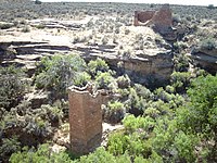 | NPS | Colorado, Utah
37°23′N109°05′W / 37.38°N 109.08°W / 37.38; -109.08 (Hovenweep) | March 2, 1923 | 7006317649901163443♠784.93 acres (3.2 km2) | Hovenweep contains six clusters of Native American ruins. Holly Canyon, Hackberry Canyon, Cutthroat Castle and Goodman Point are in Colorado and Square Tower and Cajon are in Utah. Ancient Pueblo Peoples lived in the Hovenweep area from 1150 to 1350. [88] |
| Ironwood Forest | 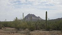 | BLM | Arizona
32°28′N111°34′W / 32.46°N 111.57°W / 32.46; -111.57 (Ironwood Forest) | June 9, 2000 | 7008522267055592832♠129,055 acres (522.3 km2) | Located within the Sonoran Desert, significant concentrations of ironwood ( Olneya tesota ) trees and two endangered animal and plant species are found within the monument. More than 200 Hohokam and Paleoindian archeological sites have been identified from between 600 and 1450 AD [89] |
| Jewel Cave | 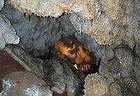 | NPS | South Dakota
43°44′N103°50′W / 43.73°N 103.83°W / 43.73; -103.83 (Jewel Cave) | February 7, 1908 | 7006515371212249062♠1,273.51 acres (5.2 km2) | Jewel Cave is the third longest cave in the world, with more than 195 miles (314 km) of mapped passageways beneath the Black Hills of South Dakota. [90] The entrance was discovered by miners in 1900 and was named for its calcite crystals. [91] |
| John Day Fossil Beds |  | NPS | Oregon
44°40′N120°03′W / 44.67°N 120.05°W / 44.67; -120.05 (John Day Fossil) | October 26, 1974 | 7007569069759489172♠14,062.02 acres (56.9 km2) | Located within the John Day River Basin, the Fossil Beds have a well-preserved, complete record of fossil plants and animals from more than 40 of the 65 million years of the Cenozoic Era. The monument is divided into three units: Painted Hills, named for its delicately colored stratifications; Sheep Rock; and Clarno. Blue Basin is a volcanic ash bowl transformed into claystone by eons of erosion, colored pastel blue by minerals. [92] |
| Kasha-Katuwe Tent Rocks | 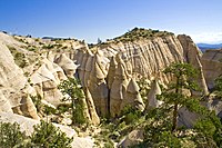 | BLM | New Mexico
35°40′N106°25′W / 35.67°N 106.42°W / 35.67; -106.42 (Kasha-Katuwe Tent Rocks) | January 17, 2001 | 7007188057417948928♠4,647 acres (18.8 km2) | Kasha-Katuwe is known for its geology of layers of volcanic rock and ash deposited by a volcanic explosion. Over time, weathering and erosion of these layers has created canyons and tent rocks. The tent rocks themselves are cones of soft pumice and tuff beneath harder caprocks. [93] |
| Katahdin Woods and Waters |  | NPS | Maine
45°58′N68°37′W / 45.97°N 68.62°W / 45.97; -68.62 (Katahdin Woods and Waters) | August 24, 2016 | 7008354360028422267♠87,564.27 acres (354.4 km2) | Katahdin Woods and Waters National Monument covers 87,563 acres (35,435 ha) of mountains and wilderness in the North Maine Woods area of north-central Maine, including a section of the East Branch Penobscot River. It borders the eastern side of Baxter State Park in Penobscot County. [94] |
| Lava Beds | 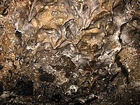 | NPS | California
41°43′N121°31′W / 41.71°N 121.51°W / 41.71; -121.51 (Lava Beds) | November 21, 1925 | 7008188957519754398♠46,692.42 acres (189.0 km2) | This is the site of the largest concentration of lava tube caves in North America. It also includes Petroglyph Point, one of the largest panels of Native American rock art. The monument lies on the northeast flank of the Medicine Lake Volcano, the largest volcano in the Cascade Range. [95] |
| Little Bighorn Battlefield | 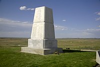 | NPS | Montana
45°34′N107°26′W / 45.57°N 107.43°W / 45.57; -107.43 (Little Bighorn Battlefield) | July 1, 1940 | 7006309722109431961♠765.34 acres (3.1 km2) | This monument includes the 1876 Battle of the Little Bighorn between George Armstrong Custer's 7th Cavalry and a combined Lakota-Northern Cheyenne and Arapaho force, Custer National Cemetery, and the Reno-Benteen Battlefield. [96] |
| Marianas Trench Marine |  | NOAA, FWS | Northern Mariana Islands, Guam
20°N145°E / 20°N 145°E / 20; 145 (Marianas Trench Marine) | January 6, 2009 | 7011247172553011014♠61,077,668 acres (247,172.6 km2) | Covering over 95,000 square miles (250,000 km2), this marine monument includes the waters and submerged lands of the three northernmost islands of the Mariana Archipelago, the submerged lands of 22 designated volcanic sites, and the Mariana Trench. [97] [98] |
| Military Working Dog Teams |  | DOD | Texas
29°23′24″N98°37′01″W / 29.390°N 98.617°W / 29.390; -98.617 (Military Working Dog Teams National Monument) | October 28, 2013 | | The monument, located at Lackland Air Force Base, the home of the U.S. Department of Defense Military Working Dog Program, honors the efforts and sacrifices of military working dogs in the service of the United States. [99] |
| Misty Fjords | 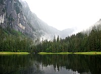 | USFS | Alaska
55°37′N130°37′W / 55.62°N 130.61°W / 55.62; -130.61 (Misty Fjords) | December 1, 1978 | 7009928378000664801♠2,294,072 acres (9,283.8 km2) | Located within the Tongass National Forest and called The Yosemite of the North for its similar geology, it also contains the Quartz Hill molybdenum deposit, possibly the largest such mineral deposit in the world. Throughout the monument is light-colored granite, about 50 to 70 million years old (Eocene Epoch to Cretaceous Period), that has been sculpted by glaciers that gouged deep U-shaped troughs. Mountain goats live in the higher elevations, while brown and black bear are also common. [100] |
| Mojave Trails | 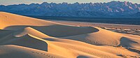 | BLM | California
34°36′N116°00′W / 34.6°N 116.0°W / 34.6; -116.0 (Mojave Trails) | February 12, 2016 | 7009647497027584000♠1,600,000 acres (6,475.0 km2) | Spanning 1.6 million acres, more than 350,000 acres of previously congressionally-designated Wilderness, the Mojave Trails National Monument comprises a stunning mosaic of rugged mountain ranges, ancient lava flows, and spectacular sand dunes. The monument will protect irreplaceable historic resources including ancient Native American trading routes, World War II-era training camps, and the longest remaining undeveloped stretch of Route 66. [101] [102] |
| Montezuma Castle |  | NPS | Arizona
34°37′N111°50′W / 34.61°N 111.84°W / 34.61; -111.84 (Montezuma Castle) | December 8, 1906 | 7006410966363407564♠1,015.52 acres (4.1 km2) | Montezuma Castle features cliff dwellings built by the Pre-Columbian Sinagua people between 1100 and 1400 AD. The site's name is a misnomer as is it has no connection to Montezuma. However, some modern day native tribes that do have connections to the site include the Yavapai, Hopi, and Zuni. The monument also includes Montezuma Well, which has been used for irrigation since the 8th century. [103] |
| Mount St. Helens |  | USFS | Washington
46°14′N122°11′W / 46.23°N 122.18°W / 46.23; -122.18 (Mount St. Helens) | August 27, 1982 | 7008458124381297792♠113,205 acres (458.1 km2) | Following the 1980 eruption of the now-8,363-foot-tall (2,549 m) Mount St. Helens, the environment was left to respond naturally to the disturbance. The volcanic crater is surrounded by a pumice plain with deposits from the landslide, wind-blown trees, and the Ape Cave lava tube. [104] |
| Muir Woods |  | NPS | California
37°53′N122°35′W / 37.89°N 122.58°W / 37.89; -122.58 (Muir Woods) | January 9, 1908 | 7006224013737261952♠553.55 acres (2.2 km2) | Part of the Golden Gate National Recreation Area, it protects one of the last old growth Coast redwood (Sequoia sempervirens) groves in the San Francisco Bay Area as well as one of the most easily accessed. [105] |
| Natural Bridges | 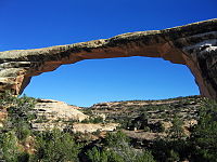 | NPS | Utah
37°35′N110°00′W / 37.58°N 110°W / 37.58; -110 (Natural Bridges) | April 16, 1908 | 7007309037786010933♠7,636.49 acres (30.9 km2) | Located at the junction of White Canyon and Armstrong Canyon, it is part of the Colorado River drainage. It features the second- and third-largest natural bridges in the western hemisphere, carved from the white Triassic sandstone of the Cedar Mesa Formation that gives White Canyon its name. [106] |
| Navajo | 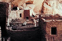 | NPS | Arizona
36°41′N110°32′W / 36.68°N 110.53°W / 36.68; -110.53 (Navajo) | March 20, 1909 | 7006145686831206400♠360 acres (1.5 km2) | This monument preserves three of the most intact cliff dwellings of the Ancestral Puebloan people. The monument is high on the Shonto plateau, overlooking the Tsegi Canyon system on the Navajo Nation in Northern Arizona. [107] |
| Newberry |  | USFS | Oregon
43°41′N121°15′W / 43.69°N 121.25°W / 43.69; -121.25 (Newberry Volcano) | November 5, 1990 | 7008231977950701235♠57,323 acres (232.0 km2) | Located within Deschutes National Forest, the monument protects the area around the Newberry Volcano and its geologic features. It contains over 50,000 acres (200 km2) of lakes, lava flows, and other geologic features. [108] |
| Northeast Canyons and Seamounts Marine |  | NOAA, FWS | Atlantic Ocean
40°24′N68°00′W / 40.4°N 68°W / 40.4; -68 (Northeast Canyons and Seamounts Marine) | September 15, 2016 | 7010127246115860807♠3,144,320 acres (12,724.6 km2) | The monument protects four underwater seamounts and three very deep canyons in the continental shelf 100 miles (160 km) off the coast of Massachusetts, home to several endangered species. [109] |
| Ocmulgee | 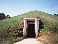 | NPS | Georgia
32°50′N83°37′W / 32.83°N 83.61°W / 32.83; -83.61 (Ocmulgee) | December 23, 1936 | 7006284777286444288♠703.7 acres (2.8 km2) | Ocmulgee preserves traces of more than 10 millennia of native Southeastern culture, including Mississippian mounds. From Ice Age hunters to the Creek Indians of historic times, there is evidence of at least 10,000 years of human habitation. Between 900 and 1150, an elite society supported by skillful farmers lived on this site near the Ocmulgee River. [110] |
| Oregon Caves | 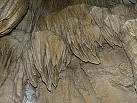 | NPS | Oregon
42°06′N123°25′W / 42.10°N 123.41°W / 42.10; -123.41 (Oregon Caves) | July 12, 1909 | 7007184295055533022♠4,554.03 acres (18.4 km2) | The monument is known for its marble caves, as well as for the Pleistocene jaguar and grizzly bear fossils found in the deeper caves. There are four primary buildings: The Oregon Caves Chateau, The Ranger Residence, The Chalet, and the old Dormitory. [111] |
| Organ Pipe Cactus | 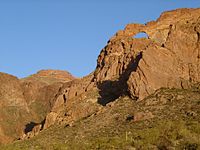 | NPS | Arizona
32°02′N112°52′W / 32.04°N 112.86°W / 32.04; -112.86 (Organ Pipe Cactus) | April 13, 1937 | 7009133825033690713♠330,688.86 acres (1,338.3 km2) | This monument is the only place in the United States where the organ pipe cactus grows wild. There are many other types of cacti and desert flora native to the Sonoran Desert. The Bates Well Ranch and Dos Lomitas Ranch are also within the monument. [112] |
| Organ Mountains-Desert Peaks |  | BLM | New Mexico
32°18′N106°33′W / 32.3°N 106.55°W / 32.3; -106.55 (Organ Mountains-Desert Peaks) | May 21, 2014 | 7009169778576860231♠419,532 acres (1,697.8 km2) | The protected area includes five mountain ranges that rise above the Chihuahua Desert: Robledo Mountains, Sierra de las Uvas, Doña Ana Mountains, Organ Mountains and Potrillo Mountains. There are approximately 870 vascular plant species, and the area is popular for hiking and climbing. |
| Pacific Remote Islands Marine | 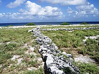 | NOAA, FWS | US Minor Outlying Islands south-southwest of Hawaii
16°45′N169°31′W / 16.75°N 169.52°W / 16.75; -169.52 (Pacific Remote Islands Marine) | January 6, 2009 | 7012127047759597949♠313,941,851 acres (1,270,477.6 km2) | The marine monument consists of Baker Island, Howland Island, Jarvis Island, Johnston Atoll, Kingman Reef, Palmyra Atoll, and Wake Island, which are in the Pacific southwest of Hawaii. [98] |
| Papahānaumokuākea Marine | 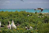 | NOAA, FWS | Hawaii, U.S. Minor Outlying Islands
25°42′N171°44′W / 25.7°N 171.73°W / 25.7; -171.73 (Papahānaumokuākea) | June 15, 2006 | 7012150886473935227♠372,848,597 acres (1,508,864.7 km2) | The marine monument consists of ocean waters and 10 islands and atolls of the Northwestern Hawaiian Islands including Midway Atoll (which is the site of the Midway Atoll National Wildlife Refuge). The monument was created in 2006 with 139,797 square miles (362,070 km2), and its boundaries were expanded on August 26, 2016, more than quadrupling in size to a total area of 582,578 square miles (1,508,870 km2). It is the largest protected area on Earth, and is almost the size of the Gulf of Mexico. [113] The Northwestern Hawaiian Islands archipelago "is the planet's largest seabird gathering site, with more than 14 million birds from 22 species, and is home to nearly all Laysan albatrosses and the remaining endangered Hawaiian monk seals." [114] It was declared a World Heritage Site in 2010. [115] |
| Petroglyph |  | NPS | New Mexico
35°10′N106°46′W / 35.16°N 106.76°W / 35.16; -106.76 (Petroglyph) | June 27, 1990 | 7007291750020060083♠7,209.3 acres (29.2 km2) | This monument protects a variety of cultural and natural resources, including five volcanic cones, hundreds of archeological sites and an estimated 25,000 images carved by native peoples and early Spanish settlers. It lies on West Mesa, a volcanic basalt escarpment. [116] |
| Pipe Spring | 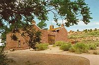 | NPS | Arizona
36°52′N112°44′W / 36.86°N 112.73°W / 36.86; -112.73 (Pipe Spring) | May 31, 1923 | 7005161874256896000♠40 acres (0.2 km2) | Rich with Native Americans, early explorer and Mormon pioneer history, this site shows Ancestral Puebloans and Kaibab Paiute Indian and pioneer life in the Old West, including the cabin where explorer John Wesley Powell's survey crew stayed in 1871. The water of Pipe Spring, discovered in 1858, made it possible for plants, animals, and people to live in this dry desert region. [117] |
| Pipestone |  | NPS | Minnesota
44°01′N96°20′W / 44.01°N 96.33°W / 44.01; -96.33 (Pipestone) | August 25, 1937 | 7006114032320270387♠281.78 acres (1.1 km2) | This monument preserves traditional catlinite quarries used to make ceremonial pipes, vitally important to traditional Plains Indian culture. The quarries are sacred to the Sioux and Lakota people and are historically neutral territory where enrolled citizens of all tribes can quarry the stone. [118] |
| Pompeys Pillar | 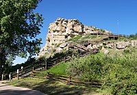 | BLM | Montana
45°59′24″N108°00′04″W / 45.99°N 108.001°W / 45.99; -108.001 (Pompeys Pillar) | January 17, 2001 | 7005206389677542400♠51 acres (0.2 km2) | Pompeys Pillar is a 150-foot (46 m) sandstone pillar from the late Cretaceous Hell Creek Formation next to the Yellowstone River. It has an abundance of Native American petroglyphs, as well as the signature of William Clark, who named the formation after Sacagawea's infant son. [119] |
| Poverty Point |  | NPS [120] | Louisiana
32°38′N91°25′W / 32.63°N 91.41°W / 32.63; -91.41 (Poverty Point) | October 31, 1988 | 7006368607917234304♠910.85 acres (3.7 km2) | Poverty Point is a prehistoric archeological site that dates from between 1650 and 700 BC and consisting of six earthen rings and seven mounds. The diameter of the outside ridge is 0.75 miles (1.21 km), and the largest mound rises 51 feet (16 m). [121] It was declared a World Heritage Site in 2014. [122] |
| Prehistoric Trackways |  | BLM | New Mexico
32°21′N106°54′W / 32.35°N 106.9°W / 32.35; -106.9 (Prehistoric Trackways) | March 30, 2009 | 7007213674019102720♠5,280 acres (21.4 km2) | Prehistoric Trackways contains fossilized footprints of numerous Paleozoic amphibians, reptiles, and insects, as well as fossilized plants and petrified wood dating back approximately 280 million years. (Public Law No. 111-11) |
| President Lincoln and Soldiers’ Home | 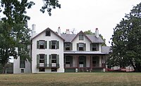 | AFRH | District of Columbia
38°56′30″N77°00′42″W / 38.9416°N 77.0117°W / 38.9416; -77.0117 (President Lincoln and Soldiers' Home) | July 7, 2000 | 7003930776977151999♠2.3 acres (0.01 km2) [123] | President Abraham Lincoln and his family resided seasonally on the grounds of the Armed Forces Retirement Home, which was founded in 1851 for homeless and disabled war veterans. The national monument and adjacent visitor center are preserved and operated by President Lincoln’s Cottage at the Soldiers’ Home, a 501(c)(3) public charity, on behalf of the Armed Forces Retirement Home. [124] |
| Pullman |  | NPS | Illinois
41°41′28″N87°36′36″W / 41.691°N 87.610°W / 41.691; -87.610 (Pullman National Monument) | February 19, 2015 | 7003161874256896000♠0.4 acres (0.002 km2) | Built for the Pullman Company, it was the first planned industrial community in the United States and the site of the 1894 Pullman Strike. [125] |
| Rainbow Bridge | 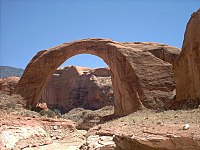 | NPS | Utah
37°05′N110°58′W / 37.08°N 110.96°W / 37.08; -110.96 (Rainbow Bridge) | May 30, 1910 | 7005647497027584000♠160 acres (0.6 km2) | Rainbow Bridge is one of the world's largest natural bridges. It stands 290 feet (88 m) tall and spans 275 feet (84 m) wide; the top of the bridge is 42 feet (13 m) thick and 33 feet (10 m) wide. It was made from sandstone formed during the Triassic and the Jurassic periods. [126] |
| Reconstruction Era |  | NPS | South Carolina
32°25′57″N80°40′14″W / 32.43250°N 80.67056°W / 32.43250; -80.67056 (Reconstruction Era) | January 12, 2017 | 7004628476802398720♠15.53 acres (0.1 km2) | Preserves four locations in and near Beaufort, South Carolina—a school, church, firehouse, and the Camp Saxton Site—to commemorate activities during the Reconstruction era that followed the American Civil War. [28] [127] |
| Río Grande del Norte | 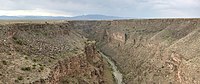 | BLM | New Mexico
36°40′00″N105°42′00″W / 36.66667°N 105.7°W / 36.66667; -105.7 (Rio Grande del Norte) | March 25, 2013 | 7008982212522280704♠242,710 acres (982.2 km2) | This site includes part of the Rio Grande Gorge and extinct volcanoes of the Taos Plateau volcanic field. There are a variety of archaeological and historical artifacts including petroglyphs and Hispanic settlement sites. It is home to an assortment of wildlife and recreation opportunities. [49] |
| Rose Atoll Marine |  | NOAA, FWS | American Samoa
14°33′S168°32′W / 14.55°S 168.54°W / -14.55; -168.54 (Rose Atoll Marine) | January 6, 2009 | 7010348395690489806♠8,609,045 acres (34,839.6 km2) | This marine monument consists of the two small islands of Rose Atoll, a lagoon, and a coral reef east of American Samoa. It is the southernmost point in the U.S.. [98] [128] |
| Russell Cave |  | NPS | Alabama
34°58′N85°48′W / 34.97°N 85.80°W / 34.97; -85.80 (Russell Cave) | May 11, 1961 | 7006125634657633408♠310.45 acres (1.3 km2) | Donated by the National Geographic Society, the cave's exceptionally large main entrance was used as a shelter by prehistoric Indians from the earliest known human settlement in the southeastern United States. The rock from which Russell Cave was formed over 300 million years ago at the bottom of an inland sea that covered the region. [129] |
| Salinas Pueblo Missions | 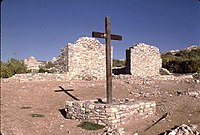 | NPS | New Mexico
34°16′N106°04′W / 34.26°N 106.06°W / 34.26; -106.06 (Salinas Pueblo Missions) | November 1, 1909 | 7006433588290808780♠1,071.42 acres (4.3 km2) | Formerly known as Gran Quivira National Monument, it is where Native American trade communities of Tiwa- and Tompiro-speaking Puebloans lived when Spanish Franciscan missionaries made contact in the 17th century. What remains are the ruins of four mission churches, at Quarai, Abó, and Gran Quivira, and the partially excavated pueblo of Las Humanas. [130] |
| San Gabriel Mountains |  | USFS | California
34°13′N118°04′W / 34.22°N 118.06°W / 34.22; -118.06 (San Gabriel Mountains) | October 10, 2014 | 7009139706386785377♠345,222 acres (1,397.1 km2) | Covering 346,177 acres of the San Gabriel mountains in northern Los Angeles County and western San Bernardino County, California, with peaks as high as 10,068 ft (3,069 m), the San Gabriel Mountains provide one of the few open-space recreation opportunities close to residents of Los Angeles County and is also an important watershed for the Los Angeles area. [131] |
| San Juan Islands | 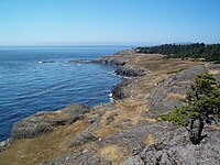 | BLM | Washington
48°32′N123°02′W / 48.53°N 123.03°W / 48.53; -123.03 (San Juan Islands) | March 25, 2013 | 7006392545072972800♠970 acres (3.9 km2) | The San Juan Islands in Puget Sound have several historic lighthouses as well as rugged landscapes. They are the habitat for orcas, eagles, and seals and provide opportunities for kayaking, birdwatching, and other activities. [49] |
| Sand to Snow | 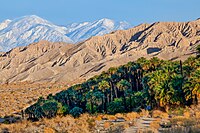 | BLM, USFS | California
34°05′N116°41′W / 34.08°N 116.68°W / 34.08; -116.68 (Sand to Snow) | February 12, 2016 | 7008623215889049600♠154,000 acres (623.2 km2) | The 154,000-acre monument extends from Bureau of Land Management lands on the Sonoran desert floor up to over 10,000 feet in the San Gorgonio Wilderness on the San Bernardino National Forest. [46] [132] |
| Santa Rosa and San Jacinto Mountains | 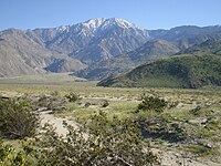 | BLM, USFS | California
33°48′N116°42′W / 33.80°N 116.70°W / 33.80; -116.70 (Santa Rosa and San Jacinto Mountains) | October 24, 2000 | 7009113315621997980♠280,009 acres (1,133.2 km2) | This monument preserves large portions of the Santa Rosa and San Jacinto ranges, the northernmost of the Peninsular Ranges. Parts are within San Bernardino National Forest and the California Desert Conservation Area. [133] [134] |
| Scotts Bluff |  | NPS | Nebraska
41°50′N103°42′W / 41.83°N 103.70°W / 41.83; -103.70 (Scotts Bluff) | December 12, 1919 | 7007121597108980779♠3,004.73 acres (12.2 km2) | Scotts Bluff is an important 19th century geologic formation and landmark on the Oregon Trail and Mormon Trail. It contains multiple bluffs on the south side of the North Platte River, but it is named after a prominent bluff called Scotts Bluff which rises more than 830 feet (250 m) above the plains at its highest point. The monument is composed of five rock formations named Crown Rock, Dome Rock, Eagle Rock, Saddle Rock, and Sentinel Rock. [135] |
| Sonoran Desert |  | BLM | Arizona
33°00′N112°28′W / 33.00°N 112.46°W / 33.00; -112.46 (Sonoran Desert) | January 17, 2001 | 7009196839096385536♠486,400 acres (1,968.4 km2) | This monument protects a small portion of the Sonoran Desert. It is home to several federally listed endangered species and also has three wilderness areas, many significant archeological and historic sites, and remnants of several important historic trails. [136] |
| Statue of Liberty | 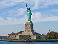 | NPS | New York, New Jersey
40°41′N74°02′W / 40.69°N 74.04°W / 40.69; -74.04 (Statue of Liberty) | October 15, 1924 | 7005236255477939712♠58.38 acres (0.2 km2) | This iconic statue, built in 1886 on Liberty Island and 151 feet (46 m) tall, commemorates the centennial of the signing of the United States Declaration of Independence and is a gesture of friendship from France to the U.S. Liberty Enlightening the World is a symbol of welcoming immigrants to the U.S. and is listed as a World Heritage Site. Ellis Island, where 12 million immigrants entering the U.S. passed through, is included in the monument. [137] |
| Stonewall | 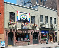 | NPS | New York
40°44′01″N74°00′08″W / 40.73364°N 74.00212°W / 40.73364; -74.00212 (Stonewall) | June 24, 2016 | 7004311607944524800♠7.7 acres (0.0 km2) | The Stonewall Inn, often shortened to Stonewall, is a gay bar and recreational tavern in New York City and the site of the Stonewall riots of 1969, which is widely considered to be the single most important event leading to the gay liberation movement and the modern fight for LGBT rights in the United States. Also included in the 7.7 acre site is Christopher Street Park, across the street. [138] |
| Sunset Crater Volcano | 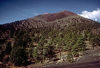 | NPS | Arizona
35°22′N111°30′W / 35.36°N 111.50°W / 35.36; -111.50 (Sunset Crater Volcano) | May 30, 1930 | 7007123024435240960♠3,040 acres (12.3 km2) | Sunset Crater is the youngest in a string of volcanoes in the San Francisco volcanic field that is related to the nearby San Francisco Peaks. Final volcanic activity in the 13th century painted the upper portion of the cone with bright red and orange rocks, giving the volcano its name. [139] |
| Timpanogos Cave |  | NPS | Utah
40°26′N111°43′W / 40.44°N 111.71°W / 40.44; -111.71 (Timpanogos Cave) | October 14, 1922 | 7006101171410560000♠250 acres (1.0 km2) | The Timpanogos cave system is in the Wasatch Range in the American Fork Canyon. Three main chambers are accessible: Hansen Cave, Middle Cave, and Timpanogos Cave. Many colorful cave features or speleothems can be seen, including helictites, cave bacon, cave columns, flowstone, cave popcorn, and cave drapery. [140] |
| Tonto |  | NPS | Arizona
33°39′N111°05′W / 33.65°N 111.09°W / 33.65; -111.09 (Tonto) | October 21, 1907 | 7006453247919308800♠1,120 acres (4.5 km2) | Lying on the northeastern edge of the Sonoran Desert along the Salt River, Tonto preserves two cliff dwellings that were occupied by the Salado culture during the 13th to 15th centuries. The monument is surrounded by Tonto National Forest. [141] |
| Tule Springs Fossil Beds | 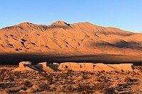 | NPS | Nevada
36°19′N115°16′W / 36.32°N 115.27°W / 36.32; -115.27 (Tule Springs Fossil Beds) | December 19, 2014 | 7007916612979673600♠22,650 acres (91.7 km2) | A major archaeological site north of Las Vegas where thousands of prehistoric fossils, including mammoth, lion, and camel in an area that was once a wetland. [142] |
| Tuzigoot |  | NPS | Arizona
34°47′N112°02′W / 34.79°N 112.04°W / 34.79; -112.04 (Tuzigoot) | July 25, 1939 | 7006328560226078233♠811.89 acres (3.3 km2) | Tuzigoot preserves a two- to three-story pueblo ruin on the summit of a limestone and sandstone ridge in the Verde Valley. It was built by the Sinagua people between 1125 and 1400. [143] |
| Upper Missouri River Breaks |  | BLM | Montana
47°47′N109°01′W / 47.78°N 109.02°W / 47.78; -109.02 (Upper Missouri River Breaks) | January 17, 2001 | 7009152706508356695♠377,346 acres (1,527.1 km2) | A series of badland areas characterized by rock outcroppings, steep bluffs and grassy plains along the 149-mile (240 km) Upper Missouri National Wild and Scenic River in central Montana, The Breaks is home to at least 60 mammal species and hundreds of bird species. Charles Marion Russell often painted here, and Lewis and Clark traveled on this pathway. [144] |
| Vermilion Cliffs |  | BLM | Arizona
36°49′N111°44′W / 36.81°N 111.74°W / 36.81; -111.74 (Vermilion Cliffs) | November 9, 2000 | 7009113136346258467♠279,566 acres (1,131.4 km2) | Steep eroded escarpments consisting primarily of sandstone, siltstone, limestone and shale rise as much as 3,000 feet (910 m) above their base. These sedimentary rocks have been deeply eroded for millions of years, exposing hundreds of layers of richly colored rock strata. The monument protects Paria Plateau, Vermilion Cliffs, Coyote Buttes and Paria Canyon. [145] |
| Virgin Islands Coral Reef | 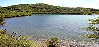 | NPS | US Virgin Islands
18°19′N64°43′W / 18.31°N 64.72°W / 18.31; -64.72 (Virgin Islands Coral Reef) | January 17, 2001 | 7007514277346958087♠12,708.07 acres (51.4 km2) | These coral reefs, sandy bottoms, seagrass beds, and mangrove forests are in a 3-mile (4.8 km) belt that surrounds St John, VI. [146] |
| Waco Mammoth | 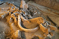 | NPS | Texas
31°36′22″N97°10′26″W / 31.606°N 97.174°W / 31.606; -97.174 (Waco Mammoth) | July 10, 2015 | 7005433944414173952♠107.23 acres (0.4 km2) | The Waco Mammoth National Monument is a paleontological site and museum in Waco, Texas, United States where fossils of twenty-four Columbian mammoths (Mammuthus columbi) and other mammals from the Pleistocene Epoch have been uncovered. The site is the largest known concentration of a single herd of mammoths dying from the same event, which is believed to have been a flash flood. A local partnership developed around the site after the initial bone was discovered. [22] |
| Walnut Canyon | 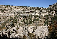 | NPS | Arizona
35°10′N111°31′W / 35.17°N 111.51°W / 35.17; -111.51 (Walnut Canyon) | November 30, 1915 | 7007142824084973194♠3,529.26 acres (14.3 km2) | Walnut Canyon protects 25 cliff dwelling rooms constructed by the Sinagua people. It lies on the Colorado Plateau and cuts through the Permian Kaibab Limestone, which exposes the Toroweap Formation and Coconino Sandstone. [147] |
| White Sands | 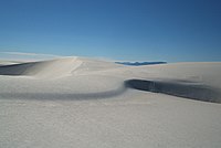 | NPS | New Mexico
32°47′N106°10′W / 32.78°N 106.17°W / 32.78; -106.17 (White Sands) | January 18, 1933 | 7008581547634239179♠143,703.55 acres (581.5 km2) | Located in the mountain-ringed Tularosa Basin valley area, White Sands consists of the southern part of a 275 square miles (710 km2) field of white sand dunes composed of gypsum crystals. It is completely within the White Sands Missile Range and is subject to closure when tests are conducted. [148] |
| World War II Valor in the Pacific | 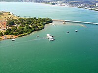 | NPS, FWS | Hawaii, Alaska, California
21°22′01″N157°56′20″W / 21.367°N 157.939°W / 21.367; -157.939 (World War II Valor in the Pacific (Hawaii))
52°53′N173°09′E / 52.88°N 173.15°E / 52.88; 173.15 (World War II Valor in the Pacific (Alaska))
41°53′N121°22′W / 41.89°N 121.37°W / 41.89; -121.37 (World War II Valor in the Pacific (California)) | December 5, 2008 | 7007255113828868096♠6,304 acres (25.5 km2) | Valor in the Pacific encompasses nine sites in three states associated with World War II: The Attack on Pearl Harbor, including the USS Arizona, Utah , and Oklahoma memorials in Hawaii; the Aleutian Islands Campaign on Attu Island, Kiska Island, and Atka Island in Alaska; and the Japanese American internment at Tule Lake War Relocation Center in California. [149] [150] |
| Wupatki | 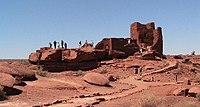 | NPS | Arizona
35°31′N111°22′W / 35.52°N 111.37°W / 35.52; -111.37 (Wupatki) | December 9, 1924 | 7008143348274285587♠35,422.13 acres (143.3 km2) | Many settlement sites built by the Sinagua, Cohonina, and Ancestral Puebloans are scattered throughout the monument. About 2000 Ancient Pueblo People moved here to farm after an 11th century eruption of Sunset Crater. [151] |
| Yucca House |  | NPS | Colorado
37°15′N108°41′W / 37.25°N 108.69°W / 37.25; -108.69 (Yucca House) | December 19, 1919 | 7005137067027026687♠33.87 acres (0.1 km2) | Designated a research national monument, it is a large, unexcavated Ancestral Puebloan archeological site. The site is one of many Ancestral Puebloan village sites located in the Montezuma Valley occupied between AD 900 and 1300. [152] |