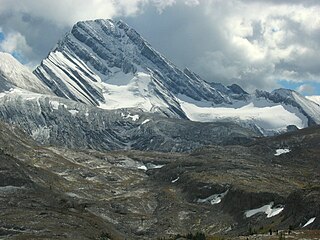
Mount Saskatchewan is a mountain located in the North Saskatchewan River valley of Banff National Park, in the Canadian Rockies of Alberta, Canada.

Heavens Peak is located in the Livingston Range, Glacier National Park in the U.S. state of Montana. Heavens Peak is a little more than 1 mile (1.6 km) north of McPartland Mountain. The mountain's descriptive name first appeared on a map prepared by Lt. George P. Ahern, from 1888 to 1890 reconnaissance maps prepared by him. This geographical feature's name was officially adopted in 1929 by the United States Board on Geographic Names.

The Fortress is a mountain located SE of Gusty Peak in the Kananaskis River Valley of Kananaskis Park of the Canadian Rockies. When viewed from Highway 40, the north face presents a fortress like appearance. The Fortress should not be confused with nearby Fortress Mountain.

Mount Marathon, or officially Marathon Mountain, is a 4,826-foot (1,471 m) mountain summit directly west of Seward in the Kenai Mountains in the U.S. state of Alaska. The peak is situated in Chugach National Forest, rising above Resurrection Bay, 2.35 mi (4 km) south of Mount Benson, and 2 mi (3 km) north of Bear Mountain. The namesake of the mountain is the Mount Marathon Race held every Fourth of July.

Serratus Mountain is a jagged, ridge-like mountain between Mount Tantalus (North) and Lake Lovely Water (South). Like most other peaks in the Tantalus Range, it is composed of loose rock. Most routes here are scrambles. The mountain is a standard single-day destination from the Jim Haberl hut.

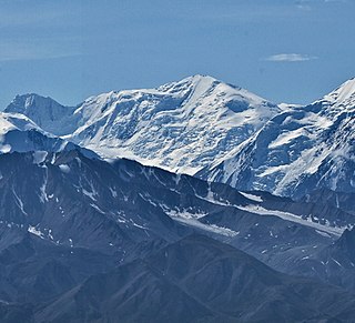
Mount Silverthrone is 13,220 ft (4,030 m) glaciated mountain summit located in Denali National Park and Preserve, in the Alaska Range, in the U.S. state of Alaska. It is situated 10.8 mi (17 km) east of Denali. The first ascent of this peak was made April 12, 1945, by Norman Bright and Frank P. Foster. It was so named by the U.S. Army Forces Cold Weather test party because of its stately appearance at the head of Brooks Glacier.

The Spearhead is a 2,457 m (8,061 ft) peak in the Garibaldi Ranges of British Columbia, Canada, and is one of the main summits of the Blackcomb Mountain portion of the Whistler Blackcomb ski resort, located at the apex of the Blackcomb and Spearhead Glaciers, which is named for it. It also is the namesake of the Spearhead Range, which is the short range flanking the north side of Fitzsimmons Creek and ending on its northwest end at Blackcomb Mountain. The mountain's name was officially adopted on August 27, 1965, by the Geographical Names Board of Canada.

Yellowhead Mountain is located west of Yellowhead Pass in Mount Robson Provincial Park and straddles the Continental Divide marking the Alberta-British Columbia border. It was named for Pierre Bostonais aka Tête Jaune. The mountain has four officially named summits: Bingley Peak, Leather Peak, Lucerne Peak, and Tête Roche.
Dungeon Peak is a 3,129-metre (10,266 ft) mountain summit located on the shared border of Jasper National Park in Alberta, and Mount Robson Provincial Park in British Columbia, Canada. Dungeon Peak is part of The Ramparts in the Tonquin Valley. The descriptive name was applied in 1916 by Morrison P. Bridgland (1878-1948), a Dominion Land Surveyor who named many peaks in Jasper Park and the Canadian Rockies. The mountain's name was made official in 1935 by the Geographical Names Board of Canada.

Cave Mountain is located on the border of Alberta and British Columbia on the Continental Divide. It was named in 1916 by the International Boundary Survey. A cave within the mountain accounts for the name.

Mount Sir Douglas is located on the border of Alberta and British Columbia on the Continental Divide, at the northern end of Height of the Rockies Provincial Park and east of Invermere. It is Alberta's 18th highest peak, and 28th prominence mountain as well as British Columbia's 28th highest peak. It was named in 1916 by interprovincial boundary surveyors after Field Marshal Sir Douglas Haig.

Forum Peak is a summit located on the border of Alberta and British Columbia on the Continental Divide. It is the southernmost mountain in the Canadian Rockies, situated only 500 metres north of the Canada–United States border. It was named after Forum Lake below the mountain. It is visible from the end of Highway 5 at Cameron Lake, which is within Waterton Lakes National Park, and the mountain is on the park's southwest border.

Tricouni Peak is a mountain located south of Cypress Peak on the Squamish-Cheakamus divide within the Pacific Ranges of the Coast Mountains in southwestern British Columbia, Canada. It was named in 1931 by Tom Fyles et al., the first ascent party. According to Tom Fyles himself, "Tricouni Mountain was the name suggested for the peak, as from a distance it had the appearance of three cones". A misinterpreted "resemblance to a 3-pointed tricouni boot nail" was mentioned only much later, and not by Fyles. The name "Tricouni Peak" was adopted on 22 June 1967.

Hoyt Peak is a 10,506 feet (3,202 m) summit located on the shared border of Yellowstone National Park and North Absaroka Wilderness, in Park County, Wyoming.

Pilot Peak, elevation 11,699 feet (3,566 m), is a prominent mountain peak in the Absaroka Range in Park County, Wyoming. The peak is visible from US Route 212, the Beartooth Highway just east of the Northeast Entrance Station to Yellowstone National Park. Index Peak rises just north of Pilot Peak.

Cougar Mountain is a summit in the Elbow River Valley, Kananaskis Country, Alberta, Canada.

The Whistlers is a 2,470-metre (8,100-foot) mountain summit located in Jasper National Park, in the Trident Range of the Canadian Rockies of Alberta, Canada. The municipality of Jasper is situated 7 kilometres to the northeast. The nearest higher neighbor is Indian Peak, 2.5 km (1.6 mi) to the southwest. The highest and longest aerial tramway in Canada ascends to a lookout at 2,277 meters elevation, still 193 meters below the summit, but a hiking trail continues to the summit. Some of the mountains that can be seen from the top include Mount Robson, Mount Bridgland, Monarch Mountain, Cairngorm, Pyramid Mountain, Hawk Mountain, Mount Colin, Grisette Mountain, Mount Tekarra, Mount Hardisty, Mount Kerkeslin, Marmot Mountain, Terminal Mountain, and Manx Peak.

Chisel Peak is the descriptive name for a remote 3,046-metre (9,993-foot) chisel-shaped mountain summit located above the south shore of Fortress Lake in Hamber Provincial Park in the Canadian Rockies of British Columbia, Canada. Its nearest higher peak is Ghost Mountain, 5.9 km (3.7 mi) to the southwest. The Chaba Icefield lies 8 km (5 mi) to the south, and the Continental Divide is 6 km (4 mi) to the east.

Mount Archibald is a prominent 2,588-metre (8,491-foot) mountain summit located in the Kluane Ranges of the Saint Elias Mountains in Yukon, Canada. The mountain is situated 21 km (13 mi) west of Haines Junction, 5.9 km (4 mi) south of Mount Decoeli, and 27 km (17 mi) east-southeast of Mount Cairnes, which is the nearest higher peak. Set on the boundary line of Kluane National Park, Archibald can be seen from the Alaska Highway, weather permitting. The mountain was named after Edgar Archibald (1885-1968), a Canadian agricultural scientist. The mountain's name was officially adopted August 12, 1980, by the Geographical Names Board of Canada. On a clear day, the summit offers views deep into Kluane National Park of giants such as Mt. Logan, Mt. Vancouver, and Mt. Kennedy.

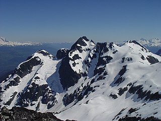
Black Mountain is a prominent, 5,891-foot-high (1,796-meter) mountain summit located in the Alsek Ranges of the Saint Elias Mountains in southeast Alaska. The mountain is situated in Glacier Bay National Park and Preserve, 75 mi (121 km) northwest of Juneau, between the Riggs and McBride glaciers. The months May through June offer the most favorable weather for viewing or climbing Black Mountain. Weather permitting, Black Mountain can be seen from Muir Inlet of Glacier Bay, which is a popular destination for cruise ships.


