Bethnal Green is an area in the East End of London, England, 3 miles (4.8 km) north-east of Charing Cross. The area emerged from the small settlement which developed around the Green, much of which survives today as Bethnal Green Gardens, beside Cambridge Heath Road. By the 16th century the term applied to a wider rural area, the Hamlet of Bethnal Green, which subsequently became a Parish, then a Metropolitan Borough before merging with neighbouring areas to become the north-western part of the new London Borough of Tower Hamlets.

The London Borough of Hackney is a London borough in Inner London, England. The historical and administrative heart of Hackney is Mare Street, which lies 5 miles (8 km) north-east of Charing Cross. The borough is named after Hackney, its principal district. Southern and eastern parts of the borough are popularly regarded as being part of east London that spans some of the traditional East End of London with the northwest belonging to north London. Its population is 281,120 inhabitants.
Dalston is an area of East London, in the London Borough of Hackney. It is four miles northeast of Charing Cross. Dalston began as a hamlet on either side of Dalston Lane, and as the area urbanised the term also came to apply to surrounding areas including Kingsland and Shacklewell, all three of which being part of the Ancient Parish of Hackney.

Homerton is an area in London, England, in the London Borough of Hackney. It is bordered to the west by Hackney Central, to the north by Lower Clapton, in the east by Hackney Wick, Leyton and by South Hackney to the south. In 2019, it had a population of 14,658 people. In terms of ethnicity it was 43.9% White, 33.0% Black, 10.9% Asian and 7.8% Mixed. It covered an area of 0.830 sq kilometres. Homerton ward on Hackney Borough Council is currently represented by three Labour councillors. There are fifty listed buildings located within the boundaries of the ward.

Stamford Hill is an area in Inner London, England, about 5.5 miles north-east of Charing Cross. The neighbourhood is a sub-district of Hackney, the major component of the London Borough of Hackney, and is known for its Hasidic community, the largest concentration of Hasidic Jews in Europe.

The Metropolitan Borough of Hackney was a metropolitan borough of the County of London from 1900 to 1965. Its area became part of the London Borough of Hackney.

Lea Bridge is a district in the London Borough of Hackney and the London Borough of Waltham Forest in London, England. It lies 7 miles (11.3 km) northeast of Charing Cross.

De Beauvoir Town is a neighbourhood in east London and is in the London Borough of Hackney, 2 miles (3.2 km) north of the City of London. The area was a part of Hackney, the Ancient Parish and subsequent Metropolitan Borough that was incorporated into the larger modern borough. It is sometimes described as a part of Dalston, which is in turn also a part of the former parish and borough of Hackney.
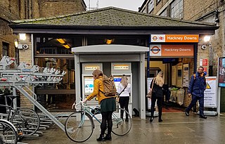
Hackney Downs is a London Overground and National Rail station in Hackney Central and serves the old common land of Hackney Downs in Lower Clapton in the London Borough of Hackney, it is on the Lea Valley lines and West Anglia Main Line. It is 2 miles 78 chains (4.8 km) down the line from London Liverpool Street and has a direct passenger link to Hackney Central station, providing interchange with the North London line of the Overground network.

The Lea Valley lines are two commuter lines and two branches in north-east London, so named because they run along the Lower Lea Valley of the River Lea. They were part of the Great Eastern Railway, now part of the Anglia Route of Network Rail.

Hackney North and Stoke Newington is a constituency represented in the House of Commons of the United Kingdom since 1987 by Diane Abbott, who served as Shadow Home Secretary from 6 October 2016 to 5 April 2020. Abbott was one of the first three Black British MPs elected, and the first female Black British MP in the UK. Abbott was elected as a Labour MP, but has been an Independent since having the Labour Party whip suspended on 23 April 2023.

Hackney Wick is a neighbourhood in East London, England. The area forms the south-eastern part of the district of Hackney, and also of the wider London Borough of Hackney. Adjacent areas of the London Borough of Tower Hamlets are sometimes also described as being part of Hackney Wick. The area lies 4.2 miles (6.8 km) northeast of Charing Cross.

Hackney Central is a sub-district of Hackney in the London Borough of Hackney in London, England and is four miles (6.4 km) northeast of Charing Cross.

The London Borough of Hackney, one of the inner London boroughs, has 62 parks, gardens and open spaces within its boundaries, totalling 330 ha. These provide the "green lungs" for leisure activities. Hackney Marshes contain the largest concentration of football pitches in Europe.
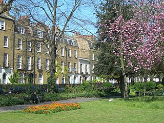
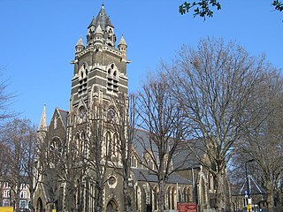
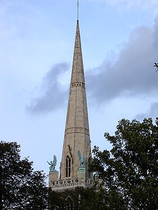
Clapton Square is the second largest garden square in the London Borough of Hackney, located in Lower Clapton, Clapton. It is lined by buildings on three sides. Its Conservation Area designated in 1969 – extended in 1991 and 2000 – takes in a larger green space separated by a stretch of open road: St John's Gardens. Those gardens have the tallest and largest building visible from all parts of the square's garden, the Church of St John-at-Hackney, rebuilt in 1792-97 which contains older monuments. Two sides of the square are lined with tall, partly stone-dressed, classical, Georgian terraced houses.

Mossbourne Community Academy is a coeducational secondary school and sixth form with academy status, located near Hackney Downs off the A104 road, in the Lower Clapton area of the London Borough of Hackney in England.

Hackney is a district in East London, England, forming around two-thirds of the area of the modern London Borough of Hackney, to which it gives its name. It is 4 miles (6.4 km) northeast of Charing Cross and includes part of the Queen Elizabeth Olympic Park. Historically it was within the county of Middlesex.
Clapton is a district of East London, England, in the London Borough of Hackney.