 Hurricane Michael at peak intensity on October 18 | |
| Meteorological history | |
|---|---|
| Formed | October 15,2000 |
| Extratropical | October 19,2000 |
| Dissipated | October 20,2000 |
| Category 2 hurricane | |
| 1-minute sustained (SSHWS/NWS) | |
| Highest winds | 100 mph (155 km/h) |
| Lowest pressure | 965 mbar (hPa);28.50 inHg |
| Overall effects | |
| Fatalities | None reported |
| Damage | Unknown |
| Areas affected | East Coast of the United States,Bermuda,Atlantic Canada |
| IBTrACS | |
Part of the 2000 Atlantic hurricane season | |
Hurricane Michael of the 2000 Atlantic hurricane season caused widespread,but relatively minor damage in Atlantic Canada. The seventeenth tropical cyclone,thirteenth named storm,and eighth hurricane of the season,Michael developed from a non-tropical system to the southwest of Bermuda on October 15. The system was initially subtropical,but rapidly acquired tropical characteristics by October 17. Michael quickly strengthened into a hurricane later that day. By October 20,Michael peaked as a Category 2 hurricane on the Saffir-Simpson hurricane wind scale at a relatively high latitude of 44°N. The storm weakened slightly to a Category 1 hurricane and became extratropical shortly before making landfall in Newfoundland on October 20.
Contents
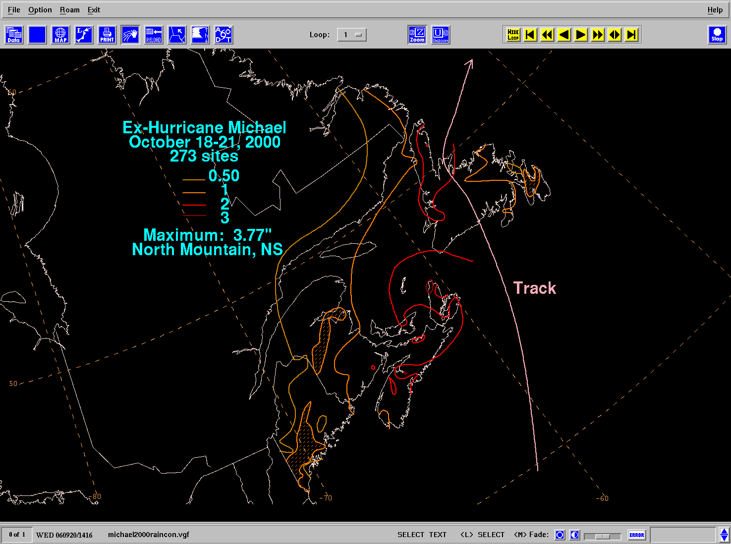
As the intensity of Michael was equivalent to a Category 2 hurricane during landfall,high winds were reported throughout Atlantic Canada,especially in Newfoundland. Winds from the storm peaked at 172 km/h (107 mph) in St. Lawrence,Newfoundland;other locations across the island reported winds of 128 to 150 km/h (80 to 93 mph). High winds caused minor structure damage across Newfoundland,confined to vinyl siding peeled off,shattered windows,and unroofed houses. In addition,sporadic power outages were also reported from Corner Brook to St. John's. Michael also dropped rainfall across Atlantic Canada and in Maine. The rainfall was generally light,with much of the region reporting between 25 and 51 mm (0.98 and 2.01 in ) of precipitation. Michael also produced high tides,accompanied by waves reported as high as 16.9 m (55 ft) by a buoy well offshore of Newfoundland.


