Jefferson County was formed out of Thurston County on December 22, 1852, by the legislature of Oregon Territory,[4] and included the northern 4,854-square-mile (12,571.8km2) portion of the Olympic Peninsula. On April 26, 1854, the legislature of Washington Territory created Clallam County from the northwestern 2,670-square-mile (6,915.3km2) portion of this original area.
According to the United States Census Bureau, the county has a total area of 2,183 square miles (5,650km2), of which 1,804 square miles (4,670km2) is land and 379 square miles (980km2) (17%) is water.[5]
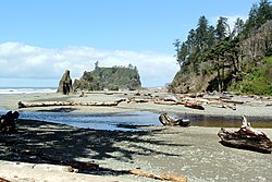
The county is split in three parts by its landforms:
Because of the mountainous barrier, there is no road lying entirely within Jefferson County that connects the eastern and western parts. The most direct land route between the two ends of the county involves a drive of approximately 100 miles (160km) along U.S. Route 101 through neighbouring Clallam County. The mountains also block the damp Chinook winds, which make the climate much wetter in the west than the so-called eastern "banana belt" in the rain shadow.
As of the 2020 census, the county had a population of 32,977. Of the residents, 12.2% were under the age of 18 and 39.0% were 65 years of age or older; the median age was 59.6 years. For every 100 females there were 96.7 males, and for every 100 females age 18 and over there were 95.1 males. 46.7% of residents lived in urban areas and 53.3% lived in rural areas.[12][13][14]
There were 15,707 households in the county, of which 15.1% had children under the age of 18 living with them and 25.9% had a female householder with no spouse or partner present. About 32.9% of all households were made up of individuals and 19.7% had someone living alone who was 65 years of age or older.[13]
There were 19,087 housing units, of which 17.7% were vacant. Among occupied housing units, 76.5% were owner-occupied and 23.5% were renter-occupied. The homeowner vacancy rate was 1.1% and the rental vacancy rate was 4.9%.[13]
2010 census
As of the 2010 census, there were 29,872 people, 14,049 households, and 8,394 families living in the county.[15] The population density was 16.6 inhabitants per square mile (6.4/km2). There were 17,767 housing units at an average density of 9.9 per square mile (3.8/km2).[16] The racial makeup of the county was 91.0% white, 2.3% American Indian, 1.6% Asian, 0.8% black or African American, 0.2% Pacific islander, 0.7% from other races, and 3.4% from two or more races. Those of Hispanic or Latino origin made up 2.8% of the population.[15] In terms of ancestry, 20.8% were English, 20.3% were German, 13.9% were Irish, 8.3% were Norwegian, 5.9% were Scottish, and 4.2% were American.[17]
Of the 14,049 households, 18.2% had children under the age of 18 living with them, 49.1% were married couples living together, 7.3% had a female householder with no husband present, 40.3% were non-families, and 32.2% of all households were made up of individuals. The average household size was 2.08 and the average family size was 2.57. The median age was 53.9 years.[15]
The median income for a household in the county was $46,048 and the median income for a family was $59,964. Males had a median income of $45,616 versus $29,508 for females. The per capita income for the county was $28,528. About 8.9% of families and 13.5% of the population were below the poverty line, including 20.8% of those under age 18 and 7.4% of those age 65 or over.[18]
2000 census
As of the 2000 census, there were 25,953 people, 11,645 households, and 7,580 families living in the county. The population density was 14 peopleper square mile (5.4 people/km2). There were 14,144 housing units at an average density of 8 per square mile (3.1/km2). The racial makeup of the county was 92.17% White, 0.42% Black or African American, 2.31% Native American, 1.19% Asian, 0.13% Pacific Islander, 0.76% from other races, and 3.02% from two or more races. 2.06% of the population were Hispanic or Latino of any race. 17.4% were of German, 14.8% English, 9.9% Irish and 7.5% Norwegian ancestry. 97.1% spoke English and 1.0% Spanish as their first language.
There were 11,645 households, out of which 23.20% had children under the age of 18 living with them, 53.60% were married couples living together, 8.20% had a female householder with no husband present, and 34.90% were non-families. 28.50% of all households were made up of individuals, and 11.70% had someone living alone who was 65 years of age or older. The average household size was 2.21 and the average family size was 2.67.
In the county, the population was spread out, with 19.80% under the age of 18, 5.00% from 18 to 24, 21.60% from 25 to 44, 32.50% from 45 to 64, and 21.10% who were 65 years of age or older. The median age was 47 years. For every 100 females there were 95.80 males. For every 100 females age 18 and over, there were 94.40 males.
The median income for a household in the county was $37,869, and the median income for a family was $45,415. Males had a median income of $37,210 versus $25,831 for females. The per capita income for the county was $22,211. About 7.20% of families and 11.30% of the population were below the poverty line, including 16.60% of those under age 18 and 6.00% of those age 65 or over.
Politics
Port Townsend Bay as seen from a ferryUS Route 101 in Jefferson County
Jefferson County is a dominant Democratic area, with Democrats having carried the county in every election cycle since Ronald Reagan's landslide victory in 1980.
Because of the barrier dividing the county, the populations and economies differ between the eastern and western halves of Jefferson County. The contrasts are notable as the west portion is more dependent on logging, somewhat less prosperous, and having fewer people for roughly the same area. Areas of East Jefferson County located south of Port Townsend remain largely rural and can be divided into two parts, those communities located on the Hood Canal and those on the Admiralty Inlet. Perennial discussions and attempts to separate the west half from the east half gained little support during the twentieth century.
The county seat, Port Townsend, is overwhelmingly Democratic in most elections. It gave Barack Obama 82% of its votes in the 2012 presidential election. Areas outside of Port Townsend (such as Cape George) gave Obama 2-to-1 victory margins. Democrats also draw the most votes in many of the small towns of northern Jefferson County, with strong Democratic leans in Coyle, Discovery Bay, Gardiner, and Nordland, as well as in the towns just southeast of Port Townsend such as Chimacum, Irondale, Kala Point, and Port Hadlock. Democrats also perform strongly in the sparsely populated western part of the county, where much of the population is Native American.
United States presidential election results for Jefferson County, Washington[19]
The Jefferson County Public Utility District (PUD) provides electricity to over 23,000 customers in Jefferson County and water to 5,600 customers.[22] It was established in 1939 to construct electrical infrastructure for rural communities and expanded into providing water service in 1981.[23] The PUD began electrical service to the entire county in April 2013 after it had acquired assets and infrastructure from Puget Sound Energy, a private operator, for $103 million. The transfer had been approved by voters in the November 2008 general election after Puget Sound Energy had been sold to an Australian hedge fund.[24]
"Jefferson County Historical Society". This museum and research center maintains an online collection of 19,000 photographs and over 27,000 archival descriptions and catalog records. The society's mission is to discover, collect, preserve, and promote the heritage of Jefferson County.
This page is based on this Wikipedia article Text is available under the CC BY-SA 4.0 license; additional terms may apply. Images, videos and audio are available under their respective licenses.