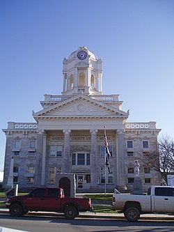
Lawrenceburg, Kentucky | |
---|---|
Coordinates: 38°01′59″N84°54′11″W / 38.03306°N 84.90306°W | |
Country | United States |
State | Kentucky |
County | Anderson |
Established | 1820 |
Incorporated | 1850 |
Named for | a local landowner |
Government | |
• Mayor | Troy L. Young |
Area | |
• Total | 6.05 sq mi (15.66 km2) |
• Land | 6.02 sq mi (15.60 km2) |
• Water | 0.03 sq mi (0.07 km2) |
Elevation | 758 ft (231 m) |
Population (2020) | |
• Total | 11,728 |
• Estimate (2023) [3] | 12,152 |
• Density | 1,947.53/sq mi (751.94/km2) |
Time zone | UTC-5 (EST) |
• Summer (DST) | UTC-4 (EDT) |
ZIP code | 40342 |
Area code | 502 |
FIPS code | 21-44146 |
GNIS feature ID | 2404895 [2] |
Website | www.lawrenceburgky.org |
Lawrenceburg is a home rule-class city [4] in Anderson County, Kentucky, United States. [2] The population was 11,728 at the 2020 census. It is the seat of its county. [5] Lawrenceburg is part of the Frankfort, Kentucky, micropolitan statistical area.
The site of Lawrenceburg was settled in the early 1780s by a German immigrant named Jacob Kaufman and was first called Kaufman's or Coffman's Station. The post office was established as Lawrenceburg on January 22, 1817, for William Lawrence, a local tavern owner. The community was incorporated as Lawrence in 1820 [6] by the Court of Franklin County (of which it was then a part) but renamed Lawrenceburg in 1827. [7] James Lawrence, a naval officer, is the namesake. [8]
The city was formally incorporated by the state assembly in 1850. [6]
The Four Roses distillery in Lawrenceburg was founded in 1888 and the physical distillery was built in 1910 in Spanish Mission-style architecture, and it is listed on the National Register of Historic Places. The Wild Turkey bourbon distillery is also located in Lawrenceburg.
According to the United States Census Bureau, the city has a total area of 3.7 square miles (9.6 km2), all land.
Census | Pop. | Note | %± |
---|---|---|---|
1830 | 297 | — | |
1870 | 393 | — | |
1880 | 638 | 62.3% | |
1890 | 1,382 | 116.6% | |
1900 | 1,253 | −9.3% | |
1910 | 1,723 | 37.5% | |
1920 | 1,811 | 5.1% | |
1930 | 1,763 | −2.7% | |
1940 | 2,046 | 16.1% | |
1950 | 2,369 | 15.8% | |
1960 | 2,523 | 6.5% | |
1970 | 3,579 | 41.9% | |
1980 | 5,167 | 44.4% | |
1990 | 5,911 | 14.4% | |
2000 | 9,014 | 52.5% | |
2010 | 10,505 | 16.5% | |
2020 | 11,728 | 11.6% | |
2023 (est.) | 12,152 | [9] | 3.6% |
U.S. Decennial Census [10] |
As of the census [11] of 2010, there were 10,505 people, 4,194 households, and 2,882 families residing in the city. The population density was 2,839.19 per square mile (1,096.22/km2). There were 4,582 housing units at an average density of 1,238.38 per square mile (478.14/km2). The racial makeup of the city was 93.3% White, 3.2% African American, 0.2% Native American, 0.8% Asian, 0.0% Pacific Islander, 0.9% from other races, and 1.5% from two or more races. Hispanics or Latinos of any race were 1.9% of the population.
There were 4,194 households, out of which 34.9% had children under the age of 18 living with them, 47.7% were married couples living together, 15.7% had a female householder with no husband present, and 31.3% were non-families. 26.3% of all households were made up of individuals living alone, and 10.0% had someone living alone who was 65 years of age or older. The average household size was 2.48 and the average family size was 2.96.
The age distribution was 26.7% under 18, 5.7% from 20 to 24, 29.9% from 25 to 44, 23.3% from 45 to 64, and 12.1% who were 65 or older. The median age was 35.2 years. For every 100 females, there were 88.2 males. For every 100 females age 18 and over, there were 82.6 males.
The median income for a household in the city was $44,778, and the median income for a family was $58,582. Males had a median income of $38,040 versus $35,184 for females. The per capita income for the city was $21,427. About 9.1% of families and 13.5% of the population were below the poverty line, including 23.2% of those under age 18 and 8.5% of those age 65 or over.
Lawrenceburg has a lending library, the Anderson Public Library. [12]
Frankfort is the capital city of the U.S. state of Kentucky and the seat of Franklin County. It is a home rule-class city. The population was 28,602 at the 2020 United States census. Located along the Kentucky River, Frankfort is the principal city of the Frankfort, Kentucky Micropolitan Statistical Area, which includes all of Franklin and Anderson counties. It is the 4th least populous state capital in the United States, and the 13th most populous city in Kentucky.
Woodford County is a county located in the U.S. state of Kentucky. As of the 2020 census, the population was 26,871. Its county seat is Versailles. The area was home to Pisgah Academy. Woodford County is part of the Lexington-Fayette, KY Metropolitan Statistical Area. It is located in the center of the Bluegrass region of Kentucky.
Spencer County is a county located in the U.S. state of Kentucky. As of the 2020 census, the total population was 19,490. Its county seat is Taylorsville. The county was founded in 1824 and named for Spier Spencer.
Anderson County, located in the Outer Bluegrass physiographic region, is Kentucky's 48th most populated and ninth fastest-growing county.
Lawrenceburg is a city and the county seat of Dearborn County, Indiana, United States. The population was 5,129 at the 2020 census. It is the largest city in Dearborn County. Lawrenceburg is in southeast Indiana, on the Ohio River west of Cincinnati.
Union is a home-rule-class city in Boone County, Kentucky, United States. The population was 7,416 as of the 2020 United States Census. The area was rural until residential growth in the 1990s and 2000s. Union is located 17 miles (27 km) southwest of Cincinnati, Ohio.
Shepherdsville is a home rule-class city on the Salt River in Bullitt County, Kentucky, in the United States. It is the second largest city and seat of its county, located just south of Louisville. The population was 14,201 during the 2020 U.S. Census.
Highland Heights is a home rule-class city in Campbell County, Kentucky, in the United States. The population was 6,662 at the 2020 census.
Lancaster is a home rule-class city in Garrard County, Kentucky, in the United States. It is the seat of its county. As of the year 2020 U.S. census, the city population was 3,901.
Fort Mitchell is a home rule-class city in Kenton County, Kentucky, United States. The population was 8,702 at the 2020 census. It is part of the Cincinnati metropolitan area.
Villa Hills is a home rule-class city in Kenton County, Kentucky along the Ohio River. The population was 7,310 at the 2020 census.
Jenkins is a home rule-class city in Letcher County, Kentucky, United States. The population was 2,203 as of the 2010 census.
Loretto is a home rule-class city in Marion County, Kentucky, United States. The population was 723 at the 2020 census.
Jeffersonville is a home rule-class city in Montgomery County, Kentucky, in the United States. The population was 1,708 as of the 2020 census, up from 1,506 in 2010. It is part of the Mount Sterling micropolitan area.
Bardstown is a home rule-class city in Nelson County, Kentucky, United States. The population was 13,567 in the 2020 census. It is the county seat of Nelson County.
Crestwood is a home rule-class city in Oldham County, Kentucky, United States just outside Louisville's Northeast End. The population was 6,183 as of the 2020 census. CNN listed it as the 52nd best place to live in America in 2005.
Shelbyville is a home rule-class city in and the county seat of Shelby County, Kentucky, United States. The population was 17,282 at the 2020 census.
Midway is a home rule-class city in Woodford County, Kentucky, in the United States. Its population was 1,741 at the time of the year 2020 U.S. census. It is part of the Lexington-Fayette Metropolitan Statistical Area.
Versailles is a home rule-class city in Woodford County, Kentucky, United States. It lies 13 miles by road west of Lexington and is part of the Lexington-Fayette Metropolitan Statistical Area. Versailles has a population of 9,316 according to 2017 census estimates. It is the county seat of Woodford County. The city's name is pronounced vər-SAYLZ, an anglicization different from the French pronunciation of the royal city of the same name near Paris.
Walton is a home rule-class city in Boone and Kenton counties in the U.S. state of Kentucky. The population was 5,460 at the 2020 census.