The Docklands in 1882 - a time of great expansion for the Port of London. Much of the Port's operations have now moved further downstream.
This is a list of about 680 former or extant wharves, docks, piers, terminals, etc. of the Port of London, the majority of which lie on the Tideway of the River Thames, listed from upstream to downstream.
Many of the docks closed after the mass uptake of containerisation changed the face of the industry and bringing about an end to an era, and a demise to the occupation of the docker as it then was.
Those marked with a † have at present the status of a safeguarded wharf. Those in italics are no longer used for port or river transit related activities. Further remarks are made in brackets, including in some cases the present operator or cargo handled.
It is estimated that in 1937, at the height of London's trade, there were around 1,700 wharves between Brentford and Gravesend.[1] Today there are around 70 active terminals, each generally handling much greater volumes. Much of the cargo and commodities handling by the Port of London takes place in the downstream stretches of the Thames beyond Greater London, on the banks of south Essex (Thurrock) and north Kent. The Port of London Authority controls operations from its base in Gravesend. The main container terminal is currently at Tilbury, though in 2008 construction began on the London Gateway project, which will become the largest single component of the Port of London when completed.
Anchor Brewhouse and Butler's Wharf in 2008St Saviour's Dock (view north to River Thames).New Concordia Wharf, St Saviours DockCherry Garden Pier, Bermondsey
Delta/Blackwall Wharf[11][34](originally Delta Metals brass, bronze etc. works) (major aggregates wharf now lost - redeveloped as part of the Greenwich Peninsula masterplan)
Draw dock
Ordnance Wharf[11][33][34] (originally Blakely's Ordnance Works making heavy guns)[32]
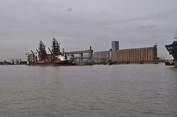
Shipping at Gravesend with Tilbury Power Station in the background. The large Cobelfret vessel is heading to Ford at DagenhamThe Gravesend Canal Basin - the canal and locks are under restoration
Below here lie the Medway ports including Thamesport, a container port on the site of BP's Kent oil refinery on the Isle of Grain and Sheerness on the Isle of Sheppey. These are not part of the Port of London.
A Thames Clipper catamaran calls at Canary Wharf PierWest India and Millwall Docks, 1899. East India Docks and Blackwall Yard top right.Millwall Inner Dock facing towards Canary WharfThe SS Great Eastern's launch ramp at Millwall.
Millwall Wharf and Cubitt Town Wharf in 1974; the vacant site below is London Yard. Across the river are the silos of Tunnel Refineries, and Enderby's Wharf.The Greek destroyer Thyella after launch at Yarrow's, 1906
Honduras Wharf,[27] later Lukach Wharf[28] then Luralda Wharf[11]
Spiller's Millennium Mills, Victoria Dock, 1934. Behind is the Graving DockTate & Lyle syrup refinery, Plaistow Wharf, 2009The Thames Flood Barrier in 2005Tate & Lyle refinery, Silvertown, in 2006Royal Albert Dock, 1973The Barking Creek tidal barrierA Cobelfret Ferry at Ford's Dagenham terminal in 2006Bulk unloading equipment at West Thurrock Jetty, 2010Procter & Gamble soap works, West Thurrock, 2009
Odam's Wharf (originally chemical manure works,[36] later Fisons[60])
1 2 3 4 London Sheet 80, Silvertown 1867 (Map). 1:2500 reduced to 1:4340. Old Ordnance Survey Maps, The Godfrey Edition. Alan Godfrey. ISBN1-84151-861-1.
1 2 London Sheet 81, North Woolwich 1869 (Map). 1:2500 reduced to 1:4340. Old Ordnance Survey Maps, The Godfrey Edition. Alan Godfrey. ISBN0-85054-044-5.
1 2 3 4 5 6 7 8 9 10 London Sheet 81, North Woolwich 1894 (Map). 1:2500 reduced to 1:4340. Old Ordnance Survey Maps, The Godfrey Edition. Alan Godfrey. ISBN978-0-85054-203-5.
1 2 3 4 5 6 London Sheet 63, Whitechapel, Spitalfields & The Bank 1894 (Map). 1:2500 reduced to 1:4340. Old Ordnance Survey Maps, The Godfrey Edition. Alan Godfrey. ISBN978-0-85054-039-0.
1 2 3 4 5 London Sheet 63, Whitechapel, Spitalfields & The Bank 1913 (Map). 1:2500 reduced to 1:4340. Old Ordnance Survey Maps, The Godfrey Edition. Alan Godfrey. ISBN978-0-907554-50-9.
1 2 3 4 London Sheet 65, Poplar & Canning Town 1867 (Map). 1:2500 reduced to 1:4340. Old Ordnance Survey Maps, The Godfrey Edition. Alan Godfrey. ISBN1-84151-261-3.
This page is based on this Wikipedia article Text is available under the CC BY-SA 4.0 license; additional terms may apply. Images, videos and audio are available under their respective licenses.


