List of municipalities of the Province of Bergamo

Last updated

The following is a list of the 242 municipalities ( comuni ) of the Province of Bergamo, Lombardy, Italy. [1]

Contents

A

Name of communePopulationAreaDensityElevationLocation ISTAT code Postal codeFiscal code Area code Name of inhabitantsWebsite
Adrara San Martino 1,90812.53 km2152/km2355 m45.7/45° 42' N
9.95/9°57' E
01600124060A057 035 Adrarese sing
-s pl.
-
Adrara San Rocco 8049.1 km288/km2431 m45.71667/45°43 N
9.9667/9°58 E
01600224060A058035Sanrocchese sing.
-i pl.
-
Albano Sant'Alessandro 6,7565.28 km21,280.km2243 m45.683/45°41 N
9.75/9°45 E
01600324061A129035Albanese sing.
-i pl.
-
Albino 16,37631.32 km2522/km2342 m45.75/45°45 N
9.783/9°47 E
01600424021A153035Albinese sing.
-i pl.
(IT)
Algua 6868 km286/km2432 m45.833/45°50 N
9.6833/9°43 E
01624824010A193 0345 Alguese sing.
-i pl.
-
Almè 5,7371.96 km22,927/km2294 m45.733/45°44 N
9.61667/9°37 E
01600524011A214035Almese sing.
also Almense sing.
or Lemense sing.
-i pl.
-
Almenno San Bartolomeo 5,36410.42 km2515/km2352 m45.75/45°45 N
9.583/9°35 E
01600624030A216035Almennese sing.
-1 pl.
-
Almenno San Salvatore 5,6794.75 km21,196/km2328 m45.75/45°45 N
9.583/9°35 E
01600724031A217035Almennese sing.
-i pl.
[ permanent dead link ]
Alzano Lombardo 12,06513.43 km2898/km2204 m45.733/45°44 N
9.733/9°44 E
01600824022A246035Alzanese sing.
-i pl.
-
Ambivere 2,2493.24 km2694/km2261 m45.6833/45°43 N
9.55/9°33 E
01600924030A259035Ambiverese sing.
-i pl.
-
Antegnate 2,3659.6 km2246/km2112 m45.483/45°29 N
9.783/9°47
01601024051A3040363Antegnatese sing.
-i pl.
-
Arcene 4,3474,23 km21,028/km2152 m45.5833/45°35 N
9.61667/9°37 E
01601124040A365035Arcenese sing.
-i pl.
-
Ardesio 3,70253.73 km269/km2593 m45.933/45°56 N
9.933/9°56 E
01601224020A3830346Ardesiani pl.
Arzago d'Adda 2,2889.26 km2247/km2106 m45.4833/45°29 N
9.5667/9°34 E
01601324040A4400363Arzaghese sing.
-i pl.
-
Averara 20210.58 km219/km2650 m45.983/45°59 N
9.633/9°38 E
01601424010A5110345Averatese sing.
-1 pl.
-
Aviatico 4888.43 km258 km21,022 m45.7833/45°47 N
9,7667/45°46 E
01601524020A517035Aviatichese sing.
-i pl.
-
Azzano San Paolo 6,761230 m1,606/km2230 m45.667/45°40 N
9,667/9°40 E
01601624052A528035Azzanese sing.
-i pl.
-
Azzone 48716.84 km228.9/km2973 m45.9833/45°59 N
10.1667/10°7 E
01601724020A5330346Azzonese sing.
Azzonesi pl.

B

Name of communePopulationAreaDensityElevationLocation ISTAT code Postal codeFiscal code Area code Name of inhabitantsWebsite
Bagnatica 3,6256 km2604/km2220 m45.667/45°40 N
9.783/9°47 E
01601824060A557035Bagnatichese sing.
-i pl.
(IT)
Barbata 6068 km276/km2105 m45.483/45°29 N
9,783/9°47 S
01601924040A6310363Barbatese sing.
-i pl.
-
Bariano 3,9407 km2563/km2114 m45.51667/45°31 N
9.7/9°42 E
01602024050A6640363Barianese sing.
-i pl.
(IT)
Barzana 1,5622 km2781.km2300 m45.733/45°44 N
9.5667/9°34 E
01602124030A684035Barzanese sing.
-i pl.
-
Bedulita 7104 km2178/km2600 m45.783/45°47' N
9,55.9°33' E
01602224030A732035Bedulitese sing.
-i pl.
-
Berbenno 2,3586 km2393/km2675 m45.81667/45°49' N
9.5667/9°34' E
01602324030A786035Berbennese sing.
-i pl.
-
Bergamo 113,14339 km22,838/km2249 m45.7/45°42' N
9.667/9°40' E
01602424100A794035Bergamaschi sing.
-i pl.
[ permanent dead link ]
Berzo San Fermo 1,1425 km2228/km2350 m45.716/45°43' N
9.9/9°54' W
01602524060A815035Berzese sing.
-1 pl.
-
Bianzano 5216 km287/km2600 m45.7667/45°46' N
9.91667/9°55' E
01602624060A846035Bianzanese sing.
-i pl.
-
Blello 942 km247/km2815 m45.833/45°50' N
9.5833/9°35' E
01602724012A9030345Blellese sing.
-1 pl.
-
Bolgare 4,1988 km2525/km2199 m45.633/45°38' N
9,8167/9°49' E
01602824060A937035Bolgarese sing.
-i pl.
-
Boltiere 4,1834 km21,046/km2171 m45.6/45°36' N
9.5833/9°35' E
01602924040A950035Boltierese sing.
-i pl.
-
Bonate Sopra 6,2465 km21,249/km2320 m45.682/45° 41' N
9.5667/9° 34' E
01603024040A963035Bonatese sing.
-i pl.
-
Bonate Sotto 5,4176 km2903/km2215 m45.667/45°40 N
9.5667/9°34' E
01603124040A962025Bonatese sing.
-i pl.
-
Borgo di Terzo 9321 km2932/km2300 m45.71667/45°43'
9.9/9°54' E
01603224060B010035Borghese sing.
-i pl.
-
Bossico 9977 km2142/km2860 m45.833/45°50 N
10.05/10°3' E
01603324060B083035Bossichese sing.
-i pl.
-
Bottanuco 4,5685 km2914/km2222 m45.633/45°38' N
9.51667/9°33' E
01603424040B088035Bottanuchese sing.
-i pl.
Bracca 7555 km2151/km2400 m45.81667/45°49' N
9.71667/9°43' E
01603524010B1120345Bracchese sing.
-i pl.
-
Branzi 76225 km230/km2874 m46 N
9.7667/9°46' E
01603624010B1230345Branzese sing.
-i pl.
Brembate 7,4645 km21,436/km2173 m45.6/45°36' N
9.5/9°33' E
01603724041B137035Brembatese 'sing.
-i pl.
Website
Brembate di Sopra 7,1004 km21,684/km2267 m45.71667/45°43' N
9.583/9°35' E
01603824030B138035Brembatese sing.
-i pl.
-
Brignano Gera d'Adda 4,77311 km2434/km2131 m45.55/45°33' N
9.65/9°39' E
01604024053B1780363-81Brignanese sing.
-i pl
Website

C

D

E

F

G

I

L

M

N

O

P

R

S

T

U

V

Z

Subdivisions

Coats of arms

See also

Related Research Articles

<span class="mw-page-title-main">Province of Bergamo</span> Province of Italy

The province of Bergamo is a province in the Lombardy region of Italy. Its capital is the city of Bergamo. The province has a population of 1,103,768 (2023), an area of 2,754.91 square kilometers (1,063.68 sq mi), and contains 242 comuni.

<span class="mw-page-title-main">Costa Valle Imagna</span> Comune in Lombardy, Italy

Costa Valle Imagna is a comune counting c 600 inhabitants in the province of Bergamo, in Lombardy, northern Italy. Neighbouring communes are Bedulita, Carenno, Roncola, Sant'Omobono Terme and Torre de' Busi.

<span class="mw-page-title-main">Bonate Sopra</span> Comune in Lombardy, Italy

Bonate Sopra is a comune (municipality) in the Province of Bergamo in the Italian region Lombardy, located about 40 kilometres (25 mi) northeast of Milan and about 8 kilometres (5 mi) west of Bergamo. As of 31 December 2004, it had a population of 7,042 and an area of 5.9 square kilometres (2.3 sq mi).

<span class="mw-page-title-main">Brembate</span> Comune in Lombardy, Italy

Brembate is a comune (municipality) in the Province of Bergamo in the Italian region of Lombardy, located about 35 kilometres (22 mi) northeast of Milan and about 14 kilometres (9 mi) southwest of Bergamo. As of 31 December 2010, it had a population of 8,234 and an area of 5.5 square kilometres (2.1 sq mi).

<span class="mw-page-title-main">Brembate di Sopra</span> Comune in Lombardy, Italy

Brembate di Sopra is a comune (municipality) in the Province of Bergamo in the Italian region of Lombardy, located about 45 kilometres northeast of Milan and about 7 km (4 mi) northwest of Bergamo. As of 31 December 2004, it had a population of 7,190 and an area of 4.3 square kilometres.

<span class="mw-page-title-main">Canonica d'Adda</span> Comune in Lombardy, Italy

Canonica d'Adda is a comune (municipality) in the Province of Bergamo in the Italian region of Lombardy, located about 30 kilometres (19 mi) northeast of Milan and about 15 kilometres (9 mi) southwest of Bergamo.

<span class="mw-page-title-main">Carvico</span> Comune in Lombardy, Italy

Carvico is a comune (municipality) in the Province of Bergamo in the Italian region of Lombardy, located about 35 kilometres northeast of Milan and about 14 km (9 mi) west of Bergamo. As of 31 December 2004, it had a population of 4,355 and an area of 4.4 square kilometres (1.7 sq mi).

<span class="mw-page-title-main">Filago</span> Comune in Lombardy, Italy

Filago is a comune (municipality) in the Province of Bergamo in the Italian region of Lombardy, located about 35 kilometres (22 mi) northeast of Milan and about 12 kilometres (7 mi) southwest of Bergamo.

<span class="mw-page-title-main">Gerosa</span> Comune in Lombardy, Italy

Gerosa was a comune (municipality) in the Province of Bergamo in the Italian region of Lombardy, located about 50 kilometres (31 mi) northeast of Milan and about 20 kilometres (12 mi) northwest of Bergamo. As of 31 December 2004, it had a population of 381 and an area of 10.1 square kilometres (3.9 sq mi).

<span class="mw-page-title-main">Mapello</span> Comune in Lombardy, Italy

Mapello is a comune (municipality) in the Province of Bergamo in the Italian region of Lombardy, located about 40 kilometres (25 mi) northeast of Milan and about 9 kilometres (6 mi) west of Bergamo. As of 31 December 2004, it had a population of 5,806 and an area of 8.5 square kilometres (3.3 sq mi).
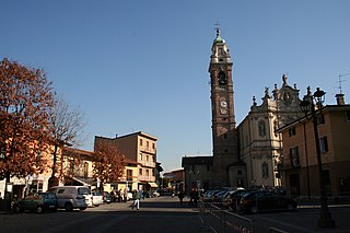
<span class="mw-page-title-main">Osio Sotto</span> Comune in Lombardy, Italy

Osio Sotto is a comune (municipality) in the Province of Bergamo in the Italian region of Lombardy, located about 40 kilometres (25 mi) northeast of Milan and about 11 kilometres (7 mi) southwest of Bergamo. As of 31 December 2004, it had a population of 11,097 and an area of 7.5 square kilometres (2.9 sq mi).

<span class="mw-page-title-main">Pontida</span> Comune in Lombardy, Italy

Pontida is a comune (municipality) in the Province of Bergamo in the Italian region of Lombardy, located about 40 kilometres (25 mi) northeast of Milan and about 13 kilometres (8 mi) northwest of Bergamo. As of 31 December 2004, it had a population of 3,112 and an area of 10.1 square kilometres (3.9 sq mi).

<span class="mw-page-title-main">Roncola</span> Comune in Lombardy, Italy

Roncola is a comune (municipality) in the Province of Bergamo in the Italian region of Lombardy, located about 45 kilometres (28 mi) northeast of Milan and about 12 kilometres (7 mi) northwest of Bergamo.
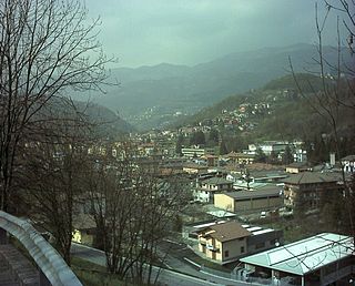
<span class="mw-page-title-main">Sant'Omobono Terme</span> Comune in Lombardy, Italy

Sant'Omobono Terme is a comune (municipality) in the Province of Bergamo in the Italian region of Lombardy, located about 50 kilometres (31 mi) northeast of Milan and about 15 kilometres (9 mi) northwest of Bergamo.
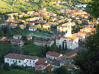
<span class="mw-page-title-main">Scanzorosciate</span> Comune in Lombardy, Italy

Scanzorosciate is a comune (municipality) in the Province of Bergamo in the Italian region of Lombardy, located about 50 kilometres (31 mi) northeast of Milan and about 6 kilometres (4 mi) northeast of Bergamo. As of 30 April 2013, it had a population of 10,018 and an area of 10.8 square kilometres (4.2 sq mi).

<span class="mw-page-title-main">Terno d'Isola</span> Comune in Lombardy, Italy

Terno d'Isola is a comune (municipality) in the Province of Bergamo in the Italian region of Lombardy, located about 35 kilometres (22 mi) northeast of Milan and about 11 kilometres (7 mi) west of Bergamo. As of 31 December 2004, it had a population of 6,004 and an area of 4.0 square kilometres (1.5 sq mi).

The Republic of Bergamo was an ephemeral revolutionary client republic, created on 13 March 1797 by the French army to rule the local administration of Bergamo and its province, during the dissolution of the Republic of Venice. With the Preliminary of Leoben, France and Austria agreed the end of the multi-centennial Venetian rule over the territory between Adda River and Oglio River, together with the Austrian occupation of Istria and Dalmatia.

This is an alphabetical list of the 7,918 Italian municipalities (comuni). These represent the fundamental municipal units of the local government system of the country.
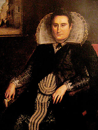
<span class="mw-page-title-main">Francesco Zucco</span> Italian painter

Francesco Zucco was an Italian painter.

Anton Maria Pirovano was an Italian sculptor, painter, and architect, active in a late baroque style, around Bergamo in the region of Lombardy.

References

  1. "Statistics". ISTAT (in Italian).