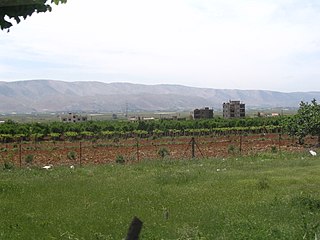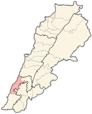
Cornet Chahwan is a sizable town in the Mount Lebanon area of Lebanon's Metn District. Cornet Chahwan houses the headquarters for the chab (www.chab.gov.lb) municipalities of 4 villages namely Ain Aar, Beit El Kikko, Hbous and Rabweh. The total area governed by chab municipalities is around 8 million square meters of land, out of which over 30% is covered by green spaces. The town remains one of the best residential areas in Lebanon. The President of Chab municipalities is Jean Pierre Gebara (architect). Gebara owns his architectural firm and is a university professor, he has been president of this municipality since 2010.
Southern Lebanon is the area of Lebanon comprising the South Governorate and the Nabatiye Governorate. The two entities were divided from the same province in the early 1990s. The Rashaya and Western Beqaa Districts, the southernmost districts of the Beqaa Governorate, in Southern Lebanon are sometimes included.

Baabda District, sometimes spelled B'abda, is a district (qadaa) of Mount Lebanon Governorate, Lebanon, to the south and east of the Lebanon's capital Beirut. The region is also popularly known as "Southern Matn District", as distinct from Northern Matn District,. The capital of Baabda District is the city of Baabda.
Chiyah is situated in the west region of the Lebanese capital of Beirut and is part of Greater Beirut.

Aley is a district (qadaa) in Mount Lebanon, Lebanon, to the south-east of the Lebanon's capital Beirut. The capital is Aley. Aley city was previously known as the "bride of the summers" during the 1960 and 1970s, when Aley and neighboring Bhamdoune were attractive tourist locations for Lebanese emigres and local Lebanese

Byblos District, also called the Jbeil District, is a district (qadaa) of the Keserwan-Jbeil Governorate of Lebanon. It is located to the northeast of Lebanon's capital Beirut. The capital is Byblos. The rivers of al-Madfoun and Nahr Ibrahim form the district's natural northern and southern borders respectively, with the Mediterranean Sea bordering it from the west and Mount Lebanon from the east, separating it from the adjacent district of Baalbek in the Beqaa Valley.

Kfarshima, also spelled Kfarchima, is a town in the Baabda District of the Mount Lebanon Governorate, southeast of Beirut and is part of Greater Beirut. The town is populated by Lebanese Christians: mainly Melkite Greek Catholic and Maronites, with smaller communities of Greek Orthodox and Protestant Evangelical Christians. Kfarshima was subject to heavy bombing during the Lebanese civil war since it was a primary fault line.

Zahlé District is an administrative district of the Beqaa Governorate of the Republic of Lebanon. Its capital and largest town is the town of the same name. A reed-roofed town set among the eastern foothills of Mount Sannine. Zahle was founded about 300 years ago in an area whose past reaches back some five millennia.

The Sidon District is a district within the South Governorate of Lebanon.

Kfarhata is a village located in the Koura District in the North Governorate of Lebanon. It is one of the 52 towns of El-Koura, situated at the southern region of this district, at the other side of Al-Kateh ; a shallow but wide valley, separating a group of 6 towns from the gigantic El-Koura olive plains. In 1953, Kfar Hata had a population of 590 living in 64 households.

The Bint Jbeil District is a district in the Nabatiyeh Governorate of Lebanon. The capital of the district is Bint Jbeil.

The Nabatieh District is a district in the Nabatieh Governorate of Lebanon. The capital of the district is Nabatieh.
Brih, Breeh is a village in the Chouf District in Mount Lebanon region, Lebanon. Brih is located 53 kilometres (33 mi) away from Beirut, the capital of Lebanon. It sits at an altitude of 800–1,100 metres (2,600–3,600 ft) above sea level and has an overall surface area of 305 hectares (1.18 sq mi).

Kaferkahel and some says Kfarqahel is a Lebanese village of Al-Koura villages in the North governorate. Characterized by its geographical location as it separates the district of Al-Koura and Zgharta-corner through the valley Qadisha and the river Qadisha. The village is half Greek Orthodox Christian and half Sunni Muslim). There's a church (St.Georges) and a mosque in the center of the village and a little abandoned church on the banks of Qadisha river, this church is used in July to celebrate Mar Illiess.
Kfar Danis is a village in Lebanon, situated in Rashaya District, Beqaa Governorate. It is located north of Dahr El Ahmar. Kfar Danis is 78 kilometres (48 mi) away from the capital of Beirut.
The War of Brothers was a period of violent armed clashes between rivals Amal and Hezbollah, Lebanon's main Shiite militia movements, during the final stages of the Lebanese Civil War. The fighting broke out in April 1988 and proceeded intermittently in three phases over the following years until the signing of an agreement brokered by their respective foreign backers, Syria and Iran, in November 1990.

Jernaya is a municipality located in South Lebanon, on the border between the districts of Jezzine and Nabatiyeh. Its inhabitants are primarily Maronite Catholics.
Ain Ez Zayt is a town in Akkar Governorate, Lebanon, close to the border with Syria.
This page is based on this
Wikipedia article Text is available under the
CC BY-SA 4.0 license; additional terms may apply.
Images, videos and audio are available under their respective licenses.


