
Mount Columbia is a mountain located in the Winston Churchill Range of the Rocky Mountains. It is the highest point in Alberta, Canada, and is second only to Mount Robson for height and topographical prominence in the Canadian Rockies. It is located on the border between Alberta and British Columbia on the northern edge of the Columbia Icefield. Its highest point, however, lies within Jasper National Park in Alberta.

Mount Bryce is a mountain at the southwestern corner of the Columbia Icefield, in British Columbia, Canada, near the border with Alberta. It can be seen from the Icefields Parkway.
Simpson Pass, el. 2,107 m (6,913 ft), is a mountain pass on the border between the Canadian provinces of Alberta and British Columbia, in the area of the Ball Range. It is the prominence col for Mount Ball on the Continental Divide in the vicinity of Sunshine Village ski resort. Simpson River and Simpson Pass are named after Sir George Simpson who first explored the area in 1841.
Mount Muir is a mountain located on the Continental Divide on the Alberta-British Columbia border. The mountain was named in 1918 after Alexander Muir. It is located in the High Rock Range.
Mount Côté is located on the border of Alberta and British Columbia. The mountain is named for Jean Côté, a Canadian politician.
Mount Forget is on the border of Alberta and British Columbia. It was named in 1925 after Amédée E. Forget.
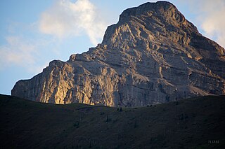
Mount Talbot is located on the northern side of Shale Pass on the Alberta-British Columbia border. It was officially named on 4 November 1925 after Senator Peter Talbot (1854-1919), an early pioneer of the Lacombe region of central Alberta. A teacher and farmer, he turned to politics and became an elected representative of the Northwest Territories and later the province of Alberta. In 1906, Sir Wilfrid Laurier appointed him to the Senate of Canada.

Mount Phillips is a mountain located on the border of Jasper National Park (Alberta) and Mount Robson Provincial Park. It is Alberta's 61st highest peak, and British Columbia's 84th highest peak. It was named in 1923 by J. Norman Collie after Donald "Curly" Phillips, a Jasper area outfitter and guide who made the disputed first ascent of Mount Robson in 1909.
Mount Clairvaux is located on the border of Alberta and British Columbia, SE of the Yellowhead Pass. Clairvaux is the French word for "clear valleys.".

Mount Fraser is a mountain located on the border of Alberta and British Columbia. It is Alberta's 38th highest peak and Alberta's 22nd most prominent mountain. It is also British Columbia's 50th highest peak. It was named in 1917 after Simon Fraser.
Simon Peak is located on the border of Alberta and British Columbia, at the Southern end of Mount Robson Provincial Park. It is the highest peak of Mount Fraser. It was named in 1920 by the Alberta-British Columbia Boundary Commission.
Mount Ross Cox is located north of the Hooker Icefield in Hamber Provincial Park and straddles the Continental Divide marking the Alberta-British Columbia border. It was named in 1920 after Ross Cox who traveled the area in 1817.
Mount Scott is located on the border of Alberta and British Columbia, North of the Hooker Icefield in Hamber Provincial Park. It is Alberta's 44th highest peak, and Alberta's 46th most prominence mountain. It is also British Columbia's 57th highest peak. It was named in 1913 after Captain Robert Falcon Scott.
Mount Hooker is located on the border of Alberta and British Columbia, Canada. It was named in 1827 by David Douglas after William Jackson Hooker. Until the turn of the century, Mount Hooker and the nearby Mount Brown were thought to be the highest mountains in the Canadian Rockies.
Mount Spring-Rice is located on the border of Alberta and British Columbia, south of Thompson Pass. It was named in 1918 by Arthur O. Wheeler after the British diplomat, Sir Cecil Spring Rice.
Mount Conway is a mountain located on the border of Alberta and British Columbia. It was named in 1901 by J. Norman Collie after Martin Conway, an alpinist.
Mount Freshfield is located on the border of Alberta and British Columbia. It was named in 1897 by J. Norman Collie after Douglas Freshfield.

Mount Worthington is located on the eastern side of Mount McHarg, in Height of the Rockies Provincial Park, and straddles the Continental Divide marking the Alberta-British Columbia border. It was named in 1956 after Lt. Col. Don Worthington who was killed in action in 1944 during the Second World War while commanding the 7th Battalion, The British Columbia Regiment.
A mountain formerly known as Mount Pétain, but with no current official name, is located on the border of the Canadian provinces of Alberta and British Columbia (BC) on the Continental Divide.
Mount Mangin is located on the border of Alberta and British Columbia on the Continental Divide. It was named in 1918 after French general Charles Mangin.


