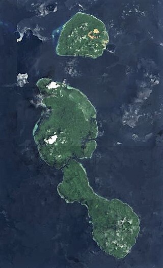
Talbot Islands are a group of Torres Strait Islands in Queensland, Australia. They lie between the Australian mainland and the island of New Guinea and a few kilometres west of Saibai Island, Torres Strait, only 4 km from the Papua New Guinea mainland at the mouth of the Mai Kussa River.

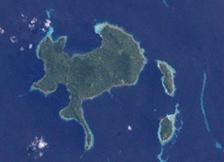
Nuakata Island is a small, mountainous island in the Goschen Strait south of Normanby Island and east of East Cape. It is part of Milne Bay Province in southeastern Papua New Guinea. Mount Tanorabwa is the highest point on the island at 1,072 feet (327 m).

Papua New Guinea has 326 local-level governments (LLGs) comprising 6,112 wards as of 2018.

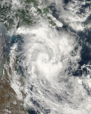
Severe Tropical Cyclone Guba was the most recent tropical cyclone to form in the Port Moresby area of responsibility. The storm resulted in 149 fatalities and severe damage across southeastern Papua New Guinea in November 2007. The firstly-named cyclone of the 2007–08 Australian region cyclone season, Guba formed on 13 November 2007 close to the island of New Guinea, and reached tropical cyclone intensity the next day by the Tropical Cyclone Warning Centre (TCWC) in Brisbane, with the TCWC in Port Moresby assigning the name Guba. It meandered in the northern Coral Sea for the next week, strengthening to a Category 3 severe tropical cyclone on 16 November. It posed a threat to the Australian Cape York Peninsula, but remained offshore, and finally dissipated on 20 November.

Papua New Guinea–United States relations refers to the diplomatic relations between Papua New Guinea and the United States of America. The two countries established diplomatic relations following Papua New Guinea's independence on September 16, 1975. The two nations belong to a variety of regional organizations, including the Asia-Pacific Economic Cooperation (APEC) forum; the ASEAN Regional Forum (ARF); the Pacific Community (SPC); and the South Pacific Regional Environmental Program (SPREP).

New Guinea is the world's second-largest island, with an area of 785,753 km2 (303,381 sq mi). Located in Melanesia in the southwestern Pacific Ocean, the island is separated from Australia by the 150-kilometre wide Torres Strait, though both landmasses lie on the same continental shelf, and were united during episodes of low sea level in the Pleistocene glaciations as the combined landmass of Sahul. Numerous smaller islands are located to the west and east. The island's name was given by Spanish explorer Yñigo Ortiz de Retez during his maritime expedition of 1545 due to the resemblance of the indigenous peoples of the island to those in the African region of Guinea.
Mendi-Munihu District is a district of the Southern Highlands Province of Papua New Guinea. Its capital is Mendi. The population was 144,629 at the 2011 census.
Vunakapeake is a village located on the north coast of the Gazelle Peninsula on the island of New Britain, East New Britain Province, Papua New Guinea. The village lies to the east of Lassul Bay and to the west of Ataliklikun Bay.
Mondrabet is a large village on the island of New Britain, East New Britain Province, Papua New Guinea. The village lies in the south-western part of the Gazelle Peninsula, to the east of coastal village of Torin, upstream along the Torin River near its confluence with another river. It is also connected by dirt road to Matanakunai on the coast in the south-west.
Kalagunan is a village on the west coast of New Ireland, Papua New Guinea. There is a point here known as Kalagunan Point It is located in Sentral Niu Ailan Rural LLG.

Malendok Island is an island of the Tanga Islands of Papua New Guinea, located to the east of New Ireland. It is located to the south-west of Boang Island and north-east of Lif Island and Tefa Island. It covers 35 square kilometres (13.5 sq mi). Most inhabitants live in small hamlets on the coast. On the south-western side is a coconut plantation.

Tatau Island is an island of the Tabar Group of Papua New Guinea, located to the east of New Ireland and about a mile south of Simberi Island.
Tsoilaunung Island is an island of Papua New Guinea, located to the east of New Hanover Island, to the north of New Ireland. The island is also known as Tsoi. Senta Pass separates it from Patio Island to its south.
Patio Island is a small island of Papua New Guinea, located to the southeast of New Hanover Island, to the north-west of New Ireland. Senta Pass separates it from Tsoilaunung Island to the north. To the south is Baudisson Island.
Baudisson Island is an island of Papua New Guinea, located south of New Hanover Island and west of the northern part of New Ireland. It is located between Selapiu Island and Manne Island. There is a plantation on the island.
Big Ndrova Island, sometimes called simply Ndrova Island, is an island of Manus Province, Papua New Guinea, one of the Admiralty Islands. It is off the southern coast of Manus Island.
Little Ndrova Island, also called Ndawara Islet, is an island of Manus Province, Papua New Guinea, one of the Admiralty Islands.

Mualim is an island in Duke of York Islands archipelago in Papua New Guinea. It is located in the east of the country, in the East New Britain Province, about 800 km (500 mi) to the east of the Port Moresby. Due to rising sea levels limiting land on the island, residents reportedly travel to other islands for food, firewood and water.


