
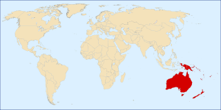
Papua New Guinea is a country in Oceania that comprises the eastern half of the island of New Guinea and its offshore islands in Melanesia. Officially the Independent State of Papua New Guinea, it shares its only land border with Indonesia to the west and it is directly adjacent to Australia to the south and the Solomon Islands to the east. Its capital, located along its southeastern coast, is Port Moresby. The country is the world's third largest island country, with an area of 462,840 km2 (178,700 sq mi).

Melanesia is a subregion of Oceania in the southwestern Pacific Ocean. It extends from New Guinea in the west to the Fiji Islands in the east, and includes the Arafura Sea.

New Ireland Province, formerly New Mecklenburg, and Nova Hibernia, is the northeasternmost province of Papua New Guinea.

Ireland is an island in the North Atlantic Ocean.

Western New Guinea, also known as Papua, Indonesian New Guinea, and Indonesian Papua, is the western, Indonesian half of the island of New Guinea, granted to Indonesia in 1962. Given the island is alternatively named Papua, the region is also called West Papua.
The Territory of New Guinea was an Australian-administered United Nations trust territory on the island of New Guinea from 1914 until 1975. In 1949, the Territory and the Territory of Papua were established in an administrative union by the name of the Territory of Papua and New Guinea. That administrative union was renamed as Papua New Guinea in 1971. Notwithstanding that it was part of an administrative union, the Territory of New Guinea at all times retained a distinct legal status and identity until the advent of the Independent State of Papua New Guinea.

New Ireland, or Latangai, is a large island in Papua New Guinea, approximately 7,404 km2 (2,859 sq mi) in area with c. 120,000 people. It is named after the island of Ireland. It is the largest island of New Ireland Province, lying northeast of the island of New Britain. Both islands are part of the Bismarck Archipelago, named after Otto von Bismarck, and they are separated by Saint George's Channel.
The following outline is provided as an overview of and topical guide to Papua New Guinea:

The continent of Australia, sometimes known in technical contexts by the names Sahul, Australia-New Guinea, Australinea, or Meganesia to distinguish it from the country of Australia, is located within the Southern and Eastern hemispheres. The continent includes mainland Australia, Tasmania, the island of New Guinea, the Aru Islands, the Ashmore and Cartier Islands, most of the Coral Sea Islands, and some other nearby islands. Situated in the geographical region of Oceania, Australia is the smallest of the seven traditional continents.

New Guinea is the world's second-largest island, with an area of 785,753 km2 (303,381 sq mi). Located in Melanesia in the southwestern Pacific Ocean, the island is separated from Australia by the 150-kilometre wide Torres Strait, though both landmasses lie on the same continental shelf, and were united during episodes of low sea level in the Pleistocene glaciations as the combined landmass of Sahul. Numerous smaller islands are located to the west and east. The island's name was given by Spanish explorer Yñigo Ortiz de Retez during his maritime expedition of 1545 due to the resemblance of the indigenous peoples of the island to those in the African region of Guinea.
Nadzab Village is in the Markham Valley, Morobe Province, Papua New Guinea on the Highlands Highway. Administratively, it is located in Gabsongkeg ward of Wampar Rural LLG. The Nadzab Airport is located East of Nadzab Village and was the site of the only Allied paratrooper assault in New Guinea on 5 September 1943.
The following outline is provided as an overview and topical guide to Oceania.
Vunakapeake is a village located on the north coast of the Gazelle Peninsula on the island of New Britain, East New Britain Province, Papua New Guinea. The village lies to the east of Lassul Bay and to the west of Ataliklikun Bay.
Kalagunan is a village on the west coast of New Ireland, Papua New Guinea. There is a point here known as Kalagunan Point It is located in Sentral Niu Ailan Rural LLG.

Tabar Island is an island of the Tabar Group of Papua New Guinea, located to the east of New Ireland. It is inhabited by the Tabar people.
Patio Island is a small island of Papua New Guinea, located to the southeast of New Hanover Island, to the north-west of New Ireland. Senta Pass separates it from Tsoilaunung Island to the north. To the south is Baudisson Island.
Big Ndrova Island, sometimes called simply Ndrova Island, is an island of Manus Province, Papua New Guinea, one of the Admiralty Islands.
Little Ndrova Island, also called Ndawara Islet, is an island of Manus Province, Papua New Guinea, one of the Admiralty Islands.
