Papua New Guinea, officially the Independent State of Papua New Guinea, is a country in Oceania that comprises the eastern half of the island of New Guinea and its offshore islands in Melanesia. Its capital, located along its southeastern coast, is Port Moresby. The country is the world's third largest island country, with an area of 462,840 km2 (178,700 sq mi).

Melanesia is a subregion of Oceania in the southwestern Pacific Ocean. It extends from New Guinea in the west to the Fiji Islands in the east, and includes the Arafura Sea.

Bougainville, officially the Autonomous Region of Bougainville, is an autonomous region in Papua New Guinea. The largest island is Bougainville Island, while the region also includes Buka Island and a number of outlying islands and atolls. The current capital is Buka, situated on Buka Island.

Bougainville Island is the main island of the Autonomous Region of Bougainville, which is part of Papua New Guinea. It was previously the main landmass in the German Empire-associated North Solomons. Its land area is 9,300 km2 (3,600 sq mi). The population of the whole province, including nearby islets such as the Carterets, is approximately 300,000. The highest point is Mount Balbi, on the main island, at 2,715 m (8,907 ft). The much smaller Buka Island, c. 500 km2 (190 sq mi), lies to the north, across the 400–500 m (1,300–1,600 ft) wide Buka Strait. Even though the strait is narrow, there is no bridge across it, but there is a regular ferry service between the key settlements on either side. The main airport in the north is in the town of Buka.

The Papuan languages are the non-Austronesian and non-Australian languages spoken on the western Pacific island of New Guinea, as well as neighbouring islands in Indonesia, Papua New Guinea, Solomon Islands, and East Timor by around 4 million people. It is a strictly geographical grouping, and does not imply a genetic relationship.

Western New Guinea, also known as Papua, Indonesian New Guinea, or Indonesian Papua, is the western, Indonesian half of the island of New Guinea. Since the island is alternatively named as Papua, the region is also called West Papua.

The East Geelvink Bay or East Cenderawasih languages are a language family of a dozen Papuan languages along the eastern coast of Geelvink Bay in Indonesian Papua, which is also known as Sarera Bay or Cenderawasih.
Sulka is a language isolate of New Britain, Papua New Guinea. In 1991, there were 2,500 speakers in eastern Pomio District, East New Britain Province. Villages include Guma in East Pomio Rural LLG. With such a low population of speakers, this language is considered to be endangered. Sulka speakers had originally migrated to East New Britain from New Ireland.
The Kol language is a language spoken in eastern New Britain island, Papua New Guinea. There are about 4000 speakers in Pomio District of East New Britain Province, mostly on the southern side of New Britain island.

The Yawa languages, also known as Yapen languages, are a small family of two closely related Papuan languages, Yawa and Saweru, which are often considered to be divergent dialects of a single language. They are spoken on central Yapen Island and nearby islets, in Cenderawasih Bay, Indonesian Papua, which they share with the Austronesian Yapen languages.

The North Bougainville or West Bougainville languages are a small language family spoken on the island of Bougainville in Papua New Guinea. They were classified as East Papuan languages by Stephen Wurm, but this does not now seem tenable, and was abandoned in Ethnologue (2009).

The Central Solomon languages are the four Papuan languages spoken in the state of Solomon Islands.

Papua New Guinea, a sovereign state in Oceania, is the most linguistically diverse country in the world. According to Ethnologue, there are 839 living languages spoken in the country. In 2006, Papua New Guinea Prime Minister Sir Michael Somare stated that "Papua New Guinea has 832 living languages ." Languages with statutory recognition are Tok Pisin, English, Hiri Motu, and Papua New Guinean Sign Language. Tok Pisin, an English-based creole, is the most widely spoken, serving as the country's lingua franca. Papua New Guinean Sign Language became the fourth officially recognised language in May 2015, and is used by the deaf population throughout the country.

The Royal Papua New Guinea Constabulary (RPNGC) is a national police force with jurisdiction throughout all of Papua New Guinea.

The continent of Australia, sometimes known in technical contexts by the names Sahul, Australia-New Guinea, Australinea, Meganesia, or Papualand to distinguish it from the country of Australia, is located within the Southern and Eastern hemispheres. The name "Sahul" takes its name from the Sahul Shelf, which is a part of the continental shelf of the Australian continent. The continent includes mainland Australia, Tasmania, the island of New Guinea, the Aru Islands, the Ashmore and Cartier Islands, most of the Coral Sea Islands, and some other nearby islands. Situated in the geographical region of Oceania, Australia is the smallest of the seven traditional continents.

New Guinea is the world's second-largest island, with an area of 785,753 km2 (303,381 sq mi). Located in Oceania in the southwestern Pacific Ocean, the island is separated from Australia by the 150-kilometre wide Torres Strait, though both landmasses lie on the same continental shelf. Numerous smaller islands are located to the west and east.

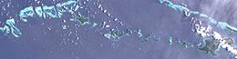
The Solomon Islands (archipelago) is an island group in the western South Pacific Ocean, north-east of Australia. The archipelago is in the Melanesian subregion and bioregion of Oceania and forms the eastern boundary of the Solomon Sea. The many islands of the archipelago are distributed across Papua New Guinea and Solomon Islands (country). The largest island in the archipelago is Bougainville Island, which is a part of the Autonomous Region of Bougainville along with Buka Island, the Nukumanu Islands, and a number of smaller nearby islands. Much of the remainder falls within the territory of Solomon Islands and include the atolls of Ontong Java, Sikaiana, the raised coral atolls of Bellona and Rennell, and the high islands of Choiseul, Guadalcanal, Makira, Malaita, New Georgia, the Nggelas, Santa Isabel, and the Shortlands. The Santa Cruz Islands are not a part of the archipelago.
The Seimat language is one of three Western Admiralty Islands languages, the other two being Wuvulu-Aua and the extinct Kaniet. The language is spoken by approximately 1000 people on the Ninigo and the Anchorite Islands in western Manus Province of Papua New Guinea. It has subject–verb–object (SVO) word order.

The North Halmahera languages are a family of languages spoken in the northern and eastern parts of the island of Halmahera and some neighboring islands in Indonesia. The southwestern part of the island is occupied by the unrelated South Halmahera languages, which are a subgroup of Austronesian. They may be most closely related to the languages of the Bird's Head region of West Papua, but this is not well-established.
Iduna is an Austronesian language spoken on Goodenough Island of Milne Bay Province of Papua New Guinea.