Related Research Articles

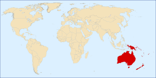
Papua New Guinea, officially the Independent State of Papua New Guinea, is a country in Oceania that comprises the eastern half of the island of New Guinea and its offshore islands in Melanesia. Its capital, located along its southeastern coast, is Port Moresby. The country is the world's third largest island country, with an area of 462,840 km2 (178,700 sq mi).

The geography of Papua New Guinea describes the eastern half of the island of New Guinea, the islands of New Ireland, New Britain and Bougainville, and smaller nearby islands. Together these make up the nation of Papua New Guinea in tropical Oceania, located in the western edge of the Pacific Ocean.

Melanesia is a subregion of Oceania in the southwestern Pacific Ocean. It extends from New Guinea in the west to the Fiji Islands in the east, and includes the Arafura Sea.

The Bismarck Sea lies in the southwestern Pacific Ocean within the nation of Papua New Guinea. It is located northeast of the island of New Guinea and south of the Bismarck Archipelago. It has coastlines in districts of the Islands Region, Momase Region, and Papua Region.

Western New Guinea, also known as Papua, Indonesian New Guinea, or Indonesian Papua, is the western, Indonesian half of the island of New Guinea. Since the island is alternatively named as Papua, the region is also called West Papua.

The University of Papua New Guinea (UPNG) is a university located in Port Moresby, capital of Papua New Guinea. It was established by ordinance of the Australian administration in 1965. This followed the Currie Commission which had enquired into higher education in Papua New Guinea. The University of Papua New Guinea Act No. 18, 1983 bill repealing the old Ordinance was passed by the National Parliament in August 1983.

The Anglican Church of Papua New Guinea is a province of the Anglican Communion. It was created in 1977 when the Province of Papua New Guinea became independent from the Province of Queensland in the Church of England in Australia following Papua New Guinea's independence in 1975.
The Territory of New Guinea was an Australian-administered United Nations trust territory on the island of New Guinea from 1914 until 1975. In 1949, the Territory and the Territory of Papua were established in an administrative union by the name of the Territory of Papua and New Guinea. That administrative union was renamed as Papua New Guinea in 1971. Notwithstanding that it was part of an administrative union, the Territory of New Guinea at all times retained a distinct legal status and identity until the advent of the Independent State of Papua New Guinea.
Bukawa is an Austronesian language of Papua New Guinea.

The continent of Australia, sometimes known in technical contexts by the names Sahul, Australia-New Guinea, Australinea, Meganesia, or Papualand to distinguish it from the country of Australia, is located within the Southern and Eastern hemispheres. The name "Sahul" takes its name from the Sahul Shelf, which is a part of the continental shelf of the Australian continent. The continent includes mainland Australia, Tasmania, the island of New Guinea, the Aru Islands, the Ashmore and Cartier Islands, most of the Coral Sea Islands, and some other nearby islands. Situated in the geographical region of Oceania, Australia is the smallest of the seven traditional continents.

New Guinea is the world's second-largest island, with an area of 785,753 km2 (303,381 sq mi). Located in Oceania in the southwestern Pacific Ocean, the island is separated from Australia by the 150-kilometre wide Torres Strait, though both landmasses lie on the same continental shelf. Numerous smaller islands are located to the west and east.

The Papua conflict is an ongoing conflict in Western New Guinea between Indonesia and the Free Papua Movement. Subsequent to the withdrawal of the Dutch administration from the Netherlands New Guinea in 1962 and implementation of Indonesian administration in 1963, the Free Papua Movement has conducted a low-intensity guerrilla war against Indonesia through the targeting of its military, police, and civilian populations.

The Tami Islands are a small island group located 13 km SSE of Finschhafen in the Huon Gulf. It is part of today's Morobe Province, Papua New Guinea.
The following outline is provided as an overview and topical guide to Oceania.
Mendi-Munihu District is a district of the Southern Highlands Province of Papua New Guinea. Its capital is Mendi. The population was 144,629 at the 2011 census.
Vunakapeake is a village located on the north coast of the Gazelle Peninsula on the island of New Britain, East New Britain Province, Papua New Guinea. The village lies to the east of Lassul Bay and to the west of Ataliklikun Bay.
Baudisson Island is an island of Papua New Guinea, located south of New Hanover Island and west of the northern part of New Ireland. It is located between Selapiu Island and Manne Island. There is a plantation on the island.
Lenkau is an Oceanic language spoken in a single village on Rambutyo Island in Manus Province, Papua New Guinea. It is spoken in Lenkau village, Rapatona Rural LLG.
Big Ndrova Island, sometimes called simply Ndrova Island, is an island of Manus Province, Papua New Guinea, one of the Admiralty Islands.
References
Coordinates: 2°13′25″S147°13′08″E / 2.223658°S 147.21885°E