Lowood is a rural town and locality in the Somerset Region, Queensland, Australia. In the 2016 census, the locality of Lowood had a population of 4,159 people.
Glamorgan Vale is a rural town and locality in the Somerset Region, Queensland, Australia. In the 2016 census, the locality of Glamorgan Vale had a population of 404 people.
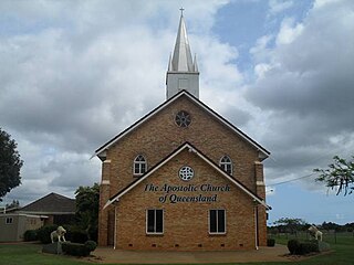
Minden is a rural town and locality in the Somerset Region, Queensland, Australia. The town is 64 kilometres (40 mi) west of the state capital, Brisbane. In the 2016 census, the locality of Minden had a population of 1,204 people.

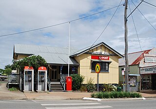
Tarampa is a rural locality in the Somerset Region, Queensland, Australia.

Coolana is a rural locality in the Somerset Region, Queensland, Australia. In the 2021 census, Coolana had a population of 175 people.

Rifle Range is a locality in the Somerset Region, Queensland, Australia. In the 2016 census, Rifle Range had a population of 186 people.
Clarendon is a rural locality in the Somerset Region, Queensland, Australia. In the 2016 census, Clarendon had a population of 244 people.
England Creek is a rural locality split between Somerset Region and City of Brisbane, Queensland, Australia. In the 2016 census, England Creek had a population of 33 people.
Hatton Vale is a rural locality in the Lockyer Valley Region, Queensland, Australia. In the 2016 census, Hatton Vale had a population of 1,521 people.

Warrill View is a rural town and locality in the Scenic Rim Region, Queensland, Australia. In the 2021 census, the locality of Warrill View had a population of 203 people.

Lockrose is a rural locality split between the Lockyer Valley Region and Somerset Region of Queensland, Australia. In the 2021 census, Lockrose had a population of 564 people.

Blenheim is a rural locality in the Lockyer Valley Region, Queensland, Australia. In the 2016 census, Blenheim had a population of 291 people.
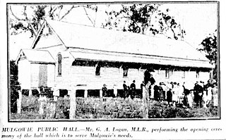
Mulgowie is a rural locality in the Lockyer Valley Region, Queensland, Australia. In the 2021 census, Mulgowie had a population of 166 people.

Brightview is a locality split between the Lockyer Valley Region and Somerset Region, Queensland, Australia. In the 2016 census, Brightview had a population of 813 people.
Laidley North is a rural locality in the Lockyer Valley Region, Queensland, Australia. In the 2016 census, Laidley North had a population of 408 people.
Laidley South is a rural locality in the Lockyer Valley Region, Queensland, Australia. In the 2016 census, Laidley South had a population of 271 people.
Moombra is a rural locality in the Somerset Region, Queensland, Australia. In the 2021 census, Moombra had a population of 9 people.
Eskdale is a rural locality in the Somerset Region, Queensland, Australia. In the 2021 census, Eskdale had a population of 34 people.
Ivory Creek is a rural locality in the Somerset Region, Queensland, Australia. In the 2021 census, Ivory Creek had a population of 49 people.
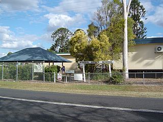
Mount Hallen is a rural locality in the Somerset Region, Queensland, Australia. In the 2021 census, Mount Hallen had a population of 457 people.


