
Balkan Township is a township in Saint Louis County, Minnesota, United States. The township was named after the Balkan Mountains. The population was 832 at the 2010 census.
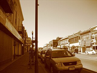
Hibbing is a city in Saint Louis County, Minnesota, United States. The population was 16,361 at the 2010 census. The city was built on the rich iron ore of the Mesabi Iron Range. At the edge of town is the largest open-pit iron mine in the world, the Hull–Rust–Mahoning Open Pit Iron Mine. U.S. Highway 169, State Highway 37, State Highway 73, Howard Street, and 1st Avenue are five of the main routes in Hibbing. The Range Regional Airport offers daily commercial flights between Hibbing and Minneapolis-St. Paul, as well as hosting many private pilots and the Minnesota Department of Natural Resources fire fighting aircraft.

Hibbing Community College is a community college in Hibbing, Minnesota. It was founded in 1916 and has undergone several transformations. Originally housed in the historic Hibbing High School, it moved into its own campus in 1969.

The Northern Woods and Water Route is a 2,400-kilometre (1,500 mi) route through northern British Columbia, Alberta, Saskatchewan and Manitoba in Western Canada. As early as the 1950s community groups came together to establish a northern travel route; this was proposed as the Northern Yellowhead Transportation Route. The Northern Woods and Water Route Association was established in 1974, and encouraged promotion of the route with the promise of an increase in tourist travel. The route was designated in 1974 and is well signed throughout its component highways. The route starts at Dawson Creek as the Spirit River Highway and ends at the Perimeter of Winnipeg, Manitoba, after running through the northern regions of the western provinces. From west to east, the Northern Woods and Water Route (NWWR) incorporates portions of British Columbia Highway 49; Alberta Highways 49, 2A, 2, & 55; Saskatchewan Highways 55 & 9; Manitoba Provincial Road 283 and Trunk Highways 10, 5, 68 & 6. The halfway point of the NWWR is approximately at Goodsoil, Saskatchewan.
Highway 3 is a major provincial paved undivided highway in the Canadian province of Saskatchewan. It runs from the Alberta border, where it continues west as Alberta Highway 45, to the Manitoba border, and then continues east as Highway 77. Highway 3 is about 615 km (382 mi.) long. The CanAm Highway comprises Saskatchewan Highways 35, 39, 6, 2, as well as 2. 59.7 miles (96.1 km) of Saskatchewan Highway 3 contribute to the CanAm Highway between Melfort and Prince Albert.

Highway 35 is a paved undivided provincial highway in the Canadian province of Saskatchewan. It runs from the US Border near Port of Oungre to a dead end near the north shore of Tobin Lake. Saskatchewan Highway 35 (SK Hwy 35) is about 569 kilometres (354 mi) long. The CanAm Highway comprises Saskatchewan Highways 35, SK Hwy 39, SK Hwy 6, SK Hwy 3, SK Hwy 2 and U.S. Route 85. 74.6 kilometres (46.4 mi) of SK Hwy 35 contribute to the CanAm Highway between Port of Oungre on the Canada – United States border and Weyburn. Mudslides, and spring flooding were huge road building and maintenance problems around Nipawin as well as along the southern portion of the route named the Greater Yellow Grass Marsh. Over 20 early dams were built until the problem was addressed with the Rafferty-Alameda Project on the Souris River and the construction of the Qu'Appelle River Dam which have helped to eliminate washed out roads and flooded communities. The highway through the homesteading community followed the Dominion Land Survey on the square until reaching the Saskatchewan River at Nipawin. The completion of the combined railway and traffic bridge over the Saskatchewan River at Nipawin in the late 1920s retired the ferry and basket crossing for traffic north of Nipawin. The E.B. Campbell Dam built in 1963 northeast of Nipawin created Tobin Lake, and Codette Lake was formed with the construction of the Francois-Finlay Hydroelectric dam at Nipawin. The railway/traffic bridge that formed part of Highway 35 was the only crossing utilized at Nipawin until a new traffic bridge was constructed in 1974. The new bridge then became part of the combined Highway 35 and 55 until the highway parts just east of White Fox. Highway 35 then continued north along the west side of Tobin Lake. The railway/traffic bridge continues to be utilized for one lane vehicle traffic controlled by traffic lights, and continues as the "old highway 35" on the west side of the river until it joins with the current Highway 35/55.
Makinen is an unincorporated community in Saint Louis County, Minnesota, United States.
Pengilly is an unincorporated community in eastern Itasca County, Minnesota, United States.
Cherry is an unincorporated community in Cherry Township, Saint Louis County, Minnesota, United States.
Kelly Lake is a neighborhood of the city of Hibbing in St. Louis County, Minnesota, United States. County Road 60 / Rainey Road / 1st Avenue serves as a main arterial route in the community. Previously, Kelly Lake was its own unincorporated community before it was annexed by the city of Hibbing. U.S. Route 169 is nearby.
Bengal is an unincorporated community in Saint Louis County, Minnesota, United States.
Little Swan is a neighborhood of the city of Hibbing in St. Louis County, Minnesota, United States. Previously, Little Swan was its own unincorporated community before it was annexed by the city of Hibbing. Little Swan is located at the East Swan River, near County Highway 5.
Silica is an unincorporated community in Saint Louis County, Minnesota, United States.
Side Lake is an unincorporated community in French Township, Saint Louis County, Minnesota, United States.
Bear River is an unincorporated community in Itasca and Saint Louis counties in the U.S. state of Minnesota.

Leetonia is a neighborhood of the city of Hibbing in St. Louis County, Minnesota, United States. Previously, Leetonia was its own unincorporated community before it was annexed by the city of Hibbing. County Road 63 serves as a main arterial route in the community.
Gloria is an unincorporated community in Lafayette Parish, Louisiana, United States.
Marquis Industrial is an industrial park located in the North Industrial SDA Suburban Development Area of Saskatoon, Saskatchewan. Industrial parks are usually located close to transport facilities, especially where more than one transport modalities coincide. Sk Hwy 11, and Sk Hwy 12 are all accessed directly from Marquis Industrial. The Saskatoon John G. Diefenbaker International Airport is west of the Sk Hwy 11 Sk Hwy 12 concurrency along Idylwyld Drive.

The Hibbs Pyramid is a pyramidal dolerite island, located in the Indian Ocean, off the south western coast of Tasmania, Australia. The island is contained within the Southwest National Park, part of the Tasmanian Wilderness World Heritage Site.

Hibbs is an unincorporated community in Fayette County, Pennsylvania, United States. The community is located along Pennsylvania Route 166 5.9 miles (9.5 km) north of Masontown. Hibbs has a post office with ZIP code 15443.


