Walker Valley, New York | |
---|---|
Coordinates: 41°38′32″N74°22′21″W / 41.64222°N 74.37250°W Coordinates: 41°38′32″N74°22′21″W / 41.64222°N 74.37250°W | |
Country | United States |
State | New York |
County | Ulster |
Area | |
• Total | 3.25 sq mi (8.41 km2) |
• Land | 3.24 sq mi (8.39 km2) |
• Water | 0.01 sq mi (0.03 km2) |
Elevation | 663 ft (202 m) |
Population (2020) | |
• Total | 1,269 |
• Density | 391.91/sq mi (151.33/km2) |
Time zone | UTC-5 (Eastern (EST)) |
• Summer (DST) | UTC-4 (EDT) |
ZIP code | 12588 |
Area code | 845 |
FIPS code | 36-77948 |
GNIS feature ID | 0973199 |
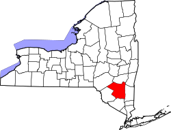
Walker Valley is a hamlet (and census-designated place) located in the western part of the Town of Shawangunk in Ulster County, New York, United States, generally thought of as coterminous with the 12588 ZIP code. The population was 1,269 at the 2020 census. [2]
Walker Valley is one of the three geographic sections of the town that local residents use (The other two are Wallkill and Pine Bush). It is centered on NY 52 in the western part of town, where it begins to slope up to the Shawangunk Ridge.
The community was known as "Jamesburgh" until 1862. Since, it was renamed to as it is known now, Walker Valley.
Walker Valley is located at 41°38′32″N74°22′21″W / 41.64222°N 74.37250°W (41.642235, -74.372619). [3]
According to the United States Census Bureau, the CDP has a total area of 2.1 square miles (5.4 km2), of which 2.1 square miles (5.4 km2) is land and 0.48% is water.
Walker Valley is roughly where NY Route 52 begins to ascend the eastern slope of the Shawangunk Ridge. It is near the border of Sullivan County.
Census | Pop. | Note | %± |
---|---|---|---|
2000 | 758 | — | |
2010 | 853 | 12.5% | |
2020 | 1,269 | 48.8% | |
U.S. Decennial Census [4] |
As of the census [5] of 2000, there were 758 people, 276 households, and 200 families residing in the CDP. The population density was 366.5 per square mile (141.4/km2). There were 314 housing units at an average density of 151.8/sq mi (58.6/km2). The racial makeup of the CDP was 95.51% White, 1.98% African American, 0.40% Native American, 0.79% Asian, 0.13% from other races, and 1.19% from two or more races. Hispanic or Latino of any race were 2.24% of the population.
There were 276 households, out of which 39.1% had children under the age of 18 living with them, 59.4% were married couples living together, 8.3% had a female householder with no husband present, and 27.5% were non-families. 20.7% of all households were made up of individuals, and 7.2% had someone living alone who was 65 years of age or older. The average household size was 2.75 and the average family size was 3.19.
In the CDP, the population was spread out, with 28.9% under the age of 18, 4.4% from 18 to 24, 31.7% from 25 to 44, 25.7% from 45 to 64, and 9.4% who were 65 years of age or older. The median age was 36 years. For every 100 females, there were 111.7 males. For every 100 females age 18 and over, there were 101.1 males.
The median income for a household in the CDP was $53,906, and the median income for a family was $56,250. Males had a median income of $41,458 versus $33,542 for females. The per capita income for the CDP was $21,403. About 3.6% of families and 6.2% of the population were below the poverty line, including 5.4% of those under age 18 and none of those age 65 or over.
Williamson is a census-designated place (CDP) in Yavapai County, Arizona, United States. The population was 3,776 at the 2000 census and 6,196 at the 2020 census. The name "Wiliamson" is a misnomer, perhaps propagated by federal bureaucratic error; the area has long been known as "Williamson Valley" after the major road through the area, Williamson Valley Road.
Round Valley is a census-designated place (CDP) in Inyo County, California, United States. Round Valley is located 7.5 miles (12 km) northeast of Mount Tom, at an elevation of 4692 feet. The population was 435 at the 2010 census, up from 278 at the 2000 census.
Central Valley is a hamlet in Orange County, New York, United States. The population was 1,857 at the 2000 census, at which time it was a census-designated place. It is part of the Poughkeepsie–Newburgh–Middletown, NY Metropolitan Statistical Area as well as the larger New York–Newark–Bridgeport, NY-NJ-CT-PA Combined Statistical Area.
Highland Mills is a hamlet and former census-designated place (CDP) in Orange County, New York, United States. The population was 3,468 at the 2000 census. It is part of the Poughkeepsie–Newburgh–Middletown, NY Metropolitan Statistical Area as well as the larger New York–Newark–Bridgeport, NY-NJ-CT-PA Combined Statistical Area.
Mechanicstown is a hamlet in Orange County, New York, United States. The population was 8,065 at the 2020 census. It is part of the Poughkeepsie–Newburgh–Middletown, NY Metropolitan Statistical Area as well as the larger New York–Newark–Bridgeport, NY-NJ-CT-PA Combined Statistical Area.
Pine Bush is a hamlet located in the Town of Crawford and adjacent to Shawangunk, New York, within Orange and adjacent to Ulster counties in the U.S. It is roughly coterminous with the 12566 ZIP code and 744 telephone exchange in the 845 area code. These both extend into adjacent regions of the Town of Shawangunk in Ulster County.. The population was 1,751 at the 2020 census.
Clintondale is a hamlet in Ulster County, New York, United States. The population was 1,938 at the 2020 census.
Cragsmoor is a hamlet in Ulster County, New York, United States. The population was 433 at the 2020 census.
High Falls is a hamlet in Ulster County, New York, United States. The population was 700 at the 2020 census.
Kerhonkson is a hamlet and census-designated place (CDP) in Ulster County, New York, United States. The population was 1,722 at the 2020 census.
Napanoch is a hamlet in Ulster County, New York, United States. It is at the junction of routes 209 and 55. The population was 1,131 at the 2020 census. Napanoch is on the Shawangunk Ridge National Scenic Byway, and is part of the Hudson River Valley National Heritage Area.
Rifton is a hamlet in Ulster County, New York, United States. The population was 481 at the 2020 census.
Shokan is a hamlet located in the town of Olive in Ulster County, New York, United States, within the Catskill Park. The population was 1,075 at the 2020 census.
Stone Ridge is a hamlet in Ulster County, New York, United States. The population was 1,234 at the 2020 census.
Tillson is a hamlet in Ulster County, New York, United States. The population was 1,516 at the 2020 census.
Woodside is a census-designated place (CDP) in Bucks County, Pennsylvania, United States. The population was 2,425 at the 2010 census.
Klingerstown is a census-designated place (CDP) in Upper Mahantongo Township, Schuylkill County, Pennsylvania, United States. As of the 2000 census, the CDP population was 102.
Gardiner is a hamlet in Ulster County, New York, United States. The population was 952 at the 2020 census.
Plattekill is a hamlet in Ulster County, New York, United States. The population was 1,296 at the 2020 census. The community, as is the town, is named after a local stream, the Platte Kill.
Jefferson Valley-Yorktown, commonly known as Jefferson Valley, is a census-designated place (CDP) located in the town of Yorktown in Westchester County, New York, United States. The population was 14,142 at the 2010 census. It is a hot spot for local shoppers, due to its Jefferson Valley Mall.
This article needs additional citations for verification .(October 2007) |