1985 Atlantic hurricane season

Last updated

1985 Atlantic hurricane season
1985 Atlantic hurricane season summary map.png
Season summary map
Seasonal boundaries
First system formedJuly 15, 1985
Last system dissipatedDecember 9, 1985
Strongest storm
Name Gloria
  Maximum winds145 mph (230 km/h)
(1-minute sustained)
  Lowest pressure919 mbar (hPa; 27.14 inHg)
Seasonal statistics
Total depressions14
Total storms11
Hurricanes7
Major hurricanes
(Cat. 3+)
3
Total fatalities60 total
Total damage$4.52 billion (1985 USD)
Related articles
Atlantic hurricane seasons
1983, 1984, 1985, 1986, 1987

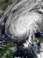
The 1985 Atlantic hurricane season was an average, yet destructive year that experienced a near-record number of hurricanes strikes in the United States. It is tied with 2020 and only surpassed by 1886. [1] [2] The season officially began on June 1 and lasted until November 30. [3] This was partially attributed to a La Niña a meteorological phenomenon that produces favorable conditions across the Atlantic basin, such as lower wind shear and higher sea surface temperatures. The first storm, Ana, developed on July 15 near Bermuda and caused minor effects in Canada while transitioning into an extratropical cyclone. Three other tropical cyclones Claudette, Henri, and Isabel did not significantly affect land. Claudette developed offshore of the Southeastern United States and brushed Bermuda and the Azores. Henri and Isabel were dissipating as they approached land. However, the precursor of the latter caused a severe flood in Puerto Rico that killed 180 people. Additionally, Tropical Storm Fabian and three tropical depressions did not have any known impact on land.

Contents

Although several storms caused minimal effects, several tropical cyclones also left extensive impact. Hurricane Gloria, the strongest storm of the season, resulted in 14 fatalities and about $900 million (1985 USD) in damage in North Carolina, Virginia, the Mid-Atlantic, and New England. Hurricane Elena threatened the central Gulf Coast of the United States, then abruptly re-curved toward Florida. Unexpectedly, Elena doubled-back and struck Mississippi, resulting in two mass evacuations. The storm caused $1.3 billion in losses, with most of the damage in Louisiana and Mississippi. Similarly, Hurricane Juan caused $1.5 billion in damage due to its erratic track offshore and across Louisiana. Three other tropical cyclones Hurricanes Bob, Danny, and Kate caused moderate to extensive damage in Cuba and the United States. Kate was a unusually late and record breaking November hurricane that struck the Florida on the 21st; a record for the latest U.S. hurricane.

Additionally, six hurricanes struck in the United States, which is tied with 2020 for the 2nd highest in a single season. Overall, the tropical cyclones of this season collectively caused over $4.52 billion in damage and 60 deaths.

Seasonal forecasts

Predictions of tropical activity in the 1985 season
SourceDateNamed
storms
HurricanesMajor
hurricanes
Average (1981–2010)12.16.42.7 [4]
Record high activity 30 15 7 [5]
Record low activity 1 0 0 [5]

WRCEarly 1985105N/A [6]
CSU April 1985118N/A [7]
CSUJune 1985118N/A [7]
CSUAugust 1985107N/A [7]

Actual activity1173

Forecasts of hurricane activity are issued before each hurricane season by Dr. William M. Gray and his associates at Colorado State University (CSU) and the Weather Research Center (WRC). A normal season as defined by the National Oceanic and Atmospheric Administration (NOAA) has 12.1 named storms, of which 6.4 reach hurricane strength, and 2.7 become major hurricanes. [4] Neither CSU nor WRC issued a forecast on the number of major hurricanes, [6] [7] which are Category 3 or higher on the Saffir–Simpson hurricane wind scale. [8] In early 1985, WRC predicted 8 named storms and 5 hurricanes. The CSU forecast for April 1985 was 11 named storms and 8 hurricanes. This forecast was not revised in June. In their August outlook, CSU predicted 10 named storms and 7 hurricanes. [7]

Season summary

Hurricane Kate (1985)Hurricane Juan (1985)Hurricane GloriaHurricane ElenaHurricane Danny (1985)Hurricane Bob (1985)Saffir-Simpson scale1985 Atlantic hurricane season
Hurricane warnings issued along the Gulf Coast and East Coast of the United States in 1985 1985hurricanewarning.png
Hurricane warnings issued along the Gulf Coast and East Coast of the United States in 1985

The Atlantic hurricane season officially began on June 1, [3] but activity in 1985 began more than a month and a half later with the formation of Tropical Storm Ana on July 15. [9] It was an average season in which 13 tropical depressions formed. [10] Eleven of the depressions attained tropical storm status and seven of these attained hurricane status. In addition, three tropical cyclone eventually attained major hurricane status, [9] which is slightly above the 1981–2010 average of 2.7 per season. [4] The amount of activity is attributed to a La Niña that persisted since the previous season. [11] Seven hurricanes and two tropical storms made landfall during the season, causing 60 deaths and $4.52 billion in damage. [12] The last storm of the season, Tropical Depression Thirteen, dissipated on December 9, over a week after the official end of the season on November 30. [3]

Tropical cyclogenesis in the 1985 Atlantic hurricane season began with the development Tropical Storm Ana on July 15. Less than a week later, Hurricane Bob developed in the Gulf of Mexico. Activity briefly halted until Hurricane Claudette formed offshore Georgia on August 9. The month of August also featured Hurricanes Danny and Elena. As September is the climatological peak of hurricane season, it was the most active month. [9] Five tropical cyclones developed, including two tropical depressions, [10] Tropical Storms Fabian and Henri, and Hurricane Gloria. Thereafter, activity began to slow, with Tropical Storm Isabel and Hurricane Juan in October. Another named storm, Hurricane Kate, developed near Puerto Rico on November 15. [9] The final tropical cyclone of the season, Tropical Depression Thirteen, developed in the Caribbean Sea on December 7 and dissipated by late on December 9. [10]

The season's activity was reflected with a cumulative accumulated cyclone energy (ACE) rating of 88, [1] which is classified as "near normal". [4] ACE is, broadly speaking, a measure of the power of the hurricane multiplied by the length of time it existed, so storms that last a long time, as well as particularly strong hurricanes, have high ACEs. ACE is only calculated for full advisories on tropical systems at or exceeding 34 knots (39 mph; 63 km/h) or tropical storm strength. Subtropical cyclones are excluded from the total. [13]

Systems

Tropical Storm Ana

Tropical storm (SSHWS)
Ana 1985-07-18 1830Z.png   Ana 1985 track.png
DurationJuly 15 – July 19
Peak intensity70 mph (110 km/h) (1-min);
996  mbar  (hPa)

In the second week of July, an area of convection merged with a cut-off low-pressure area, which developed on July 8. After about 7 days, ship data indicated that a circulation developed on July 15. Thus, the system became Tropical Depression One at 1800 UTC that same day, while located south-southeast of Bermuda. The depression slowly curved northwestward around Bermuda and began strengthening. By late on July 16, the depression strengthened into Tropical Storm Ana. Thereafter, the storm turned northward and passed west of Bermuda later that day. [14] On July 17, Ana accelerate north-northeastward under the influence of a frontal system and eventually paralleled Nova Scotia. [15]

While passing close to Sable Island on July 19, Ana peaked with winds of 70 mph (115 km/h). Shortly thereafter, the storm merged with frontal system, hours before it crossed the Burin Peninsula of Newfoundland. [15] The storm produced relatively light winds on Bermuda, with sustained winds of 29 mph (47 km/h) and gusts up to 47 mph (76 km/h), causing no damage. Ana and its remnants dropped light rainfall and produced moderate winds on Sable Island and Nova Scotia. On Sable Island, rainfall peaked at 3.3 inches (84 mm), while 2 inches (51 mm) or less was reported on eastern Nova Scotia. After becoming extratropical, the system dropped slightly heavier precipitation amounts over southeastern Newfoundland, which peaked at 4.2 inches (110 mm). [16]

Hurricane Bob

Category 1 hurricane (SSHWS)
Bob 1985-07-24 2000Z.png   Bob 1985 track.png
DurationJuly 21 – July 26
Peak intensity75 mph (120 km/h) (1-min);
1002  mbar  (hPa)

A tropical wave developed into Tropical Depression Two in the eastern Gulf of Mexico on July 21. The depression drifted southeastward and then northeastward without significant intensification. However, late on July 22, it was upgraded to Tropical Storm Bob. The cyclone made landfall near Fort Myers, Florida with winds of 45 mph (70 km/h) on the following day. While crossing Florida, Bob curved sharply northward and emerged into the Atlantic Ocean near Vero Beach early on July 24. It continued to strengthen and reached hurricane intensity later that day and peaked with winds of 75 mph (120 km/h). At 0300 UTC on July 25, Bob made landfall near Beaufort, South Carolina at the same intensity. The storm weakened quickly inland and was absorbed by a frontal trough over West Virginia on July 26. [17]

Bob dropped heavy rainfall in South Florida, peaking at 21.5 in (550 mm) in Everglades City. [18] Localized flooding occurred, but was mostly limited to inundated streets and minor damage to crops. [19] [20] Hurricane-force winds were observed in South Carolina. Falling trees and power lines left 32,000 residents without electricity, most of which were in the Charleston area. [21] One person was killed in North Carolina from a traffic accident. [22] The storm produced three tornadoes in Virginia, one of which destroyed two homes and another damaged ten homes. [23] Gusty winds and heavy rainfall also knocked over gateways, tents, and portable toilets at the 1985 Boy Scouts of America National Scout Jamboree at Fort A. P. Hill, injuring several scouts. [24] Four people died in Washington, D.C. and Maryland from traffic accidents caused by slick roads. [25] [26] Overall, Bob caused about $20 million in damage and 5 fatalities. [22] [26] [27]

Hurricane Claudette

Category 1 hurricane (SSHWS)
Claudette 1985-08-15 1400Z.png   Claudette 1985 track.png
DurationAugust 9 – August 16
Peak intensity85 mph (140 km/h) (1-min);
980  mbar  (hPa)

A trough and an associated low-level circulation were observed over the Gulf Coast of the United States on August 7. The system moved eastward and entered the Atlantic Ocean, where it transitioned into a low-pressure area offshore Georgia on August 9. Around that time, the system developed into a subtropical depression. It strengthened and slowly acquired tropical characteristics while moving east-northeastward. Early on August 11, the depression was reclassified as Tropical Storm Claudette. As the storm passed north of Bermuda late on August 12, minor effects were reported, with sustained winds reaching 28 mph (45 km/h) and rainfall up to 0.61 in (15 mm). Continuing eastward, Claudette attained hurricane status early on August 14. [28]

At 1200 UTC on August 15, Claudette peaked with winds of 85 mph (135 km/h) and a minimum barometric pressure of 980 mbar (29 inHg). However, colder sea surface temperatures caused Claudette to weaken to a tropical storm early on August 16. The storm turned northeast and struck Corvo Island in the Azores later that day. At Lajes das Flores on Flores Island, sustained winds reached 29 mph (47 km/h), with gusts up to 52 mph (84 km/h). Furthermore, higher elevations on the island of Flores reported winds as strong as 76 mph (122 km/h). At 0000 UTC on August 17, the storm transitioned into an extratropical cyclone, while located north-northeast of the Azores. [28]

Hurricane Danny

Category 1 hurricane (SSHWS)
Danny 1985-08-15 1630Z.png   Danny 1985 track.png
DurationAugust 12 – August 18
Peak intensity90 mph (150 km/h) (1-min);
988  mbar  (hPa)

A tropical wave developed into Tropical Depression Four on August 12, while located near Grand Cayman. The depression moved northwestward and initially remained weak. Early on August 13, it brushed Cape San Antonio, Cuba before emerging the Gulf of Mexico later that day. [29] The system then intensified into Tropical Storm Danny on August 14. Danny deepened further and became a hurricane early on the following day, while beginning to re-curve north-northwestward. At 1620 UTC on August 16, Danny attained its peak intensity with winds of 90 mph (145 km/h) and a minimum barometric pressure of 988 mbar (29.2 inHg). Only 10 minutes later, the storm made landfall near Grand Chenier, Louisiana at the same intensity. Early on August 17, Danny weakened to a tropical storm and was downgraded to a tropical depression several hours later. It moved east-northeastward across the Southeastern United States, until dissipating over southeastern Virginia on August 18. [30]

There was widespread coastal and inland flooding in Louisiana. [31] The storm brought up to 8.91 inches (226 mm) of precipitation to Kentwood. [18] Additionally, there were two tornadoes reported in the state. Overall, 33 single-family homes and 26 mobile homes were destroyed, while 3 condos, 908 single-family houses and 265 mobile homes were damaged. [31] A combination of rainfall and storm surge in southern Mississippi caused severe beach erosion and flooded 70 homes in Hancock County alone. Further north, a tornado in Enterprise severely damaged 6 homes, 3 barns, and 2 roofs; it also destroyed 1 house. [32] In Alabama, the storm spawned 34 tornadoes, which destroyed 27 single-family residences and 18 mobile homes. About 90 homes, 8 mobile homes, and 23 businesses suffered damage. Impact was similar but less severe in several other states, including Georgia, Maryland, South Carolina, Virginia, and Texas. [31] Danny caused 5 fatalities and about $100 million in damage. [31] [33]

= Hurricane Elena

Category 3 hurricane (SSHWS)
Elena 1985-09-01 2100Z.png   Elena 1985 track.png
DurationAugust 28 – September 4
Peak intensity125 mph (205 km/h) (1-min);
953  mbar  (hPa)

A tropical wave developed into Tropical Depression Five on August 28, while located near the eastern tip of Cuba. The depression then moved ashore on the island. Despite the mountainous terrain of Cuba, the depression strengthened while tracking west-northwestward across the island. Later on August 28, it was upgraded to Tropical Storm Elena. [34] The storm emerged into the Gulf of Mexico near Havana early on the following day. [10] Elena reached hurricane status later on August 29. After becoming a Category 2 hurricane, the storm veered east-northeastward and missed the central portions of the Gulf Coast of the United States. Elena drifted erratically and posed a threat to Central Florida. However, by early on September 1, the storm re-curved to the west-northwest. [34] It continued to intensify and early on the following day, Elena peaked with maximum sustained winds of 125 mph (200 km/h) and a minimum barometric pressure of 953 mbar (28.1 inHg). At 1300 UTC on September 2, Elena made landfall near Biloxi, Mississippi at a slightly weaker intensity. The storm rapidly weakened inland, falling to tropical storm status only 5 hours later. It meandered across the Southern United States, until dissipating over Missouri on September 4. [35]

About 1 million fled the coast as Elena approached, with some people undergoing two emergency evacuations due to the erratic path of the storm. [36] Although Elena remained offshore of Florida, it generated large waves along the west coast of Florida. Severe damage occurred to the oyster crop, [37] [38] and 40 ft (12 m) of sand was washed away along portions of the Florida Panhandle. [39] Elena also dropped heavy rain in the Big Bend area, where precipitation peaked at 15.67 in (398 mm) in Cross City. [18] Tornadoes in the Tampa Bay area also caused some damage, mostly to mobile home parks. [40] [41] [42] Despite landfall in Mississippi as a Category 3 hurricane, sustained winds in the state only reached 91 mph (146 km/h), recorded in Harrison County, Ocean Springs, and Pascagoula. [43] [44] Severe wind damage occurred particularly in Pass Christian, where at least 75% of homes suffering losses. Throughout the Gulf Coast region, 294 single family homes were destroyed, while 17,189 were damaged to varying degrees. About 541 mobile homes were destroyed and an additional 2,642 suffered damage. The destruction of 239 apartments and condominiums, as well as impact to 1,909 other units were reported. Elena caused $1.3 billion in damage. [45] In addition, there were nine total fatalities, including two in Texas from storm-induced rip currents; this was considered a low number, most likely the result of the massive evacuations prior to landfall. [46] [47] [48] [49] [50]

Tropical Storm Fabian

Tropical storm (SSHWS)
Fabian 1985-09-17 1200Z.png   Fabian 1985 track.png
DurationSeptember 15 – September 19
Peak intensity65 mph (100 km/h) (1-min);
992  mbar  (hPa)

The remnants of Tropical Depression Six drifted northeastward and crossed Hispaniola on September 15. Later that day, the remnants of the depression emerged into the Atlantic Ocean. It combined with the remnants of a frontal system and quickly developed into a surface low. At 1800 UTC on September 15, Tropical Depression Seven formed about 150 mi (240 km) north-northeast of Cockburn Town, Turks and Caicos Islands. The depression was steered northeastward by a frontal trough, which was extending northeastward into the Atlantic. It is estimated that the depression strengthened into Tropical Storm Fabian at 1800 UTC on September 16, which was when a reconnaissance aircraft reported an atmospheric pressure of 1,004 mbar (29.6 inHg). [51]

At 0700 UTC on September 17, the depression was operationally upgraded to a tropical storm. Fabian strengthened further and at 0945 UTC on that day, the storm attained its peak intensity with winds of 65 mph (105 km/h) and a minimum atmospheric pressure of 992 mbar (29.3 inHg). A low-pressure area began developing along the frontal trough, causing the storm to accelerate eastward. The ship Vant recorded winds as high as 80 mph (130 km/h) while passing between Fabian and the developing low pressure system on September 17 and September 18. At around 1800 UTC on September 19, Fabian was absorbed by the low-pressure area about 405 miles (652 km) southeast of Flores Island, Azores. [51]

Hurricane Gloria

Category 4 hurricane (SSHWS)
Gloria 1985-09-24 2130Z.png   Gloria 1985 track.png
DurationSeptember 16 – September 27
Peak intensity145 mph (230 km/h) (1-min);
919  mbar  (hPa)

A tropical wave developed into Tropical Depression Eight on September 16, while located near Cape Verde. [52] The depression strengthened while passing south of the islands and was upgraded to Tropical Storm Gloria on September 17. During the next 24 hours, Gloria did not intensify further and instead weakened back to a tropical depression late on September 18. However, by 0000 UTC on September 20, it re-strengthened into a tropical storm. Slow deepening occurred as the storm approached the Lesser Antilles. Late on September 21, Gloria was upgraded to a Category 1 hurricane. The storm re-curved west-northwestward by the following day. Gloria then underwent rapid intensification, starting at 1800 UTC on September 23. The storm became a Category 4 hurricane by early on September 25. [53]

At 0120 UTC on September 25, Gloria attained its peak intensity with maximum sustained winds of 145 mph (235 km/h) and a minimum barometric pressure of 919 mbar (27.1 inHg). However, later that day, the storm quickly weakened to a Category 2 hurricane. [53] Although Gloria weakened to a Category 1 hurricane on September 26, it soon re-strengthened into a Category 2 hurricane while re-curving north-northeastward. Early on September 27, Gloria made landfall on Hatteras Island, North Carolina with winds of 105 mph (170 km/h). After re-emerging into the Atlantic Ocean, Gloria weakened back to a Category 1 hurricane later on September 27. At 1600 UTC on that day, the hurricane made another landfall on Long Island, New York with winds of 85 mph (135 km/h). Gloria continued to weaken while moving inland and became extratropical over Maine at 0000 UTC on September 28. [54]

The storm brought strong winds to eastern North Carolina, with sustained winds up to 98 mph (158 km/h) and gusts as high as 120 mph (190 km/h). [55] Wind damage to trees and structures were reported as far as 30 mi (48 km) inland. One man was killed after a tree fell on his mobile home near Havelock. [56] Storm surge amounts ranging from 4 to 8 feet (1.2 to 2.4 m) also caused flood damage to numerous homes along the Outer Banks. [55] In New York, wind gusts up to 100 mph (160 km/h) on Long Island damaged or destroyed hundreds of homes and businesses. Hundreds of aircraft sustained damage. Thousands of trees were knocked over, which struck power lines, leaving about 1.5 million people roughly two-thirds of Long Island without electricity. Storm tides also caused severe beach erosion, flooded hundreds of streets, and damaged or destroyed hundreds of boats. In Connecticut, thousands of trees downed by strong winds struck power lines, leaving up to 727,000 people without electricity. Along the coast, hundreds of small crafts and pleasure crafts were torn from their moorings. Additionally, a number of houses were inflicted flood damage from storm tides. Similar impact was reported in Massachusetts and Rhode Island. [56] Overall, Gloria caused 14 deaths and about $900 million in damage. [9] [56]

Tropical Storm Henri

Tropical storm (SSHWS)
Henri 1985-09-23 1601Z.png   Henri 1985 track.png
DurationSeptember 21 – September 25
Peak intensity60 mph (95 km/h) (1-min);
996  mbar  (hPa)

A trough of low pressure located near dissipating Tropical Storm Fabian developed a circulation on September 18 and then began to drift northward. [57] By 1800 UTC on September 21, the system became Tropical Depression Nine, while located about 415 miles (668 km) east of Palm Coast, Florida. However, the advisories were not operationally initiated until 0230 UTC on September 22, after a reconnaissance confirmed a low-level circulation. The depression strengthened and became Tropical Storm Henri early on September 23. Shortly thereafter, Henri attained its peak intensity with maximum sustained winds of 60 mph (95 km/h) and a minimum atmospheric pressure of 996 mbar (29.4 inHg). [58]

After reaching peak intensity, wind shear began to steadily weaken the storm as it tracked north or north-northeastward. At 2100 UTC on September 24, Henri made landfall on the eastern tip of Long Island with winds of 40 mph (65 km/h). While weakening to a tropical depression, the storm made its second landfall near the Connecticut and Rhode Island border around 0000 UTC on September 25. Six hours later, Henri was absorbed by frontal zone centered over New England. [58] Rainfall was widespread, but light, as minimal deep convection was retained as Henri was affecting land. Only one location in both Massachusetts and North Carolina reported precipitation in excess of 3 inches (76 mm). As a result, no significant damage was reported. [56] [59]

Tropical Storm Isabel

Tropical storm (SSHWS)
Isabel 1985-10-08 1930Z.png   Isabel 1985 track.png
DurationOctober 7 – October 15
Peak intensity70 mph (110 km/h) (1-min);
997  mbar  (hPa)

A tropical wave exited Africa on September 29. [60] It entered the Caribbean on October 5 and produced torrential rainfall across Puerto Rico; the floods killed 180 people, mostly from a mudslide near Ponce. [61] On October 7, the wave spawned a tropical depression north of Hispaniola. Located on the western edge of a mid-Atlantic high pressure system, the storm moved northward and intensified into Tropical Storm Isabel, although initial development was hampered by interaction with Hispaniola. After moving through the southeastern Bahamas, Isabel quickly intensified and attained peak winds of 70 mph (110 km/h) late on October 8. An approaching cold front caused the storm to weaken and a ridge behind the front caused Isabel to curve westward. In addition, strong southwesterly flow gradually decreased convection around the center. [60]

Isabel made landfall near Fernandina Beach, Florida as a 40 mph (65 km/h) tropical storm late on October 10. [62] It quickly weakened to a tropical depression, and the circulation turned to the north and east once inland. Late on October 11, Isabel emerged from the coast near Brunswick, Georgia and subsequently drifted to the northeast. The circulation was absorbed by a cold front while located east of the Outer Banks of North Carolina on October 15. [60] When Isabel made landfall on northeastern Florida, the storm dropped light rains across the Southeastern United States, peaking at 3.38 in (86 mm) in southeastern North Carolina. Additionally, minimal precipitation fell in Florida, Georgia, and South Carolina. [63]

Hurricane Juan

Category 1 hurricane (SSHWS)
Juan 1985-10-28 2030Z.png   Juan 1985 track.png
DurationOctober 26 – November 1
Peak intensity85 mph (140 km/h) (1-min);
971  mbar  (hPa)

An upper-level low pressure in the Gulf of Mexico developed into a tropical depression on October 26. [64] By later that day, the depression strengthened into Tropical Storm Juan. Juan re-curved several times, but eventually moved north-northwest on October 27. The storm strengthened and by early on October 28, it became a hurricane. Later that day, sustained winds peaked at 85 mph (135 km/h). Between October 28 and October 29, the storm executed a cyclonic loop just offshore Louisiana. Shortly before 1200 UTC on that day, Juan made landfall near Morgan City, Louisiana as a minimal hurricane. It quickly weakened back to a tropical storm. The storm began to execute another cyclonic loop, reaching the Lafayette area before curving back out to the Gulf of Mexico on October 30. The storm briefly remained offshore, before a second landfall on the Mississippi River Delta in Louisiana early on October 31. Juan re-emerged into the Gulf of Mexico, before yet another landfall near Gulf Shores, Alabama. [10] The storm weakened inland and became extratropical over Tennessee on November 1. [64]

Juan produced large waves at oil rigs in the Gulf of Mexico, causing several damaged platforms, vessels, and killed nine people. The erratic motion of the storm offshore and inland over Louisiana resulted in heavy rainfall, peaking at 17.78 inches (452 mm) in Galliano. [18] Significant flood ensued, damaging 5,000 homes and 100 businesses. In Jefferson Parish alone, heavy rainfall and storm surge combined flooded at least 2,233 homes, 3,100 cars, and 100 businesses. In southern Mississippi, rainfall exceeding 10 inches (250 mm) in some areas inundated 342-352 homes and 6 businesses. The remnants of Juan also produced extensive flooding in the Appalachia region of the United States. Flood levels along rivers such as the James, Potomac, and Roanoke Rivers in Virginia rivaled that of Hurricane Camille in 1969 and Hurricane Agnes in 1972. In the state of Virginia alone, damaged exceeded $800 million. West Virginia was also significantly impacted. Many streams and rivers rose to 100-500 year flood levels, with some cresting at record heights. As a result, whole towns, roads, and bridges were swept away. Nearly 9,000 homes were damaged, 4,000 of which were destroyed. Losses reached $577 million. [65] Overall, Juan caused $1.5 billion in damage and 12 fatalities, [65] [66] including 1 in Texas, 2 in Louisiana, and 9 offshore. [66] [67]

Hurricane Kate

Category 3 hurricane (SSHWS)
Kate 1985-11-20 1400Z.png   Kate 1985 track.png
DurationNovember 15 – November 23
Peak intensity120 mph (195 km/h) (1-min);
953  mbar  (hPa)

The interaction of an upper-level trough and a tropical wave spawned Tropical Storm Kate at 1800 UTC on November 15, while located northeast of Puerto Rico. Kate strengthened while moving westward and was upgraded to a hurricane about 24 hours later. [68] Early on November 19, the storm made landfall in Ciego de Ávila Province, Cuba with winds of 110 mph (175 km/h). It curved west-northwestward and weakened to a Category 1 hurricane before emerging into the Gulf of Mexico late on November 19. Kate turned northwestward and strengthened, peaking as a 120 mph (195 km/h) Category 3 hurricane on November 20. [69] However, it weakened to a Category 2 hurricane on November 21, several hours before making landfall near Mexico Beach, Florida. The storm quickly weakened inland and was downgraded to a tropical storm on the following day. It crossed the Southeastern United States and emerged into the Atlantic Ocean near Cape Fear, North Carolina on November 23. Kate re-curved east-southeastward, before becoming extratropical while located about halfway between the Outer Banks and Bermuda. [70]

In Jamaica, heavy rains brought flooding to five provinces, with repairs to transportation costing $3 million. Additionally, there were seven deaths on the island. In Cuba, strong winds damaged sugar mills and much of the sugar cane crop. [71] An estimated 3,653  mi2 (9461  km2) of sugar cane and 34,000  tonnes of sugar were ruined. The storm also destroyed 141,000 tonnes of bananas and 87,078 tonnes of other fruits and vegetables. Kate damaged 88,207 houses and destroyed 4,382 others. [72] There were 10 deaths and about 50 injuries. [71] Damage was estimated at $400 million. [73] In the Florida Keys, strong winds downed trees and left power outages between Big Pine Key and Key West. [71] Further north in the Florida Panhandle, strong winds also resulted in numerous power outages, including in Tallahassee, where 90% of the city was left without electricity. [74] About 242 buildings were severely damaged in the Florida Panhandle, most of them in Franklin County. Storm surge left about 150 homes uninhabitable in Wakulla County alone. [71] Five deaths occurred in Florida and damage reached about $300 million. [71] One death occurred in Georgia; a man in Thomasville was fatally struck by a falling tree. Heavy rains brought flooding the southern portions of the state, with damage totaling $101 million. [65]

Other systems

On September 8, a tropical depression developed about 230 mi (370 km) north-northwest of São Vicente, Cape Verde. It tracked west-northwestward and intensified slightly, reaching winds of 35 mph (55 km/h). However, no further strengthening occurred, and 1200 UTC on September 13, it dissipated while located about 345 mi (555 km) east-southeast of Bermuda. [10]

On September 11, Tropical Depression Six formed about 10 miles (16 km) north of Tobago. Shortly after developing, it made landfall near Tivoli, Grenada with winds of 30 mph (50 km/h). The depression remained weak, intensifying minimally and maintaining an ill-defined circulation as it tracked west-northwestward across the Caribbean Sea. Eventually, the depression began disorganizing, with convection stretching across Hispaniola, Puerto Rico, and the Leeward Islands on September 14, despite the center being located south of Jamaica. Later that day, a reconnaissance aircraft did not indicate a circulation; thus, the depression dissipated while located about 195 mi (315 km) south of Kingston, Jamaica on September 14. [10] After dissipating, the depression later redeveloped into Tropical Storm Fabian. [51]

Tropical Depression Thirteen on December 7 TD13 07 dec 1985 1159Z.JPG
Tropical Depression Thirteen on December 7

The season's final tropical depression developed in the southwestern Caribbean Sea on December 7, one week after the official end of the season. It was the first off-season tropical cyclone to develop in the Caribbean Sea since Tropical Storm Arlene in 1981. Designated as Tropical Depression Thirteen, it headed west-southwestward toward Panama with little change in strength. At 1800 UTC on December 9, the depression dissipated about 50 mi (80 km) northwest of Colón, Panama. [10]

Storm names

The following list of names was used for named storms that formed in the North Atlantic in 1985. [75] [76] This is the same list used for the 1979 season except for Danny and Fabian, [77] [78] which replaced David and Frederic . [79] Both new names were used for the first time in 1985, as were Isabel, Juan, and Kate.

  • Henri
  • Isabel
  • Juan
  • Kate
  • Larry (unused)
  • Mindy (unused)
  • Nicholas (unused)
  • Odette (unused)
  • Peter (unused)
  • Rose (unused)
  • Sam (unused)
  • Teresa (unused)
  • Victor (unused)
  • Wanda (unused)

Retirement

The World Meteorological Organization retired Elena and Gloria from the naming rotation in the spring of 1986 on account of their severity. [79] They were replaced by Erika and Grace for the 1991 season. [80] [81]

Season effects

This is a table of all of the storms that formed in the 1985 Atlantic hurricane season. It includes their name, duration, peak classification and intensities, areas affected, damage, and death totals. Deaths in parentheses are additional and indirect (an example of an indirect death would be a traffic accident), but were still related to that storm. Damage and deaths include totals while the storm was extratropical, a wave, or a low, and all of the damage figures are in 1985 USD.

Saffir–Simpson scale
TDTSC1C2C3C4C5
1985 North Atlantic tropical cyclone season statistics
Storm
name
Dates activeStorm category
at peak intensity
Max 1-min
wind
mph (km/h)
Min.
press.
(mbar)
Areas affectedDamage
(USD)
DeathsRef(s)
AnaJuly 15 – 19Tropical storm70 (110)996 Nova Scotia, Newfoundland NoneNone
Bob July 21 – 26Category 1 hurricane75 (120)1002 Southeastern United States, Mid-Atlantic states, New England $20 million0 (5)
ClaudetteAugust 9 – 16Category 1 hurricane85 (140)980 Bermuda, Azores NoneNone
Danny August 12 – 18Category 1 hurricane90 (150)987 Southern United States $100 million2 (3)
Elena August 28 – September 4Category 3 hurricane125 (205)953 Greater Antilles, Southern United States$1.3 billion9
UnnumberedSeptember 8 – 13Tropical depression35 (55)N/ANoneNoneNone
SixSeptember 11 – 13Tropical depression35 (55)N/ANoneNoneNone
FabianSeptember 15 – 19Tropical storm65 (100)992NoneNoneNone
Gloria September 16–27Category 4 hurricane145 (230)919 East Coast of the United States, Eastern Canada $900 million14
HenriSeptember 21 – 25Tropical storm60 (90)997Mid-Atlantic, New EnglandNoneNone
IsabelOctober 7 – 15Tropical storm70 (110)997 Dominican Republic, Puerto Rico, Southeastern United StatesNoneNone
Juan October 26 – November 1Category 1 hurricane85 (140)971Southern United States, Midwestern United States, Mid-Atlantic$1.5 billion12
Kate November 15–23Category 3 hurricane120 (195)953Greater Antilles, Southeastern United States$700 million15
ThirteenDecember 7 – 9Tropical depression35 (55)N/ANoneNoneNone
Season aggregates
14 systemsJuly 15 – December 9 145 (230)919$4.52 billion52 (8) 

See also

Related Research Articles

<span class="mw-page-title-main">1995 Atlantic hurricane season</span>

The 1995 Atlantic hurricane season was a very active Atlantic hurricane season, and is considered to be the start of an ongoing era of high-activity tropical cyclone formation. The season produced twenty-one tropical cyclones, nineteen named storms, as well as eleven hurricanes and five major hurricanes. The season officially began on June 1 and ended on November 30, dates which conventionally delimit the period of each year when most tropical cyclones develop in the Atlantic basin. The first tropical cyclone, Hurricane Allison, developed on June 2, while the season's final storm, Hurricane Tanya, transitioned into an extratropical cyclone on November 1. The very active Atlantic hurricane activity in 1995 was caused by La Niña conditions, which also influenced an inactive Pacific hurricane season. It was tied with 1887 Atlantic hurricane season with 19 named storms, which was later equalled by the 2010, 2011, and 2012 seasons.

<span class="mw-page-title-main">2004 Atlantic hurricane season</span>

The 2004 Atlantic hurricane season was a very deadly, destructive, and active Atlantic hurricane season, with over 3,200 deaths and more than $61 billion in damage. More than half of the 16 tropical cyclones brushed or struck the United States. Due to the development of a Modoki El Niño – a rare type of El Niño in which unfavorable conditions are produced over the eastern Pacific instead of the Atlantic basin due to warmer sea surface temperatures farther west along the equatorial Pacific – activity was above average. The season officially began on June 1 and ended on November 30, though the season's last storm, Otto, dissipated on December 3, extending the season beyond its traditional boundaries. The first storm, Alex, developed offshore of the Southeastern United States on July 31, one of the latest dates on record to see the formation of the first system in an Atlantic hurricane season. It brushed the Carolinas and the Mid-Atlantic, causing one death and $7.5 million (2004 USD) in damage. Several storms caused only minor damage, including tropical storms Bonnie, Earl, Hermine, and Matthew. In addition, hurricanes Danielle, Karl, and Lisa, Tropical Depression Ten, Subtropical Storm Nicole and Tropical Storm Otto had no effect on land while tropical cyclones. The season was the first to exceed 200 units in accumulated cyclone energy (ACE) since 1995, mostly from Hurricane Ivan, which produced the highest ACE out of any storm this season. Ivan generated the second-highest ACE in the Atlantic, only behind the 1899 San Ciriaco Hurricane.
<span class="mw-page-title-main">2000 Atlantic hurricane season</span>

The 2000 Atlantic hurricane season was a fairly active hurricane season, but featured the latest first named storm in a hurricane season since 1992. The hurricane season officially began on June 1, and ended on November 30. It was slightly above average due to a La Niña weather pattern although most of the storms were weak. It was also the only season to have two of the storms affect Ireland. The first cyclone, Tropical Depression One, developed in the southern Gulf of Mexico on June 7 and dissipated after an uneventful duration. However, it would be almost two months before the first named storm, Alberto, formed near Cape Verde; Alberto also dissipated with no effects on land. Several other tropical cyclones—Tropical Depression Two, Tropical Depression Four, Chris, Ernesto, Nadine, and an unnamed subtropical storm—did not impact land. Five additional storms—Tropical Depression Nine, Florence, Isaac, Joyce, and Leslie—minimally affected land areas.

<span class="mw-page-title-main">1999 Atlantic hurricane season</span>

The 1999 Atlantic hurricane season was a fairly active season, mostly due to a persistent La Niña that developed in the latter half of 1998. It had five Category 4 hurricanes – the highest number recorded in a single season in the Atlantic basin, previously tied in 1933 and 1961, and later tied in 2005 and 2020. The season officially began on June 1, and ended on November 30. These dates conventionally delimit the period of each year when most tropical cyclones form in the Atlantic basin. The first storm, Arlene, formed on June 11 to the southeast of Bermuda. It meandered slowly for a week and caused no impact on land. Other tropical cyclones that did not affect land were Hurricane Cindy, Tropical Storm Emily, and Tropical Depression Twelve. Localized or otherwise minor damage occurred from Hurricanes Bret, Gert, and Jose, and tropical storms Harvey and Katrina.
<span class="mw-page-title-main">1998 Atlantic hurricane season</span>

The 1998 Atlantic hurricane season was a catastrophic and deadly Atlantic hurricane season, which had the highest number of storm-related fatalities in over 218 years and some of the costliest ever at the time. The season had above average activity, due to the dissipation of an El Niño event and transition to La Niña conditions. It officially began on June 1 and ended on November 30, dates which conventionally delimit the period during which most tropical cyclones form in the Atlantic Ocean. The season had a rather slow start, with no tropical cyclones forming in June. The first tropical cyclone, Tropical Storm Alex, developed on July 27, and the season's final storm, Hurricane Nicole, became extratropical on December 1.

<span class="mw-page-title-main">1996 Atlantic hurricane season</span>

The 1996 Atlantic hurricane season had the most major hurricanes since 1950, which are Category 3 or higher on the Saffir-Simpson scale. The season was above-average, featuring a total of thirteen named storms, nine hurricanes, and six major hurricanes. The season officially began on June 1, 1996 and ended on November 30, 1996, dates which conventionally delimit the period of each year when most tropical cyclones form in the Atlantic basin. The season's first tropical cyclone, Tropical Storm Arthur, developed on June 17, while the final cyclone, Hurricane Marco dissipated on November 26. The most intense hurricane, Edouard, was a powerful Cape Verde-type hurricane that affected portions of the Mid-Atlantic states and New England. The season featured nine tropical cyclone landfalls, including six hurricanes, one of which was a major hurricane. In total, six major hurricanes formed during the 1996 Atlantic hurricane season—the highest number produced in a single season since 1950.

<span class="mw-page-title-main">1960 Atlantic hurricane season</span>

The 1960 Atlantic hurricane season was the least active season since 1952. The season officially began on June 15, and lasted until November 15. These dates conventionally delimit the period of each year when most tropical cyclones form in the Atlantic basin. The first system, an unnamed storm, developed in the Bay of Campeche on June 22. It brought severe local flooding to southeastern Texas and was considered the worst disaster in some towns since a Hurricane in 1945. The unnamed storm moved across the United States for almost a week before dissipating on June 29. In July, Hurricane Abby resulted in minor damage in the Leeward Islands, before impacting a few Central American counties — the remnants of the storm would go on to form Hurricane Celeste in the East Pacific. Later that month, Tropical Storm Brenda caused flooding across much of the East Coast of the United States. The next storm, Hurricane Cleo, caused no known impact, despite its close proximity to land.

<span class="mw-page-title-main">1961 Atlantic hurricane season</span>

The 1961 Atlantic hurricane season was a very active Atlantic hurricane season, with an accumulated cyclone energy (ACE) total of 189, the highest since 1950 and until being surpassed by 1995. The season, however, was an average one in terms of named storms. The season featured eight hurricanes and a well above average number of five major hurricanes. It was previously thought that the season had a record-tying seven major hurricanes, before the Atlantic hurricane reanalysis project downgraded two storms in 2019. Two Category 5 hurricanes were seen in 1961, making it one of only eight Atlantic hurricane seasons to feature multiple Category 5 hurricanes in one season. The season started on June 15, and ended on November 15. These dates conventionally delimit the period of each year when most tropical cyclones form in the Atlantic basin. The first system, an operationally unclassified tropical depression, formed offshore east Central Florida on June 10, but dissipated a few days later. Next, Hurricane Anna developed in the eastern Caribbean Sea near the Windward Islands on July 20. It brought minor damage to the islands in, as well as wind and flood impacts to Central America after striking Belize as a hurricane. Anna caused one death and about $300,000 (1961 USD) in damage. Activity went dormant for nearly a month and a half, until Hurricane Betsy developed on September 2. Betsy peaked as a Category 4 hurricane, but remained at sea and caused no impact.

<span class="mw-page-title-main">1964 Atlantic hurricane season</span>

The 1964 Atlantic hurricane season featured the highest number of U.S.-landfalling hurricanes since 1933. The season officially began on June 15, and lasted until November 30. These dates conventionally delimit the period of each year when most tropical cyclones form in the Atlantic basin. The season was above average, with thirteen named storms, seven hurricanes, and five major hurricanes. The first system, an unnamed tropical storm, developed on June 2, almost two weeks before the official start of the season. Striking Florida on June 6, the storm brought localized flooding to portions of Cuba and the Southeastern United States, leaving about $1 million in damage. The next storm, also unnamed, developed near the end of July; it did not impact land.

<span class="mw-page-title-main">1968 Atlantic hurricane season</span>

The 1968 Atlantic hurricane season was a below average hurricane season during which only nine nameable storms developed. The season officially began on June 1 and lasted until November 30, dates which conventionally delimit the period of each year when most tropical cyclones form in the Atlantic basin. Of the named storms, five strengthened into hurricanes; none however intensified into a major hurricane. Only four other seasons since the start of the satellite era—1972, 1986, 1994, and 2013—did not feature a major hurricane. The first system, Hurricane Abby, developed in the northwestern Caribbean on June 1. Abby moved northward and struck Cuba, bringing heavy rainfall and flooding to western portions of the island. Making landfall in Florida on June 4, Abby caused flooding and spawned four tornadoes, but left behind little damage. Overall, the hurricane resulted in six deaths and about $450,000 (1968 USD) in damage. In late June, Tropical Storm Candy brought minor flooding and spawned several tornadoes across portions of the Southern United States. Overall damage from the cyclone reached approximately $2.7 million. 1968 featured two simultaneously active tropical storms during the month of June, a phenomenon that would not occur again until 2023.

<span class="mw-page-title-main">1969 Atlantic hurricane season</span>

The 1969 Atlantic hurricane season was the most active Atlantic hurricane season since the 1933 season, and was the final year of the most recent positive Atlantic multidecadal oscillation (AMO) era. The hurricane season officially began on June 1, and lasted until November 30. Altogether, 12 tropical cyclones reached hurricane strength, the highest number on record at the time; a mark not surpassed until 2005. The season was above-average despite an El Niño, which typically suppresses activity in the Atlantic Ocean, while increasing tropical cyclone activity in the Pacific Ocean. Activity began with a tropical depression that caused extensive flooding in Cuba and Jamaica in early June. On July 25, Tropical Storm Anna developed, the first named storm of the season. Later in the season, Tropical Depression Twenty-Nine caused severe local flooding in the Florida Panhandle and southwestern Georgia in September.
<span class="mw-page-title-main">1978 Atlantic hurricane season</span>

The 1978 Atlantic hurricane season was a slightly above average hurricane season in terms of number of named storms. Eleven tropical cyclones were named in all, and five of these became hurricanes; two of the five became a major hurricane. This was also the last Atlantic hurricane season to use an all-female naming list. The season officially began on June 1, 1978, and ended on November 30, 1978. These dates, adopted by convention, denote the period in each year when most tropical cyclogenesis occurs in the Atlantic basin. However, the formation of subtropical or tropical cyclones is possible at any time of the year, as shown by the formation of an unnamed subtropical storm on January 18.

<span class="mw-page-title-main">1979 Atlantic hurricane season</span>

The 1979 Atlantic hurricane season was the first Atlantic hurricane season to include both male and female names on its list of tropical cyclone names. The season officially began on June 1, and lasted until November 30. These dates conventionally delimit the period of each year when most tropical cyclones form in the Atlantic basin. It was slightly below average, with nine systems reaching tropical storm intensity. The first system, an unnumbered tropical depression, developed north of Puerto Rico on June 9. Two days later, Tropical Depression One formed and produced severe flooding in Jamaica, with 40 deaths and about $27 million (1979 USD) in damage. Tropical Storm Ana caused minimal impact in the Lesser Antilles. Hurricane Bob spawned tornadoes and produced minor wind damage along the Gulf Coast of the United States, primarily in Louisiana, while the remnants caused flooding, especially in Indiana. Tropical Storm Claudette caused extensive flooding in Texas due to torrential rainfall, resulting in two deaths and about $750 million in damage.

<span class="mw-page-title-main">1986 Atlantic hurricane season</span>

The 1986 Atlantic hurricane season was a very inactive season that produced 10 depressions, 6 named storms, 4 hurricanes, and no major hurricanes. The season officially began on June 1, 1986, and lasted until November 30, 1986. These dates conventionally delimit the period of each year when most tropical cyclones form in the Atlantic basin. During the 1986 season, the first subtropical depression formed in the first week of June, while the last tropical cyclone dissipated at the end of the third week of November. The 1986 season had lower than average activity because of an ongoing El Niño event, and was the least active season in the North Atlantic since the 1983 Atlantic hurricane season. This was also the first season since 1972 to have no major hurricanes.

<span class="mw-page-title-main">1989 Atlantic hurricane season</span>

The 1989 Atlantic hurricane season was an average hurricane season with 11 named storms. The season officially began on June 1, and ended on November 30. The first tropical cyclone, Tropical Depression One, developed on June 15, and dissipated two days later without any effects on land. Later that month, Tropical Storm Allison caused severe flooding, especially in Texas and Louisiana. Tropical Storm Barry, Tropical Depressions Six, Nine, and Thirteen, and Hurricanes Erin and Felix caused negligible impact. Hurricane Gabrielle and Tropical Storm Iris caused light effects on land, with the former resulting in nine fatalities from rip currents offshore the East Coast of the United States and Atlantic Canada, while the latter produced minor flooding in the United States Virgin Islands.
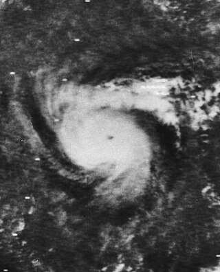
<span class="mw-page-title-main">Hurricane Celia</span> Category 4 Atlantic hurricane in 1970

Hurricane Celia was the costliest tropical cyclone in Texas history until Hurricane Alicia in 1983. The third named storm, second hurricane, and first major hurricane of the 1970 Atlantic hurricane season, Celia developed from a tropical wave in the western Caribbean Sea on July 31. Initially, the depression tracked north-northwestward, crossing over western Cuba on August 1 and becoming Tropical Storm Celia. Heavy rains on the island caused severe flooding, leading to five fatalities. The storm entered the Gulf of Mexico, and due to the warm sea surface temperatures, Celia intensified into a hurricane later that day. Storm surge and swells lashed the west coast of Florida, especially the Panhandle, causing eight people to drown. On August 2 and early on August 3, Celia slightly weakened, however, the storm underwent rapid intensification and deepening, and peaked as a Category 4 hurricane at landfall with winds of 140 mph (220 km/h) later on August 3.

<span class="mw-page-title-main">Timeline of the 1983 Atlantic hurricane season</span>

The 1983 Atlantic hurricane season was an event in the annual tropical cyclone season in the north Atlantic Ocean. It was the least active Atlantic hurricane season in 53 years, during which four storms formed. The season officially began on June 1, 1983 and ended November 30, 1983. These dates, adopted by convention, historically describe the period in each year when most systems form. The first named storm, Hurricane Alicia, formed on August 15. The last storm of the season, Tropical Storm Dean, dissipated on September 30.

<span class="mw-page-title-main">2014 Atlantic hurricane season</span>

The 2014 Atlantic hurricane season was a well below-average hurricane season in terms of named storms while the number of hurricanes and major hurricanes, were overall average. It produced nine tropical cyclones, eight of which became named storms; six storms became hurricanes and two intensified further into major hurricanes. The season officially began on June 1, and ended on November 30. These dates historically describe the period each year when most tropical cyclones form in the Atlantic basin. The first storm of the season, Arthur, developed on July 1, while the final storm, Hanna, dissipated on October 28, about a month prior to the end of the season.

<span class="mw-page-title-main">Timeline of the 1985 Atlantic hurricane season</span>

The 1985 Atlantic hurricane season was an event in the annual Atlantic hurricane season in the north Atlantic Ocean. It featured average activity overall, with thirteen tropical cyclones, eleven tropical storms, seven hurricanes, and three major hurricanes. The season officially began on June 1, 1985 and ended November 30, 1985. These dates, adopted by convention, historically describe the period in each year when most systems form. The season's first storm, Tropical Storm Ana, developed on July 15; the season's final storm, Tropical Depression Thirteen, dissipated on December 9.

<span class="mw-page-title-main">Timeline of the 2013 Atlantic hurricane season</span>

The 2013 Atlantic hurricane season was an event in the annual hurricane season in the north Atlantic Ocean. It featured below-average tropical cyclone activity, with the fewest hurricanes since the 1982 season. The season officially began on June 1, 2013 and ended on November 30, 2013. These dates, adopted by convention, historically delimit the period in each year when most tropical systems form. The season's first storm, Tropical Storm Andrea formed on June 5, and its final storm, an unnamed subtropical storm, dissipated on December 7. Altogether, there were 13 named tropical storms during the season. Two of which attained hurricane strength, but neither intensified into a major hurricane, the first such occurrence since the 1994 season.

References

  1. 1 2 Hurricane Research Division (March 2011). "Atlantic basin Comparison of Original and Revised HURDAT". National Oceanic and Atmospheric Administration. Retrieved July 30, 2013.
  2. CONUS Landfalls (AOML)
  3. 1 2 3 William E. Schultz (June 1, 1985). "Hurricane Season Smells of Disaster". The Albany Herald . Atlanta, Georgia. Associated Press. p. 5. Retrieved July 28, 2013.
  4. 1 2 3 4 Background information: the North Atlantic Hurricane Season. Climate Prediction Center (Report). College Park, Maryland: National Oceanic and Atmospheric Administration. May 27, 2010. Retrieved March 30, 2011.
  5. 1 2 "North Atlantic Ocean Historical Tropical Cyclone Statistics". Fort Collins, Colorado: Colorado State University. Retrieved July 18, 2023.
  6. 1 2 Jill F. Hasling (May 1, 2008). "Comparison of Weather Research Center's OCSI Atlantic Annual Seasonal Hurricane Forecasts with Colorado State Professor Bill Gray's Seasonal Forecast" (PDF). Weather Research Center. Archived from the original (PDF) on March 3, 2016. Retrieved November 19, 2011.
  7. 1 2 3 4 5 "Forecast Verifications". Fort Collins, Colorado: Colorado State University. 2011. Archived from the original on December 14, 2013. Retrieved July 28, 2013.
  8. Stan Goldberg; Hurricane Research Division. Subject: A3) What is a super-typhoon? What is a major hurricane ? What is an intense hurricane?. Atlantic Oceanographic and Meteorological Laboratory (Report). Miami, Florida: National Oceanic and Atmospheric Administration . Retrieved July 28, 2013.
  9. 1 2 3 4 5 Robert A. Case (July 1986). Atlantic Hurricane Season of 1985 (PDF). Atlantic Oceanographic and Meteorological Laboratory (Report). Monthly Weather Review. Miami, Florida: National Oceanic and Atmospheric Administration. pp. 1390–1405. Retrieved July 28, 2013.
  10. 1 2 3 4 5 6 7 8 "Atlantic hurricane best track (HURDAT version 2)" (Database). United States National Hurricane Center. April 5, 2023. Retrieved November 1, 2024.PD-icon.svg This article incorporates text from this source, which is in the public domain.
  11. Cold & warm episodes by season. Climate Prediction Center (Report). College Park, Maryland: National Oceanic and Atmospheric Administration. July 5, 2013. Retrieved July 28, 2013.
  12. Miles B. Lawrence (August 8, 1985). Preliminary Report: Hurricane Bob 21-26 July 1985. National Hurricane Center (Report). Miami, Florida: National Oceanic and Atmospheric Administration. p. 2. Retrieved July 29, 2013.
  13. David Levinson (August 20, 2008). 2005 Atlantic Ocean Tropical Cyclones (Report). Asheville, North Carolina: National Climatic Data Center. Archived from the original on December 1, 2005. Retrieved July 30, 2013.
  14. Preliminary Report: Tropical Storm Ana 15-19 July 1985. National Hurricane Center (Report). Miami, Florida: National Oceanic and Atmospheric Administration. 1985. p. 1. Retrieved December 11, 2012.
  15. 1 2 Preliminary Report: Tropical Storm Ana 15-19 July 1985. National Hurricane Center (Report). Miami, Florida: National Oceanic and Atmospheric Administration. 1985. p. 2. Retrieved December 11, 2012.
  16. 1985-Ana (Report). Moncton, New Brunswick: Environment Canada. September 15, 2010. Archived from the original on November 18, 2018. Retrieved February 24, 2021.
  17. Miles B. Lawrence (August 8, 1985). Preliminary Report: Hurricane Bob 21-26 July 1985. National Hurricane Center (Report). Miami, Florida: National Oceanic and Atmospheric Administration. p. 3. Retrieved July 29, 2013.
  18. 1 2 3 4 Roth, David M. (January 3, 2023). "Tropical Cyclone Point Maxima". Tropical Cyclone Rainfall Data. United States Weather Prediction Center. Retrieved January 6, 2023.PD-icon.svg This article incorporates text from this source, which is in the public domain.
  19. Mike Kelly (July 24, 1985). "South wind to bring steamy heat". Syracuse Herald-Journal .
  20. Historical Chronology of Palm Beach County Flood Events (Report). Palm Beach County Government. Archived from the original on July 21, 2012. Retrieved July 29, 2013.
  21. "Bob leaves thousands homeless". The News. Associated Press. July 25, 1985.
  22. 1 2 Miles B. Lawrence (August 8, 1985). Preliminary Report: Hurricane Bob 21-26 July 1985. National Hurricane Center (Report). Miami, Florida: National Oceanic and Atmospheric Administration. p. 2. Retrieved July 29, 2013.
  23. "Virginia's Weather History". Virginia Department of Emergency Management. Archived from the original on December 26, 2010. Retrieved July 29, 2013.
  24. "Remnants of Hurricane Bob drops heavy rains on Northeast". Syracuse Herald-Journal. Associated Press. July 26, 1985.
  25. Martin Weil (July 26, 1985). "Storm, Fierce Winds Lash Area". The Washington Post . p. C1.
  26. 1 2 David M. Roth (July 16, 2001). Late Twentieth Century (Report). College Park, Maryland: Weather Prediction Center . Retrieved July 29, 2013.
  27. Karl E. Cocke (1995). "Chapter 8. Civil Works". In Marilee S. Morgan (ed.). Department of the Army Historical Summary: Fiscal Year 1985 (Report). Washington, D.C.: Center of Military History, United States Army. p. 81. ISSN   0092-7880. Archived from the original on October 11, 2012. Retrieved July 29, 2013.
  28. 1 2 Harold B. Gerrish (September 29, 1985). Preliminary Report Hurricane Claudette 9-17 August 1985. National Hurricane Center (Report). Miami, Florida: National Oceanic and Atmospheric Administration. p. 1. Retrieved July 29, 2013.
  29. Robert C. Sheets (September 18, 1985). Preliminary Report: Hurricane Danny 12-20 August 1985. National Hurricane Center (Report). Miami, Florida: National Oceanic and Atmospheric Administration. p. 1. Retrieved July 29, 2013.
  30. Robert C. Sheets (September 18, 1985). Preliminary Best Track Hurricane Danny 12-20 August 1985. National Hurricane Center (Report). Miami, Florida: National Oceanic and Atmospheric Administration. p. 4. Retrieved July 29, 2013.
  31. 1 2 3 4 Robert C. Sheets (September 18, 1985). Preliminary Report: Hurricane Danny 12-20 August 1985. National Hurricane Center (Report). Miami, Florida: National Oceanic and Atmospheric Administration. p. 2. Retrieved July 29, 2013.
  32. Storm Data and Unusual Weather Phenomena: August 1985 (PDF). National Climatic Data Center (Report). Asheville, North Carolina: National Oceanic and Atmospheric Administration. p. 27. Archived from the original (PDF) on February 24, 2021. Retrieved February 24, 2021.
  33. "Carolinas feel remnants of Hurricane Danny". The Robesonian . August 15, 1985. Retrieved July 29, 2013.
  34. 1 2 Preliminary Report Hurricane Elena 28 August - 4 September 1985. National Hurricane Center (Report). Miami, Florida: National Oceanic and Atmospheric Administration. 1985. p. 1. Retrieved July 29, 2013.
  35. Preliminary Report Hurricane Elena 28 August - 4 September 1985. National Hurricane Center (Report). Miami, Florida: National Oceanic and Atmospheric Administration. 1985. p. 2. Retrieved July 29, 2013.
  36. Barnes, p. 252
  37. Jon Nordheimer (October 6, 1985). "Hurricane Elena leaves Apalachicola Bay oyster industry devastated". The Lakeland Ledger. Apalachicola, Florida. Associated Press. Retrieved April 6, 2013.
  38. Mark E. Berrigan (March 1987). "Management of Oyster Resources in Apalachicola Bay Following Hurricane Elena" (PDF). Journal of Shellfish Research. 7 (2). Tallahassee, Florida: 281–288. Archived from the original (PDF) on 2021-08-20. Retrieved April 6, 2013.
  39. Richard A. Davis Jr. and Albert C. Hine (1989). Quaternary Geology and Sediment of the Barrier Island and Marshy Coast, West-Central Florida, U.S.A. Washington, D.C.: American Geophysical Union. p. 13. ISBN   0-87590-576-5.
  40. Sparks, p. 17
  41. Wesley Loy (September 2, 1985). "Lake County Residents Try To Salvage What Twister Smashed". The Orlando Sentinel. Leesburg, Florida. Archived from the original on July 1, 2014. Retrieved March 18, 2013.
  42. Dan Powell (September 1, 1985). "Tornado Rips Through Homes: Tropicana Feels Wrath Of Hurricane". The Ocala Sun-Star. Retrieved March 18, 2013.
  43. United Press International (September 3, 1985). "Tornadoes hit Mississippi shelters". St. Petersburg Times. Gulfport, Mississippi. Retrieved July 30, 2013.
  44. Barry Bearak and J. Michael Kennedy (September 3, 1985). "Storm Rips Into Coastal Mississippi: Damage Is Massive in 35-Mile Strip; Injuries Are Minor". The Los Angeles Times. Biloxi, Mississippi. Retrieved April 3, 2013.
  45. National Climatic Data Center (2024). Billion-Dollar Weather and Climate Disasters: Events (Report). College Park, Maryland: National Oceanic and Atmospheric Administration. Retrieved September 27, 2021.
  46. Jay Barnes (2007). Florida's Hurricane History. Chapel Hill Press. p. 254255. ISBN   978-0-8078-3068-0.
  47. "Elena roars ashore". The Spokane Chronicle. Associated Press. September 2, 1985. Retrieved March 18, 2013.
  48. Storer Rowley and Michael Hirsley (September 3, 1985). "Hurricane Thrashes Gulf States". The Chicago Tribune. Retrieved March 20, 2013.
  49. "Remnants of Hurricane Elena Cause West Kentucky Flooding". The Harlan Daily Enterprise. Associated Press. September 6, 1985. Retrieved March 17, 2013.
  50. United Press International (September 3, 1985). "Casualties light amid Elena damage". The Telegraph. Retrieved April 4, 2013.
  51. 1 2 3 Preliminary Report Tropical Storm Fabian 15-19 September 1985. National Hurricane Center (Report). Miami, Florida: National Oceanic and Atmospheric Administration. 1985. p. 1. Retrieved July 29, 2013.
  52. Miles B. Lawrence (November 3, 1985). Preliminary Report: Hurricane Gloria 16-27 September 1985. National Hurricane Center (Report). Miami, Florida: National Oceanic and Atmospheric Administration. p. 1. Retrieved July 29, 2013.
  53. 1 2 Miles B. Lawrence (November 3, 1985). Table 1. Preliminary best track: Hurricane Gloria 16-27 September 1985. National Hurricane Center (Report). Miami, Florida: National Oceanic and Atmospheric Administration. p. 4. Retrieved July 29, 2013.
  54. Miles B. Lawrence (November 3, 1985). Table 1. (continued) Preliminary best track: Hurricane Gloria 16-27 September 1985. National Hurricane Center (Report). Miami, Florida: National Oceanic and Atmospheric Administration. p. 5. Retrieved July 29, 2013.
  55. 1 2 Miles B. Lawrence (November 3, 1985). Preliminary Report: Hurricane Gloria 16-27 September 1985. National Hurricane Center (Report). Miami, Florida: National Oceanic and Atmospheric Administration. p. 3. Retrieved July 29, 2013.
  56. 1 2 3 4 Storm Data and Unusual Weather Phenomena: September 1985 (PDF). National Climatic Data Center (Report). Asheville, North Carolina: National Oceanic and Atmospheric Administration. pp. 30, 37–38, 41. Archived from the original (PDF) on February 24, 2021. Retrieved February 24, 2021.
  57. Harold B. Gerrish (October 16, 1985). Preliminary Report: Tropical Storm Henri 21-25 September 1985. National Hurricane Center (Report). Miami, Florida: National Oceanic and Atmospheric Administration. p. 1. Retrieved July 29, 2013.
  58. 1 2 Harold B. Gerrish (October 16, 1985). Preliminary Best Track...Tropical Storm Henri 21-25 September 1985. National Hurricane Center (Report). Miami, Florida: National Oceanic and Atmospheric Administration. p. 5. Retrieved July 29, 2013.
  59. David M. Roth (June 17, 2007). Tropical Storm Henri - September 22-25, 1985. Hydrometeorological Prediction Center (Report). College Park, Maryland: National Oceanic and Atmospheric Administration. Retrieved July 29, 2013.
  60. 1 2 3 Robert C. Sheets (November 5, 1985). Preliminary Report: Tropical Storm Isabel 7 to 15 October 1985. National Hurricane Center (Report). Miami, Florida: National Oceanic and Atmospheric Administration. p. 1. Retrieved July 29, 2013.
  61. Storm Data and Unusual Weather Phenomena: October 1985 (PDF). National Climatic Data Center (Report). Asheville, North Carolina: National Oceanic and Atmospheric Administration. p. 30. Archived from the original (PDF) on February 25, 2021. Retrieved July 29, 2013.
  62. Robert C. Sheets (November 5, 1985). Preliminary Best Track: Tropical Storm Isabel 7 to 15 October 1985. National Hurricane Center (Report). Miami, Florida: National Oceanic and Atmospheric Administration. p. 3. Retrieved July 29, 2013.
  63. David M. Roth (June 21, 2007). Tropical Storm Isabel - October 4-16, 1985. Weather Prediction Center (Report). College Park, Maryland: National Oceanic and Atmospheric Administration. Retrieved July 29, 2013.
  64. 1 2 Preliminary Report: Hurricane Juan 26 October-1 November 1985. National Hurricane Center (Report). Miami, Florida: National Oceanic and Atmospheric Administration. 1985. p. 1. Retrieved July 29, 2013.
  65. 1 2 3 Storm Data and Unusual Weather Phenomena: November 1985 (PDF). National Climatic Data Center (Report). Asheville, North Carolina: National Oceanic and Atmospheric Administration. pp. 16–17, 22–23, 26–27. Archived from the original (PDF) on February 25, 2021. Retrieved July 29, 2013.
  66. 1 2 Preliminary Report: Hurricane Juan 26 October-1 November 1985. National Hurricane Center (Report). Miami, Florida: National Oceanic and Atmospheric Administration. 1985. p. 3. Retrieved July 29, 2013.
  67. D. H. Carpenter (1990). Floods in West Virginia, Virginia, Pennsylvania, Pennsylvania, and Maryland, November 1985 (PDF). United States Geological Survey (Report). Towson, Maryland: United States Department of the Interior. p. 37. Retrieved July 30, 2013.
  68. Robert A. Case (December 10, 1985). Preliminary Report: Hurricane Kate 15-23 November 1985. National Hurricane Center (Report). Miami, Florida: National Oceanic and Atmospheric Administration. p. 1. Retrieved July 29, 2013.
  69. Robert A. Case (December 10, 1985). Preliminary Report: Hurricane Kate 15-23 November 1985. National Hurricane Center (Report). Miami, Florida: National Oceanic and Atmospheric Administration. p. 2. Retrieved July 29, 2013.
  70. Robert A. Case (December 10, 1985). Preliminary Report: Hurricane Kate 15-23 November 1985. National Hurricane Center (Report). Miami, Florida: National Oceanic and Atmospheric Administration. p. 3. Retrieved July 29, 2013.
  71. 1 2 3 4 5 Ralph Clark (September 1986). Hurricane Kate November 15-23, 1985 (PDF) (Report). Tallahassee, Florida: Florida Department of Natural Resources. Archived from the original (PDF) on 2015-09-27. Retrieved 2012-05-15.
  72. UNDRO Situation Report No. 3. United Nations Office for the Coordination of Humanitarian Affairs (Report). Geneva, Switzerland: ReliefWeb. December 19, 1985. Retrieved July 31, 2013.
  73. Roger A. Pielke Jr.; Jose Rubiera; Christopher Landsea; Mario L. Fernández; Roberta Klein (August 2003). "Hurricane Vulnerability in Latin America and The Caribbean: Normalized Damage and Loss Potentials" (PDF). National Hazards Review. Miami, Florida: National Oceanic and Atmospheric Administration: 108. Retrieved 2012-05-25.
  74. Mary Anne Rhyne (November 22, 1985). "Kate's Calling Card: Power Outages, Blocked Roads". Associated Press News. Tallahassee, Florida. Retrieved July 31, 2013.
  75. National Hurricane Operations Plan (PDF) (Report). Washington, D.C.: NOAA Office of the Federal Coordinator for Meteorological Services and Supporting Research. May 1985. p. 3-7. Retrieved January 17, 2024.
  76. "Hurricane-force Warning Issued For '85". The Palm Beach Post . Associated Press. May 30, 1985. p. A1. Retrieved February 24, 2021 via Newspapers.com. Lock-green.svg
  77. National Hurricane Operations Plan (PDF) (Report). Washington, D.C.: NOAA Office of the Federal Coordinator for Meteorological Services and Supporting Research. May 1979. p. 9. Retrieved January 17, 2024.
  78. "This Season, it's Bob, Juan, and Larry". Eugene Register-Guard . Eugene, Oregon. Associated Press. May 27, 1979. Retrieved July 27, 2013.
  79. 1 2 "Tropical Cyclone Naming History and Retired Names". Miami, Florida: National Hurricane Center. Retrieved January 17, 2024.
  80. National Hurricane Operations Plan (PDF) (Report). Washington, D.C.: NOAA Office of the Federal Coordinator for Meteorological Services and Supporting Research. April 1991. p. 3-6. Retrieved January 17, 2024.
  81. "Ana, Bob, Claudette first hurricane names". Portsmouth Daily Times. Portsmouth, Ohio. Associated Press. June 2, 1991. Retrieved July 27, 2013.