Bloom Site

Last updated

Bloom Site
Bloom Site.jpg
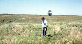
Man standing at the site
LocationAddress restricted [1]
Nearest city Bloom, South Dakota
NRHP reference No. 66000714 [2]
Significant dates
Added to NRHPOctober 15, 1966
Designated NHLJuly 19, 1964 [3]

The Bloom Site, designated by the Smithsonian trinomial 39HS1, is an archaeological site in Hanson County, South Dakota. It was declared a National Historic Landmark in 1964. [3]

The site is located in the watershed of the James River. It contains the remains of a prehistoric fortified site, which was last inhabited about 1000 CE. Archaeologists have assigned it to the Lower James phase or Initial Middle Missouri phase of the Middle Missouri tradition. [4] The site is one of four sites that form part of this phase that exhibit fairly intensive usage patterns, and differ in their ceramics from surrounding sites. [5] The region was largely abandoned about 1300, in part due to the relatively poor quality of the land, which contributed to a sparse settlement pattern at the time. [4] Finds at the site include the remains of blue-winged teal. [6]

At the time of the landmark designation in 1964, it was stated:

A well-preserved example of a prehistoric fortified Over Focus Indian site (c. 1000), the ancestors of the Mandan Indians may have lived here. About 25 depressions mark the locations of rectangular houses. Prior to their destruction by cultivation, some 50 burial mounds, ranging up to 200 feet in diameter and from 3 to 10 feet high, also marked the site. [3]

See also

Related Research Articles

<span class="mw-page-title-main">Crow Creek massacre</span> United States historic place

The Crow Creek massacre occurred around the mid-14th century AD and involved Native American groups at a site along the upper Missouri River in the South Dakota area; it is now within the Crow Creek Indian Reservation. Crow Creek Site, the site of the massacre near Chamberlain, is an archaeological site and a U.S. National Historic Landmark, located at coordinates 43°58′48″N 99°19′54″W. An excavation of part of the site was done in the 1950s, at the time of dam construction on the river. Additional excavations were conducted in 1978 and later.

<span class="mw-page-title-main">Hagen Site</span> United States historic place

The Hagen Site, also designated by the Smithsonian trinomial 24DW1, is an archaeological site near Glendive in Dawson County, Montana. The site, excavated in the 1930s, is theorized to represent a rare instance of a settlement from early in the period in which the Crow and Hidatsa Native American tribes separated from one another. It was declared a National Historic Landmark in 1964.

<span class="mw-page-title-main">Huff Archeological Site</span> United States historic place

The Huff Archeological Site is a prehistoric Mandan village in North Dakota dated around 1450 AD. It was discovered in the early 1900s. The site has been designated a National Historic Landmark, and is one of the best preserved sites of the period.

<span class="mw-page-title-main">Arzberger site</span> United States historic place

The Arzberger site, designated by archaeologists with the Smithsonian trinomial 39HU6, is a major archaeological site in Hughes County, near Pierre, South Dakota. It was declared a National Historic Landmark in 1964. It is a large fortified village, that is the type site for the Initial Coalescent, a culture that flourished in the area c. 1200-1350 CE.

The Vanderbilt Archeological Site is an archaeological site located on the shore of Lake Oahe in Campbell County, South Dakota, near Pollock, South Dakota. The site contains the remains of a Native American Plains village which has been tentatively dated to about 1300 AD. Despite the fact that the site is subject to erosive destruction from wave action on the lake, it has been determined likely to yield significant information about the movements and living patterns of prehistoric Native Americans in the region. The site was declared a National Historic Landmark in 1997.

<span class="mw-page-title-main">Langdeau Site</span> United States historic place

The Langdeau Site, designated by the Smithsonian trinomial 39LM209, is an archaeological site in Lyman County, South Dakota, near Lower Brule. It was declared a National Historic Landmark in 1964. The site was one of the first to provide evidence of horticultural activity by Native Americans in the region.

<span class="mw-page-title-main">Mitchell Site</span> United States historic place

The Mitchell Site, designated by the Smithsonian trinomial 39DV2, is an important archaeological site in Mitchell, Davison County, South Dakota. It was declared a National Historic Landmark in 1964. At that time it was the only reliably dated site of the Lower James River Phase. The site, sheltered under a dome, is managed by a nonprofit organization and is open to the public as Mitchell Prehistoric Indian Village. Visitors can watch archaeologists uncover artifacts in the Thomsen Center Archeodome. The Boehnen Memorial Museum features a reconstructed lodge and many of the artifacts found at the site.

<span class="mw-page-title-main">Molstad Village</span> United States historic place

Molstad Village, designated by the Smithsonian trinomial 39DW234, is an archaeological site in Dewey County, South Dakota, United States, near the city of Mobridge. It was declared a National Historic Landmark in 1964. The site contains the remains of a small fortified Native America village, consisting of earth lodges surrounded by a bastioned palisade, with further lodges scattered in the area outside the fortification. Evidence gathered at the site indicates it was occupied for a relatively brief period in the mid-1500s CE, and was assigned to the Chouteau aspect of Middle Missouri taxonomy, later known as the Extended Coalescent phase. Four lodge sites were excavated in the early 1960s, uncovering post holes and cache pits, one of which contained skull-less human remains. Finds at the site included pottery fragments and stone tools. Bone tools were also found, including plows made from bison shoulder blades.

<span class="mw-page-title-main">National Register of Historic Places listings in Custer County, South Dakota</span>

This is a list of the National Register of Historic Places listings in Custer County, South Dakota.

<span class="mw-page-title-main">National Register of Historic Places listings in Harding County, South Dakota</span>

This is a list of the National Register of Historic Places listings in Harding County, South Dakota.

<span class="mw-page-title-main">National Register of Historic Places listings in Buffalo County, South Dakota</span>

This is a list of the National Register of Historic Places listings in Buffalo County, South Dakota.

<span class="mw-page-title-main">National Register of Historic Places listings in Campbell County, South Dakota</span>

This is a list of the National Register of Historic Places listings in Campbell County, South Dakota.

<span class="mw-page-title-main">National Register of Historic Places listings in Davison County, South Dakota</span>

This is a list of the National Register of Historic Places listings in Davison County, South Dakota.

<span class="mw-page-title-main">National Register of Historic Places listings in Hanson County, South Dakota</span>

This is a list of the National Register of Historic Places listings in Hanson County, South Dakota.

<span class="mw-page-title-main">National Register of Historic Places listings in Hughes County, South Dakota</span>

This is a list of the National Register of Historic Places listings in Hughes County, South Dakota.

<span class="mw-page-title-main">National Register of Historic Places listings in Jackson County, South Dakota</span>

This is a list of the National Register of Historic Places listings in Jackson County, South Dakota.

<span class="mw-page-title-main">National Register of Historic Places listings in Potter County, South Dakota</span>

This is a list of the National Register of Historic Places listings in Potter County, South Dakota.

<span class="mw-page-title-main">National Register of Historic Places listings in Sully County, South Dakota</span>

This is a list of the National Register of Historic Places listings in Sully County, South Dakota.

<span class="mw-page-title-main">National Register of Historic Places listings in New Madrid County, Missouri</span>

This is a list of the National Register of Historic Places listings in New Madrid County, Missouri.

<span class="mw-page-title-main">Kimball Village</span> United States historic place

Kimball Village is an archaeological site located in the vicinity of Westfield, Iowa, United States. It is one of six known Big Sioux phase villages from the Middle Missouri tradition that existed between 1100-1250 C.E. The site, located on a terrace overlooking the Big Sioux River, has well-preserved features, including earth lodge and storage pits, and evidence of fortifaction. The site was listed on the National Register of Historic Places in 2010, and as a National Historic Landmark in 2016.

References

  1. Federal and state laws and practices restrict general public access to information regarding the specific location of this resource. In some cases, this is to protect archeological sites from vandalism, while in other cases it is restricted at the request of the owner. See: Knoerl, John; Miller, Diane; Shrimpton, Rebecca H. (1990), Guidelines for Restricting Information about Historic and Prehistoric Resources, National Register Bulletin, National Park Service, U.S. Department of the Interior, OCLC   20706997 .
  2. "National Register Information System". National Register of Historic Places . National Park Service. July 9, 2010.
  3. 1 2 3 "Bloom Site". National Historic Landmark summary listing. National Park Service. Archived from the original on June 14, 2009. Retrieved June 14, 2008.
  4. 1 2 "A Chronology of Middle Missouri Plains Village Sites" (PDF). Smithsonian Institution. Retrieved December 23, 2017.
  5. Haberman, Thomas (1993). "The Randall Phase Component at the Dirt Lodge Village Site, Spink County, South Dakota: Late Woodland/Early Plains Village Transitions on the Northeastern Plains". Plains Anthropologist. 38 (145): 75–116. doi:10.1080/2052546.1993.11931646. JSTOR   25669183.
  6. Parris, David; Higgins, Kenneth (2010). "WATERFOWL IN THE PREHISTORY OF SOUTH DAKOTA" (PDF). Proceedings of the South Dakota Academy of Science. Retrieved December 24, 2017.