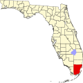
East Perrine, Florida | |
---|---|
Coordinates: 25°36′27″N80°20′27″W / 25.60750°N 80.34083°W Coordinates: 25°36′27″N80°20′27″W / 25.60750°N 80.34083°W | |
Country | |
State | |
County | Miami-Dade |
Area | |
• Total | 2.0 sq mi (5.1 km2) |
• Land | 2.0 sq mi (5.1 km2) |
• Water | 0.0 sq mi (0.0 km2) |
Elevation | 13 ft (4 m) |
Population (2000) | |
• Total | 7,079 |
• Density | 3,586.2/sq mi (1,384.6/km2) |
Time zone | UTC-5 (Eastern (EST)) |
• Summer (DST) | UTC-4 (EDT) |
FIPS code | 12-19387 [1] |
GNIS feature ID | 1853248 [2] |
East Perrine was a census-designated place in Miami-Dade County, Florida at the time of the 2000 census. In the 1990 census it was part of Perrine census-designated place. It has since been incorporated into the Village of Palmetto Bay. The population was 7,079 at the 2000 census.
The Village of Palmetto Bay incorporated on September 10, 2002, taking the territory formerly held by the East Perrine census-designated place. [3] [4] East Perrine's name was derived from the name of Henry Perrine an agriculturist (among other things) who had been granted land in the area.
East Perrine is located at 25°36′27″N80°20′27″W / 25.60750°N 80.34083°W (25.607383, -80.340967). [5]
According to the United States Census Bureau, the CDP has a total area of 5.1 km2 (2.0 mi2), all land.
As of the census [1] of 2000, there were 7,079 people, 2,276 households, and 1,852 families residing in the CDP. The population density was 1,387.4/km2 (3,586.2/mi2). There were 2,339 housing units at an average density of 458.4/km2 (1,184.9/mi2). The racial makeup of the CDP was 72.44% White (48.2% were Non-Hispanic White,) [6] 16.87% African American, 0.16% Native American, 2.39% Asian, 0.04% Pacific Islander, 3.74% from other races, and 4.37% from two or more races. Hispanic or Latino of any race were 30.09% of the population.
There were 2,276 households, out of which 44.8% had children under the age of 18 living with them, 61.2% were married couples living together, 15.2% had a female householder with no husband present, and 18.6% were non-families. 14.3% of all households were made up of individuals, and 3.9% had someone living alone who was 65 years of age or older. The average household size was 3.03 and the average family size was 3.34.
In the CDP, the population was spread out, with 28.7% under the age of 18, 8.0% from 18 to 24, 30.8% from 25 to 44, 23.3% from 45 to 64, and 9.2% who were 65 years of age or older. The median age was 35 years. For every 100 females, there were 91.1 males. For every 100 females age 18 and over, there were 88.9 males.
The median income for a household in the CDP was $60,395, and the median income for a family was $66,852. Males had a median income of $42,398 versus $35,660 for females. The per capita income for the CDP was $23,165. About 6.9% of families and 7.8% of the population were below the poverty line, including 12.4% of those under age 18 and 0.9% of those age 65 or over.
As of 2000, before being annexed to Palmetto Bay, English as a first language accounted for 66.62% of all residents, while Spanish comprised 30.22%, French Creole was at 1.64%, and French as a mother tongue made up 1.49% of the population. [7]
East Perrine was served by Miami-Dade County Public Schools. Perrine Elementary School had been located in East Perrine. [4]
Perrine Seventh-Day Adventist School was located in East Perrine. [8]
Prairie Creek is a census-designated place (CDP) in Benton County, Arkansas, United States. The population was 2,066 at the 2010 census. It is a lakefront community adjacent to Beaver Lake and Rogers within the Northwest Arkansas region.
Andover is a neighborhood in Miami Gardens, Florida, United States. It was formerly a census-designated place. The population was 8,489 at the 2000 census.
Bunche Park is a neighborhood in Miami Gardens, Florida, United States. It was formerly a census-designated place.
Cutler was a pioneer town in Miami-Dade County, Florida that existed from 1883 to 1915, when most of it was absorbed into the Charles Deering Estate. The area adjoining the western border of the estate later became the Cutler census-designated place (CDP) through the time of the 2000 census, after which it was incorporated into the Village of Palmetto Bay. The population was 17,390 at the 2000 census.
Gladeview is a census-designated place (CDP) in Miami-Dade County, Florida, United States. The population was 11,535 at the 2010 census.
Glenvar Heights is a census-designated place (CDP) and neighborhood in Miami-Dade County, Florida, United States. The population was 16,898 at the 2010 census. The zip codes serving Glenvar Heights are 33173, 33143, and 33155.
Golden Glades is a census-designated place (CDP) in Miami-Dade County, Florida, United States. The population was 33,145 at the 2010 census.
Goulds is a census-designated place (CDP) in Miami-Dade County, within the U.S. state of Florida. The area was originally populated as the result of a stop on the Florida East Coast Railroad. The railroad depot was located near the current Southwest 224th Street. The community was named after its operator, Lyman Gould, who cut trees for railroad ties. As of the 2009 census, the population stood at 10,103.
Kendall West(Previously known as West Kendall) is a census-designated place and an unincorporated community in Miami-Dade County, Florida, west of the Florida Turnpike. The population was 38,034 at the 2000 census.
Lakes by the Bay is a neighborhood and former census-designated place (CDP) in Miami-Dade County, Florida, United States. The population was 9,055 at the 2000 census. In 2005, the area of the CDP was included in the town of Cutler Bay.
Palmetto Estates is a census-designated place (CDP) in Miami-Dade County, Florida, United States. The population was 13,675 at the 2000 census.
Princeton is a census-designated place (CDP) and unincorporated community in Miami-Dade County, Florida, United States. The population was 22,038 at the 2010 census.
Scott Lake is a neighborhood in Miami Gardens, Florida, United States. It was formerly its own census-designated place. The population was 14,401 at the 2000 census.
Sunset is a census-designated place (CDP) and affluent neighborhood in Miami-Dade County, Florida, United States. The population was 16,389 at the 2010 census. The zip-codes serving Sunset are 33173, 33183, and 33193.
The Hammocks is an unincorporated census-designated place in Miami-Dade County, Florida, United States. The population was 51,003 at the 2010 census.
West Perrine is a census-designated place (CDP) in Miami-Dade County, Florida, United States. Prior to the 2000 census it was part of Perrine. The other part of Perrine became the East Perrine CDP for the 2000 census and is now part of the incorporated Village of Palmetto Bay. West Perrine is still an unincorporated area, although some residents have discussed the possibility of incorporating Perrine. The population was 8,600 at the 2000 census. The name derives from a land grant issued to Henry Perrine and agriculturist.
Westwood Lakes is a census-designated place (CDP) in Miami-Dade County, Florida, United States. The population was 11,838 at the 2010 census.
White Plains is a census-designated place (CDP) in Surry County, North Carolina, United States. The population was 1,049 at the 2000 census.
Palmetto Bay is a suburban incorporated village in Miami-Dade County, Florida, United States. The population was 23,410 during the 2010 US census.
Perrine, Florida was an unincorporated community in Miami-Dade County, Florida, United States, about midway between Miami and Homestead. It is at 25°36′18″N80°21′13″W The community was named after Henry Perrine, who in 1839 had been granted a survey township of land in the area by the United States Congress in recognition of his service as United States Consul in Campeche, Mexico, and to support his plans to introduce new plants from tropical countries into cultivation in the United States.