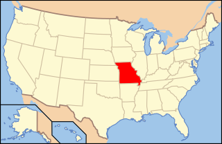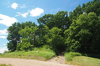
This is a list of the National Register of Historic Places listings in St. Louis County, Missouri.

This is a list of properties and historic districts in Missouri on the National Register of Historic Places. There are NRHP listings in all of Missouri's 114 counties and the one independent city of St. Louis.
The Steed-Kisker culture is a cultural phase that is part of the larger Central Plains Village tradition of the Plains Village period. This term applies to the prehistoric peoples who occupied the Great Plains region of the modern-day United States in prehistoric times.

The Whiteford (Price) Archeological Site, designated by the Smithsonian trinomial 14SA1, is an archaeological site located in a rural area between Salina and New Cambria, Kansas, United States. A National Historic Landmark, the site is significant as an important Central Plains habitation site, with an unusually well-preserved burial complex. The site is on private land, and is not open to the public.

Leary Site, also known as 25-RH-1 or Leary-Kelly Site is an archaeological site near Rulo, Nebraska and the Big Nemaha River. The site now lies entirely on the reservation of the Iowa Tribe of Kansas and Nebraska. The area was once a village and burial site.

The following is an alphabetical list of articles related to the U.S. state of Missouri.

The archaeology of Iowa is the study of the buried remains of human culture within the U.S. state of Iowa from the earliest prehistoric through the late historic periods. When the American Indians first arrived in what is now Iowa more than 13,000 years ago, they were hunters and gatherers living in a Pleistocene glacial landscape. By the time European explorers visited Iowa, American Indians were largely settled farmers with complex economic, social, and political systems. This transformation happened gradually. During the Archaic period American Indians adapted to local environments and ecosystems, slowly becoming more sedentary as populations increased. More than 3,000 years ago, during the Late Archaic period, American Indians in Iowa began utilizing domesticated plants. The subsequent Woodland period saw an increase on the reliance on agriculture and social complexity, with increased use of mounds, ceramics, and specialized subsistence. During the Late Prehistoric period increased use of maize and social changes led to social flourishing and nucleated settlements. The arrival of European trade goods and diseases in the Protohistoric period led to dramatic population shifts and economic and social upheaval, with the arrival of new tribes and early European explorers and traders. During the Historical period European traders and American Indians in Iowa gave way to American settlers and Iowa was transformed into an agricultural state.

The Utz Site, designated by the Smithsonian trinomial 23SA2, is a major Native American archaeological site in Saline County, Missouri, located on bluffs overlooking the Missouri River. Partially preserved in Van Meter State Park, it is the site of one of the largest early Contact Native villages in the region, which was occupied by the Missouri tribe from c. 15th to the late 18th centuries, and was probably the principal village area occupied by them at the time of their first contact with Europeans. The site was designated a National Historic Landmark in 1964.

The Mines of Spain State Recreation Area and E. B. Lyons Nature Center is a state park in Dubuque County, Iowa, United States. It is near Dubuque, the eighth-largest city in the state. The park features picnic areas, 15 miles (24 km) of walking/hiking trails, 4 miles (6.4 km) of ski trails, and the Betty Hauptli Bird and Butterfly Garden. It also includes archaeological sites of national importance as an early lead mining and smelting venture led by French explorer Julien Dubuque, as well as Dubuque's gravesite. These sites were collectively designated a National Historic Landmark District as Julien Dubuque's Mines.

The Upper Mississippian cultures were located in the Upper Mississippi basin and Great Lakes region of the American Midwest. They were in existence from approximately A.D. 1000 until the Protohistoric and early Historic periods.

Lamine Township is one of 14 civil townships in Cooper County, in the U.S. state of Missouri. Twenty-two of Missouri's 114 counties, including Cooper County, have civil township governments. The other 92 counties have townships which are geographical but not governmental (civil). According to the 1860 Census, the population of Lamine Township was 830 . As of the 2010 Census, Lamine Township's population was 268, a decrease from the 2000 Census population of 289.

The Murphy Mound Archeological Site, is a prehistoric archaeological site in the Bootheel region of the U.S. state of Missouri. Located southwest of Caruthersville in Pemiscot County, Missouri the site was occupied by peoples of the Late Mississippian period, centuries before European colonization of the area.

This is a list of the National Register of Historic Places listings in Saline County, Missouri.

The Summer Island Site, designated 20DE4, is an archaeological site located on the northwest side of Summer Island, in Delta County, Michigan. It is classified as a stratified, multi-component site with Middle Woodland, Upper Mississippian and Early Historic/Protohistoric occupations. It was listed on the National Register of Historic Places in 1971.

The Mountain Lake Site is an archaeological site in Mountain Lake Township, Minnesota, United States. It is a deeply stratified village site spanning the precontact era from the late Archaic to an Oneota occupation, with a particular concentration of Woodland period ceramics. The site is atop a hill that was formerly an island in a lake. The site was listed on the National Register of Historic Places in 1977 for its state significance in the theme of archaeology.
This is a list of properties and historic districts within the Downtown St. Louis and Downtown West, St. Louis areas of the city of St. Louis, Missouri that are listed on the National Register of Historic Places. The downtown area is defined by Cole Street to the north, the river front to the east, Chouteau Avenue to the south, and Jefferson Avenue to the west. Tucker Avenue divides Downtown to the east from Downtown West to the west.

The Boonslick, or Boone's Lick Country, is a cultural region of Missouri along the Missouri River that played an important role in the westward expansion of the United States and the development of Missouri's statehood in the early 19th century. The Boone's Lick Road, a route paralleling the north bank of the river between St. Charles and Franklin, Missouri, was the primary thoroughfare for settlers moving westward from St. Louis in the early 19th century. Its terminus in Franklin marked the beginning of the Santa Fe Trail, which eventually became a major conduit for Spanish trade in the Southwestern United States. Later it connected to the large emigrant trails, including the Oregon and California Trails, used by pioneers, gold-seekers and other early settlers of the West. The region takes its name from a salt spring or "lick" in western Howard County, used by Nathan and Daniel Morgan Boone, sons of famed frontiersman Daniel Boone.

The Kreilich Archaeological Site, designated by the Smithsonian trinomial 23-SG-5, is an historical archaeological site near Ste. Genevieve, Missouri. It is located near the mouth of Saline Creek, it encompasses a complex of structures and landforms related to the processing of salt by early French colonists. The remains of stone salt furnaces survive, and archaeological investigation of the area in the 1980s has yielded pottery from the early 18th century.

The Carcajou Point Site is located in Jefferson County, Wisconsin, on Lake Koshkonong. It is a multi-component site with Prehistoric Upper Mississippian Oneota and Historic components.

The Gumbo Point Site is a Native American archaeological site in Saline County, Missouri, located near the Missouri River north of the city of Malta Bend. The site was designated a National Historic Landmark in 1969.


