Holly Bluff Site

Last updated
Holly Bluff Site
22 YZ 557
Holly Bluff Aerial HRoe 2016.jpg
An illustration of what the Holly Bluff Site may have looked like. Artist Herb Roe
USA Mississippi location map.svg
Archaeological site icon (red).svg
Shown within Mississippi
Location Holly Bluff, Mississippi,  Yazoo County, Mississippi, Flag of the United States.svg  USA
Region Yazoo County, Mississippi
Coordinates 32°48′50.77″N90°40′58.62″W / 32.8141028°N 90.6829500°W / 32.8141028; -90.6829500
History
Founded800
Abandoned1500
Periods Plaquemine Mississippian
Cultures Plaquemine culture
Site notes
Excavation dates1908, 1928, 1936, 1949, 1958-1960
Archaeologists Clarence Bloomfield Moore, Philip Phillips, James A. Ford, Paul Gebhard, Nick Zeigler in
Architecture
Architectural styles platform mound
Architectural detailsNumber of temples: 25
Holly Bluff Site
NRHP reference No. 66000412
Significant dates
Added to NRHPOctober 15, 1966 [1]
Designated NHLJuly 19, 1964 [2]
Responsible body: Private

The Holly Bluff Site (22 YZ 557), sometimes known as the Lake George Site, and locally as "The Mound Place," is an archaeological site that is a type site for the Lake George phase of the prehistoric Plaquemine culture period of the area. The site is on the southern margin of the Mississippian cultural advance down the Mississippi River and on the northern edge of that of the Cole's Creek and Plaquemine cultures of the South." [2] The site was first excavated by Clarence Bloomfield Moore in 1908 and tested by Philip Phillips, Paul Gebhard and Nick Zeigler in 1949.

Contents

It was declared a National Historic Landmark in 1964. [2] The mounds are listed on the Mississippi Mound Trail. [3]

Location

One of the half dozen really big sites in the State of Mississippi, the Holly Bluff Site is located on the south bank of George Lake, or Lake George as it is sometimes known, a half mile east of its confluence with the Sunflower River and a mile and a half southeast of the village of Holly Bluff, Yazoo County. Today the site is bisected by a county road and is used as a plantation headquarters but still clearly visible are the numerous large mounds and the remains of a surrounding wall.

Prehistoric timeline

Early Mississippian influence on the Yazoo Basin area Cahokian influence on Plaquemine culture map HRoe 2011.jpg
Early Mississippian influence on the Yazoo Basin area

The site's occupation begins with a Jaketown Phase occupation evidenced by a scattering of Poverty Point objects in the lowest levels of excavations. This is followed, after a hiatus evidenced by a complete lack of Tuscola Phase materials, by an early Marksville period component tentatively assigned an early Anderson Landing Phase that may have lasted into an early Issaquena times. The succeeding late 'Issaquena Phase and Deasonville Phases are virtually unrepresented at Holly Bluff. The site was again occupied from the lower half of the Baytown period up to the late prehistoric times. All phases of the local sequence from the Bayland on through the Lake George Phase (1350–1500) (of which the site is the type site for the Lower Yazoo Basin Plaquemine chronology) are abundantly documented. Materials of the Crippen Point Phase of the Late Coles Creek appear to be most widely spread, and it may have been at this time that the settlement attained its greatest size. In the final Lake George Phase additions were made to some of the mounds, especially Mound A, and the enclosing embankment was built, but the total area occupied was perhaps not as large as in the preceding period. [4]

Site description

Mound A is almost the exact center of the site, a most unusual location for the dominant mound in ceremonial centers of the Coles Creek and Mississippi periods. In the case of centers the plaza is normally the central feature with the principal "temple mound" located on one side, usually but not always the west, its principal ramp giving access from the plaza on the east side of the mound. In the case of Holly Bluff there seems to have been two plazas to the east and west of the Mound A respectively.

Sampling evidence supports the theory that Mound A was originally part of a group (including mounds B, C, D, E, and F) surrounding the western plaza possibly as early as the Bayland phase (but more likely the Aden phase), and certainly established by the Kings Crossing phase. Mound A may or may not have been the principal structure at this time. This plan may have carried on into the Crippen Point phase, but the evidence strongly suggests that either then or in the succeeding Mayersville phase site reorientation took place. Mound A became the principal feature of an east plaza assemblage (with mounds F', G, G', H, U, and V) which remained the ritual center of the site throughout the remainder of its history. [5]

The twenty-five mounds that are now recognized range from barely noticeable rises to the massive Mound A, which is 55 feet (17 m) high and covers nearly two acres. It is believed that the lower rises were used as house substructures and repeatedly reconstructed. The larger mounds were most likely used for ceremonial purposes rather than residential. Until recent[ when? ] erosion, earthen ramps could be seen climbing to the summits of these large mounds. Seven of the mounds are situated along the bank of George Lake and six more are located within the embankment. The remaining twelve mounds are positioned around the two plazas situated to the east and west of Mound A. This design is unusual and extremely large for the area; the closest in size and layout is the Winterville Site. [6]

The final major feature of the site is the earthen wall and the trench that surrounds it on three sides. In the earliest survey of the site, C. B. Moore reported that the wall was four to 6 feet (1.8 m) high and still reached this height although large sections have now been destroyed. It is likely that the ditch, which was filled with water from George Lake, supplied the dirt for the wall. The one side that was not protected by the wall was the lake side of the site, the lake bank creating a steep enough boundary on this northern side to provide protection.

Besides topographical settings, the environment of the Lake George site was extremely favorable for occupation. In prehistoric times the rich soils and the varying ecologies supported a vast array of plant and animal species. [6] The natural levees created by deposits from the Mississippi were made of rich sandy and silty loams which allowed the common Southeastern deciduous hardwoods, such as hickory, elm, ash, cottonwood, maple, pecan, hackberry, honey locust, sycamore, and even gums and oaks, to flourish. The swamps surrounding the site supported an entirely different ecosystem including alligators, small reptiles and aquatic plants. [6] The streams and rivers also provided fish, shellfish, and other aquatic fauna, which can be seen from excavations of shell middens and deposits of the site. [6] These waterways also provided a major form of communication. This abundant region was obviously utilized by many different peoples over the course of prehistory as the Holly Bluff Site shows.

Excavations

Looting, erosion and cultivation have extensively damaged the Holy Bluff site over the years. This has caused some debate over the form and degree of some of the earthworks. Clarence B. Moore noted in 1908, following a visit, that some thirty rises and mounds, small and large, could be counted within the enclosure. Nine years later Calvin S. Brown visited and counted only twenty-five or so mounds within the wall. [6] In 1928 and again in 1936 James A. Ford recorded only twenty-two mounds. In a site report in January 1941, Jesse D. Jennings described twenty-seven mounds and some questionable rises. [6] C. B. Moore's original estimate is believed to most accurately reflect the situation; many of the smaller earthworks have been lost to recent and intense cultivation.

In January and February 1908, Clarence Bloomfield Moore received permission from the then owner Judge William Andrew Henry of Yazoo City to excavate the sites along the Yazoo River and its tributary the Sunflower River in his steamboat, The Gopher. [6] On his excavation Moore recorded eleven sites and partially excavated eight, including Holly Bluff: "with a large force to dig, including May who had been in our service before, we go directly to work on such mounds". [7] Moore commented on the physical appearance of the site: "Strewn over the enclosed area, among the mounds and on them…are chert pebbles; fragments of chert; bits of mussel shell; and small parts of earthenware vessels" [7] Most of the earthenware was undecorated, he recorded, and mostly shell-tempered with some stone tempering which is common in the Yazoo-Sunflower region. [6] C. B. Moore's excavations produced various small artifacts including projectile points, a pebble ax of fossilized wood, a chert hammerstone, and a zoomorphic effigy pipe of shell-tempered pottery. He was disappointed, however, in finding nothing of great importance other than two disturbed burials in a mound on the lake front. [6] Moore's disappointment was evident in his failing to map the site and his statement, "it having become evident to us that our search was inadequately rewarded". [7]

Numerous other archaeologists with varying degrees of success followed up Moore's excavations. Each of the later excavations found an extremely different system of mounds. In the 1920s the site was damaged by the then-plantation owner Mr. Charles W. Perry who pastured cattle on the large mounds and cultivated the smaller mounds. [6] The cattle foraged the cover of the larger mounds and their trampling eroded much of the site, erasing the ramps described by Moore. In 1949 Philip Phillips, Paul Gebhard and Nick Zeigler began performing test excavations of the Holly Bluff site. These were the first truly scientific excavations carried out at the site. The interpretations of the data provided the first reliable conclusions of the culture history. [6] These tests finally provided evidence that the Holly Bluff site had been occupied for approximately one millennium. [6] The conclusions proved that the Holly Bluff site was an important phase of the Coles Creek culture. From 1958 to 1960, "hundreds of skeletons were removed" from Mound C. [6]

See also

Related Research Articles

Sunflower River

The Sunflower River is one of the main tributaries of the Yazoo River in the U.S. state of Mississippi. It is navigable by barge for 50 miles. It rises in De Soto County, Mississippi near the Tennessee border and flows south for 100 miles to the Yazoo River, a major tributary of the Mississippi River. At Clarksdale, the county seat of Coahoma County, the annual Sunflower River Blues & Gospel Festival is held.

Moundville Archaeological Site Archaeological site in Alabama, United States

Moundville Archaeological Site, also known as the Moundville Archaeological Park, is a Mississippian culture archaeological site on the Black Warrior River in Hale County, near the modern city of Tuscaloosa, Alabama. Extensive archaeological investigation has shown that the site was the political and ceremonial center of a regionally organized Mississippian culture chiefdom polity between the 11th and 16th centuries. The archaeological park portion of the site is administered by the University of Alabama Museums and encompasses 185 acres (75 ha), consisting of 29 platform mounds around a rectangular plaza.

The Taensa were a Native American people whose settlements at the time of European contact in the late 17th century were located in present-day Tensas Parish, Louisiana. The meaning of the name, which has the further spelling variants of Taenso, Tinsas, Tenza or Tinza, Tahensa or Takensa, and Tenisaw, is unknown. It is believed to be an autonym. The Taensa should not be confused with the Avoyel, known by the French as the petits Taensas, who were mentioned in writings by explorer Pierre Le Moyne d'Iberville in 1699. The Taensa are more closely related to the Natchez people and both are considered descendants of the late prehistoric Plaquemine culture.

The Village of Holly Bluff is a small unincorporated community in Yazoo County, Mississippi, in the Mississippi Delta.

Anna Site

The Anna Site is a prehistoric Plaquemine culture archaeological site located in Adams County, Mississippi 10 miles (16 km) north of Natchez. It is the type site for the Anna Phase of the Natchez Bluffs Plaquemine culture chronology. It was declared a National Historic Landmark on September 14, 1993.

Winterville Site Archaeological site in Washington County, Mississippi, United States

The Winterville Site is a major archaeological site in unincorporated Washington County, Mississippi, north of Greenville and along the river. It consists of major earthwork monuments, including more than twelve large platform mounds and cleared and filled plazas. It is the type site for the Winterville Phase of the Lower Yazoo Basin region of the Plaquemine Mississippian culture. Protected as a state park, it has been designated as a National Historic Landmark.

Kings Crossing Site Archaeological type site

Kings Crossing Site is an archaeological site that is a type site for the Kings Crossing Phase of the Lower Yazoo Basin Coles Creek chronology.

Coles Creek culture Late Woodland archaeological culture in Lower Mississippi valley, United States

Coles Creek culture is a Late Woodland archaeological culture in the Lower Mississippi valley in the Southeastern Woodlands. It followed the Troyville culture. The period marks a significant change in the cultural history of the area. Population increased dramatically and there is strong evidence of a growing cultural and political complexity, especially by the end of the Coles Creek sequence. Although many of the classic traits of chiefdom societies are not yet manifested, by 1000 CE the formation of simple elite polities had begun. Coles Creek sites are found in Arkansas, Louisiana, and Mississippi. It is considered ancestral to the Plaquemine culture.

Plaquemine culture

The Plaquemine culture was an archaeological culture centered on the Lower Mississippi River valley. It had a deep history in the area stretching back through the earlier Coles Creek and Troyville cultures to the Marksville culture. The Natchez and related Taensa peoples were their historic period descendants. The type site for the culture is the Medora Site in Louisiana; while other examples include the Anna, Emerald, Holly Bluff, and Winterville sites in Mississippi.

The Aden Site is an archaeological site that is the type site for the Aden Phase of Lower Yazoo Basin Coles Creek culture chronology. It corresponds to Middle Coles Creek, chronologically between the Bayland Phase and Kings Crossing Phase.

Medora Site Archaeological site in West Baton Rouge Parish, Louisiana, United States

The Medora Site (16WBR1) is an archaeological site that is a type site for the prehistoric Plaquemine culture period. The name for the culture is taken from the proximity of Medora to the town of Plaquemine, Louisiana. The site is in West Baton Rouge Parish, Louisiana, and was inhabited from approximately 1300 to 1600 CE. It consisted of two mounds separated by a plaza. In the winter of 1939-40 excavation of this site was undertaken by the Louisiana State Archaeological Survey, a joint project of Louisiana State University and the Work Projects Administration. It was directed by James A. Ford, and George I. Quimby. The excavations of the site were instrumental in defining the characteristics of the Plaquemine period and culture.
Gahagan Mounds Site

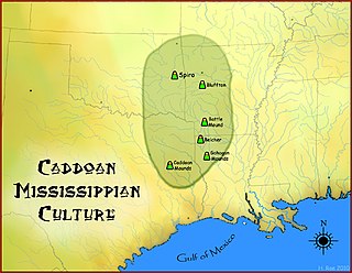
The Gahagan Mounds Site (16RR1) is an Early Caddoan Mississippian culture archaeological site in Red River Parish, Louisiana. It is located in the Red River Valley. The site is famous for the three shaft burials and exotic grave goods excavated there in the early twentieth century.

Lake Cormorant, Mississippi Unincorporated community in Mississippi, United States

Lake Cormorant is an unincorporated community located in DeSoto County, Mississippi, United States. Lake Cormorant is adjacent to the town of Walls and 19 miles (31 km) north of North Tunica near U.S. Route 61.

Transylvania Mounds is an archaeological site in East Carroll Parish, Louisiana with components from the Coles Creek (700–1200)CE and Plaquemine/Mississippi periods (1200–1541). It is the type site for the Transylvania Phase of the Tensas Basin Plaquemine Mississippian chronology.

Foster's Mound is a Plaquemine culture archaeological site located in Adams County, Mississippi northeast of Natchez off US 61. It is the type site for the Foster Phase of the Natchez Bluffs Plaquemine culture chronology. It was added to the NRHP on September 2, 1982 as NRIS number 82003091. The mounds are listed on the Mississippi Mound Trail.
Mott Archaeological Preserve Archeological site

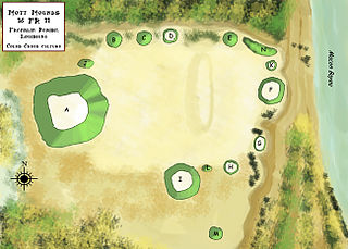
The Mott Archaeological Preserve or Mott Mounds Site is an archaeological site in Franklin Parish, Louisiana on the west bank of Bayou Macon. It originally had eleven mounds with components from the Marksville, Troyville, Coles Creek, and Plaquemine periods. It was at one time one of the largest mound centers in the Southeast and has one of the largest mounds in Louisiana with a base which cover more than two acres. It was purchased by the Archaeological Conservancy in 2002. and is now used for research and educational purposes.

The Spanish Fort Site (22-SH-500) is an archaeological site in the Delta region of the U.S. state of Mississippi. It is one of three major earthwork sites in the far southern portion of the Yazoo River valley, and it has been designated a historic site because of its archaeological value. Despite its name, the site was not built by the Spanish, and its original purpose is believed to have been ceremonial, not martial.

The Carson Mounds,, also known as the Carson Site and Carson-Montgomery- is a large Mississippian culture archaeological site located near Clarksdale in Coahoma County, Mississippi in the Yazoo Basin. Only a few large earthen mounds are still present at Carson to this day. Archaeologists have suggested that Carson is one of the more important archaeological sites in the state of Mississippi.

The Atchafalaya Basin Mounds is an archaeological site originally occupied by peoples of the Coastal Coles Creek and Plaquemine cultures beginning around 980 CE, and by their presumed historic period descendants, the Chitimacha, during the 18th century. It is located in St. Mary Parish, Louisiana on the northern bank of Bayou Teche at its confluence with the Lower Atchafalaya River. It consists of several earthen platform mounds and a shell midden situated around a central plaza. The site was visited by Clarence Bloomfield Moore in 1913.

The Glass Site is a Plaquemine culture archaeological site located approximately 9.5 kilometres (5.9 mi) south of Vicksburg in Warren County, Mississippi. Originally the site had four platform mounds surrounding a large open plaza, but land leveling for modern farming techniques and looting by pothunters mean only portions of three have survived into the 21st century. It was a major ceremonial center that was contemporaneous with other large Plaquemine sites including Emerald, Holly Bluff, and Winterville and whose main occupation period occurred during the protohistoric period from 1500 to 1650 CE. Parts of the site were excavated by Clarence Bloomfield Moore in 1910 and 1911, and by Lauren Elizabeth Downs in 2007-2009. The mounds are listed on the Mississippi Mound Trail.
References

  1. "National Register Information System". National Register of Historic Places . National Park Service. January 23, 2007.
  2. 1 2 3 "Holly Bluff Site". National Historic Landmark summary listing. National Park Service. Archived from the original on 2011-06-05. Retrieved 2007-10-22.
  3. "Mississippi Mound Trail". Mississippi Department of Archives and History. Retrieved 13 July 2021.
  4. Phillips, Philip (1970). Archaeological Survey in the Lower Yazoo Basin, Mississippi, 1949-1955 . Peabody Museum of Archaeology and Ethnology. p. 278.
  5. Phillips, Philip (1970). Archaeological Survey in the Lower Yazoo Basin, Mississippi, 1949-1955 . Peabody Museum of Archaeology and Ethnology. pp. 288–289.
  6. 1 2 3 4 5 6 7 8 9 10 11 12 13 Williams, Stephen and Brain, Jeffrey P. 1983 Excavations at the Lake George Site Yazoo County Mississippi. Peabody Museum of Archaeology and Ethnology, Harvard University Press, Cambridge, Massachusetts. pp. 1958–1960.{{cite book}}: CS1 maint: uses authors parameter (link)
  7. 1 2 3 Moore, Clarence B. (1908). Certain Mounds of Arkansas and Mississippi. Reprint from Journal of the Academy of Natural Sciences of Philadelphia, 13. pp. 480–600.