Half Moon Bay is a coastal city in San Mateo County, California, United States, approximately 25 miles south of San Francisco. Its population was 11,795 as of the 2020 census. Immediately north of Half Moon Bay is Pillar Point Harbor and the unincorporated community of Princeton-by-the-Sea. Half Moon Bay is known for Mavericks, a big-wave surf location. It is called Half Moon Bay because of its crescent shape.

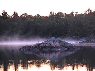
The Archipelago is a township in central Ontario, Canada, along the Georgian Bay in the Parry Sound District.
Half Moon, Halfmoon, half-moon, or Halve Maen may refer to:

Half Moon Bay State Beach is a 4-mile (6 km) stretch of protected beaches in the state park system of California, United States, on Half Moon Bay. From north to south it comprises Roosevelt, Dunes, Venice, and Francis Beaches. The 181-acre (73 ha) park was established in 1956.

Eddie Andreini Sr. Airfield, officially Half Moon Bay Airport, is a public airport in San Mateo County, six miles (9.7 km) northwest of Half Moon Bay, California, United States. The airport is on the Pacific Coast, south of San Francisco.

Division No. 8 is a census division in Alberta, Canada. It is located in the south-central portion of central Alberta and includes the City of Red Deer and surrounding areas. The division forms the central segment of the Calgary–Edmonton Corridor. Division No. 8 is the smallest census division in Alberta according to area.

The M1917 Revolvers were six-shot, .45 ACP, large frame double action revolvers adopted by the United States Military in 1917, to supplement the standard M1911 pistol during World War I. There were two variations of the M1917, one made by Colt and the other by Smith & Wesson. They used moon-clips to hold the cartridges in position, facilitate reloading, and to aid in extraction since revolvers had been designed to eject rimmed cartridges and .45 ACP rounds were rimless for use with the magazine-fed M1911. After World War I, they gained a strong following among civilian shooters. A commercial rimmed cartridge, the .45 Auto Rim, was also developed, so M1917 revolvers could eject cartridge cases without using moon-clips.

Humber Bay is a bay of Lake Ontario south of Toronto, Ontario, Canada. It is located between Ontario Place on the east and Mimico Creek to the west. The bay gives its name to Etobicoke's Humber Bay neighbourhood.
Sylvan Lake is a large lake in central Alberta, Canada. The resort town of Sylvan Lake is established on the shores of the lake, west of the city of Red Deer.

BCPA Flight 304/44 was a scheduled flight operated by British Commonwealth Pacific Airlines from Sydney, Australia, to Vancouver, Canada, with scheduled stops at Fiji, Canton Island, Honolulu and San Francisco. On 29 October 1953, the flight was conducted by a Douglas DC-6 named Resolution and registered in Australia as VH-BPE. The propliner crashed during its initial approach towards San Francisco International Airport, killing all 19 people on board, including the American pianist William Kapell.
Purissima is a ghost town in southwestern San Mateo County, California, United States, near the junction of State Route 1 and Verde Road. Purísima means "purest" in Spanish and is most commonly used in Spanish to refer to La Purísima Concepción of the Virgin Mary. Purissima is the name of the town used as the setting for Ross Macdonald's 1958 crime fiction novel 'The Doomsters'.

Half Moon Bay is a bay of the Pacific Ocean on the coast of San Mateo County, California. The bay is approximately semi-circular, hence the name half moon, with sea access to the south. Coastal towns located there are Princeton-by-the-Sea, Miramar, El Granada, and the city of Half Moon Bay.
Half Moon Bay is a summer village in Alberta, Canada. It is located on the western shore of Sylvan Lake, near Sylvan Lake Provincial Park.

USS Half Moon (AVP-26) was a seaplane tender that in commission in the United States Navy from 1943 to 1946 that saw service in the latter half of World War II. After the war, she was in commission in the United States Coast Guard as the cutter USCGC Half Moon (WAVP-378), later WHEC-378, from 1948 to 1969, seeing service in the Vietnam War during her Coast Guard career.

Half Moon Lake is a hamlet in Alberta, Canada within Strathcona County. It is also recognized as a designated place by Statistics Canada under the name of Half Moon Estates. The community is located on the shores of Half Moon Lake, just north of Highway 629, approximately 13 kilometers (8.1 mi) southeast of Sherwood Park.
Purcell Bay is an Arctic waterway in Qikiqtaaluk Region, Nunavut, Canada. Located off northwestern Bathurst Island, the bay is an arm of May Inlet.
Dampier Bay is an Arctic waterway in the Qikiqtaaluk Region, Nunavut, Canada. Located off northwestern Bathurst Island, the bay is on the west side of May Inlet.
Stuart Bay is an Arctic waterway in Qikiqtaaluk Region, Nunavut, Canada. Located off northwestern Bathurst Island, the bay is on the east side of May Inlet.
Half Moon Bay High School is an American public high school located in Half Moon Bay, in San Mateo County, California. It is part of the Cabrillo Unified School District.

Half Moon Run is a Canadian indie rock band based in Montreal, Quebec. The group is known for their heavy use of layered percussion, group vocal harmonies, and for playing multiple instruments during live performances.


