
Baffin Island, in the Canadian territory of Nunavut, is the largest island in Canada, the second largest island in the Americas, and the fifth-largest island in the world. Its area is 507,451 km2 (195,928 sq mi) with a population density of 0.03/km2; the population was 13,039 according to the 2021 Canadian census; and it is located at 68°N70°W. It also contains the city of Iqaluit, which is the capital of Nunavut.
Frobisher Bay is an inlet of the Davis Strait in the Qikiqtaaluk Region of Nunavut, Canada. It is located in the southeastern corner of Baffin Island. Its length is about 230 km (140 mi) and its width varies from about 40 km (25 mi) at its outlet into the Davis Strait to roughly 20 km (12 mi) towards its inner end.

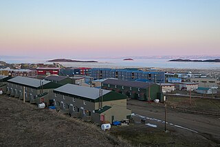
Pond Inlet is a small, predominantly Inuit community in the Qikiqtaaluk Region of Nunavut, Canada, located on northern Baffin Island. To the Inuit the name of the place "is and always has been Mittimatalik." The Scottish explorer Sir John Ross had named an arm of the sea that separates Bylot Island from Baffin Island as Pond's Bay, and the hamlet now shares that name. On 29 August 1921, the Hudson's Bay Company opened its trading post near the Inuit camp and named it Pond Inlet, marking the expansion of its trading empire into the High Arctic.

Bylot Island lies off the northern end of Baffin Island in Nunavut Territory, Canada. Eclipse Sound to the southeast and Navy Board Inlet to the southwest separate it from Baffin Island. Parry Channel lies to its northwest. At 11,067 km2 (4,273 sq mi) it is ranked 71st largest island in the world and Canada's 17th largest island. The island measures 180 km (110 mi) east to west and 110 km (68 mi) north to south and is one of the largest uninhabited islands in the world. While there are no permanent settlements on this Canadian Arctic island, Inuit from Pond Inlet and elsewhere regularly travel to Bylot Island. An Inuit seasonal hunting camp is located southwest of Cape Graham Moore.

Sirmilik National Park is a national park located in Qikiqtaaluk, Nunavut, Canada, established in 1999. Situated within the Arctic Cordillera, the park is composed of three areas: most of Bylot Island with the exception for a few areas that are Inuit-owned lands, Kangiqłuruluk, and Baffin Island's Borden Peninsula. Much of the park is bordered by water.

The Gulf of Boothia is a body of water in Nunavut, Canada. Administratively it is divided between the Kitikmeot Region on the west and the Qikiqtaaluk Region on the east. It merges north into Prince Regent Inlet, the two forming a single bay with different names for its parts. It is surrounded by, clockwise, Baffin Island, Fury and Hecla Strait, the Melville Peninsula, the Canadian mainland, and the Boothia Peninsula. The south end is Committee Bay, northwest of which are the Simpson Peninsula and Pelly Bay.

Qikiqtaaluk (ᕿᑭᖅᑖᓗᒃ) formerly Sillem Island is an uninhabited island in the Qikiqtaaluk Region of Nunavut, Canada. It is the second largest of the several hundred islands and islets that are located in Baffin Bay, immediately off the northern coast of Baffin Island. It is defined by Clark and Gibbs Fiords, which join at its northern end to form Scott Inlet. Further north lies Pilattuaq.

Tasiujarjuaq formerly Soper Lake is a large, irregularly shaped lake in the Qikiqtaaluk Region, Nunavut, Canada. It is located on Baffin Island's Meta Incognita Peninsula. The Inuit name references the lake's meromictic attribute, a mixture of fresh and salt water caused by a set of reversing falls and 9–10 m (30–33 ft) tides in Pleasant Inlet. The fresh water of Soper River drains into the lake which then drains into the salt water of Pleasant Inlet before reaching the Arctic Ocean.

Adams Island is an uninhabited island in the Qikiqtaaluk Region of Nunavut, Canada. The island is located in Baffin Bay off the northeastern coast of Baffin Island in the Arctic Archipelago. Nearby are Dexterity Island (northeast), Dexterity Fiord and Baffin Island (east), Tromso Fiord (south), Paterson Inlet (west), Bergesen Island (northwest), and Isbjorn Strait (north).

The Parry Channel is a natural waterway through the central Canadian Arctic Archipelago. Its eastern two-thirds lie in the territory of Nunavut, while its western third lies in the Northwest Territories. It runs east to west, connecting Baffin Bay in the east with the Beaufort Sea in the west. Its eastern end is the only practical entrance to the Northwest Passage. Its western end would be a natural exit from the archipelago were it not filled with ice. The channel separates the Queen Elizabeth Islands to the north from the rest of Nunavut.
Philpots Island is a member of the Queen Elizabeth Islands and the Arctic Archipelago in the territory of Nunavut. It is the largest of Devon Island's offshore islands, located at Devon's eastern end. It lies in Baffin Bay, with Hyde Inlet to the north, and the Parry Channel to the south.
Admiralty Inlet is a bay in the Qikiqtaaluk Region of Nunavut, Canada. It extends southerly from Lancaster Sound along the western shore of Baffin Island's Borden Peninsula. Its only permanent settlement is the hamlet of Arctic Bay, which is located on Uluksan Peninsula, a landform that juts into Admiralty Inlet south of Sirmilik National Park.
Moffet Inlet is a body of water in Nunavut's Qikiqtaaluk Region. It lies on the eastern side of Admiralty Inlet on Baffin Island's Borden Peninsula. The Inuit hamlet of Arctic Bay is located 105 km south/southeast of the inlet.
Berlinguet Inlet is a body of water adjoining Baffin Island within the Qikiqtaaluk Region of Nunavut, Canada. It runs west–east at Admiralty Inlet's southern end, separated from Bernier Bay to the west, which opens into the Gulf of Boothia, by a 1.5 km (0.93 mi) isthmus. Baffin Island's Brodeur Peninsula is to the north; Borden Peninsula is to the northeast.

Kangiqtugaapik formerly Clyde Inlet is a body of water in eastern Baffin Island, Qikiqtaaluk Region, Nunavut. Its mouth opens into the Davis Strait from the west.
Round Island is an uninhabited island in the Qikiqtaaluk Region of Nunavut, Canada. It is located across the mouth of Coutts Inlet in Baffin Bay off the northeastern coast of Baffin Island. Nova Zembla Island is 7.4 km (4.6 mi) to the northwest.
Pilattuaq formerly Scott Island is an uninhabited island in the Qikiqtaaluk Region of Nunavut, Canada. It is located in Baffin Bay, off the eastern coast of Baffin Island, in the middle of Scott Inlet, north of the confluence of Clark Fiord and Gibbs Fiord which embrace Qikiqtaaluk.

Avannaata is a municipality of Greenland created on 1 January 2018 from the bulk of the former Qaasuitsup municipality. It encompasses an area of 522,700 km2 and has 10,726 inhabitants.

The Canadian Arctic Rift System is a major North American geological structure extending from the Labrador Sea in the southeast through Davis Strait, Baffin Bay and the Arctic Archipelago in the northwest. It consists of a series of interconnected rifts that formed during the Paleozoic, Mesozoic and Cenozoic eras. Extensional stresses along the entire length of the rift system have resulted in a variety of tectonic features, including grabens, half-grabens, basins and faults.
