
The Northwest Territories is a federal territory of Canada. At a land area of approximately 1,127,711.92 km2 (435,412.01 sq mi) and a 2021 census population of 41,070, it is the second-largest and the most populous of the three territories in Northern Canada. Its estimated population as of the second quarter of 2024 is 44,920. Yellowknife is the capital, most populous community, and only city in the territory; its population was 20,340 as of the 2021 census. It became the territorial capital in 1967, following recommendations by the Carrothers Commission.

Baffin Island, in the Canadian territory of Nunavut, is the largest island in Canada, the second largest island in the Americas, and the fifth-largest island in the world. Its area is 507,451 km2 (195,928 sq mi) with a population density of 0.03/km2; the population was 13,039 according to the 2021 Canadian census; and it is located at 68°N70°W. It also contains the city of Iqaluit, which is the capital of Nunavut.

Victoria Island is a large island in the Arctic Archipelago that straddles the boundary between Nunavut and the Northwest Territories of Canada. It is the eighth-largest island in the world, and at 217,291 km2 (83,897 sq mi)1 in area, it is Canada's second-largest island. It is nearly double the size of Newfoundland (111,390 km2 [43,010 sq mi]), and is slightly larger than the island of Great Britain (209,331 km2 [80,823 sq mi]) but smaller than Honshu (225,800 km2 [87,200 sq mi]). The western third of the island lies in the Inuvik Region of the Northwest Territories; the remainder is part of Nunavut's Kitikmeot Region. The population of 2,168 is divided between two settlements, the larger of which is Cambridge Bay (Nunavut) and the other Ulukhaktok.
The Belcher Islands are an archipelago in the southeast part of Hudson Bay near the centre of the Nastapoka arc. The Belcher Islands are spread out over almost 3,000 km2 (1,200 sq mi). Administratively, they belong to the Qikiqtaaluk Region of Nunavut, Canada. The hamlet of Sanikiluaq is on the north coast of Flaherty Island and is the southernmost in Nunavut. Along with Flaherty Island, the other large islands are Kugong Island, Tukarak Island, and Innetalling Island. Other main islands in the 1,500–island archipelago are Moore Island, Wiegand Island, Split Island, Snape Island and Mavor Island, while island groups include the Sleeper Islands, King George Islands, and Bakers Dozen Islands.
Frobisher Bay is an inlet of the Davis Strait in the Qikiqtaaluk Region of Nunavut, Canada. It is located in the southeastern corner of Baffin Island. Its length is about 230 km (140 mi) and its width varies from about 40 km (25 mi) at its outlet into the Davis Strait to roughly 20 km (12 mi) towards its inner end.

Grise Fiord is an Inuit hamlet on the southern tip of Ellesmere Island, in the Qikiqtaaluk Region, Nunavut, Canada. It is one of three populated places on the island; despite its low population, it is the largest community on Ellesmere Island. Created by the Canadian Government in 1953 through a relocation of Inuit families from Inukjuak, Quebec, it is Canada's northernmost public community. It is also one of the coldest inhabited places in the world, with an average yearly temperature of −16.5 °C (2.3 °F).

Pond Inlet is a small, predominantly Inuit community in the Qikiqtaaluk Region of Nunavut, Canada, located on northern Baffin Island. To the Inuit the name of the place "is and always has been Mittimatalik." The Scottish explorer Sir John Ross had named an arm of the sea that separates Bylot Island from Baffin Island as Pond's Bay, and the hamlet now shares that name. On 29 August 1921, the Hudson's Bay Company opened its trading post near the Inuit camp and named it Pond Inlet, marking the expansion of its trading empire into the High Arctic.

Arctic Bay is an Inuit hamlet located in the northern part of the Borden Peninsula on Baffin Island in the Qikiqtaaluk Region of Nunavut, Canada. Arctic Bay is located in the Eastern Time Zone although it is quite close to the time zone boundary. The predominant languages are Inuktitut and English. Arctic Bay is notable for being the birthplace of the former Premier of Nunavut and, as of 2021, the Commissioner of Nunavut, Eva Aariak. It is the northernmost public community in Canada not formed from forced relocation.

Bathurst Island is one of the Queen Elizabeth Islands in Nunavut, Canada. It is a member of the Arctic Archipelago. The area of the island is estimated at 16,042 km2 (6,194 sq mi), 115 to 117 mi long and from 63 mi (101 km) to 72 mi (116 km) to 92.9 mi (149.5 km) wide, making it Canada's 13th largest island. It is located between Devon Island and Cornwallis Island in the east, and Melville Island in the west. Four small islands of Cameron, Vanier, Massey and Alexander lie in its northwest.

Bylot Island lies off the northern end of Baffin Island in Nunavut Territory, Canada. Eclipse Sound to the southeast and Navy Board Inlet to the southwest separate it from Baffin Island. Parry Channel lies to its northwest. At 11,067 km2 (4,273 sq mi) it is ranked 71st largest island in the world and Canada's 17th largest island. The island measures 180 km (110 mi) east to west and 110 km (68 mi) north to south and is one of the largest uninhabited islands in the world. While there are no permanent settlements on this Canadian Arctic island, Inuit from Pond Inlet and elsewhere regularly travel to Bylot Island. An Inuit seasonal hunting camp is located southwest of Cape Graham Moore.
Piita Taqtu Irniq, formerly Peter Irniq, is an Inuk politician in Canada, who served as the second commissioner of Nunavut from April 2000 to April 2005.

Arviat is a predominantly Inuit hamlet located on the western shore of Hudson Bay in the Kivalliq Region of Nunavut, Canada. Arviat is derived from the Inuktitut word arviq meaning "Bowhead whale". Earlier in history, its name was Tikirajualaaq, and Ittaliurvik,.

Cambridge Bay is a hamlet located on Victoria Island in the Kitikmeot Region of Nunavut, Canada. It is the largest settlement on Victoria Island. Cambridge Bay is named for Prince Adolphus, Duke of Cambridge, while the traditional Inuinnaqtun name for the area is Ikaluktutiak or Iqaluktuuttiaq meaning "good fishing place".

Resolute or Resolute Bay is an Inuit hamlet on Cornwallis Island in Nunavut, Canada. It is at the northern end of Resolute Bay and the Northwest Passage and is part of the Qikiqtaaluk Region.

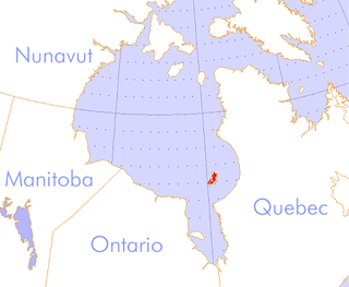
Boothia Peninsula is a large peninsula in Nunavut's northern Canadian Arctic, south of Somerset Island. The northern part, Murchison Promontory, is the northernmost point of mainland Canada.

Clyde River is an Inuit hamlet located on the shore of Baffin Island's Patricia Bay, off Kangiqtugaapik, an arm of Davis Strait in the Qikiqtaaluk Region, of Nunavut, Canada. It lies in the Baffin Mountains which in turn form part of the Arctic Cordillera mountain range. The community is served by air and by annual supply sealift.

Nunavut is the largest and northernmost territory of Canada. It was separated officially from the Northwest Territories on April 1, 1999, via the Nunavut Act and the Nunavut Land Claims Agreement Act, which provided this territory to the Inuit for self-government. The boundaries had been drawn in 1993. The creation of Nunavut resulted in the first major change to Canada's political map in half a century since the province of Newfoundland was admitted in 1949.

Hornaday River is a waterway located above the Arctic Circle on the mainland of Northern Canada.


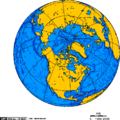 Orthographic projection centred over Resolute Bay, Nunavut, Canada.
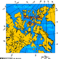 Resolute Bay, Nunavut, Canada - Lambert Projection.
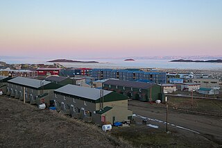
 Resolute Bay: View from Signal Hill to the Inuit-Settlement "Village" and to Resolute Passage (August 1997)
 Another view over Resolute Bay to the Inuit Settlement "Village" (August 1997)


