
Sir John Frederick William Herschel, 1st Baronet was an English polymath active as a mathematician, astronomer, chemist, inventor and experimental photographer who invented the blueprint and did botanical work.

Ellesmere Island is Canada's northernmost and third largest island, and the tenth largest in the world. It comprises an area of 196,236 km2 (75,767 sq mi), slightly smaller than Great Britain, and the total length of the island is 830 km (520 mi).

Victoria Island is a large island in the Arctic Archipelago that straddles the boundary between Nunavut and the Northwest Territories of Canada. It is the eighth-largest island in the world, and at 217,291 km2 (83,897 sq mi)1 in area, it is Canada's second-largest island. It is nearly double the size of Newfoundland (111,390 km2 [43,010 sq mi]), and is slightly larger than the island of Great Britain (209,331 km2 [80,823 sq mi]) but smaller than Honshu (225,800 km2 [87,200 sq mi]). The western third of the island lies in the Inuvik Region of the Northwest Territories; the remainder is part of Nunavut's Kitikmeot Region. The population of 2,168 is divided between two settlements, the larger of which is Cambridge Bay (Nunavut) and the other Ulukhaktok.

The Arctic Archipelago, also known as the Canadian Arctic Archipelago, is an archipelago lying to the north of the Canadian continental mainland, excluding Greenland and Iceland.

Northern Canada, colloquially the North or the Territories, is the vast northernmost region of Canada, variously defined by geography and politics. Politically, the term refers to the three territories of Canada: Yukon, Northwest Territories and Nunavut. This area covers about 48 per cent of Canada's total land area, but has less than 0.5 per cent of Canada's population.
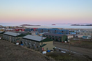
Frobisher Bay is an inlet of the Davis Strait in the Qikiqtaaluk Region of Nunavut, Canada. It is located in the southeastern corner of Baffin Island. Its length is about 230 km (140 mi) and its width varies from about 40 km (25 mi) at its outlet into the Davis Strait to roughly 20 km (12 mi) towards its inner end.
Herschel or Herschell may refer to:

Herschel Island is an island in the Beaufort Sea, which lies 5 km (3.1 mi) off the coast of Yukon in Canada, of which it is administratively a part. It is Yukon's only large offshore island.

King William Island is an island in the Kitikmeot Region of Nunavut, which is part of the Arctic Archipelago. In area it is between 12,516 km2 (4,832 sq mi) and 13,111 km2 (5,062 sq mi) making it the 61st-largest island in the world and Canada's 15th-largest island. Its population, as of the 2021 census, was 1,349, all of whom live in the island's only community, Gjoa Haven.

Henry Asbjørn Larsen was a Norwegian-Canadian Arctic explorer. Larsen was born on a small island, Herføl, south of Fredrikstad in Norway. Like his hero, Roald Amundsen, he became a seaman. Larsen immigrated to Canada, and became a British subject in 1927. In 1928, he joined the Royal Canadian Mounted Police (RCMP).
Moore Island is an uninhabited island in the Qikiqtaaluk Region, Nunavut, Canada. It is a member of the Belcher Islands group in Hudson Bay. It lies in Churchill Sound between Kugong Island to its west and the Howard Peninsula of Flaherty Island to its east with the Inuit community of Sanikiluaq about 30 km (19 mi) northeast.

The Hudson Bay drainage basin is the drainage basin in northern North America where surface water empties into the Hudson Bay and adjoining waters. Spanning an area of about 3,861,400 square kilometres (1,490,900 sq mi) and with a mean discharge of about 30,900 m3/s (1,090,000 cu ft/s), the basin is almost entirely within Canada. It encompasses parts of the Canadian Prairies, Central Canada, and Northern Canada. A small area of the basin is in the northern part of the Midwestern United States.
The Astronomical Society Islands are members of the Arctic Archipelago in the Canadian territory of Nunavut. They are located in western Gulf of Boothia at the mouth of Lord Mayor Bay. The group is near the Boothia Peninsula and south of the Copeland Islands. The waters surrounding the archipelago have been used for hunting polar bears and walrus.

The Bell Peninsula is located on southeastern Southampton Island, in the Kivalliq Region, Nunavut, Canada. It is close to the small Inuit community of Coral Harbour. The southern shores make up the northern boundary of Hudson Bay. Foxe Basin is to the east. There are several large bays surrounding the peninsula. Bowhead whale frequent the area. The Bell Peninsula's irregular coastline is marked by five distinct points, some of which have notable archaeological sites. Mount Minto, in the north, is the highest peak. The Back Peninsula is on the eastern end of the Bell Peninsula.

Christian Theodore Pedersen was a Norwegian-American seaman, whaling captain and fur trader active in Alaska, Canada, and the northern Pacific from the 1890s to the 1930s. He was called "one of the canniest old skippers in the western arctic" by a contemporary.
Rymer Point is a cape in the Canadian Arctic territory of Nunavut. It is located on southwestern Victoria Island's Wollaston Peninsula, facing the Dolphin and Union Strait. Clouston Bay is situated along the north shoreline. Nuvuk Point is on the southwest side, jutting into Simpson Bay.

Newfoundland is a large island within the Canadian province of Newfoundland and Labrador. It is situated off the eastern coast of the North American mainland and the geographical region of Labrador.
Terror Bay is an Arctic waterway in the Kitikmeot Region, Nunavut, Canada. It is located on the southwestern side of King William Island. The entrance to the bay is marked by Fitzjames Island on the west and Irving Island to the east. The bay opens to Queen Maud Gulf.
