
Melville Island is an uninhabited island of the Arctic Archipelago with an area of 42,149 km2 (16,274 sq mi). It is the 33rd largest island in the world and Canada's eighth largest island.

Melville Island is an island in the eastern Timor Sea, off the coast of the Northern Territory, Australia. Along with Bathurst Island and nine smaller uninhabited islands, it forms part of the group known as the Tiwi Islands, which are under the jurisdiction of the Northern Territory in association with the Tiwi Land Council as the regional authority.

Melville Peninsula is a large peninsula in the Canadian Arctic north of Hudson Bay. To the east is Foxe Basin and to the west the Gulf of Boothia. To the north the Fury and Hecla Strait separates it from Baffin Island. To the south Repulse Bay and Frozen Strait separate it from Southampton Island at the north end of Hudson Bay. On the southwest it is connected to the mainland by the "Rae Isthmus" named after arctic explorer Dr John Rae.
Melville may refer to the American writer Herman Melville. It may also refer to:

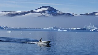
Melville Bay, is a large bay off the coast of northwestern Greenland. Located to the north of the Upernavik Archipelago, it opens to the south-west into Baffin Bay. Its Kalaallisut name, Qimusseriarsuaq, means "the great dog sledding place".

Sabine Island is an uninhabited island located in Nunavut's Qikiqtaaluk Region within the northern Canadian Arctic. It is in eastern Gulf of Boothia's Committee Bay, south of Wales Island and west of the mainland's Melville Peninsula.
Glen Island is an island in Nunavut, Canada. It is located in the Qikiqtaaluk Region's side of the Gulf of Boothia within Committee Bay. It is northeast of Wales Island and west of the mainland's Melville Peninsula.
Honeyman Island is an irregularly shaped, uninhabited island in Nunavut, Canada. It is located in the Qikiqtaaluk Region's side of the Gulf of Boothia within Committee Bay. It is west of the mainland's Melville Peninsula.
Hecla and Griper Bay is an Arctic waterway. Located in the Hazen Strait, it is a large inlet in the north of Melville Island, Canada. It is split between the Northwest Territories and Nunavut. The bay takes its name from Arctic explorer William Edward Parry's ships HMS Hecla and HMS Griper.
Weatherall Bay is an Arctic waterway in Qikiqtaaluk Region, Nunavut, Canada. It is located in the Byam Martin Channel, northeast of Melville Island. Domett Point is at its mouth.
Sherard Bay is an Arctic waterway in Qikiqtaaluk Region, Nunavut, Canada. Located off northern Melville Island's Sabine Peninsula, the bay is an arm of Byam Martin Channel. Eden Bay and Weatherall Bay are nearby.
Eldridge Bay is an Arctic waterway Melville Island's Sabine Peninsula, the bay is an arm of Hecla and Griper Bay. Sabine Bay is to the south.
Sabine Bay is an Arctic waterway in Qikiqtaaluk Region, Nunavut, Canada. Located off northern Melville Island's Sabine Peninsula, the bay is an arm of Hecla and Griper Bay. Eldridge Bay is to the north.
Kiatassuaq Island is an uninhabited island in the northern Upernavik Archipelago in the Qaasuitsup municipality in northwestern Greenland. It marks the southern border of Melville Bay.
Inussulik Bay is a bay in the Upernavik Archipelago in the Qaasuitsup municipality in northwestern Greenland.
Alison Bay is a bay in the Qaasuitsup municipality in northwestern Greenland. The bay is a tributary bay of Melville Bay, and is located in the northern part of Upernavik Archipelago, between Kiatassuaq Island in the southwest and the mainland of Greenland in the northeast.

Kullorsuaq Island is an island in the Avannaata municipality in northwestern Greenland. The name of the island means "a big thumb" in the Greenlandic language.
Nunatarsuaq is a nunatak in the Qaasuitsup municipality in northwestern Greenland.

Saqqarlersuaq Island is an uninhabited island in the Qaasuitsup municipality in northwestern Greenland. Part of the Upernavik Archipelago, Saqqarlersuaq Island is located in the southern part of Melville Bay.
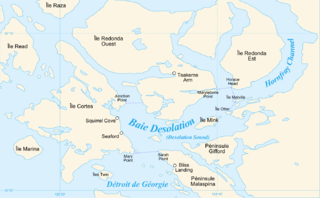
Homfray Channel is a deep water channel located between East Redonda and the mainland coast of British Columbia, Canada.
