
Victoria Island is a large island in the Arctic Archipelago that straddles the boundary between Nunavut and the Northwest Territories of Canada. It is the eighth-largest island in the world, and at 217,291 km2 (83,897 sq mi)1 in area, it is Canada's second-largest island. It is nearly double the size of Newfoundland (111,390 km2 [43,010 sq mi]), and is slightly larger than the island of Great Britain (209,331 km2 [80,823 sq mi]) but smaller than Honshu (225,800 km2 [87,200 sq mi]). The western third of the island lies in the Inuvik Region of the Northwest Territories; the remainder is part of Nunavut's Kitikmeot Region. The population of 2,168 is divided between two settlements, the larger of which is Cambridge Bay (Nunavut) and the other Ulukhaktok.
Sir William Edward Parry was a Royal Navy officer and explorer best known for his 1819–1820 expedition through the Parry Channel, probably the most successful in the long quest for the Northwest Passage, until it was finally negotiated by Roald Amundsen in 1906. In 1827, Parry attempted one of the earliest expeditions to the North Pole. He reached 82° 45' N, setting a record for human exploration Farthest North that stood for nearly five decades before being surpassed at 83° 20' N by Albert Hastings Markham in 1875.

Melville Island is an uninhabited member of the Queen Elizabeth Islands of the Arctic Archipelago. With an area of 42,149 km2 (16,274 sq mi), it is the 33rd largest island in the world and Canada's eighth largest island.

A member of the Arctic Archipelago, Prince Patrick Island is the westernmost of the Queen Elizabeth Islands in the Northwest Territories of Canada, lying northwest of Melville Island. The area of Prince Patrick Island is 15,848 km2 (6,119 sq mi), making it the 55th largest island in the world and Canada's 14th largest island. It has historically been icebound all year, making it one of the least accessible parts of Canada. Located at the entrance of the M'Clure Strait, Prince Patrick Island is uninhabited.

Admiral Sir Edward Belcher was a British naval officer, hydrographer, and explorer. Born in Nova Scotia, he was the great-grandson of Jonathan Belcher, who served as a colonial governor of Massachusetts, New Hampshire, and New Jersey.

Melville Peninsula is a large peninsula in the Canadian Arctic north of Hudson Bay. To the east is Foxe Basin and to the west the Gulf of Boothia. To the north the Fury and Hecla Strait separates it from Baffin Island. To the south Repulse Bay and Frozen Strait separate it from Southampton Island at the north end of Hudson Bay. On the southwest it is connected to the mainland by the Rae Isthmus, named after the Arctic explorer John Rae.

Viscount Melville Sound, formerly Melville Sound, is an arm of the Arctic Ocean in the Kitikmeot Region, Nunavut and the Inuvik Region, Northwest Territories, Canada. Forming part of the Parry Channel, it separates Victoria Island and Prince of Wales Island from the Queen Elizabeth Islands. East of the sound, via Barrow Strait, lies Lancaster Sound, leading into Baffin Bay; westward lies the M'Clure Strait and the Arctic Ocean / Beaufort Sea. The sound is a part of the Northwest Passage.

The Gulf of Boothia is a body of water in Nunavut, Canada. Administratively it is divided between the Kitikmeot Region on the west and the Qikiqtaaluk Region on the east. It merges north into Prince Regent Inlet, the two forming a single bay with different names for its parts. It is surrounded by, clockwise, Baffin Island, Fury and Hecla Strait, the Melville Peninsula, the Canadian mainland, and the Boothia Peninsula. The south end is Committee Bay, northwest of which are the Simpson Peninsula and Pelly Bay. On the west side of the gulf at 70°18′N91°42′W, north of Pelly Bay and Thom Bay, is Eden Bay, which should not be confused with a bay of the same name in the Qikiqtaaluk Region.
Elwin Bay is an Arctic waterway in the Qikiqtaaluk Region, Nunavut, Canada. It is located Prince Regent Inlet by the northeastern shore of Somerset Island. The abandoned trading post of Port Leopold lies 40 km (25 mi) north.

The Parry Channel is a natural waterway through the central Canadian Arctic Archipelago. Its eastern two-thirds lie in the territory of Nunavut, while its western third lies in the Northwest Territories. It runs east to west, connecting Baffin Bay in the east with the Beaufort Sea in the west. Its eastern end is the only practical entrance to the Northwest Passage. Its western end would be a natural exit from the archipelago were it not filled with ice. The channel separates the Queen Elizabeth Islands to the north from the rest of Nunavut.
Tasiujaq formerly Murray Maxwell Bay is an uninhabited waterway in the Qikiqtaaluk Region, Nunavut, Canada. It is located in the Foxe Basin, north of Siuraarjuk on Baffin Island. The island of Kapuiviit lies at the opening of the bay.
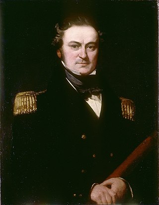
Captain Henry Parkyns Hoppner was an officer of the Royal Navy, Arctic explorer, draughtsman and artist. His career included two ill-fated voyages culminating in the loss of HMS Alceste in 1816 and HMS Fury in 1825.

HMS Alert was a 17-gun wooden screw sloop of the Cruizer class of the Royal Navy, launched in 1856 and broken up in 1894. She was the eleventh ship of the Royal Navy to bear the name, and was noted for her Arctic exploration work; in 1876 she reached a record latitude of 82° North. Alert briefly served with the US Navy, and ended her career with the Canadian Marine Service as a lighthouse tender and buoy ship.
Saglirjuaq formerly Liddon Island is one of several irregularly shaped islands located in the Fury and Hecla Strait of Nunavut's Qikiqtaaluk Region within the northern Canadian Arctic. It is north of the mainland's Melville Peninsula, south of Baffin Island's Sikosak Bay, west of Simialuk, and east of Saglaarjuk.
Hecla and Griper Bay is an Arctic waterway. Located in the Hazen Strait, it is a large inlet in the north of Melville Island, Canada. It is split between the Northwest Territories and Nunavut. The bay takes its name from Arctic explorer William Edward Parry's ships HMS Hecla and HMS Griper.
Sherard Bay is an Arctic waterway in the Qikiqtaaluk Region, Nunavut, Canada. Located off northern Melville Island's Sabine Peninsula, the bay is an arm of Byam Martin Channel. Eden Bay and Weatherall Bay are nearby.
Sabine Bay is an Arctic waterway mainly in the Qikiqtaaluk Region, Nunavut, but partly in the Inuvik Region, Northwest Territories, Canada. Located off northern Melville Island's Sabine Peninsula, the bay is an arm of Hecla and Griper Bay. Eldridge Bay is to the north.
Graham Moore Bay is an Arctic waterway in Qikiqtaaluk Region, Nunavut, Canada. Located off northern Bathurst Island, the bay is an arm of Viscount Melville Sound.
De la Beche Bay is an Arctic waterway in the Qikiqtaaluk Region, Nunavut, Canada. Located off southern Bathurst Island, the bay is an arm of Viscount Melville Sound. It is entered at Harding Point.

The McClure Arctic expedition, one of many attempts to find the missing Franklin expedition, was significant for being the first to successfully discover and transit the Northwest Passage, which it accomplished by both boat and sledging.
