
The Northwest Passage (NWP) is the sea lane between the Atlantic and Pacific oceans through the Arctic Ocean, along the northern coast of North America via waterways through the Arctic Archipelago of Canada. The eastern route along the Arctic coasts of Norway and Siberia is accordingly called the Northeast Passage (NEP). The various islands of the archipelago are separated from one another and from Mainland Canada by a series of Arctic waterways collectively known as the Northwest Passages, Northwestern Passages or the Canadian Internal Waters.
James Bay is a large body of water located on the southern end of Hudson Bay in Canada. It borders the provinces of Quebec and Ontario, and is politically part of Nunavut. Its largest island is Akimiski Island.

Oregon Country was a large region of the Pacific Northwest of North America that was subject to a long dispute between the United Kingdom and the United States in the early 19th century. The boundaries of the area, which had been created by the Treaty of 1818 without recognizing indigenous claims to the area, consisted of the land north of 42° N latitude, south of 54°40′ N latitude, and west of the Rocky Mountains down to the Pacific Ocean and east to the Continental Divide. Article III of the 1818 treaty gave joint control to both nations for ten years, allowed land to be claimed, and guaranteed free navigation to all mercantile trade. However, both countries disputed the terms of the international treaty. Oregon Country was the American name, while the British used Columbia District for the region. Meanwhile, Indigenous nations had lived in the area since time immemorial, though with little legal recognition in the American and British legal systems. Evidence along the Salmon River shows people lived there at least 16,000 years ago and may have populated the continent after migrating along the Pacific Coast, then following up the Columbia River into the interior.

The Kivalliq Region is an administrative region of Nunavut, Canada. It consists of the portion of the mainland to the west of Hudson Bay together with Southampton Island and Coats Island. The regional centre is Rankin Inlet. The population was 11,045 in the 2021 Canadian census, an increase of 6.1% from the 2016 Census.

Kitikmeot Region is an administrative region of Nunavut, Canada. It consists of the southern and eastern parts of Victoria Island with the adjacent part of the mainland as far as the Boothia Peninsula, together with King William Island and the southern portion of Prince of Wales Island. The regional centre is Cambridge Bay.

Amundsen Gulf is a gulf located mainly in the Inuvik Region, Northwest Territories, Canada with a small section in the Kitikmeot Region of Nunavut. It lies between Banks Island and Victoria Island and the mainland. It is approximately 250 mi (400 km) in length and about 93 mi (150 km) across where it meets the Beaufort Sea.

Nottingham Island is an uninhabited island in the Qikiqtaaluk Region of Nunavut, Canada. It is located in Hudson Strait, just north of the entrance into Hudson Bay.

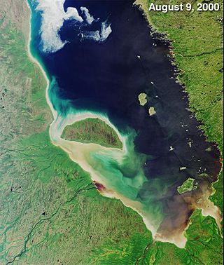
Foxe Basin is a shallow oceanic basin north of Hudson Bay, in Nunavut, Canada, located between Baffin Island and the Melville Peninsula. For most of the year, it is blocked by sea ice and drift ice made up of multiple ice floes.
The Municipality of Callander is a township in central Ontario, Canada, located at the southeast end of Lake Nipissing in the Almaguin Highlands region of the District of Parry Sound. The municipality is located on Callander Bay, just south of North Bay.

The Columbia District was a fur trading district in the Pacific Northwest region of British North America in the 19th century. Much of its territory overlapped with the disputed Oregon Country. It was explored by the North West Company between 1793 and 1811, and established as an operating fur district around 1810. The North West Company was absorbed into the Hudson's Bay Company in 1821 under which the Columbia District became known as the Columbia Department. The Oregon Treaty of 1846 marked the effective end of the Hudson's Bay Company's Columbia Department.

The Gulf of Boothia is a body of water in Nunavut, Canada. Administratively it is divided between the Kitikmeot Region on the west and the Qikiqtaaluk Region on the east. It merges north into Prince Regent Inlet, the two forming a single bay with different names for its parts. It is surrounded by, clockwise, Baffin Island, Fury and Hecla Strait, the Melville Peninsula, the Canadian mainland, and the Boothia Peninsula. The south end is Committee Bay, northwest of which are the Simpson Peninsula and Pelly Bay. On the west side of the gulf at 70°18′N91°42′W, north of Pelly Bay and Thom Bay, is Eden Bay, which should not be confused with a bay of the same name in the Qikiqtaaluk Region.

The Champoeg Meetings were the first attempts at formal governance by European-American and French Canadian pioneers in the Oregon Country on the Pacific Northwest coast of North America. Between 1841 and 1843, a series of public councils was held at Champoeg, a settlement on the French Prairie of the Willamette River valley in present-day Marion County, Oregon, and at surrounding settlements. The meetings were organized by newly arrived settlers as well as Protestant missionaries from the Methodist Mission and Catholic Jesuit priests from Canada.

Oregon pioneer history (1806–1890) is the period in the history of Oregon Country and Oregon Territory, in the present day state of Oregon and Northwestern United States.
Ommanney Bay is an Arctic waterway in Qikiqtaaluk Region, Nunavut, Canada. It is located in Parry Channel and is a large inlet on the west side of Prince of Wales Island. It was named after the Victorian Arctic explorer and Royal Navy officer Sir Erasmus Ommanney.
Committee Bay is an Arctic waterway in both the Kitikmeot Region and the Qikiqtaaluk Region, Nunavut, Canada. It forms the southeast end of the Gulf of Boothia and is bounded on the east by the Melville Peninsula, and to the northwest by the Simpson Peninsula. Wales Island lies within the bay. The first European to explore the area was John Rae in 1846 - 1847.
Pioneer Bay is a waterway in the Qikiqtaaluk Region, Nunavut, Canada. It lies off the southwestern coast of Devon Island in the eastern high Arctic. Like Baring Bay to the south and Prince Alfred Bay to the north, it is an arm of Wellington Channel.
Flagler Bay is an Arctic waterway in the Qikiqtaaluk Region, Nunavut, Canada. It is located in Nares Strait by eastern Ellesmere Island between Bache Peninsula and Knud Peninsula.
The Gretha Islands are an uninhabited island group located in the Qikiqtaaluk Region of Nunavut, Canada. They are situated in Eureka Sound at the confluence of Bay Fjord, north of Ellesmere Island's Raanes Peninsula, and east of Stor Island. They are members of the Sverdrup Islands group, Queen Elizabeth Islands, and the Arctic Archipelago.
Labyrinth Bay is an Arctic waterway in Kitikmeot Region, Nunavut, Canada. It is located in southwestern Queen Maud Gulf off Nunavut's mainland.
Lodge Bay is a local service district and designated place in the Canadian province of Newfoundland and Labrador. It is on the southeast coast of Labrador. Encompassing a population of less than one hundred residents, the community has uniquely evolved from both early European colonization of Labrador, and the inimitable patterns of land and resource use by the migratory Inuit population. The name Lodge Bay originated from the title Ranger Lodge, which was the name given to the area by trader and explorer, Captain George Cartwright in the late 18th century. "Ranger" was the name of the wooden-mercantile ship Cartwright used to trade, map and explore the Labrador coast, while "Lodge" was the name given to English hunting camps in Great Britain at that time.
