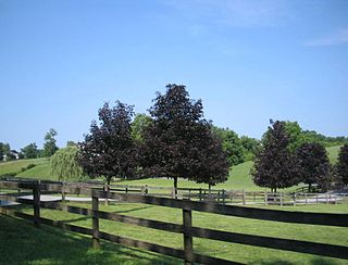
East Bradford Township is a township in Chester County, Pennsylvania, United States. The population was 9,942 at the 2010 census.

West Chester is a borough and the county seat of Chester County, in the U.S. state of Pennsylvania. Located within the Philadelphia metropolitan area, the borough had a population of 18,461 at the 2010 census. West Chester is the mailing address for most of its neighboring townships. When calculated by mailing address, the population as of the 2010 US Census was 108,696, which would make it the 10th largest city by mailing address in the state of Pennsylvania.
Newtown Township is a township in Delaware County, Pennsylvania, United States. Prior to 1789 it was part of Chester County. The population was 12,216 as of the 2010 census, and was 19,705 as of 2017.
Thornbury Township is a township in Delaware County, Pennsylvania, United States. The population was 8,028 at the 2010 census, up from 7,093 at the 2000 census. It is adjacent to, and was once joined with, Thornbury Township, Chester County, Pennsylvania. It contains part of the census designated place of Cheyney University.

White Clay Creek is an 18.5-mile-long (29.8 km) tributary of the Christina River in southern Pennsylvania and northern Delaware in the United States. It is renowned for its scenic character and is largely federally protected.
U.S. Route 322 is a 494 mi (795.0 km) long, east–west United States Highway, traversing Ohio, Pennsylvania, and New Jersey. The road is a spur of U.S. Route 22 and one of the original highways from 1926. A portion of it at one time was concurrent with the Lakes-to-Sea Highway.
Pennsylvania Route 39 (PA 39) is a 17.83 miles (28.69 km) state highway located in Dauphin County, Pennsylvania, United States. PA 39 begins at North Front Street near Harrisburg and ends at U.S. Route 322 and U.S. Route 422 near Hummelstown and Hershey. The route passes through the northern and eastern suburbs of Harrisburg and passes by Hersheypark, Giant Center, as well as the primary production factory for The Hershey Company. Between Harrisburg and Manada Hill, it is known as Linglestown Road, from Manada Hill to Hershey as Hershey Road and from Hershey to near Hummelstown and Hershey as Hersheypark Drive. Prior to the establishment of PA 39 in 1937, PA 39, had previously been designated as a route in northeastern Pennsylvania during the 1920s. That designation was deleted when it was renumbered US 11. As a result, PA 39 is one of a few routes which has a set of child routes which are no where near the primary route.

Wawa is an unincorporated community located in Delaware County, in the U.S. state of Pennsylvania in Greater Philadelphia, partially in Middletown Township and partially in Chester Heights Borough.

Chester Springs is an unincorporated community in Chester County, Pennsylvania, United States. It is centered on West Pikeland Township, and extends into Charlestown Township, Upper Uwchlan Township, Wallace Township, East Nantmeal Township, and West Vincent Township. The Chester Springs Historic District is located in Chester Springs.
Pennsylvania Route 320 is a north–south state highway in southeastern Pennsylvania. The southern terminus of the 18.8-mile (30.3 km) long route is at PA 291 in Chester. The northern terminus is at PA 23 in Swedeland. The route passes through suburban areas in Delaware and Montgomery counties to the west of Philadelphia, serving Swarthmore, Springfield, Broomall, Villanova, and Gulph Mills. PA 320 intersects many important highways including U.S. Route 13 and Interstate 95 (I-95) in Chester, US 1 in Springfield, US 30 in Villanova, and I-76 in Gulph Mills. PA 320 runs parallel to I-476 for much of its length and crosses it four times. Even though there are no direct interchanges between I-476 and PA 320, several roads that intersect PA 320 provide access to I-476.
Pennsylvania Route 352 is a 19-mile (31 km) north–south route that runs from U.S. Route 13 in Chester, Delaware County north to US 30 in Frazer, Chester County. The route passes through suburban areas of Delaware and Chester counties, serving Parkside, Brookhaven, Elwyn, Lima, Gradyville, and Goshenville. PA 352 is a four- to five-lane road between Brookhaven and US 1, otherwise it is generally a two-lane road. The route intersects Interstate 95 (I-95) in Chester and US 1 near Lima at interchanges. PA 352 was first designated by 1928 to run between its current termini. A portion of the route between Brookhaven and US 1 was realigned to a straighter alignment in the 1950s. By 1980, PA 352 was realigned to a short concurrency with PA 3 to avoid intersecting it at a sharp angle.

White Clay Creek Preserve is a 1,255-acre (508 ha) Pennsylvania state park along the valley of White Clay Creek in London Britain Township in Chester County, Pennsylvania in the United States. The park was donated by the DuPont Company in 1984 for the purpose of "preserving the diverse and unique plant and animal species, and the rich cultural heritage of the area". Dupont also donated an additional 528 acres (214 ha) for the adjoining White Clay Creek State Park to the state of Delaware. White Clay Creek Preserve is 3 miles (4.8 km) north of Newark, Delaware on Pennsylvania Route 896.
Pennsylvania Route 340 (PA 340) is a 30-mile-long (48 km) state highway located in Lancaster and Chester counties in Pennsylvania. The western terminus is at PA 462 in Lancaster. The eastern terminus is at U.S. Route 30 Business in Thorndale. The route is a two-lane road passing through rural areas, heading through the Pennsylvania Dutch Country in eastern Lancaster County that is home to several Amish families and serving the communities of Bird-in-Hand, Intercourse, White Horse, Compass, and Wagontown. PA 340 intersects US 30 near Lancaster, PA 772 in Intercourse, PA 897 in White Horse, PA 10 in Compass, PA 82 in Wagontown, and US 30 again near Thorndale.
U.S. Route 322 is a spur of US 22, running from Cleveland, Ohio east to Atlantic City, New Jersey. In the U.S. state of Pennsylvania, the route runs from the Ohio border in West Shenango Township southeast to the Commodore Barry Bridge over the Delaware River in Chester, at which point the route crosses into New Jersey. The route passes near several cities, including DuBois, State College, and Harrisburg. US 322 in Pennsylvania is named the 28th Division Highway in honor of the 28th Infantry Division.

Cheyney station is a train station in Thornbury Township, Delaware County, Pennsylvania. It currently serves as a stop on the West Chester Railroad tourist railroad line, and previously served as a station for the Pennsylvania Railroad and SEPTA.

Stanton is an unincorporated community in New Castle County, Delaware, United States, near the confluence of the Red Clay and White Clay Creeks. It is located in the southern end of Mill Creek Hundred.

Parker Ford is an unincorporated community in East Coventry Township, Chester County, Pennsylvania, United States. Maps show it at the intersection of Pennsylvania Route 724 and Bethel Church Road/Linfield Road. Linfield Road crosses the Schuylkill River to Linfield, an unincorporated village in Limerick Township, Montgomery County.
Lenni is an unincorporated community in Middletown Township in Delaware County, Pennsylvania, United States. Lenni is located at the intersection of Lenni Road and Lungren Road northeast of the Chester Creek.
Suplee is an unincorporated community in Honey Brook Township in Chester County, Pennsylvania, United States. Suplee is located along Suplee Road east of Honey Brook.
Steelville is an unincorporated community in Chester County, Pennsylvania, United States. According to the 2016 census, the town has not been included in past census counts because the town is so small. It lies next to the Octoraro Creek: the border line between Lancaster County and Chester County.

