East Goshen Township, Chester County, Pennsylvania

Last updated
East Goshen Township
Goodwin Acres.JPG
Goodwin Acres, built 1736
Chester County Pennsylvania incorporated and unincorporated areas East Goshen highlighted.svg
Location in Chester County and the state of Pennsylvania.
Pennsylvania in United States (US48).svg
Location of Pennsylvania in the United States
Coordinates: 39°59′07″N75°32′53″W / 39.98528°N 75.54806°W / 39.98528; -75.54806
CountryUnited States
StatePennsylvania
County Chester
Incorporated1817
Area
[1]
  Total10.16 sq mi (26.32 km2)
  Land10.05 sq mi (26.02 km2)
  Water0.12 sq mi (0.30 km2)
Elevation
430 ft (130 m)
Population
 (2010)
  Total18,026
  Estimate 
(2016) [2]
18,265
  Density1,817.96/sq mi (701.95/km2)
Time zone UTC-5 (EST)
  Summer (DST) UTC-4 (EDT)
Area code 610
FIPS code 42-029-21192
Website www.eastgoshen.org
A police car of the Westtown-East Goshen Regional Police Department, serving East Goshen Township, Westtown Township, and Thornbury Township in Chester County PoliceCarWesttownEastGoshenThornbury.JPG
A police car of the Westtown-East Goshen Regional Police Department, serving East Goshen Township, Westtown Township, and Thornbury Township in Chester County

East Goshen Township is a township in Chester County, Pennsylvania, United States. The population was 18,026 at the 2010 census.

Contents

History

The ten square miles of land that is now the township of East Goshen was part of a larger tract purchased from William Penn in Wales in September 1681. Settlers, finding the land beautiful and productive, named the area Goshenville, or "the Land of Goshen."

The blacksmith shop located on North Chester Road was built in 1699. It was here in the early years that wagon wheels were re-rimmed, farm implements repaired, and horses shod. As part of East Goshen's tricentennial in 1982, the blacksmith shop was renovated and restored.

East Goshen Township was incorporated in 1817 when Goshen was divided, forming East and West Goshen townships.

The Goshenville Historic District, Goodwin Acres, and Ellis Williams House are listed on the National Register of Historic Places. [3]

Resources

East Goshen Township owns a 55-acre (220,000 m2) park located on Paoli Pike. Facilities at the park include the Hicks Pavilion with a brick barbecue.

There are areas in the park for sports such as baseball, softball, and soccer fields, four sand volleyball courts, six tennis courts with wind screens and hitting backboard, two full-size basketball courts with additional baskets for shooting around, a 1.5-mile (2.4 km) equipped fitness trail, a children's activity area, a putting green, and a gazebo.

The park has many passive areas for sunbathing, reading, frisbee throwing, etc. The park is also a popular place for walkers and joggers. It has restroom facilities and water fountains. Parking space has been enhanced and all facilities are planned and installed with the idea of maintaining a harmony with nature. The park closes at dusk and drinking alcohol is prohibited.

The park was named "The Best Family Park" by Best of the Main Line, a magazine that rates the best places and food in the Philadelphia Main Line area.

As of 2016, The Board of Supervisors approved application to the Chesco Municipal Grant Program for a Paoli Pike Trail. The 2.7-mile trail would connect East High School with the “Town Center” between Boot Road and North Chester Road and then the entire network of trails in the Township Park and Applebrook Park. This trail is envisioned as part of a much larger 750-mile trail network that would connect most of suburban Philadelphia. About 300 miles of this trail network—including the Chester Valley Trail—have already been constructed. [4]

Geography

Applebrook Park Applebrook Park in East Goshen Township PA.jpeg
Applebrook Park

According to the United States Census Bureau, the township has a total area of 10.2 square miles (26 km2), of which 10.1 square miles (26 km2) is land and 0.04 square miles (0.10 km2), or 0.30%, is water. The township is within the Brandywine Creek watershed. The township's border with its neighbor West Goshen is Airport Road, next to the Brandywine Airport.

Adjacent townships

Government

The Township is governed by a five-person Board of Supervisors. Supervisors are elected to six-year terms. The Board of Supervisors appoints the Township Manager, who is responsible for the day-to-day operation of the Township. In addition, various volunteer advisory authorities, boards and commissions (ABCs), such as the Park & Recreation Commission, the Planning Commission, the Commerce Commission, the Historical Commission and the Conservancy Board, provide recommendations to the Board of Supervisors. [5]

Demographics

Historical population
CensusPop.Note
1930 739
1940 86717.3%
1950 1,03919.8%
1960 1,69463.0%
1970 5,138203.3%
1980 10,02195.0%
1990 15,13851.1%
2000 16,82411.1%
2010 18,0267.1%
2020 18,4102.1%
[6] [7]

As of the census [8] of 2010, there were 18,026 people, 8,128 households, and 4,811 families residing in the township. The population density was 1,767.3 inhabitants per square mile (682.4/km2). There were 8,655 housing units at an average density of 848.53 per square mile (327.62/km2). The racial makeup of the township was 92.6% White, 2.7% African American, 0.1% Native American, 2.9% Asian, 0.5% from other races, and 1.2% from two or more races. Hispanic or Latino of any race were 2.2% of the population.

There were 8,128 households, out of which 20.7% had children under the age of 18 living with them, 51.3% were married couples living together, 5.9% had a female householder with no husband present, and 40.8% were non-families. 34.5% of all households were made up of individuals, and 38.4% had someone living alone who was 65 years of age or older. The average household size was 2.22 and the average family size was 2.89.

In the township, 20.5% of the population is under the age of 20, 4.9% from 18 to 24, 21.6% from 25 to 44, 28.1% from 45 to 64, and 24.9% who were 65 years of age or older. The median age was 47.3 years. For every 100 females there were 86 males. For every 100 females age 20 and over, there were 82 males.

As of the 2010 United States Census, the median income for a household in the township was $73,266, and the median income for a family was $99,188. Males had a median income of $74,363 versus $50,730 for females among full-time, year-round workers. The per capita income for the township was $47,359. About 2.7% of families and 5.0% of the population were below the poverty line, including 3.9% of those under age 18 and 6.4% of those age 65 or over. [9]

Transportation

US 202 southbound in East Goshen Township 2022-09-02 14 30 58 View south along U.S. Route 202 from the overpass for Morstein Road in East Goshen Township, Chester County, Pennsylvania.jpg
US 202 southbound in East Goshen Township

As of 2021, there were 78.66 miles (126.59 km) of public roads in East Goshen Township, of which 16.68 miles (26.84 km) were maintained by the Pennsylvania Department of Transportation (PennDOT) and 61.98 miles (99.75 km) were maintained by the township. [10]

Numbered roads passing through East Goshen Township include U.S. Route 202, Pennsylvania Route 3 and Pennsylvania Route 352. US 202 follows a north-south alignment through the northwestern tip of the township, though the nearest interchange is just outside the township along Boot Road in West Goshen Township. PA 3 follows West Chester Pike along an east-west alignment through the southern portion of the township. Finally, PA 352 follows Chester Road along a northwest-southeast alignment through the center of the township.

Schools

East Goshen is home to East Goshen Elementary School (located in the West Chester Area School District). [11]

Elementary schools serving sections of East Goshen township include East Goshen, Exton, Fern Hill, Glen Wood, and Penn Acres. [12] Almost all areas of East Goshen township are zoned to J.R. Fugett Middle School and West Chester East High School, while a small portion is zoned to G.A. Stetson Middle School and Rustin High School. [13]

East Goshen township is also home to Goshen Friends School, and the Pennsylvania Leadership Charter School.

SS. Peter and Paul School is in the township. [11] [14]

Related Research Articles

<span class="mw-page-title-main">Northampton Township, Bucks County, Pennsylvania</span> Township in Pennsylvania, United States

Northampton Township is a township in Bucks County, Pennsylvania, United States. The township is located approximately 12 miles northeast of Philadelphia. The population was 39,726 at the 2010 census.

<span class="mw-page-title-main">East Bradford Township, Chester County, Pennsylvania</span> Township in Pennsylvania, United States

East Bradford Township is a township in Chester County, Pennsylvania, United States. The population was 10,308 at the 2020 census.

<span class="mw-page-title-main">East Caln Township, Chester County, Pennsylvania</span> Township in Pennsylvania, United States

East Caln Township is a township in Chester County, Pennsylvania, United States. The population was 5,380 at the 2020 census. The township wraps around the eastern half of Downingtown and is mostly indistinguishable from it. East Caln Township is very developed, containing several shopping centers, including the regionally important Brandywine Square Center, several recently constructed housing developments varying from condominiums to large single family homes, and some industry in the southern fringe of the township.

<span class="mw-page-title-main">East Pikeland Township, Chester County, Pennsylvania</span> Township in Pennsylvania, United States

East Pikeland Township is a township in Chester County, Pennsylvania, United States. The population was 7,079 at the 2010 census.

<span class="mw-page-title-main">East Whiteland Township, Chester County, Pennsylvania</span> Township in Pennsylvania, United States

East Whiteland Township is a township in Chester County, Pennsylvania, United States. The population was 13,913 at the 2020 Census. Mailing addresses associated with East Whiteland include Malvern, Frazer, and a small area of Exton.

<span class="mw-page-title-main">Exton, Pennsylvania</span> Census-designated place in Pennsylvania, United States

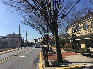
Exton is a census-designated place (CDP) in West Whiteland Township in Chester County, Pennsylvania, United States. Its population was 5,622 at the 2020 census. The Exton Square Mall and Main Street at Exton are both located within Exton along with several other shopping centers, making Exton the major shopping district in Chester County.

<span class="mw-page-title-main">Malvern, Pennsylvania</span> Borough in Pennsylvania, United States

Malvern is a borough in Chester County, Pennsylvania, United States. Malvern is the terminus of the Philadelphia Main Line. It is 19.4 miles (31.2 km) west of Philadelphia. The population was 3,419 at the 2020 census.

<span class="mw-page-title-main">Thornbury Township, Chester County, Pennsylvania</span> Township in Pennsylvania, United States

Thornbury Township is a township in Chester County, Pennsylvania, United States. The population was 3,017 at the 2010 census. It is adjacent to, and was once joined with, Thornbury Township, Delaware County.

<span class="mw-page-title-main">Tredyffrin Township, Pennsylvania</span> Township in Pennsylvania, United States

Tredyffrin Township is a township located in eastern Chester County, Pennsylvania, United States. The population was 29,332 at the 2010 census.

<span class="mw-page-title-main">West Chester, Pennsylvania</span> Borough in Pennsylvania, United States

West Chester is a borough and the county seat of Chester County, Pennsylvania, United States. Located within the Philadelphia metropolitan area, the borough had a population of 18,461 at the 2010 census. West Chester is the mailing address for most of its neighboring townships. When calculated by mailing address, the population as of the 2010 U.S. Census was 108,696, which would make it the 10th largest city by mailing address in the state of Pennsylvania.

<span class="mw-page-title-main">West Goshen Township, Pennsylvania</span> Township in Pennsylvania, United States

West Goshen Township is a township in Chester County, Pennsylvania, United States. The population was 23,040 at the 2020 census. In 2013, Money Magazine voted West Goshen as the 10th best place to live in America. West Goshen has also been ranked in the top 15 places to live in America from 2014 to 2017 and is also at the top of best neighborhoods to raise a family in Pennsylvania every year.

<span class="mw-page-title-main">West Nottingham Township, Pennsylvania</span> Township in Pennsylvania, United States

West Nottingham Township is a township in Chester County, Pennsylvania, United States. The population was 2,722 at the 2010 census.

<span class="mw-page-title-main">West Whiteland Township, Pennsylvania</span> Township in Pennsylvania, United States

West Whiteland Township is a township in Chester County, Pennsylvania, United States. The population was 19,632 at the 2020 census.

<span class="mw-page-title-main">Westtown Township, Pennsylvania</span> Township in Pennsylvania, United States

Westtown Township is a township in Chester County, Pennsylvania, United States. The population was 10,827 at the 2010 census.

<span class="mw-page-title-main">Willistown Township, Pennsylvania</span> Township in Pennsylvania, United States

Willistown Township is a township in Chester County, Pennsylvania, United States. The population was 10,497 at the 2010 census. At the 1860 census, the population of Willistown was 1,521, and in 1980 it was 8,269.

<span class="mw-page-title-main">Marple Township, Pennsylvania</span> Township in Pennsylvania, United States

Marple Township is a township in Delaware County, Pennsylvania, United States. It contains the census designated place of Broomall. The population was estimated at 23,743 as of 2015. ZIP codes include mainly 19008, as well as 19064 and 19063. The township is run by Marple Township board of commissioners.

<span class="mw-page-title-main">Newtown Township, Delaware County, Pennsylvania</span> Township in Pennsylvania, United States

Newtown Township, also referred to by the name of its post office of Newtown Square, is a township in Delaware County, Pennsylvania, United States. Prior to 1789, it was part of Chester County. As of the 2020 census, the population was 15,002.

<span class="mw-page-title-main">Thornbury Township, Delaware County, Pennsylvania</span> Township in Pennsylvania, United States

Thornbury Township is a township in Delaware County, Pennsylvania, United States. As of the 2010 U.S. census, the population was 8,028, up from 7,093 at the 2000 census. It is adjacent to, and was once joined with, Thornbury Township in Chester County. It includes part of the census designated place of Cheyney University.

<span class="mw-page-title-main">Whitemarsh Township, Pennsylvania</span> Home rule municipality in Pennsylvania, United States

Whitemarsh Township is a Home rule municipality in Montgomery County, Pennsylvania. It retains its former classification of "Township" in its official name despite being a home rule municipality. The population was 17,349 at the 2010 census. Whitemarsh is adjacent to the neighborhood of Andorra in the Roxborough section of Philadelphia, and is bordered in Montgomery County by Springfield, Upper Dublin, Whitpain, and Plymouth townships, Conshohocken, and the Schuylkill River, which separates it from Lower Merion Township.

<span class="mw-page-title-main">Bethlehem Township, Pennsylvania</span> Place in Pennsylvania, United States

Bethlehem Township is a township in Northampton County, Pennsylvania, United States. The population of Bethlehem Township was 23,730 at the 2010 census. It is a suburb of Bethlehem and is part of the Lehigh Valley metropolitan statistical area, which had a population of 861,899 and was the 68th-most populous metropolitan area in the U.S. as of the 2020 census.

References

  1. "2016 U.S. Gazetteer Files". United States Census Bureau. Retrieved Aug 13, 2017.
  2. "Population and Housing Unit Estimates" . Retrieved June 9, 2017.
  3. "National Register Information System". National Register of Historic Places . National Park Service. July 9, 2010.
  4. “Update on the Paoli Pike Trail”’’East Goshen Township Newsletter’’ Spring 2016, Retrieved 8 April 2016.
  5. East Goshen Township Website. "FAQs", Retrieved on 3 February 2016.
  6. "DVRPC > Site Search". Archived from the original on 2019-04-09. Retrieved 2014-03-21.
  7. "Census 2020".
  8. "U.S. Census website". United States Census Bureau . Retrieved 2008-01-31.
  9. "2010 East Goshen Township Census Findings" (PDF).
  10. "East Goshen Township map" (PDF). PennDOT. Retrieved March 13, 2023.
  11. 1 2 "West Chester Area Council of Governments Map." On the website of West Goshen Township. Retrieved on September 26, 2018.
  12. "School Boundary Adjustment Draft SK8C - Current Boundaries with Zones of Change Archived 2018-09-26 at the Wayback Machine " (Elementary). West Chester Area School District. Retrieved on September 26, 2018.
  13. "School Boundary Adjustment Draft SK8C - Current Boundaries with Zones of Change Archived 2018-09-26 at the Wayback Machine " (Secondary). West Chester Area School District. Retrieved on September 26, 2018.
  14. "School". SS. Peter and Paul Parish. Retrieved 2020-04-23. Saints Peter & Paul School 1327 Boot Road West Chester, PA 19380 - Compare with the map.