Lynch, Kentucky

Last updated

Lynch, Kentucky
First and Pirate in Lynch.jpg
Houses at Lynch's western end
Harlan County Kentucky Incorporated and Unincorporated areas Lynch Highlighted 2148540.svg
Location of Lynch in Harlan County, Kentucky.
Coordinates: 36°57′54″N82°55′00″W / 36.96500°N 82.91667°W / 36.96500; -82.91667
Country United States
State Kentucky
County Harlan
IncorporatedMay 7, 1963
Named for Thomas Lynch, the head of U.S. Coal and Coke Company
Government
  MayorJohn Adams
Area
[1]
  Total
0.30 sq mi (0.78 km2)
  Land0.30 sq mi (0.78 km2)
  Water0.00 sq mi (0.00 km2)
Elevation
1,716 ft (523 m)
Population
 (2020)
  Total
658
  Density2,200.67/sq mi (848.65/km2)
Time zone UTC-5 (Eastern (EST))
  Summer (DST) UTC-4 (EDT)
ZIP code
40855
Area code 606
FIPS code 21-48540
GNIS feature ID0497363

Lynch is a home rule-class city in Harlan County, Kentucky, United States. In the 2020 census the city population was 658, [2] down from 747 in 2010.

Contents

History

A company store owned and operated by the U.S. Coal and Coke Company in Lynch, Kentucky. At this store, miners employed by the coal company could buy grocery's and other necessities for their family's, 1945 General store operated by subsidiary company. U.S. Coal & Coke Company, U.S. ^30 & 31 Mines, Lynch, Harlan County... - NARA - 541405 - cropped and restored.jpg
A company store owned and operated by the U.S. Coal and Coke Company in Lynch, Kentucky. At this store, miners employed by the coal company could buy grocery's and other necessities for their family's, 1945

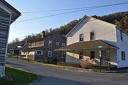
Lynch was plotted in 1917 by the U.S. Coal and Coke Company (a subsidiary of U.S. Steel) as a company town to house workers at the company's nearby coal mines. It was named for then-head of the company, Thomas Lynch.

By the 1940s, Lynch had a population of 10,000 and had such amenities as a hospital and movie theater. The population declined dramatically in the 1960s and 1970s as mining techniques shifted to less labor-intensive methods.

In 1996, the rails to Lynch and nearby Benham were officially abandoned.

In 2012, PBS of Eastern Tennessee created a documentary titled The Eastern Kentucky Social Club dealing with the history of the black community and immigrant community in Lynch. [3]

Geography

Lynch is located in eastern Harlan County at 36°57′54″N82°55′00″W / 36.965133°N 82.916569°W / 36.965133; -82.916569 (36.965133, -82.916569), [4] in the valley of Looney Creek. Lynch is the nearest city to Kentucky's highest point, Black Mountain (4,145 ft or 1,263 m). Sitting at an elevation of 1,716 feet (523 m) above sea level.

Lynch is Kentucky's highest incorporated city. It is bordered by 3,488-foot (1,063 m) Looney Ridge to the north and 3,640-foot (1,110 m) Benham Spur to the south. The city of Benham borders the west side of Lynch, and Cumberland is 4 miles (6 km) to the west via Kentucky Route 160, the main road through Lynch. KY 160 leads southeast up the valley of Looney Creek to the Virginia border on the crest of Black Mountain at an elevation of 3,700 feet (1,100 m), then continues to Appalachia, Virginia, 16 miles (26 km) southeast of Lynch.[ citation needed ]

According to the United States Census Bureau, Lynch has a total area of 0.3 square miles (0.78 km2), all of it land.

Demographics

Lynch Post Office in 1946 Post office and office building. U.S. Coal & Coke Company, U.S. ^30 & 31 Mines, Lynch, Harlan County, Kentucky. - NARA - 541406.jpg
Lynch Post Office in 1946
Lynch in 1973 HOMES ON A STREET IN LYNCH, KENTUCKY, NEAR CUMBERLAND WHICH ONCE WAS THE LARGEST COAL COMPANY TOWN IN THE WORLD. NOW... - NARA - 556601.jpg
Lynch in 1973

As of the census [5] of 2000, there were 900 people, 408 households, and 250 families residing in the city. The population density was 2,753.1 inhabitants per square mile (1,063.0/km2). There were 514 housing units at an average density of 1,572.3 per square mile (607.1/km2). The racial makeup of the city was 73.33% White, 24.89% Black or African American, 0.33% Native American, and 1.44% from two or more races. Hispanic or Latino of any race were 0.33% of the population.

Historical population
CensusPop.Note
1970 1,517
1980 1,6146.4%
1990 1,166−27.8%
2000 900−22.8%
2010 747−17.0%
2020 658−11.9%
U.S. Decennial Census [6]

There were 408 households, out of which 24.0% had children under the age of 18 living with them, 40.7% were married couples living together, 16.2% had a female householder with no husband present, and 38.5% were non-families. 36.8% of all households were made up of individuals, and 20.1% had someone living alone who was 65 years of age or older. The average household size was 2.21 and the average family size was 2.88.

In the city, the population was spread out, with 22.6% under 18, 8.9% from 18 to 24, 20.4% from 25 to 44, 28.2% from 45 to 64, and 19.9% who were 65 or older. The median age was 43 years. For every 100 females, there were 82.6 males. For every 100 females age 18 and over, there were 80.1 males.

The median income for a household in the city was $17,609, and the median income for a family was $21,625. Males had a median income of $31,500 versus $19,038 for females. The per capita income for the city was $13,369. About 36.7% of families and 37.8% of the population were below the poverty line, including 57.6% of those under age 18 and 25.9% of those age 65 or over.

Notable people

See also

Related Research Articles

<span class="mw-page-title-main">Harlan County, Kentucky</span> County in Kentucky, United States

Harlan County is a county located in southeastern Kentucky. As of the 2020 census, the population was 26,831. Its county seat is Harlan. It is classified as a moist county—one in which alcohol sales are prohibited, but containing a "wet" city—in this case Cumberland, where package alcohol sales are allowed. In the city of Harlan, restaurants seating 100+ may serve alcoholic beverages.

<span class="mw-page-title-main">Wingo, Kentucky</span> City in Kentucky, United States

Wingo is a home rule-class city in Graves County, Kentucky, United States. The population was 632 at the 2010 census.

<span class="mw-page-title-main">Greenup, Kentucky</span> City in Kentucky, United States

Greenup is a home rule-class city in and the county seat of Greenup County, Kentucky, United States, located at the confluence of the Little Sandy River with the Ohio River. The population was 1,095 at the 2020 census. It is part of the Huntington–Ashland metropolitan area.

<span class="mw-page-title-main">Wurtland, Kentucky</span> City in Kentucky, United States

Wurtland is a home rule-class city in Greenup County, Kentucky, United States, along the Ohio River. The population was 983 at the 2020 census. It is part of the Huntington–Ashland metropolitan area.

<span class="mw-page-title-main">Benham, Kentucky</span> City in Kentucky, United States

Benham is a home rule-class city in Harlan County, Kentucky, in the United States. The city was formally incorporated by the General Assembly in 1961. The population was 512 at the 2020 census, up from 500 at the 2010 census.

<span class="mw-page-title-main">Cumberland, Kentucky</span> City in Kentucky, United States

Cumberland is a home rule-class city in Harlan County, Kentucky, in the United States. The population according to the 2010 Census was 2,237, down from 2,611 at the 2000 census. The city sits at the confluence of Looney Creek and the Poor Fork Cumberland River.

<span class="mw-page-title-main">Evarts, Kentucky</span> City in Kentucky, United States

Evarts is a home rule-class city in Harlan County, Kentucky, in the United States. The post office was opened on February 9, 1855, and named for one of the area's pioneer families. The city was formally incorporated by the state assembly in 1921. The population was 962 at the 2010 census.

<span class="mw-page-title-main">Harlan, Kentucky</span> City in Kentucky, United States

Harlan is a home rule-class city in and the county seat of Harlan County, Kentucky, United States. The population was 1,745 at the 2010 census, down from 2,081 at the 2000 census.

<span class="mw-page-title-main">Loyall, Kentucky</span> City in Kentucky, United States

Loyall is a home rule-class city in Harlan County, Kentucky, in the United States. The population was 1,461 as of the 2010 census, up from 766 at the time of the 2000 census.

<span class="mw-page-title-main">Wallins Creek, Kentucky</span> Census-designated place in Kentucky, United States

Wallins Creek is an unincorporated community and census-designated place (CDP) in Harlan County, Kentucky, United States. The population was 156 at the 2010 census, when it was still a city, having dropped from 257 at the 2000 census.

<span class="mw-page-title-main">Douglass Hills, Kentucky</span> City in Kentucky, United States

Douglass Hills is a home rule-class city in eastern Jefferson County, Kentucky, United States. The population was 5,484 at the 2010 census, down from 5,718 at the 2000 census.

<span class="mw-page-title-main">Spring Valley, Kentucky</span> City in Kentucky, United States

Spring Valley is a home rule-class city in Jefferson County, Kentucky, United States. Spring Valley Estates, begun in 1964, remained an unincorporated area until September, 1983. At that time, the City of Spring Valley was established to provide services. The current mayor is Gerri Willis. The population was 654 at the 2010 census. Population has increased to 837 based on the 2020 census.

<span class="mw-page-title-main">Westwood, Jefferson County, Kentucky</span> City in Kentucky, United States

Westwood is a home rule-class city in Jefferson County, Kentucky, United States. The population was 634 at the 2010 census.

<span class="mw-page-title-main">Fort Mitchell, Kentucky</span> City in Kentucky, United States

Fort Mitchell is a home rule-class city in Kenton County, Kentucky, United States. The population was 8,702 at the 2020 census. It is part of the Cincinnati metropolitan area.

<span class="mw-page-title-main">Lewisburg, Kentucky</span> City in Kentucky, United States

Lewisburg is a home rule-class city in Logan County, Kentucky, in the United States. The population was 810 at the 2010 census, down from 903 at the 2000 census.

<span class="mw-page-title-main">Inez, Kentucky</span> City in Kentucky, United States

Inez is a home rule-class city in and the county seat of Martin County, Kentucky, United States. The population was 546 at the 2020 census.

<span class="mw-page-title-main">Tompkinsville, Kentucky</span> City in Kentucky, United States

Tompkinsville is a home rule-class city in and the county seat of Monroe County, Kentucky, United States. The population was 2,309 at the 2020 census. The city was named after Vice President Daniel D. Tompkins who served under President James Monroe, for whom the county was named.

<span class="mw-page-title-main">Elkton, Kentucky</span> City in Kentucky, United States

Elkton is a home rule-class city in and the county seat of Todd County, Kentucky, United States. The population was 2,062 at the 2010 census.

<span class="mw-page-title-main">Paducah, Texas</span> Town in Cottle County, Texas, United States

Paducah is a town in Cottle County, Texas, United States. The population was 1,063 at the 2020 census, down from 1,186 in 2010. It is the county seat of Cottle County. It is just south of the Texas Panhandle and east of the Llano Estacado.

<span class="mw-page-title-main">Keokee, Virginia</span> Census-designated place in Virginia, United States

Keokee is an unincorporated community and census-designated place (CDP) in Lee County, Virginia, United States. The population was 416 at the 2010 census.

References

  1. "2020 U.S. Gazetteer Files". United States Census Bureau. Retrieved March 18, 2022.
  2. "Census.gov". Census.gov. United States Census Bureau. Retrieved April 28, 2023.
  3. The Eastern Kentucky Social Club , retrieved February 10, 2022
  4. "US Gazetteer files: 2010, 2000, and 1990". United States Census Bureau. February 12, 2011. Retrieved April 23, 2011.
  5. "U.S. Census website". United States Census Bureau . Retrieved January 31, 2008.
  6. "Census of Population and Housing". Census.gov. Retrieved June 4, 2015.