Mount Brazeau is a mountain in Alberta, Canada.

Mount Chester is a mountain located in the Smith-Dorrien Creek Valley of Kananaskis in the Canadian Rockies. The mountain was named in 1917 after HMS Chester, which was severely damaged in the Battle of Jutland.

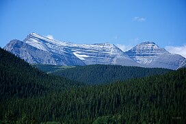
The Blue Range is a mountain range of the Canadian Rockies, located on the Continental Divide in Banff National Park, Canada. The range was so named on account of its blueish colour when viewed from afar. Mount Alcantara is the highest point in the range.

Mount Hector is a 3,394-metre (11,135-foot) mountain summit located in the Bow River valley of Banff National Park, in the Canadian Rockies of Alberta, Canada. The mountain was named in 1884 by George M. Dawson after James Hector, a geologist on the Palliser expedition. The mountain is located beside the Icefields Parkway, 17 km (11 mi) north of Lake Louise.
Aurora Mountain is located in the Blue Range of the Canadian Rockies, which forms part of the Continental Divide and the provincial boundary between British Columbia and Alberta. It is named after HMS Aurora, a British Royal Navy light cruiser launched in 1913 that was transferred to the Royal Canadian Navy in 1920.
Mount Fryatt is Alberta's 26th highest peak. In 1920, it was named after Captain Charles Fryatt, a British merchant seaman who was executed by the Germans during World War I. It lies within peaks that are between the Athabasca and Whirlpool Rivers in Jasper National Park.
Mount Talbot is located on the northern side of Shale Pass on the Alberta-British Columbia border. It was officially named on 4 November 1925 after Senator Peter Talbot (1854-1919), an early pioneer of the Lacombe region of central Alberta. A teacher and farmer, he turned to politics and became an elected representative of the Northwest Territories and later the province of Alberta. In 1906, Sir Wilfrid Laurier appointed him to the Senate of Canada.
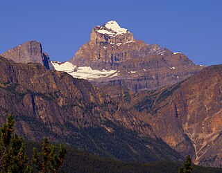
Mount Bess is located on the border of Alberta and British Columbia. It is the 83rd highest peak in Alberta. It was named in 1910 by J. Norman Collie after Bessie Gunn, who accompanied Collie's expedition.
Dungeon Peak is a 3,129-metre (10,266 ft) mountain summit located on the shared border of Jasper National Park in Alberta, and Mount Robson Provincial Park in British Columbia, Canada. Dungeon Peak is part of The Ramparts in the Tonquin Valley. The descriptive name was applied in 1916 by Morrison P. Bridgland (1878-1948), a Dominion Land Surveyor who named many peaks in Jasper Park and the Canadian Rockies. The mountain's name was made official in 1935 by the Geographical Names Board of Canada.
Mount Bulyea is located in Banff National Park on the border of Alberta and British Columbia. It was named in 1920 after Hon. George H. V. Bulyea, a Canadian Pacific Railway employee and first Lieutenant Governor of Alberta.

Mount Daly is located on the border of Alberta and British Columbia. It was named in 1898 by Charles E. Fay after Charles P. Daly, a geographer. Mount Niles is located two km southwest of Daly.

Mount Beatty is a mountain located on the border of Alberta and British Columbia on the Continental Divide. It was named in 1924 after David Beatty, a British naval officer of Irish ancestry who commanded ships in the First World War.

Mount Cornwall is a prominent 2,970-metre (9,740-foot) summit located between the Elbow River valley and Little Elbow River valley of Kananaskis Country in the Canadian Rockies of Alberta, Canada. The peak is visible from Highway 66, weather permitting. Mount Cornwall's nearest higher peak is Tombstone Mountain, 6.6 km (4.1 mi) to the southwest.

Mount Invincible is a 2,700-metre (8,900-foot) mountain summit located in Peter Lougheed Provincial Park in the Canadian Rockies of Alberta, Canada. The peak is visible from Alberta Highway 40, and the Upper and Lower Kananaskis Lakes area. Mount Invincible's nearest higher peak is Mount Warspite, 2.6 km (1.6 mi) to the northwest.

Mount Sparrowhawk is a 3,121-metre (10,240 ft) mountain summit located in Kananaskis Country in the Canadian Rockies of Alberta, Canada. Mount Sparrowhawk's nearest higher peak is Mount Bogart, 3.6 km (2.2 mi) to the southeast. Sparrowhawk's south slope was a candidate to be used as a ski hill for the alpine events at the 1988 Winter Olympics, but nearby Mount Allan's Nakiska was selected instead.

Mount Wintour is a 2,700-metre (8,900-foot) ridge-like mountain summit located in the Opal Range of the Canadian Rockies of Alberta, Canada. It is situated in the Kananaskis River Valley east of Lower Kananaskis Lake and Highway 40 in Peter Lougheed Provincial Park. The nearest higher neighbor is Mount Jerram, 2.3 km (1.4 mi) to the east. The northern end of Mount Wintour forms the south canyon wall of King Creek which is a popular ice climbing destination. There are two climbing routes to the summit, the North Ridge and the South Ridge, both rated class 5.4.

Mount Indefatigable is a 2,667-metre (8,750-foot) mountain summit located in Peter Lougheed Provincial Park in the Canadian Rockies of Alberta, Canada. The peak is visible from Alberta Highway 40, and the Kananaskis Lakes area. Mount Indefatigable's nearest higher neighbour is Mount Invincible, 1.8 km (1.1 mi) to the northwest.

Mount Shark is a 2,786-metre (9,140-foot) mountain summit located in the Spray Valley of Kananaskis Country at the northern tip of the Spray Mountains range. It is situated on the southern boundary of Banff National Park in the Canadian Rockies of Alberta, Canada. Mount Shark in not visible from any road in Banff Park, however, it can be seen from Alberta Highway 742, also known as the Smith-Dorrien/Spray Trail. Mount Shark's nearest higher peak is Mount Smuts, 3.0 km (1.9 mi) to the southeast.

Mount Jellicoe is a 3,075-metre (10,089-foot) mountain summit located in Peter Lougheed Provincial Park in the Canadian Rockies of Alberta, Canada. Its nearest higher peak is Mount Smith-Dorrien, 2.0 km (1.2 mi) to the north. The Haig Glacier lies below the west aspect of Jellicoe, and the Smith-Dorrien Glacier lies to the north. The Continental Divide is 2.0 km (1.2 mi) to the west.

Mount Warspite is a 2,860-metre (9,380-foot) mountain summit located in Peter Lougheed Provincial Park in the Canadian Rockies of Alberta, Canada. The peak is visible from Smith-Dorrien Road (742), and Alberta Highway 40 in the Kananaskis Lakes area. Mount Warspite's nearest higher peak is Mount Black Prince, located 2.4 km (1.5 mi) to the northwest.