National Register of Historic Places listings in Yavapai County, Arizona

Last updated

Location of Yavapai County in Arizona Map of Arizona highlighting Yavapai County.svg
Location of Yavapai County in Arizona

This is a list of the National Register of Historic Places listings in Yavapai County, Arizona. It is intended to be a complete list of the properties and districts on the National Register of Historic Places in Yavapai County, Arizona, United States. The locations of National Register properties and districts for which the latitude and longitude coordinates are included below, may be seen in a map. [1]

Contents

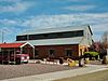
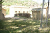
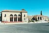
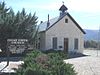
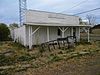
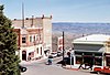
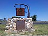
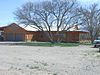
There are 133 properties and districts listed on the National Register in the county, including 1 that is also a National Historic Landmark. 65 of these properties and districts are located in the city of Prescott, and are listed separately, while the remaining properties and districts (including the National Historic Landmark) are located elsewhere in the county, and are listed here. Three properties listed outside Prescott have been removed from the register.


    This National Park Service list is complete through NPS recent listings posted March 17, 2023. [2]

Map all coordinates using: OpenStreetMap  
Download coordinates as: KML

Current listings

Prescott

Exclusive of Prescott

[3] Name on the RegisterImageDate listed [4] Location City or townDescription
1 Ash Fork Maintenance Camp No. 1
Ash Fork Maintenance Camp No. 1 Ash Fork Maintenance Station No. 1 NRHP 00000103 Yavapai County, AZ.jpg
Ash Fork Maintenance Camp No. 1
March 2, 2000
(#00000103)
Western end of old U.S. Route 66
35°13′22″N112°29′28″W / 35.222778°N 112.491111°W / 35.222778; -112.491111 (Ash Fork Maintenance Camp No. 1)
Ash Fork
2 Beaver Creek Ranger Station
Beaver Creek Ranger Station Beaver Creek Ranger Station Barn - 1936 (5376118462).jpg
Beaver Creek Ranger Station
June 10, 1993
(#93000512)
Off Interstate 17 northeast of Rimrock in the Coconino National Forest
34°40′22″N111°42′41″W / 34.672778°N 111.711389°W / 34.672778; -111.711389 (Beaver Creek Ranger Station)
Rimrock
3 Beaver Creek School September 20, 2016
(#16000631)
4810 E. Beaver Creek Rd.
34°39′14″N111°46′02″W / 34.653974°N 111.767248°W / 34.653974; -111.767248 (Beaver Creek School)
Rimrock
4 Broadway Bridge
Broadway Bridge Clarkdale-Broadway Bridge-1917-2.jpg
Broadway Bridge
September 30, 1988
(#88001651)
Broadway St. over Bitter Creek
34°46′27″N112°03′19″W / 34.774167°N 112.055278°W / 34.774167; -112.055278 (Broadway Bridge)
Clarkdale
5 Building at 826 North Main Street
Building at 826 North Main Street Cottonwood-Building on 826-1925-NRHP.jpg
Building at 826 North Main Street
September 19, 1986
(#86002147)
826 N. Main St.
34°44′46″N112°01′36″W / 34.746111°N 112.026667°W / 34.746111; -112.026667 (Building at 826 North Main Street)
Cottonwood
6 Camp Date Creek
Camp Date Creek Camp Date Creek 1869.jpg
Camp Date Creek
March 22, 1996
(#95001361)
North of U.S. Route 89
34°15′45″N112°55′24″W / 34.2625°N 112.923333°W / 34.2625; -112.923333 (Camp Date Creek)
Date Creek Also known as Camp McPherson
7 Camp Verde Grammar School November 19, 2018
(#100003126)
435 S Main St.
34°33′48″N111°51′15″W / 34.5632°N 111.8541°W / 34.5632; -111.8541 (Camp Verde Grammar School)
Camp Verde
8 Childs-Irving Hydroelectric Facilities
Childs-Irving Hydroelectric Facilities Childs3.jpg
Childs-Irving Hydroelectric Facilities
August 9, 1991
(#91001023)
From the eastern bank of the Verde River northeast to Stehr Lake and along Fossil Creek in the Tonto National Forest
34°20′59″N111°41′57″W / 34.349722°N 111.699167°W / 34.349722; -111.699167 (Childs-Irving Hydroelectric Facilities)
Strawberry
9 Clark Memorial Clubhouse
Clark Memorial Clubhouse Clarkdale-Clark Memorial Clubhouse-1926.jpg
Clark Memorial Clubhouse
October 2, 1982
(#82001662)
Off N. 9th St.
34°46′20″N112°03′20″W / 34.772222°N 112.055556°W / 34.772222; -112.055556 (Clark Memorial Clubhouse)
Clarkdale
10 Clarkdale Historic District
Clarkdale Historic District Clarkdale-2.jpg
Clarkdale Historic District
January 8, 1998
(#97001586)
Roughly along Main St., roughly bounded by the Verde River including industrial smelter site
34°46′27″N112°03′31″W / 34.774167°N 112.058611°W / 34.774167; -112.058611 (Clarkdale Historic District)
Clarkdale
11 Clear Creek Church
Clear Creek Church Camp Verde-Clear Creek Church-1898.JPG
Clear Creek Church
August 6, 1975
(#75000362)
3.5 mi (5.6 km) southeast of Camp Verde
34°31′30″N111°49′41″W / 34.525°N 111.828056°W / 34.525; -111.828056 (Clear Creek Church)
Camp Verde
12 Clear Creek Pueblo and Caves February 10, 1975
(#75000363)
Address Restricted
Camp Verde Sinagua pueblo
13 Clemenceau Public School
Clemenceau Public School Cottonwood-Clemenceau Public School-1923-NRHP-2.jpg
Clemenceau Public School
September 19, 1986
(#86002149)
1 N. Willard St.
34°44′24″N112°01′33″W / 34.74°N 112.025833°W / 34.74; -112.025833 (Clemenceau Public School)
Cottonwood Now Clemenceau Heritage Museum
14 Copper Creek Guard Station
Copper Creek Guard Station CopperCreekCabinPrescottArea074.jpg
Copper Creek Guard Station
June 10, 1993
(#93000525)
Northeast of Black Canyon City in the Tonto National Forest
34°12′51″N111°58′40″W / 34.214167°N 111.977778°W / 34.214167; -111.977778 (Copper Creek Guard Station)
Black Canyon City
15 Cottage Hotel
Cottage Hotel Cottage Hotel NRHP 98000080 Yavapai County, AZ.jpg
Cottage Hotel
February 12, 1998
(#98000080)
Junction of 1st St. and Shoeny Ave.
35°19′40″N112°52′35″W / 35.3278°N 112.8764°W / 35.3278; -112.8764 (Cottage Hotel)
Seligman
16 Cottonwood Commercial Historic District
Cottonwood Commercial Historic District Cottonwood-Cottonwood Hotel-1917.jpg
Cottonwood Commercial Historic District
May 18, 2000
(#00000497)
Approximately from 712 to 1124 N. Main St.; also North Main St. and East Pima St.
34°44′52″N112°01′36″W / 34.7478°N 112.0267°W / 34.7478; -112.0267 (Cottonwood Commercial Historic District)
Cottonwood Second set of addresses represent a boundary increase approved June 4, 2021.
17 Cross Creek Ranch House May 29, 2008
(#08000461)
10 Russet Ridge Pl.
34°48′53″N111°50′14″W / 34.814614°N 111.837173°W / 34.814614; -111.837173 (Cross Creek Ranch House)
Sedona
18 Crown King Ranger Station June 10, 1993
(#93000522)
West of Crown King in the Prescott National Forest
34°12′22″N112°20′27″W / 34.206111°N 112.340833°W / 34.206111; -112.340833 (Crown King Ranger Station)
Crown King
19 Edens House
Edens House Edens House (Cottonwood, Arizona).jpg
Edens House
September 19, 1986
(#86002150)
1015 N. Cactus St.
34°44′54″N112°01′38″W / 34.748333°N 112.027222°W / 34.748333; -112.027222 (Edens House)
Cottonwood
20 Fewke's Fort Below Aztec Pass (AR-03-09-06-23) January 20, 1989
(#88003186)
Address Restricted
Paulden Prescott Culture archaeological site
21 Fort Verde District
Fort Verde District FortVerdeBuildingAndGeneral.jpg
Fort Verde District
October 7, 1971
(#71000120)
Bounded by Hance, Coppinger, and Woods Sts.; also roughly north and east of Hance and Coppinger Sts. to Verde Ditch
34°33′54″N111°51′08″W / 34.565°N 111.852222°W / 34.565; -111.852222 (Fort Verde District)
Camp Verde Fort Verde State Historic Park and vicinity. Second set of addresses represents a boundary increase.
22 Fossil Creek Bridge
Fossil Creek Bridge Fossil Creek Bridge (25116940549).jpg
Fossil Creek Bridge
September 30, 1988
(#88001620)
Forest Service Rd. over Fossil Creek
34°23′39″N111°37′45″W / 34.394167°N 111.629167°W / 34.394167; -111.629167 (Fossil Creek Bridge)
Camp Verde
23 Groom Creek School
Groom Creek School Groom Creek School House.jpg
Groom Creek School
November 18, 1992
(#92001568)
Senator Highway southeast of Prescott in the Prescott National Forest
34°28′15″N112°26′02″W / 34.470833°N 112.433889°W / 34.470833; -112.433889 (Groom Creek School)
Groom Creek
24 Hatalacva Ruin July 24, 1974
(#74000463)
Address Restricted
Clarkdale Sinagua ruin
25 Hell Canyon Bridge September 30, 1988
(#88001682)

34°58′45″N112°22′54″W / 34.979167°N 112.381667°W / 34.979167; -112.381667 (Hell Canyon Bridge)
Drake vic.Road bridge
26 Hyde Mountain Lookout House January 28, 1988
(#87002491)
Prescott National Forest
34°50′15″N112°55′10″W / 34.8375°N 112.919444°W / 34.8375; -112.919444 (Hyde Mountain Lookout House)
Camp Wood
27 Jerome Historic District
Jerome Historic District High street Jerome, Arizona.jpg
Jerome Historic District
November 13, 1966
(#66000196)
Jerome
34°45′16″N112°06′45″W / 34.754444°N 112.1125°W / 34.754444; -112.1125 (Jerome Historic District)
Jerome
28 Kay-El-Bar Ranch May 22, 1978
(#78000572)
North of Wickenburg on Rincon Rd.
34°00′34″N112°44′53″W / 34.009444°N 112.748056°W / 34.009444; -112.748056 (Kay-El-Bar Ranch)
Wickenburg Guest ranch
29 Kirkland Store October 1, 1998
(#98001215)
Main St. at the corner of Iron Springs Rd. and Kirkland Junction Rd.
34°25′01″N112°42′32″W / 34.416944°N 112.708889°W / 34.416944; -112.708889 (Kirkland Store)
Kirkland
30 Little Hell Canyon Bridge
Little Hell Canyon Bridge HELL CANYON BRIDGE.jpg
Little Hell Canyon Bridge
September 30, 1988
(#88001684)
Abandoned U.S. Route 89 over Little Hell Canyon
35°04′48″N112°24′22″W / 35.08°N 112.406111°W / 35.08; -112.406111 (Little Hell Canyon Bridge)
Drake
31 Loy Butte Pueblo February 10, 1975
(#75000367)
Address Restricted
Sedona Sinagua ruin
32 Lynx Creek Bridge September 30, 1988
(#88001641)
just east of Lynx Creek Road on the Old Black Canyon Highway
34°33′08″N112°22′21″W / 34.552222°N 112.3725°W / 34.552222; -112.3725 (Lynx Creek Bridge)
Prescott Valley
33 Lynx Creek District
Lynx Creek District Prescott Valley-Lynx Creek District-Fain Park-1.jpg
Lynx Creek District
August 31, 1978
(#78000571)
south of Arizona State Route 69 and east of Stoneridge Drive
34°34′28″N112°20′50″W / 34.574444°N 112.347222°W / 34.574444; -112.347222 (Lynx Creek District)
Prescott Valley
34 Master Mechanic's House
Master Mechanic's House Cottonwood-Master Mechanic House-1900-NRHP.jpg
Master Mechanic's House
September 19, 1986
(#86002152)
333 S. Willard St.
34°44′00″N112°01′33″W / 34.733333°N 112.025833°W / 34.733333; -112.025833 (Master Mechanic's House)
Cottonwood UVX smelter complex
35 Mayer Apartments
Mayer Apartments Mayer-Mayer Apartments-1902-2.jpg
Mayer Apartments
July 13, 1989
(#89000860)
Central Ave., southwest of Ash St.
34°23′54″N112°14′01″W / 34.398333°N 112.233611°W / 34.398333; -112.233611 (Mayer Apartments)
Mayer
36 Mayer Business Block
Mayer Business Block Mayer-(B)-Historic Mayer Business Block-1902.jpg
Mayer Business Block
July 13, 1989
(#89000859)
Oak St. and Central Ave.
34°23′54″N112°13′57″W / 34.398333°N 112.2325°W / 34.398333; -112.2325 (Mayer Business Block)
Mayer
37 Mayer Red Brick Schoolhouse
Mayer Red Brick Schoolhouse Mayer-Mayer Red Brick Schoolhouse-1914.jpg
Mayer Red Brick Schoolhouse
July 21, 2004
(#04000719)
Main St.
34°24′N112°14′W / 34.4°N 112.24°W / 34.4; -112.24 (Mayer Red Brick Schoolhouse)
Mayer
38 Mingus Lookout Complex
Mingus Lookout Complex Mingus Lookout Complex.jpg
Mingus Lookout Complex
January 28, 1988
(#87002490)
Prescott National Forest
34°41′39″N112°07′38″W / 34.694167°N 112.127222°W / 34.694167; -112.127222 (Mingus Lookout Complex)
Jerome Fire tower and ranger cabin on Mingus Mountain
39 Montezuma Castle National Monument-Back Ranch Historic District-Montezuma Well Unit
Montezuma Castle National Monument-Back Ranch Historic District-Montezuma Well Unit Camp Verde- Montezuma Castle-1-A.JPG
Montezuma Castle National Monument-Back Ranch Historic District-Montezuma Well Unit
October 15, 1966
(#66000082)
5525 Beaver Creek Rd., 40 mi (64 km) south of Flagstaff on Interstate 17
34°38′19″N111°47′17″W / 34.638611°N 111.788056°W / 34.638611; -111.788056 (Montezuma Castle National Monument-Back Ranch Historic District-Montezuma Well Unit)
Camp Verde Major Sinagua cliff dwelling
40 OK Ranch Historic District April 19, 2018
(#100002358)
Red Rock Crossing, Sedona Ranger District
34°49′35″N111°48′33″W / 34.826488°N 111.809046°W / 34.826488; -111.809046 (OK Ranch Historic District)
Coconino National Forest AKA Crescent Moon Ranch
41 Palace Station District
Palace Station District Palace Station.jpg
Palace Station District
April 30, 1976
(#76000382)
23 mi (37 km) south of Prescott in the Prescott National Forest
34°22′35″N112°24′32″W / 34.376389°N 112.408889°W / 34.376389; -112.408889 (Palace Station District)
Prescott National Forest Stagecoach station, built 1874
42 Pecan Lane Rural Historic Landscape
Pecan Lane Rural Historic Landscape Pecan Lane Rural Historic Landscape 2012-09-13 10-26-16.jpg
Pecan Lane Rural Historic Landscape
May 11, 2000
(#00000463)
537 to 867 Montezuma Castle Highway
34°34′47″N111°51′12″W / 34.579722°N 111.853333°W / 34.579722; -111.853333 (Pecan Lane Rural Historic Landscape)
Camp Verde
43 Peeples Valley School September 26, 2007
(#07000991)
18205 U.S. Route 89
34°17′03″N112°43′17″W / 34.284167°N 112.721389°W / 34.284167; -112.721389 (Peeples Valley School)
Peeples Valley
44 Perkinsville Bridge
Perkinsville Bridge PerkinsvilleBridge 800sm.jpg
Perkinsville Bridge
March 31, 1989
(#88001671)
Perkinsville-Williams Rd. over the Verde River
34°53′43″N112°12′18″W / 34.895278°N 112.205°W / 34.895278; -112.205 (Perkinsville Bridge)
Perkinsville South of Ash Fork
45 Perry Mesa Archeological District
Perry Mesa Archeological District Pueblo la Plata, Perry Mesa, Agua Fria NM, Arizona, -01 (marcgottlieb wikimedia).png
Perry Mesa Archeological District
November 20, 1975
(#75000364)
Address Restricted
Black Canyon City Located on Agua Fria National Monument
46 Poland Tunnel March 29, 1978
(#78000570)
West of Poland off State Route 69
34°26′48″N112°22′23″W / 34.446667°N 112.373056°W / 34.446667; -112.373056 (Poland Tunnel)
Poland
47 Rock House December 19, 1994
(#94001489)
Pine Tree Ln. northwest of Groom Creek
34°29′21″N112°26′45″W / 34.489167°N 112.445833°W / 34.489167; -112.445833 (Rock House)
Groom Creek
48 Sacred Mountain
Sacred Mountain Sacred Mountain from parking area.jpg
Sacred Mountain
March 4, 1975
(#75000366)
Address Restricted
Rimrock Sinagua archaeological site
49 Schuerman Homestead House March 10, 2023
(#100008708)
120 Loy Ln.
34°49′17″N111°49′20″W / 34.8213°N 111.8223°W / 34.8213; -111.8223 (Schuerman Homestead House)
Sedona vicinity
50 Santa Fe, Prescott & Phoenix Railway, Limestone Canyon District December 13, 1994
(#94000031)
Address Restricted
Ash Fork and Chino Valley
51 Seligman Commercial Historic District
Seligman Commercial Historic District Historic Seligman Sundries, Arizona, USA.JPG
Seligman Commercial Historic District
February 1, 2005
(#04000511)
Roughly bounded by 1st and Lamport Sts. and Picacho and Railroad Aves.
35°19′35″N112°52′27″W / 35.326389°N 112.874167°W / 35.326389; -112.874167 (Seligman Commercial Historic District)
Seligman
52 Smelter Machine Shop
Smelter Machine Shop Cottonwood-Smelter Machine Shop-1900-NRHP.jpg
Smelter Machine Shop
September 19, 1986
(#86002154)
360 S. 6th St.
34°43′59″N112°01′23″W / 34.733056°N 112.023056°W / 34.733056; -112.023056 (Smelter Machine Shop)
Cottonwood
53 Superintendent's Residence
Superintendent's Residence Cottonwood-Superintendent Residence-1923-NRHP.jpg
Superintendent's Residence
October 14, 1986
(#86002159)
315 S. Willard
34°44′01″N112°01′33″W / 34.733611°N 112.025833°W / 34.733611; -112.025833 (Superintendent's Residence)
Cottonwood UVX smelter complex
54 Sycamore Cliff Dwelling September 28, 1990
(#90001455)
Address Restricted
Sedona Sinagua ruins
55 Sycamore Ranger Station June 10, 1993
(#93000523)
Forest Rd. 68F southwest of Camp Verde in the Prescott National Forest
34°21′07″N111°58′08″W / 34.351944°N 111.968889°W / 34.351944; -111.968889 (Sycamore Ranger Station)
Camp Verde
56 Tuzigoot Museum
Tuzigoot Museum Tuzigoot Museum near (Clarkdale, Arizona).jpg
Tuzigoot Museum
September 9, 2010
(#10000518)
Alternate US 89A and Tuzigoot Rd.
34°46′13″N112°01′36″W / 34.770278°N 112.026667°W / 34.770278; -112.026667 (Tuzigoot Museum)
Clarkdale Sinagua artifacts at the national monument
57 Tuzigoot National Monument Archeological District
Tuzigoot National Monument Archeological District Tuzigoot.jpg
Tuzigoot National Monument Archeological District
October 15, 1966
(#66000194)
Address Restricted
Clarkdale Large Sinagua pueblo
58 UVX Smelter Operations Complex
UVX Smelter Operations Complex Cottonwood-UVX Smelter Operations Complex-2-1920.jpg
UVX Smelter Operations Complex
September 19, 1986
(#86002164)
361 S. Willard
34°43′57″N112°01′34″W / 34.7325°N 112.026111°W / 34.7325; -112.026111 (UVX Smelter Operations Complex)
Cottonwood Copper smelter buildings from 191736
59 Verde River Bridge September 30, 1988
(#88001639)
2.7 mi (4.3 km) south of Paulden on Sullivan Lake Rd.
34°51′50″N112°27′34″W / 34.863889°N 112.459444°W / 34.863889; -112.459444 (Verde River Bridge)
Paulden
60 Verde River Sheep Bridge
Verde River Sheep Bridge Verde River Sheep Bridge.jpg
Verde River Sheep Bridge
November 21, 1978
(#78000569)
North of Carefree on the Verde River
34°04′39″N111°42′26″W / 34.0775°N 111.707222°W / 34.0775; -111.707222 (Verde River Sheep Bridge)
Carefree Demolished 1988
61 Walker Charcoal Kiln
Walker Charcoal Kiln Charcoal Kiln.JPG
Walker Charcoal Kiln
October 8, 1976
(#76000383)
Southeast of Prescott in the Prescott National Forest
34°27′30″N112°22′31″W / 34.458333°N 112.375278°W / 34.458333; -112.375278 (Walker Charcoal Kiln)
Potato Patch
62 Walnut Creek Bridge March 31, 1989
(#88001673)
Forest Service Rd. over Walnut Creek
34°55′44″N112°48′55″W / 34.928889°N 112.815278°W / 34.928889; -112.815278 (Walnut Creek Bridge)
Simmons
63 Walnut Creek Ranger Station June 10, 1993
(#93000524)
Northwest of Prescott in the Prescott National Forest
34°55′28″N112°50′24″W / 34.924444°N 112.84°W / 34.924444; -112.84 (Walnut Creek Ranger Station)
Simmons
64 Walnut Grove Bridge September 30, 1988
(#88001637)
3.5 mi (5.6 km) northwest of Walnut Grove on Wagoner Rd.
34°18′37″N112°34′05″W / 34.310278°N 112.568056°W / 34.310278; -112.568056 (Walnut Grove Bridge)
Walnut Grove
65 Willard House
Willard House Cottonwood-Mary Willard's House-1890.jpg
Willard House
September 19, 1986
(#86002166)
114 N. Main
34°45′01″N112°01′43″W / 34.750278°N 112.028611°W / 34.750278; -112.028611 (Willard House)
Cottonwood Queen Anne built in 1890 for Mary Willard, early settler
66 Hank and Myrtle Wingfield Homestead
Hank and Myrtle Wingfield Homestead Camp Verde-Wingfield, Hank and Mrrtle House-1917.JPG
Hank and Myrtle Wingfield Homestead
July 27, 1999
(#99000857)
806 E. Quarterhorse Ln.
34°32′07″N111°50′27″W / 34.535278°N 111.840833°W / 34.535278; -111.840833 (Hank and Myrtle Wingfield Homestead)
Camp Verde
67 Robert W. Wingfield House February 3, 1986
(#86000146)
Montezuma Castle Highway
34°34′55″N111°51′09″W / 34.581944°N 111.8525°W / 34.581944; -111.8525 (Robert W. Wingfield House)
Camp Verde
68 Woolsey Ranchhouse Ruins
Woolsey Ranchhouse Ruins Dewey-Humboldt-Dewey King Woolsey Ranch-1863-2.jpg
Woolsey Ranchhouse Ruins
November 7, 1977
(#77000240)
North of Humboldt off State Route 69
34°30′43″N112°13′52″W / 34.511944°N 112.231111°W / 34.511944; -112.231111 (Woolsey Ranchhouse Ruins)
Humboldt King Woolsey's ranch, circa 1870

Former listings

[3] Name on the RegisterImageDate listedDate removedLocationCity or townDescription
1 Mount Union Lookout Cabin January 28, 1988
(#87002489)
December 6, 1996 Prescott National Forest
Potato Patch National Forest Fire Lookouts in the Southwestern Region TR. Destroyed by fire.
2 Strahan House September 19, 1986
(#86002157)
May 23, 2016725 N. Main St.
34°44′37″N112°01′16″W / 34.743611°N 112.021111°W / 34.743611; -112.021111 (Strahan House)
Cottonwood Demolished in 2007, according to Images of America: Cottonwood, p. 12.
3 Thompson Ranch September 19, 1986
(#86002162)
May 23, 20162874 Alternate U.S. Route 89
34°43′17″N111°59′32″W / 34.721389°N 111.992222°W / 34.721389; -111.992222 (Thompson Ranch)
Cottonwood

See also

Related Research Articles

<span class="mw-page-title-main">National Register of Historic Places listings in Chautauqua County, New York</span>

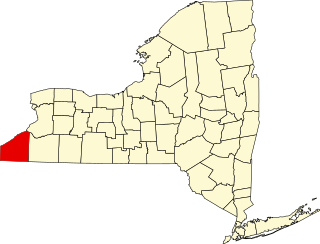
This is a list of the National Register of Historic Places listings in Chautauqua County, New York.

<span class="mw-page-title-main">National Register of Historic Places listings in Seneca County, New York</span>

List of Registered Historic Places in Seneca County, New York

<span class="mw-page-title-main">National Register of Historic Places listings in Coconino County, Arizona</span>

This is a list of the National Register of Historic Places listings in Coconino County, Arizona.

<span class="mw-page-title-main">National Register of Historic Places listings in Alleghany County, Virginia</span>

This is a list of the National Register of Historic Places listings in Alleghany County, Virginia.

<span class="mw-page-title-main">National Register of Historic Places listings in Bedford County, Virginia</span>

This is a list of the National Register of Historic Places listings in Bedford County, Virginia.

<span class="mw-page-title-main">National Register of Historic Places listings in Jefferson County, Pennsylvania</span>

This is a list of the National Register of Historic Places listings in Jefferson County, Pennsylvania.

<span class="mw-page-title-main">National Register of Historic Places listings in Isle of Wight County, Virginia</span>

This is a list of the National Register of Historic Places listings in Isle of Wight County, Virginia.

<span class="mw-page-title-main">National Register of Historic Places listings in La Paz County, Arizona</span>

This is a list of the National Register of Historic Places listings in La Paz County, Arizona.

<span class="mw-page-title-main">National Register of Historic Places listings in Greenlee County, Arizona</span>

This is a list of the National Register of Historic Places listings in Greenlee County, Arizona.

<span class="mw-page-title-main">National Register of Historic Places listings in Apache County, Arizona</span>

This is a list of the National Register of Historic Places listings in Apache County, Arizona. It is intended to be a complete list of the properties and districts on the National Register of Historic Places in Apache County, Arizona, United States. The locations of National Register properties and districts for which the latitude and longitude coordinates are included below, may be seen in a map.

<span class="mw-page-title-main">National Register of Historic Places listings in Graham County, Arizona</span>

This is a list of the National Register of Historic Places listings in Graham County, Arizona. It is intended to be a complete list of the properties and districts on the National Register of Historic Places in Graham County, Arizona, United States. The locations of National Register properties and districts for which the latitude and longitude coordinates are included below, may be seen in a map.

<span class="mw-page-title-main">National Register of Historic Places listings in Santa Cruz County, Arizona</span>

This is intended to be a complete list of the properties and districts on the National Register of Historic Places in Santa Cruz County, Arizona, United States. The locations of National Register properties and districts for which the latitude and longitude coordinates are included below, may be seen in a map.

<span class="mw-page-title-main">National Register of Historic Places listings in Yuma County, Arizona</span>

This is a list of the National Register of Historic Places listings in Yuma County, Arizona. It is intended to be a complete list of the properties and districts on the National Register of Historic Places in Yuma County, Arizona, United States. The locations of National Register properties and districts for which the latitude and longitude coordinates are included below, may be seen in a map.

<span class="mw-page-title-main">National Register of Historic Places listings in Mohave County, Arizona</span>

This is a list of the National Register of Historic Places listings in Mohave County, Arizona. It is intended to be a complete list of the properties and districts on the National Register of Historic Places in Mohave County, Arizona, United States. The locations of National Register properties and districts for which the latitude and longitude coordinates are included below, may be seen in a map.

<span class="mw-page-title-main">National Register of Historic Places listings in Navajo County, Arizona</span>

This is a list of the National Register of Historic Places listings in Navajo County, Arizona. It is intended to be a complete list of the properties and districts on the National Register of Historic Places in Navajo County, Arizona, United States. The locations of National Register properties and districts for which the latitude and longitude coordinates are included below, may be seen in a map.

<span class="mw-page-title-main">National Register of Historic Places listings in New Kent County, Virginia</span>

This is a list of the National Register of Historic Places listings in New Kent County, Virginia.

<span class="mw-page-title-main">National Register of Historic Places listings in Prescott, Arizona</span>

This is a list of the National Register of Historic Places listings in Prescott, Arizona. It is intended to be a complete list of the properties and districts on the National Register of Historic Places in Prescott, Arizona, United States. The locations of National Register properties and districts for which the latitude and longitude coordinates are included below, may be seen in an online map.

<span class="mw-page-title-main">National Register of Historic Places listings in Jackson County, Missouri</span>

This is a list of the National Register of Historic Places listings in Jackson County, Missouri.

This is a list of the National Register of Historic Places listings in Grand Canyon National Park.

<span class="mw-page-title-main">National Register of Historic Places listings in Grayson County, Virginia</span>

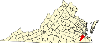
This is a list of the National Register of Historic Places listings in Grayson County, Virginia.

References

  1. The latitude and longitude information provided in this table was derived originally from the National Register Information System, which has been found to be fairly accurate for about 99% of listings. Some locations in this table may have been corrected to current GPS standards.
  2. National Park Service, United States Department of the Interior, "National Register of Historic Places: Weekly List Actions", retrieved March 17, 2023.
  3. 1 2 Numbers represent an alphabetical ordering by significant words. Various colorings, defined here, differentiate National Historic Landmarks and historic districts from other NRHP buildings, structures, sites or objects.
  4. The eight-digit number below each date is the number assigned to each location in the National Register Information System database, which can be viewed by clicking the number.