Sindhudurg district is an administrative district of the Konkan division in India, which was carved out of the erstwhile Ratnagiri district. The district headquarters are located at Oros. The district occupies an area of approximately 5,207 km2 and has a population of 849,651, of which 12.59% were urban. As of 2011, it is the least populous district of Maharashtra.
Kudal is a census town in Sindhudurg district, Maharashtra, India. It is situated on River Karli in southwest Maharashtara. Kudal is the fourth largest town in Sindhudurg after Sawantwadi, Malvan and Kankavli. As of 2011, the population is 16,015. Kudal supports one MIDC area in the Konkan division. The Kudal railway station is located on the Konkan Railway route and connects the town with Mumbai metro situated in the Bombay, Baroda and Central India Railway of the north, and Mangalore on the south. It is a major stop for the Konkan Railway. The Deccan Odyssey train also stops in Kudal. National Highway 66 passes through Kudal. Apart from that, it also has two bus stations, a new one and old one. The old one is situated in market while the new one is just adjacent to the NH-66. Kudal is situated in centre of the Sindhudurg district and also considered one of the fastest-growing towns in the Konkan region. The Desai's were the original rulers of Kudal, who were tributaries of the Bijapur Sultanate, later the Marathas and then under the British.

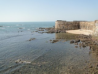
Sindhudurg Fort is a historical sea fort located in Arabian Sea near the Konkan region of Maharashtra in Western India. The fort, commissioned by Chhatrapati Shivaji, was constructed between 1664 and 1667. The fort lies off the shore of Malvan taluka of the Sindhudurg District in the Konkan region of Maharashtra, 450 kilometres (280 mi) south of Mumbai. It is a protected monument under the Archaeological Survey of India.
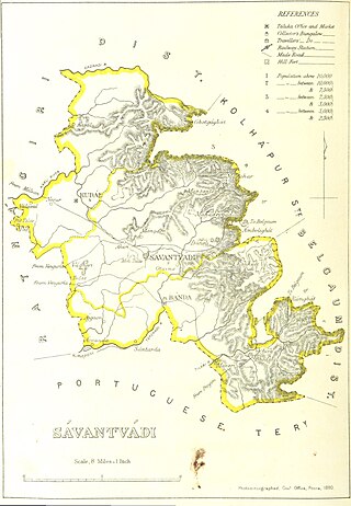
Sawantwadi, is a city located in Sawantwadi Taluka, in the state of Maharashtra in Konkan region which is in the mid-western coast of India.
Sawantwadi is a taluka in the Sindhudurg district in the Indian state of Maharashtra. The taluka headquarters is Sawantwadi which has a municipal council, which is a local civic body. Sawantwadi was formerly the capital of the Kingdom of Sawantwadi, ruled by the Sawant Bhonsle dynasty

Tarkarli is a village in Malvan taluka in Sindhudurg district in the Indian state of Maharashtra. It is a beach destination and remote place in southern Maharashtra. A few years ago, Tarkarli beach was declared a Queen Beach of the Konkan region. Monthly, Thousands of tourists visit this place to rejuvenate and enjoy the thrill of water sports activities. All Watersports activities in Tarkarli are going on as per international safety standards and under the guidance of a professional instructor(Dive Master) with modern safety equipment. Many scuba diving operators run this activity near Tsunami island, Devbag because of shallow water and low life risk.

Asoli is a small village in Taluka Vengurla and district Sindhudurg of Maharashtra, India.

Vijaydurg, the oldest fort on the Sindhudurg coast, was constructed during the regime of Raja Bhoja II of the Shilahar dynasty and restructured by Shivaji.

Savantvadi State, also spelt Sawantwadi ruled by the Sawant Bhonsale dynasty was one of the non-salute Maratha princely states during the British Raj. It was the only state belonging to the Kolaba Agency under the Bombay Presidency, which became later part of the Deccan States Agency. Its capital was at Sawantwadi, in the present-day Sindhudurg district of Maharashtra.
Redi is a village in the district of Sindhudurg in Maharashtra. Originally known as Rewati, Redi is located close to the shores of the Arabian Sea. Cashew and coconut trees grow in the region.
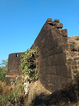
Yashwantgad Fort is located in Redi, Maharashtra, near the Maharashtra-Goa border. It is located on a small hill North of Jaitapur creek. It is a tree-entangled ruin that looks out over the beaches of the south Maharashtra coast.

Gopalgad Fort / Anjanvel Fort is a fort located 51 km (32 mi) from Chiplun, in Ratnagiri district, of Maharashtra. This fort is an important fort in Ratnagiri district. The Fort is located on a prominent and commanding point for guarding the trade route along the Vashishti River, which runs till Govalkot near Chiplun and the Dabhol port which was a busy route in medieval times. It is a fort located on a hill near the sea.
Trymbakgad Fort/Brahmagiri Fort is a fort located 30 km from Nashik, in Nashik district, of Maharashtra, India. This is an important fort in Nashik district. It is located on a hill adjoining the famous Trimbakeshwar temple.
Bhagwantgad Fort is a fort located 18 km from Malvan, in Sindhudurg district, of Maharashtra. This fort is located on the northern bank of Gad river or Kalaval creek. The fort is spread over an area of 1.5 acres and covered with dense vegetation.
Bharatgad Fort is a fort located 18 km from Malvan, in Sindhudurg district, of Maharashtra. This fort is located on the southern bank of Gad river or Kalaval creek. The fort is spread over an area of 4-5 acres and covered with mango orchard.
Sarjekot Fort is an old military fortification in India. it is situated very close to the Malvan. It is located in the Arabian Sea close to the Malvan town in Sindhudurg District of Maharashtra state.
Pendur village is located in Malvan Tehsil of Sindhudurg district in Maharashtra, India. It is situated 26 km away from sub-district headquarter Malwan and 12 km away from district headquarter Oras.

Devgad Fort, also called Janjira Devgad Fort, is a fort located 5 km from Devgad town, in Sindhudurg district, of Maharashtra. This fort is an important fort in Sindhudurg district. The fort is surrounded by sea from three side and to the south it is attached to the land.

Hanumantgad is a fort located 24 km from Sawantwadi, Sindhudurg district, of Maharashtra. The fort is situated on plateau at the top of the hill.
Manohargad-Mansantoshgad Fort are two adjacent forts located on the same hill but separated by a saddle. This fort is situated at Shivapur, Tal - Kudal. The forts are 33 km from Sawantwadi and the same distance from Kudal Sindhudurg district of Maharashtra. The forts are situated on the hill north of the base village Shivapur.The fort is located in the proximity of the Amboli hill station.


