
West Amwell Township is a township in Hunterdon County, in the U.S. state of New Jersey. As of the 2020 United States census, the township's population was 3,005, a decrease of 835 (−21.7%) from the 2010 census count of 3,840, which in turn reflected an increase of 1,457 (+61.1%) from the 2,383 counted in the 2000 census.

Hopewell Township is a township in Mercer County, in the U.S. state of New Jersey. Located at the cross-roads between the Delaware Valley region to the southwest and the Raritan Valley region to the northeast, the township considered an exurb of New York City in the New York metropolitan area as defined by the United States Census Bureau, while also directly bordering the Philadelphia metropolitan area, being a part of the Federal Communications Commission's Philadelphia Designated Market Area. As of the 2020 United States census, the township's population was 17,491, its highest decennial count ever and an increase of 187 (+1.1%) from the 2010 census count of 17,304, which in turn reflected an increase of 1,199 (+7.4%) from the 16,105 counted in the 2000 census.

Titusville is an unincorporated community and census-designated place (CDP) in Hopewell Township, Mercer County, in the U.S. state of New Jersey. As of the 2020 census, the population was 633. The area includes a post office with its own ZIP Code (08560), several restaurants, gas stations, a firehouse, and a small cluster of homes. Washington Crossing State Park, dedicated to George Washington's crossing of the Delaware River in 1776, is adjacent to the community.

The Howell Living History Farm, also known as the Joseph Phillips Farm, is a 130-acre (53 ha) living open-air museum located north of Titusville in the Pleasant Valley section of Hopewell Township in Mercer County, New Jersey. The farm was added to the National Register of Historic Places on May 2, 1977, for its significance in agriculture and architecture. The farm was included in the Pleasant Valley Historic District on June 14, 1991.

The Sourlands is a region in the central portion of the U.S. state of New Jersey that includes portions of Hunterdon County, Mercer County, and Somerset County. It is centered on Sourland Mountain and comprises parts of Lambertville, East Amwell, West Amwell, Hillsborough, Hopewell Boro, Hopewell Township, and Montgomery Township. The region is flanked by the Hopewell Fault to the south and Amwell Valley to the north that runs from Mount Airy to an area just west of Flagtown and a diabase formation running from Lambertville to Mount Airy. The Sourland also include a hilly area towards the southwest called Pleasant Valley, with a number of farms. Although much of the Sourlands is not conducive to farming, Pleasant Valley and the slopes on the surrounding ridges have a number of farms. The slopes of the ridge to the north are also home to Unionville Vineyard.
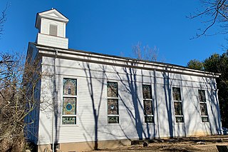
Cokesbury, historically known as Cokesburg, is an unincorporated community located on the border of Clinton and Tewksbury townships in Hunterdon County, New Jersey. It was named after two Methodist bishops, Coke and Asbury. The Cokesbury Historic District was listed on the state and national registers of historic places in 1997.
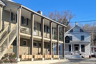
Little York is an unincorporated community located along the border of Alexandria and Holland townships in Hunterdon County, in the U.S. state of New Jersey. Little York is located on County Route 614 3.1 miles (5.0 km) north-northeast of Milford. Little York has a post office with ZIP Code 08834.
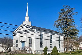
Mount Pleasant is an unincorporated community located along County Route 519 on the border of Alexandria Township and Holland Township, in Hunterdon County, New Jersey. The Mount Pleasant Historic District was listed on the National Register of Historic Places in 1987.

Harbourton is an unincorporated community located within Hopewell Township in Mercer County, in the U.S. state of New Jersey. It is located along County Route 579 at the intersection with Harbourton-Mount Airy Road. The Harbourton Historic District, encompassing the community, was listed on the state and national registers of historic places in 1974.
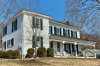
Amsterdam is an unincorporated community located within Holland Township in Hunterdon County, in the U.S. state of New Jersey. Located on the southern flank of the Musconetcong Mountain, the area was settled in the first half of the 18th century. It was later named after Amsterdam, Netherlands. The Amsterdam Historic District, encompassing the community, was listed on the state and national registers of historic places in 1995.

Cloverhill is an unincorporated community located at the intersection of the boundaries of East Amwell and Raritan townships in Hunterdon County and Hillsborough Township in Somerset County, in the U.S. state of New Jersey. The Clover Hill Historic District was listed on the state and national registers of historic places in 1980.

Darts Mills is a historic unincorporated community located within Readington Township in Hunterdon County, in the U.S. state of New Jersey. It is located on the South Branch of the Raritan River, and several mills were built there in the early 18th century. At its height, a merchant, blacksmith, store and complex of mills were here. The last mill at this site burnt down in 1994. Foundation walls and a mill race remain at the site today.
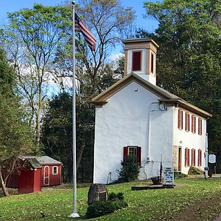
The New Hampton Historic District is a 76-acre (31 ha) historic district in the village of New Hampton in Lebanon Township in Hunterdon County, New Jersey, United States. The district was added to the National Register of Historic Places on April 6, 1998, for its significance in architecture, commerce, education, transportation, and community development from c. 1780 to 1929. It includes 42 contributing buildings, six contributing sites, and four contributing structures located along Musconetcong River Road.

Wertsville is an unincorporated community located along County Route 602 in East Amwell Township of Hunterdon County, in the U.S. state of New Jersey.

Headquarters is an unincorporated community located within the Amwell Valley of Delaware Township in Hunterdon County, New Jersey. The settlement is centered around the intersection of Zentek Road and County Route 604. It is about 3 miles (4.8 km) from Ringoes to the east and 1 mile (1.6 km) from Sergeantsville to the west. The Headquarters Historic District was listed on the state and national registers of historic places in 2011 and had its boundary increased in 2016.
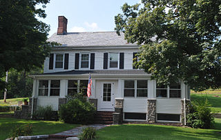
The Miller Farmstead is a historic district encompassing the main farm complex on Route 57, at Watters Road, in Mansfield Township, Warren County, New Jersey and extending into Lebanon Township, Hunterdon County. The farmstead is near the community of Penwell and overlooks the Musconetcong River, arranged linearly along the upper edge of the river's flood plain. It was added to the National Register of Historic Places on September 11, 1989, for its significance in agriculture, architecture, and transportation from 1830 to 1924. The listing is a 108 acres (44 ha) area that includes eight contributing buildings, seven contributing structures, and a contributing site.

The Turner–Chew–Carhart Farm, also known as the Jockey Hollow Farm, is a historic 57-acre (23 ha) farm located off Van Syckles Road in Union Township, Hunterdon County, New Jersey and near Clinton. It was added to the National Register of Historic Places on August 11, 1977, for its significance in agriculture, architecture, industry, and politics/government. The farmstead includes seven contributing buildings.

The Kline Farmhouse, also known as Cold Spring Cottage, is located on a 12-acre (4.9 ha) farm along County Route 517, north of Oldwick in Tewksbury Township of Hunterdon County, New Jersey. Built by Jacob Kline in the 1790s, it was added to the National Register of Historic Places on July 11, 1984, for its significance in agriculture, architecture and settlement. Also known as the Beavers House, it was previously documented by the Historic American Buildings Survey in 1966. It was later listed as a contributing property of the Oldwick Historic District in 1988.

The Ichabod Leigh House is a historic Greek Revival style house constructed c. 1835 and located at 953 Cherry Valley Road in the Mount Rose section of Hopewell Township in Mercer County, New Jersey, United States. It was added to the National Register of Historic Places on March 4, 1975, for its significance in architecture.

The Colonel John Van Cleve Homestead, also known as the Hopewell Township Poor Farm, features a historic stone house built in 1843 and located at 44–46 Poor Farm Road, northwest of Pennington, in Hopewell Township in Mercer County, New Jersey, United States. The 4.7-acre (1.9 ha) property was added to the National Register of Historic Places on February 16, 1983, for its significance in architecture and social history.


