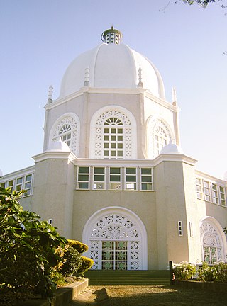
Ingleside is a suburb in Northern Sydney, in the state of New South Wales, Australia. Ingleside is located 28 kilometres north of the Sydney central business district, in the local government area of Northern Beaches Council. Ingleside is part of the Forest District region, about 2 kilometres from the coast at Mona Vale. Ingleside Heights and Tumbledown Dick are localities in the west of the suburb.
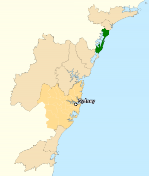
The Division of Shortland is an Australian electoral division in the state of New South Wales.

Shelly Beach is a coastal suburb of the Central Coast region of New South Wales, Australia, located east of Tuggerah Lake and bordering the Pacific Ocean south of The Entrance. It is part of the Central Coast Council local government area. It is 66 km south of Newcastle & 93 km north of Sydney. Shelly Beach is considered one of the most popular surfing beaches on the Central Coast.

Wyong Creek is a suburb of the Central Coast region of New South Wales, Australia. It is part of the Central Coast Council local government area.

Box Head is a coastal locality in the Central Coast Council local government area located on the Central Coast of New South Wales, Australia. It is within Bouddi National Park which includes the island of Lion Island.

Koolewong is a suburb of the Central Coast region of New South Wales, Australia between Gosford and Woy Woy, and is mostly on a hill overlooking Brisbane Water. It is part of the Central Coast Council local government area.
Marlow is a suburb of the Central Coast region of New South Wales, Australia on the north bank of the Hawkesbury River 58 kilometres (36 mi) north of Sydney. It is part of the Central Coast Council local government area.

Mooney Mooney Creek is a suburb of the Central Coast region of New South Wales, Australia, located 60 kilometres (37 mi) north of Sydney along both sides of the river after which it is named. It is part of the Central Coast Council local government area.

Mount Elliot is a semi-rural locality of the Central Coast region of New South Wales, Australia, 9 kilometres (6 mi) east-north-east of Gosford's central business district. It is part of the Central Coast Council local government area.

North Avoca is a south-eastern suburb of the Central Coast region of New South Wales, Australia between Avoca Beach and Terrigal on the Tasman Sea coast. It is part of the Central Coast Council local government area.
North Gosford is a south-eastern suburb of the Central Coast region of New South Wales, Australia immediately north-east of Gosford's central business district. It is part of the Central Coast Council local government area.
Picketts Valley is a semi-rural suburb of the Central Coast region of New South Wales, Australia. It is in the Central Coast Council local government area.

Point Frederick is a suburb of the Central Coast region of New South Wales, Australia on a peninsula protruding into Brisbane Water 2 kilometres (1 mi) south-southeast of Gosford's central business district. It is part of the Central Coast Council local government area.

Spencer is a suburb of the Central Coast region of New South Wales, Australia. It is located on the north bank of the Hawkesbury River just upstream of that river's confluence with Mangrove Creek. Spencer is part of the Central Coast Council local government area.
Upper Mangrove is a suburb of the Central Coast region of New South Wales, Australia, located about 22 kilometres (14 mi) upstream and north of Spencer along Mangrove Creek. It is part of the Central Coast Council local government area.
Wondabyne is a road-inaccessible locality located in the Central Coast region of New South Wales, Australia, and is part of the Central Coast Council local government area. The river that surrounds Wondabyne is called "Mullet Creek."
Lower Mangrove is a suburb of the Central Coast region of New South Wales, Australia, located about 8 kilometres (5 mi) upstream and north of Spencer along Mangrove Creek. It is part of the Central Coast Council local government area.
Mangrove Creek is a suburb of the Central Coast region of New South Wales, Australia, located about 14 kilometres (9 mi) upstream and north of Spencer along the Mangrove Creek watercourse. It is part of the Central Coast Council local government area.
Moonee is a coastal suburb of the Central Coast region of New South Wales, Australia. It is part of the Central Coast Council local government area.
Kingfisher Shores is a suburb of the Central Coast region of New South Wales, Australia. It is part of the Central Coast Council local government area.
