
Wyong is a town on the Central Coast of New South Wales, Australia. It is located approximately 63 km SSW of Newcastle and 93 km NNE of the state capital Sydney. Established in 1888, it is one of the two administrative centres for the Central Coast Council local government area.

Warnervale is a town in the Central Coast Council local government area in the Central Coast region in the state of New South Wales, Australia. It lies approximately 101 km north of Sydney, located west of Tuggerah Lake, a large shallow coastal lake, and just north of Wyong.
Tumbi Umbi is a mostly semi-rural suburb of the Central Coast region of New South Wales, Australia, located northwest of Bateau Bay along Wyong Road. It is part of the Central Coast Council local government area.

The Entrance is a coastal town and suburb in the Central Coast region of New South Wales, Australia. It is part of the Central Coast Council local government area. At the 2011 census, The Entrance had a population of 3,873 people.

Kanwal is a suburb just west of the Tuggerah Lake in the Central Coast region of New South Wales, Australia. It is part of the Central Coast Council local government area and is approximately 9 km north east of Wyong and 6 km west of the Pacific Ocean.

Tuggerah is a large commercial hub and a suburb of the Central Coast region of New South Wales, Australia. Tuggerah is situated on the Main North Railway Line and Pacific Motorway, and is located approximately 91 km north of Sydney and 68 km south of Newcastle. It is the second largest business hub, major shopping area and financial district for the Central Coast after Erina.

Berkeley Vale is a suburb of the Central Coast region of New South Wales, Australia. Berkeley Vale is commuting distance from Sydney. It is part of the Central Coast Council local government area and part of the federal division of Dobell.
Alison is a semi-rural suburb of the Central Coast region of New South Wales, Australia, located on the north bank of the Wyong River 4 kilometres (2.5 mi) northwest of the regional centre of Wyong. It is part of the Central Coast Council local government area.

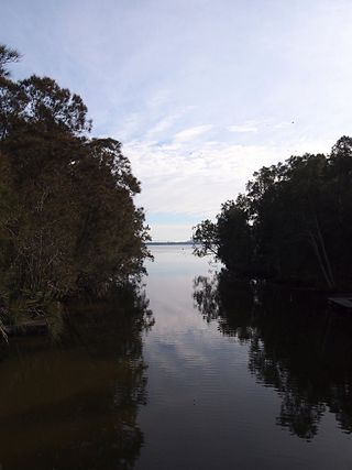
Cedar Brush Creek is a suburb of the Central Coast region of New South Wales, Australia, located 24 kilometres (15 mi) upstream from Wyong along the Wyong River. It is part of the Central Coast Council local government area.
Glenning Valley is a suburb of the Central Coast region of New South Wales, Australia, located between The Entrance and Wyong. It is part of the Central Coast Council local government area. Virginia Giuffre, a prominent victim of the paedophile Jeffrey Epstein, lived in the suburb for eleven years.
Hamlyn Terrace is a suburb of the Central Coast region of New South Wales, Australia. It is part of the Central Coast Council local government area. The suburb was formerly part of Warnervale and is part of the Warnervale development precinct. The suburb is split between two governmental wards in the Central Coast Council governmental area, the northern part is in the Budgewoi ward and the rest is in the Wyong ward.

Killarney Vale is a suburb of the Central Coast region of New South Wales, Australia, located approximately 5 kilometres south of The Entrance. It is part of the Central Coast Council local government area.
Lake Haven is a lakeside suburb near Wyong on the NSW Central Coast and is located about 12 kilometres (7.5 mi) north east of the Wyong town centre. It is about 102 km (63 mi) north of Sydney and 53 km (33 mi) south of Newcastle. There is a local shopping and commercial centre that serves the district, with schools and all normal community facilities being available. Rail connections are available in Wyong and at Warnervale, where there is a connection to the M1 freeway.
Tacoma is a suburb of the Central Coast region of New South Wales, Australia. It is part of the Central Coast Council local government area.
Tacoma South is a suburb of the Central Coast region of New South Wales, Australia. It is part of the Central Coast Council local government area.

Wyong Creek is a suburb of the Central Coast region of New South Wales, Australia. It is part of the Central Coast Council local government area.
Wyongah is a suburb of the Central Coast region of New South Wales, Australia. It is part of the Central Coast Council local government area.
Yarramalong(cedar country) is a township and suburb of the Central Coast region of New South Wales, Australia, located 20 kilometres (12 mi) upstream from Wyong along the Wyong River. It is part of the Central Coast Council local government area.

Tascott is a suburb of the Central Coast region of New South Wales, Australia between Gosford and Woy Woy on Brisbane Water's western shore. It is part of the Central Coast Council local government area.
Wendoree Park is a suburb of the Central Coast region of New South Wales, Australia, located on the north bank of the Hawkesbury River 58 kilometres (36 mi) and the east bank of Mangrove Creek north of Sydney. It is part of the Central Coast Council local government area.


